

6 datasets found
-
Federal
CMS: LiDAR Data for Forested Areas in Paragominas, Para, Brazil, 2012-2014
National Aeronautics and Space Administration —
This data set provides raw LiDAR point cloud data and derived Digital Terrain Models (DTMs) for five forested areas in the municipality of Paragominas, Para, Brazil,... -
Federal
Burned and Unburned Field Site Data, Noatak, Seward, and North Slope, AK, 2016-2018
National Aeronautics and Space Administration —
This dataset includes field measurements from unburned and burned 10 m x 10 m and 1 m x 1 m plots in the Noatak, Seward, and North Slope regions of the Alaskan tundra... -
Federal
Pre-Delta-X: L1 UAVSAR Single Look Complex and Interferograms, MRD, LA, USA, 2016
National Aeronautics and Space Administration —
This Level 1 (L1) dataset includes single look complex (SLC) stack products and co-registered interferograms in the HH (horizontal transmit and horizontal receive)... -
Federal
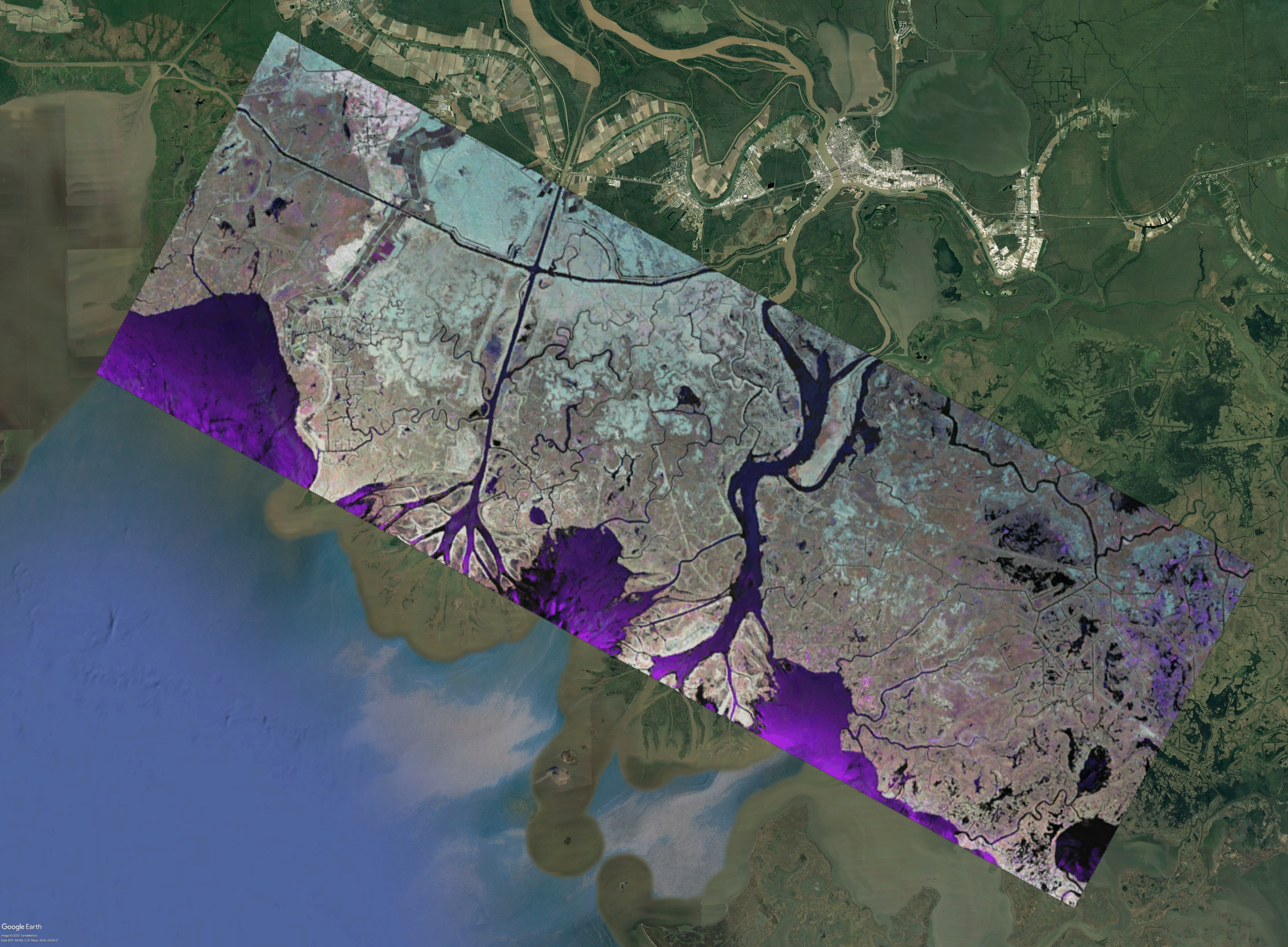
Delta-X: UAVSAR L2 Interferometric Products, MRD, Louisiana, 2021
National Aeronautics and Space Administration —
This dataset contains georeferenced UAVSAR Level 2 (L2) interferometric products for Delta-X flight lines acquired during the spring (2021-03-27 to 2021-04-18) and... -
Federal
CO2 and CH4 Fluxes from Waterbodies, Yukon-Kuskokwim Delta, Alaska, 2016-2019
National Aeronautics and Space Administration —
This dataset provides estimates of carbon dioxide (CO2) and methane (CH4) diffusive fluxes from waterbodies, and watershed landcover data for the central-interior of... -
Federal
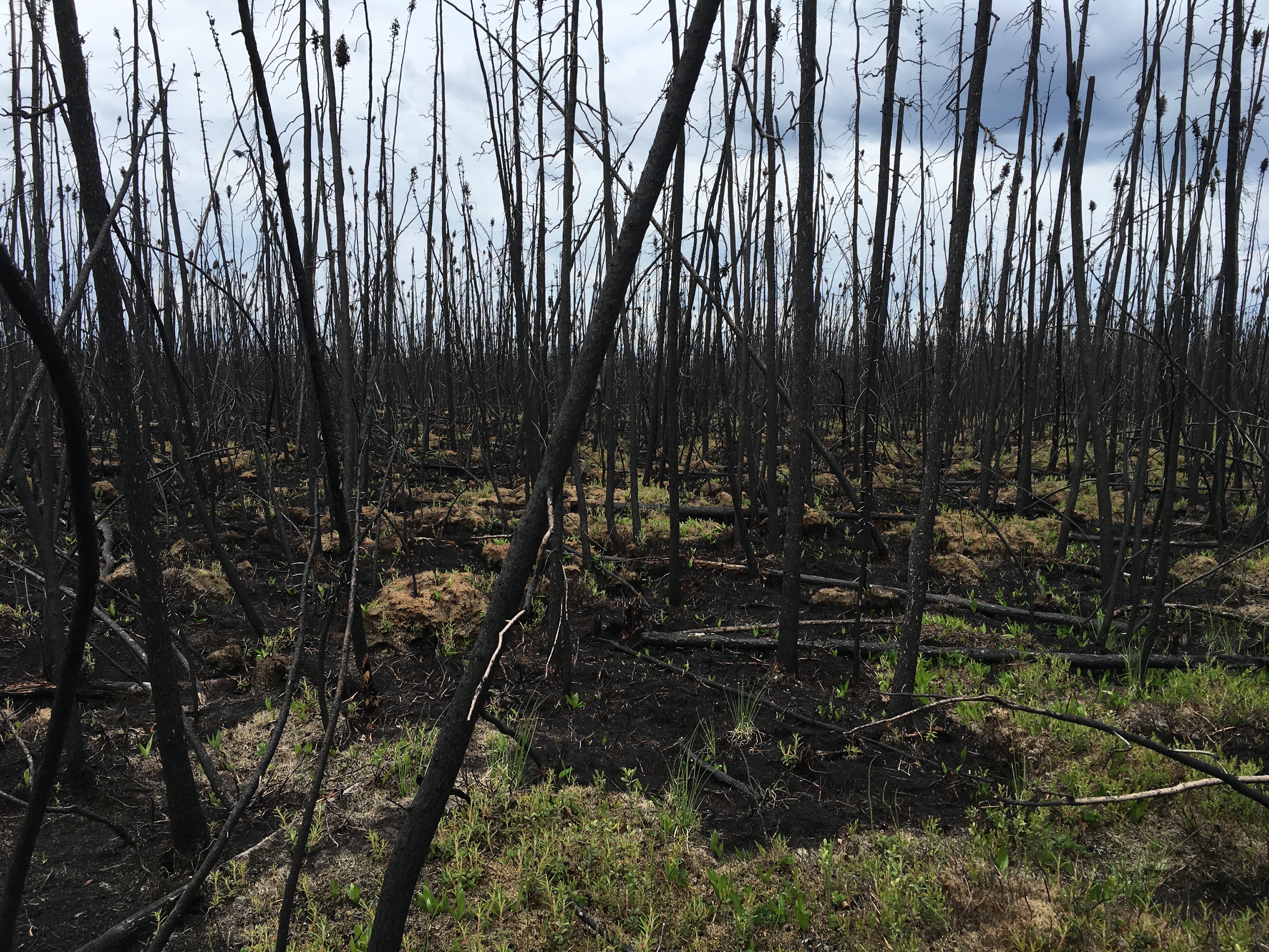
ABoVE: Characterization of Burned and Unburned Boreal Forest Stands, SK, Canada, 2016
National Aeronautics and Space Administration —
This dataset provides the results of field measurements and estimates of carbon stocks and combustion rates that characterize burned and unburned southern boreal...
6 datasets found