
-
Federal
SARP 2021 Data
National Aeronautics and Space Administration —
SARP_2021_Data is the data collected onboard the NASA DC-8 aircraft during the 2021 deployment of the Student Airborne Research Program (SARP) mission. Data... -
Federal
CYGNSS Level 3 MRG Science Data Record Near Real Time Version 3.2.1
National Aeronautics and Space Administration —
This dataset contains the version 3.2.1 CYGNSS Level 3 Merged (MRG) Science Data Record Near Real Time (NRT) Storm Wind Speed derived from the Delay Doppler Mapping... -
Federal
CYGNSS Level 2 Ocean Surface Heat Flux Climate Data Record Version 1.1
National Aeronautics and Space Administration —
This dataset contains the first release, Version 1.1, of the CYGNSS Level 2 Ocean Surface Heat Flux Climate Data Record (CDR), which provides the time-tagged and... -
Federal
CYGNSS L3 Ocean Microplastic Concentration V1.0
National Aeronautics and Space Administration —
This dataset contains the version 1.0 CYGNSS level 3 ocean microplastic concentration data record, which provides 18 netCDF files, each containing one month of daily... -
Federal
SARP 2017 Data
National Aeronautics and Space Administration —
SARP_2017_Data is the data collected onboard the Wallops C-23 aircraft during the 2017 deployment of the Student Airborne Research Program (SARP) mission. Data... -
Federal
SARP 2024 Data
National Aeronautics and Space Administration —
SARP_2024_Data is the data collected onboard the NASA P-3B and the Dynamic Aviation B200 aircrafts during the 2024 deployment of the Student Airborne Research Program... -
Federal
TIROS-4 Medium-Resolution Scanning Radiometer Level 1 Final Meteorological Radiation Data V001 (TIROS4L1FMRT) at GES DISC
National Aeronautics and Space Administration —
TIROS-4 Medium-Resolution Scanning Radiometer Level 1 Final Meteorological Radiation Data (FMRT) product contains radiances expressed in five infrared/visible... -
Federal
SARP-East 2023 Data
National Aeronautics and Space Administration —
SARP_2023_East_Data is the ground site data and data collected onboard the Dynamic Aviation B200 aircraft during the 2023 deployment of the Student Airborne Research... -
Federal
Supercritical Airfoil Coordinates
National Aeronautics and Space Administration —
Rectangular Supercritical Wing (Ricketts) - design and measured locations are provided in an Excel file RSW_airfoil_coordinates_ricketts.xls . One sheet is with Non... -
Federal
U.S. Census Grids (Summary File 3), 1990: Metropolitan Statistical Areas
National Aeronautics and Space Administration —
The U.S. Census Grids (Summary File 3), 1990: Metropolitan Statistical Areas data set contains grids of demographic and socioeconomic data from the year 1990 U.S.... -
Federal
CYGNSS Level 2 Climate Data Record Version 1.2
National Aeronautics and Space Administration —
This dataset contains the Version 1.2 CYGNSS Level 2 Climate Data Record which provides the time-tagged and geolocated average wind speed (m/s) and mean square slope... -
Federal
CYGNSS Level 2 Science Data Record Version 3.1
National Aeronautics and Space Administration —
This dataset contains the Version 3.1 CYGNSS Level 2 Science Data Record which provides the time-tagged and geolocated average wind speed (m/s) and mean square slope... -
Federal
CYGNSS Level 2 Science Data Record Version 2.1
National Aeronautics and Space Administration —
This dataset contains the Version 2.1 CYGNSS Level 2 Science Data Record which provides the time-tagged and geolocated average wind speed (m/s) and mean square slope... -
Federal
CYGNSS Level 3 Science Data Record Version 3.2
National Aeronautics and Space Administration —
This dataset contains the version 3.2 CYGNSS level 3 science data record which provides the average wind speed and mean square slope (MSS) on a 0.2x0.2 degree... -
Federal
HIRENASD Beam FEM
National Aeronautics and Space Administration —
This contains attempts to create BEAM FEM model. I have started a Blog to discuss this... please put your comments there and I will attempt to keep everything... -
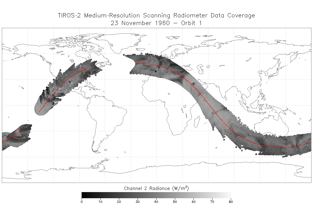
Federal
TIROS-2 Medium-Resolution Scanning Radiometer Level 1 Final Meteorological Radiation Data V001 (TIROS2L1FMRT) at GES DISC
National Aeronautics and Space Administration —
TIROS-2 Medium-Resolution Scanning Radiometer Level 1 Final Meteorological Radiation Data (FMRT) product contains radiances expressed in five infrared/visible... -
Federal
CYGNSS Level 2 Ocean Surface Heat Flux Climate Data Record Version 1.2
National Aeronautics and Space Administration —
This dataset contains the third release, Version 1.2, of the CYGNSS Level 2 Ocean Surface Heat Flux Climate Data Record (CDR), which provides the time-tagged and... -
Federal
VISSR/SMS-1 Level 1 Atmospheric and Oceanographic Image Processing System (AOIPS) Data V001 (VISSRSMS1L1AOIPS) at GES DISC
National Aeronautics and Space Administration —
VISSRSMS1L1AOIPS is the Visible Infrared Spin-Scan Radiometer (VISSR) Level 1 Atmospheric and Oceanographic Image Processing System (AOIPS) data product from the... -
Federal
SARP 2011 Data
National Aeronautics and Space Administration —
SARP_2011_Data is the data collected onboard the NASA DC-8 aircraft during the 2011 deployment of the Student Airborne Research Program (SARP) mission. Data...

Official websites use .gov
A
.gov website belongs to an official government
organization in the United States.
Secure .gov websites use HTTPS
A
lock (
) or https:// means you’ve safely connected to
the .gov website. Share sensitive information only on official,
secure websites.