

CYGNSS Level 2 Climate Data Record Version 1.2
Access & Use Information
Downloads & Resources
-
Data Information (Unknown Format)BIN
-
Data Information (Unknown Format)BIN
-
Data Information (PDF)PDF
148-0389_ATBD_Trackwise_Corrected_CDR_R1_released.pdf
-
Data Information (Unknown Format)BIN
-
Data Information (PDF)PDF
CYGNSS_Handbook_April2016.pdf
-
Data Information (PDF)PDF
148-0139-L2-MSS-ATBD-R3.pdf
-
Data Information (XLSX)EXCEL
148-0387-3_Level_2_CDR_netCDF_Data_Dictionary.xlsx
-
Data Information (PDF)PDF
148-0138_ATBD_L2_Wind_Speed_Retrieval_Rev5_Aug2018_release.pdf
-
Data Information (Unknown Format)BIN
-
Data Information (Unknown Format)BIN
-
Data Information (Unknown Format)BIN
-
Data Information (Unknown Format)BIN
Attitude_Table_FM_1.txt
-
Data Information (Unknown Format)BIN
Attitude_Table_FM_2.txt
-
Data Information (Unknown Format)BIN
Attitude_Table_FM_3.txt
-
Data Information (Unknown Format)BIN
Attitude_Table_FM_4.txt
-
Data Information (Unknown Format)BIN
Attitude_Table_FM_5.txt
-
Data Information (Unknown Format)BIN
Attitude_Table_FM_6.txt
-
Data Information (Unknown Format)BIN
Attitude_Table_FM_7.txt
-
Data Information (Unknown Format)BIN
Attitude_Table_FM_8.txt
-
Data Information (Unknown Format)BIN
-
Data Information (HTML)HTML
-
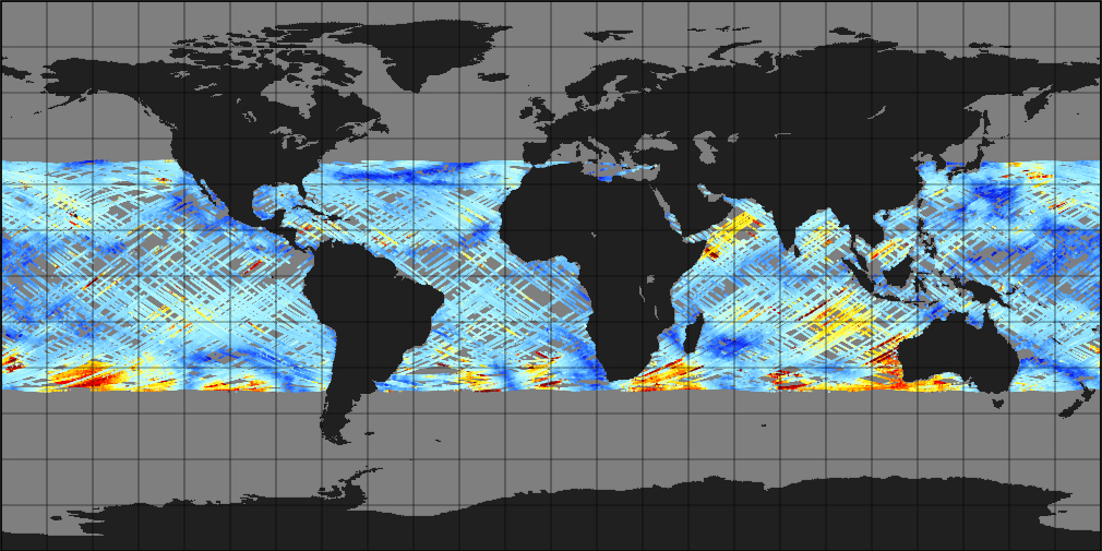
Data Information (JPEG)JPEG
CYGNSS_L2_CDR_V1.2.jpg
-
Landing PageLanding Page
Dates
| Metadata Created Date | April 11, 2025 |
|---|---|
| Metadata Updated Date | September 19, 2025 |
Metadata Source
- Data.json Data.json Metadata
Harvested from NASA Data.json
Additional Metadata
| Resource Type | Dataset |
|---|---|
| Metadata Created Date | April 11, 2025 |
| Metadata Updated Date | September 19, 2025 |
| Publisher | NASA/JPL/PODAAC;NASA/ESSP/UMICH/CYGNSS |
| Maintainer | |
| Identifier | 10.5067/CYGNS-L2C12 |
| Data Last Modified | 2025-09-11 |
| Category | Earth Science |
| Public Access Level | public |
| Bureau Code | 026:00 |
| Metadata Context | https://project-open-data.cio.gov/v1.1/schema/catalog.jsonld |
| Schema Version | https://project-open-data.cio.gov/v1.1/schema |
| Catalog Describedby | https://project-open-data.cio.gov/v1.1/schema/catalog.json |
| Harvest Object Id | 374d34b7-fa12-49e3-b314-9f39d4d08f3f |
| Harvest Source Id | 58f92550-7a01-4f00-b1b2-8dc953bd598f |
| Harvest Source Title | NASA Data.json |
| Homepage URL | https://podaac.jpl.nasa.gov/CitingPODAAC |
| Old Spatial | "CARTESIAN",{"NorthBoundingCoordinate":40.0,"WestBoundingCoordinate":-180.0,"EastBoundingCoordinate":180.0,"SouthBoundingCoordinate":-40.0} |
| Program Code | 026:000 |
| Source Datajson Identifier | True |
| Source Hash | 052a6cabc67f5ddcee5c47dbc50faa4dbb58d1d81480f4d352fb9037ba3c3b87 |
| Source Schema Version | 1.1 |
| Spatial | |
| Temporal | 2018-08-01/2018-08-01 |
Didn't find what you're looking for? Suggest a dataset here.