
-
Federal
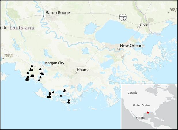
Delta-X: Delft3D Sediment Model, Site 322, Terrebonne Basin, MRD, Louisiana, USA
National Aeronautics and Space Administration —
This dataset contains the Delft3D model of the intensive site 322 in the Terrebonne Basin along the Mississippi River Delta (MRD) in coastal Louisiana. Simulations... -
Federal
LMOS Zion Ground Site Data
National Aeronautics and Space Administration —
LMOS_Ground_Zion_Data_1 is the Lake Michigan Ozone Study (LMOS) data collected at the Zion ground site during the LMOS field campaign. This product is a result of a... -
Federal
Faint Images of the Radio Sky at Twenty cm (FIRST)
National Aeronautics and Space Administration —
This catalog comprises the Faint Images of the Radio Sky at Twenty cm (FIRST) Survey. The FIRST survey began in 1993, and covers the north and south Galactic caps.... -
Federal
Microarray Profile of Gene Expression during Osteoclast Differentiation in Modeled Microgravity
National Aeronautics and Space Administration —
Microgravity leads to a 10-15% loss of bone mass in astronauts during space flight. Osteoclast is the multinucleated bone resorbing cell. In this study we used NASA... -
Federal
GPM GROUND VALIDATION NASA MICRO RAIN RADAR (MRR) MC3E V1
National Aeronautics and Space Administration —
The GPM Ground Validation NASA Micro Rain Radar (MRR) MC3E dataset was collected by a Micro Rain Radar (MRR), which is a vertically pointing Doppler radar which... -
Federal
Microarray Profile of Gene Expression during Osteoclast Differentiation in Modeled Microgravity
National Aeronautics and Space Administration —
Microgravity leads to a 10-15% loss of bone mass in astronauts during space flight. Osteoclast is the multinucleated bone resorbing cell. In this study we used NASA... -
Federal
INTEX-B Ground data
National Aeronautics and Space Administration —
INTEX-NA is a two phase experiment that aims to understand the transport and transformation of gases and aerosols on transcontinental/intercontinental scales and... -
Federal
HLS Sentinel-2 Multi-spectral Instrument Surface Reflectance Daily Global 30m v2.0
National Aeronautics and Space Administration —
The Harmonized Landsat Sentinel-2 (HLS) project provides consistent surface reflectance data from the Operational Land Imager (OLI) aboard the joint NASA/USGS Landsat... -
Federal
MASTER: Geological Earth Mapping Experiment (GEMx), Spring 2024
National Aeronautics and Space Administration —
This dataset includes Level 1B (L1B) data products from the MODIS/ASTER Airborne Simulator (MASTER) instrument. The spectral data were collected during 26 flights... -
Federal
Measurement of Air Pollution from Satellites (MAPS) Space Radar Laboratory - 1 (SRL1) Carbon Monoxide 5 degree by 5 degree data
National Aeronautics and Space Administration —
MAPS OverviewThe MAPS experiment measures the global distribution of carbon monoxide (CO) mixing ratios in the free troposphere. Because of MAPS' previous flights on... -
Federal
LMOS Schiller Park Ground Site Data
National Aeronautics and Space Administration —
LMOS_Ground_SchillerPark_Data_1 is the Lake Michigan Ozone Study (LMOS) data collected at the Schiller Park ground site during the LMOS field campaign. This product... -
Federal
S-MODE Level 3 Seaglider Observations Version 1
National Aeronautics and Space Administration —
This dataset contains profiles of temperature, dissolved oxygen, salinity, and other observations collected by Seagliders during the Sub-Mesoscale Ocean Dynamics... -
Federal
Pre-Delta-X: Total Suspended Solids of Surface Water across MRD, LA, USA, 2015-2016
National Aeronautics and Space Administration —
This dataset contains the total suspended solids (TSS) concentration of in situ water samples collected at selected sites across the Atchafalaya and Terrebonne Basins... -
Federal
GPM GROUND VALIDATION NASA MICRO RAIN RADAR (MRR) MC3E
National Aeronautics and Space Administration —
The GPM Ground Validation NASA Micro Rain Radar (MRR) MC3E dataset was collected by a Micro Rain Radar (MRR), which is a vertically pointing Doppler radar which... -
Federal
Delta-X: Acoustic Doppler Current Profiler Channel Surveys, MRD, Louisiana, 2021, V2
National Aeronautics and Space Administration —
This dataset provides river discharge measurements collected at selected locations in the Atchafalaya and Terrebonne Basins within the Mississippi River Delta (MRD)... -
Federal
LOFAR 2-Meter Sky Survey Preliminary Data Release Source Catalog
National Aeronautics and Space Administration —
The Low Frequency Array (LOFAR) Two-metre Sky Survey (LoTSS) is a deep 120-168 MHz imaging survey that will eventually cover the entire Northern sky. Each of the... -
Federal
AIRSAR_POLSAR_3_FREQ_POLARIMETRY
National Aeronautics and Space Administration —
AIRSAR three-frequency polarimetric frame product -
Federal
Local Observations from the Seasonal Ice Zone Observing Network (SIZONet) and Alaska Arctic Observatory and Knowledge Hub (AAOKH), Version 2
National Aeronautics and Space Administration —
The Seasonal Ice Zone Observing Network (SIZONet) and the Alaska Arctic Observatory and Knowledge Hub (AAOKH) share the Local Observations Interface, which allows...

Official websites use .gov
A
.gov website belongs to an official government
organization in the United States.
Secure .gov websites use HTTPS
A
lock (
) or https:// means you’ve safely connected to
the .gov website. Share sensitive information only on official,
secure websites.