
-
Federal
GRIP HURRICANE IMAGING RADIOMETER (HIRAD) V1
National Aeronautics and Space Administration —
The GRIP Hurricane Imaging Radiometer (HIRAD) V1 dataset contains measurements of brightness temperature taken at 4, 5, 6 and 6.6 GHz, as well as MERRA 2 m wind speed... -
Federal
TCSP HIGH ALTITUDE MMIC SOUNDING RADIOMETER (HAMSR) V1
National Aeronautics and Space Administration —
The High Altitude MMIC Sounding Radiometer (HAMSR) is a 25-channel microwave atmospheric sounder operating as a cross-track scanner. There are three bands: an... -
Federal
GPM Ground Validation Composite Satellite Overpasses OLYMPEX V4
National Aeronautics and Space Administration —
The GPM Ground Validation Composite Satellite Overpasses OLYMPEX dataset provides brightness temperature, precipitation, and total column water vapor estimates from... -
Federal
HURRICANE AND SEVERE STORM SENTINEL (HS3) GLOBAL HAWK HIGH ALTITUDE MMIC SOUNDING RADIOMETER (HAMSR) V1
National Aeronautics and Space Administration —
The Hurricane and Severe Storm Sentinel (HS3) Global Hawk High Altitude MMIC Sounding Radiometer (HAMSR) dataset includes measurements gathered by the HAMSR... -
Federal
RSS MONTHLY 1-DEG MICROWAVE TOTAL PRECIPITABLE WATER NETCDF V7R01
National Aeronautics and Space Administration —
The Remote Sensing Systems (RSS) Monthly 1-degree Microwave Total Precipitable Water (TPW) netCDF dataset V7R01 provides global total columnar water vapor values, or... -
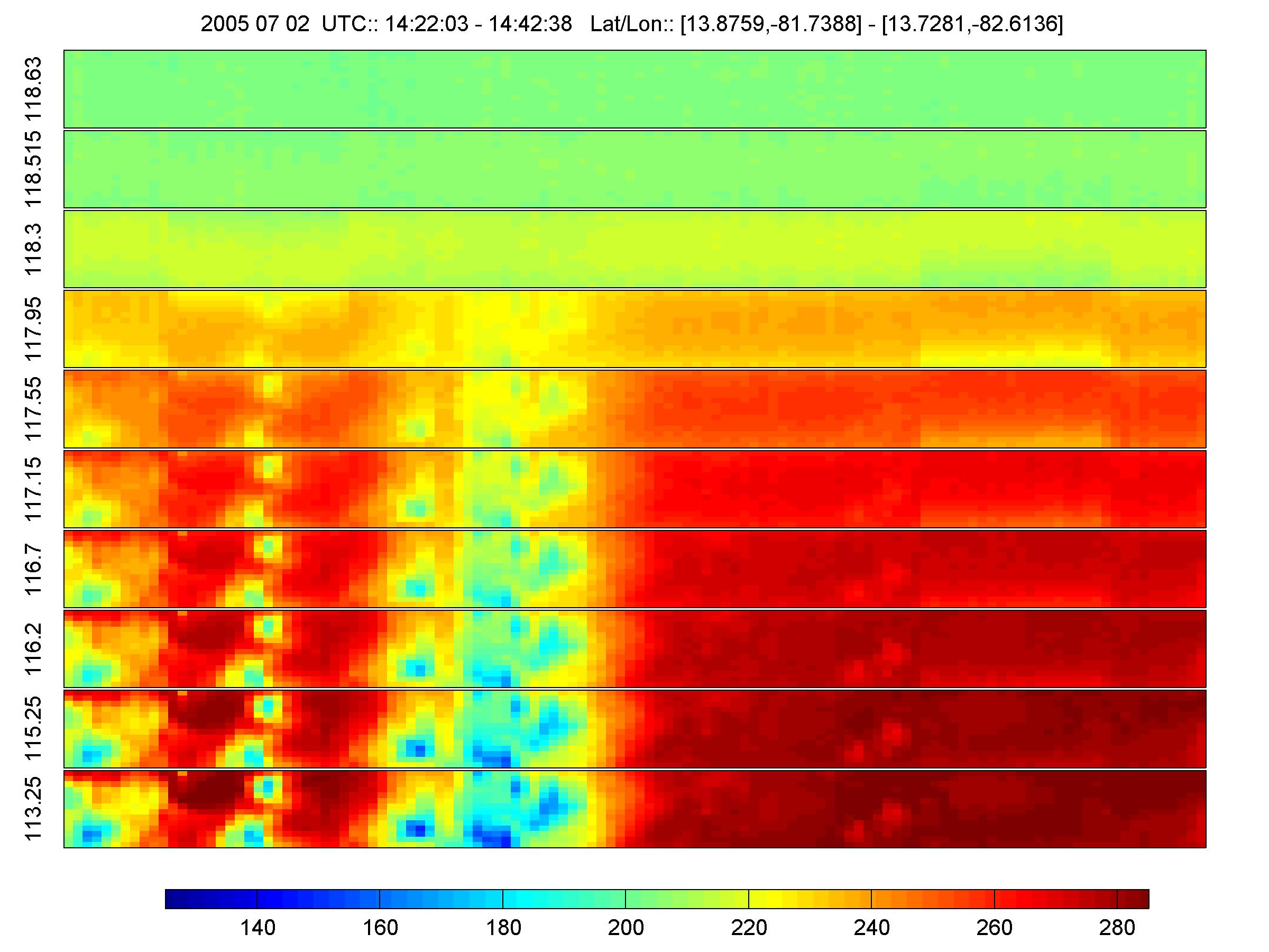
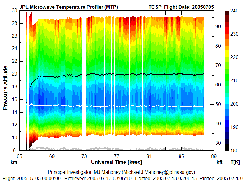
Federal
TCSP ER-2 MICROWAVE TEMPERATURE PROFILER (MTP) V1
National Aeronautics and Space Administration —
The TCSP ER-2 Microwave Temperature Profiler (MTP) dataset was collected by the ER-2 Microwave Temperature Profiler (MTP), which is a passive microwave radiometer... -
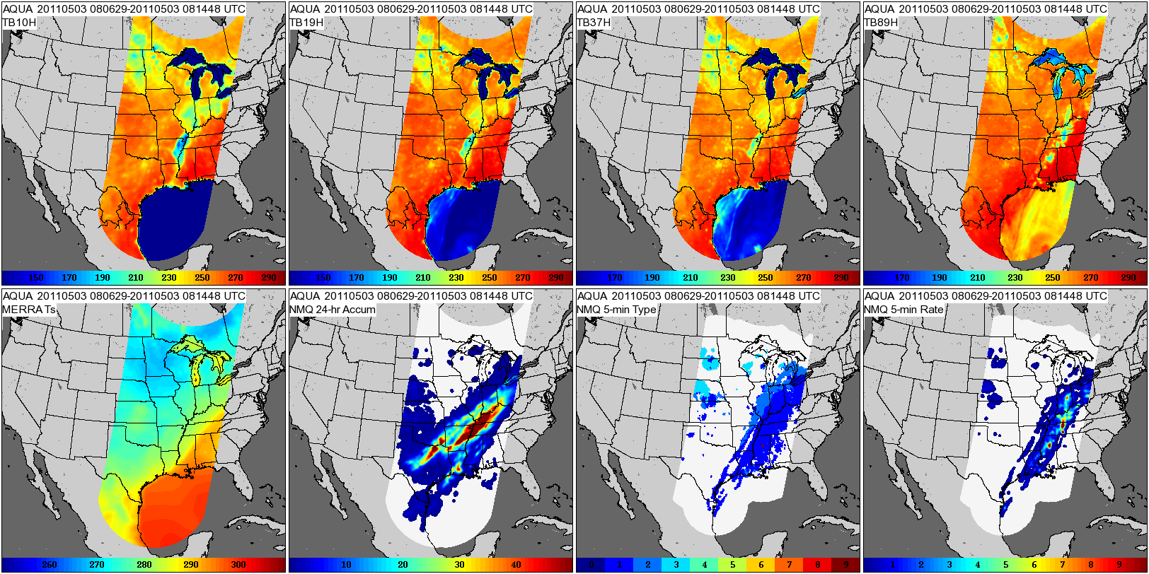
Federal
GPM GROUND VALIDATION COMPOSITE SATELLITE OVERPASSES MC3E V1
National Aeronautics and Space Administration —
The GPM Ground Validation Composite Satellite Overpasses MC3E dataset provides satellite overpasses from the AQUA satellite during the Midlatitude Continental... -
Federal
GPM GROUND VALIDATION SATELLITE SIMULATED ORBITS MC3E V1
National Aeronautics and Space Administration —
The GPM Ground Validation Satellite Simulated Orbits MC3E dataset is available in the Orbital database , which takes account for the atmospheric profiles, the... -
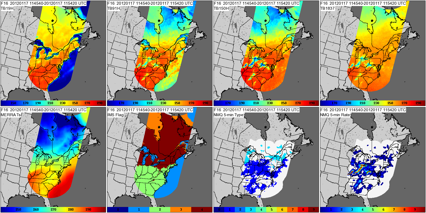
Federal
GPM GROUND VALIDATION COMPOSITE SATELLITE OVERPASSES GCPEX V1
National Aeronautics and Space Administration —
The GPM Ground Validation Composite Satellite Overpasses GCPEx dataset provides satellite overpasses from the Special Sensor Microwave Imager/Sounder (SSMIS)... -
Federal
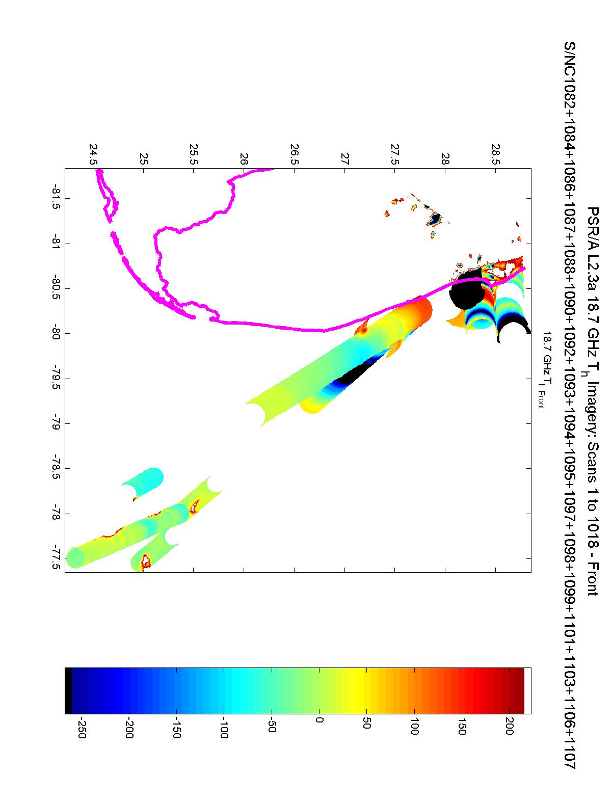
CAMEX-3 POLARIMETRIC SCANNING RADIOMETER (PSR) V1
National Aeronautics and Space Administration —
The Polarimetric Scanning Radiometer (PSR) is a versatile airborne microwave imaging radiometer developed by the Georgia Institute of Technology and the NOAA... -
Federal
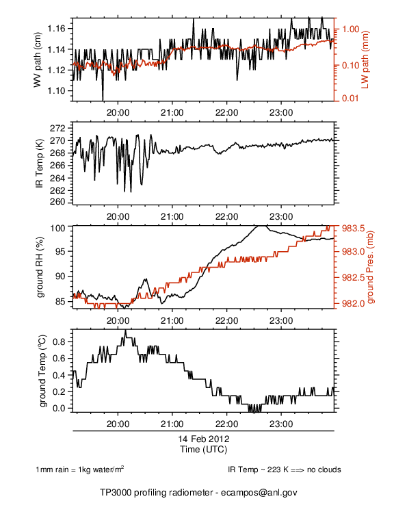
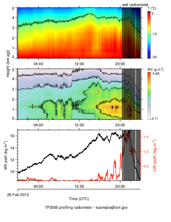
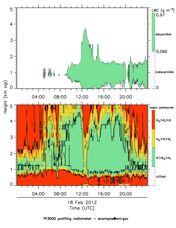
GPM GROUND VALIDATION ENVIRONMENT CANADA (EC) RADIOMETER GCPEX V1
National Aeronautics and Space Administration —
The GPM Ground Validation Environment Canada (EC) Radiometer GCPEx dataset contains retrievals of temperature, water vapor, relative humidity, liquid water profiles... -
Federal
HURRICANE AND SEVERE STORM SENTINEL (HS3) HURRICANE IMAGING RADIOMETER (HIRAD) V1
National Aeronautics and Space Administration —
The Hurricane and Severe Storm Sentinel (HS3) Hurricane Imaging Radiometer (HIRAD) was collected by the Hurricane Imaging Radiometer (HIRAD), which was a multi-band... -
Federal
TRMM TROPICAL CYCLONE PRECIPITATION FEATURE (TCPF) DATABASE - LEVEL 1 V1
National Aeronautics and Space Administration —
The TRMM Cyclone Precipitation Feature (TCPF) Database - Level 1 provides Tropical Rainfall Measuring Mission (TRMM)-based tropical cyclone data in a common framework... -
Federal
High Altitude MMIC Sounding Radiometer (HAMSR) EPOCH V1
National Aeronautics and Space Administration —
The High Altitude MMIC Sounding Radiometer (HAMSR) EPOCH dataset includes measurements gathered by the HAMSR instrument during the East Pacific Origins and... -
Federal
GPM GROUND VALIDATION ADVANCED MICROWAVE RADIOMETER RAIN IDENTIFICATION (ADMIRARI) GCPEX V1
National Aeronautics and Space Administration —
The GPM Ground Validation Advanced Microwave Radiometer Rain Identification (ADMIRARI) GCPEx dataset measures brightness temperature at three frequencies (10.7, 21.0... -
Federal
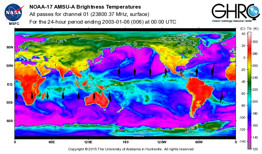
ADVANCED MICROWAVE SOUNDING UNIT-A (AMSU-A) SWATH FROM NOAA-17 V1
National Aeronautics and Space Administration —
AMSU-A, the Advanced Microwave Sounding Unit, is a 15-channel passive microwave radiometer used to profile atmospheric temperature and moisture from the earth's... -
Federal
GPM GROUND VALIDATION SATELLITE SIMULATED ORBITS C3VP V1
National Aeronautics and Space Administration —
The GPM Ground Validation Satellite Simulated Orbits C3VP dataset is available in the Orbital database, which takes account for the atmospheric profiles, the... -
Federal
GRIP HURRICANE IMAGING RADIOMETER (HIRAD) V0
National Aeronautics and Space Administration —
The GRIP Hurricane Imaging Radiometer (HIRAD) dataset was collected by the HIRAD instrument, which is a hurricane imaging, single-polarization passive C-band... -
Federal
GPM GROUND VALIDATION SATELLITE SIMULATED ORBITS LPVEX V1
National Aeronautics and Space Administration —
The GPM Ground Validation Satellite Simulated Orbits LPVEx dataset is available in the Orbital database, which takes account for the atmospheric profiles, the... -
Federal
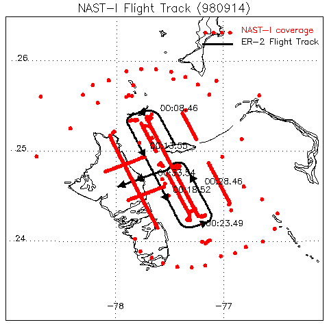
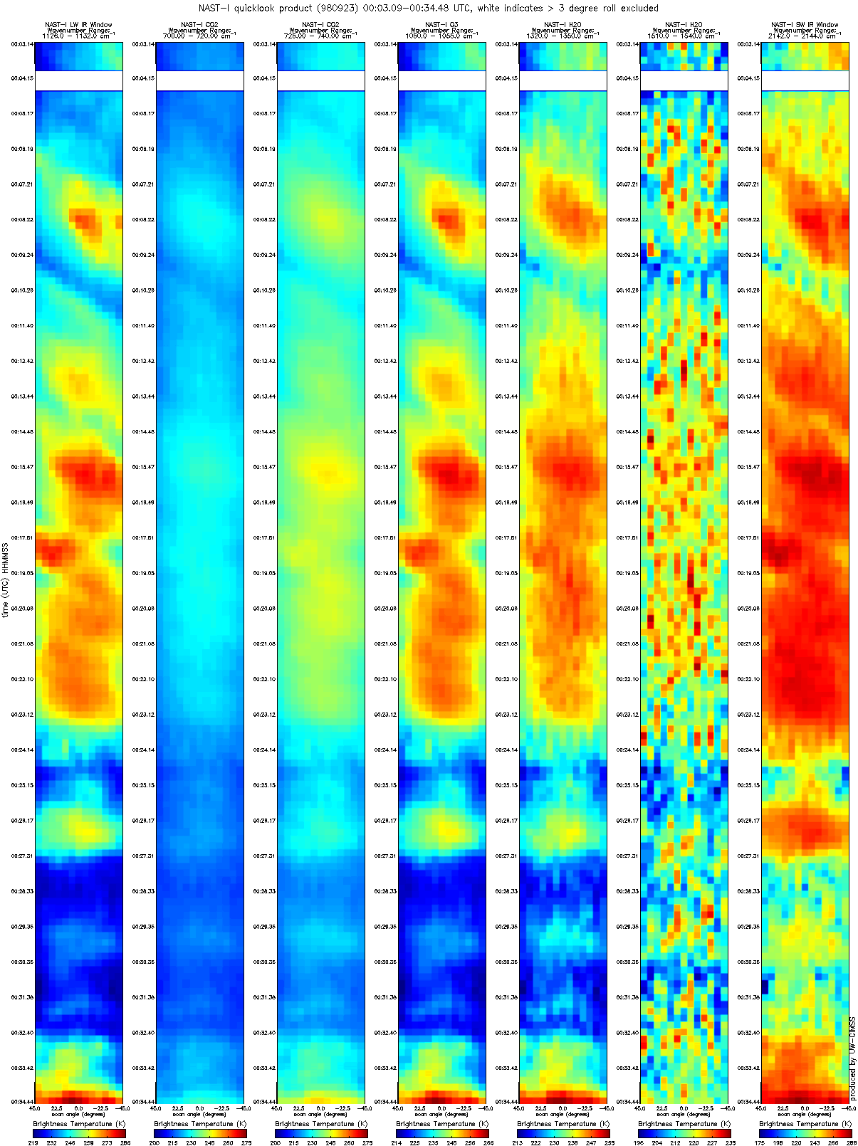
CAMEX-3 NAST-I RADIANCE PRODUCTS V1
National Aeronautics and Space Administration —
The National Polar-orbiting Operational Environmental Satellite System (NPOESS) Atmospheric Sounding Testbed (NAST) is a suite of airborne infrared and microwave...

Official websites use .gov
A
.gov website belongs to an official government
organization in the United States.
Secure .gov websites use HTTPS
A
lock (
) or https:// means you’ve safely connected to
the .gov website. Share sensitive information only on official,
secure websites.