
-
Federal
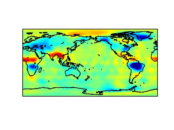
NOAA-20 VIIRS Level-3 Global Mapped 11µm Daytime Sea Surface Temperature (SST) Data, version R2024.0
National Aeronautics and Space Administration —
The Visible and Infrared Imager/Radiometer Suite (VIIRS) is a multi-disciplinary instrument that is being flown on the Joint Polar Satellite System (JPSS) series of... -
Federal
Latin America and the Caribbean Population Time Series
National Aeronautics and Space Administration —
The Latin America and the Caribbean Population Time Series data set provides total population estimates using spatially consistent and comparable Units for Latin... -
Federal
A Global Database of Gas Fluxes from Soils after Rewetting or Thawing, Version 1.0
National Aeronautics and Space Administration —
This database contains information compiled from published studies on gas flux from soil following rewetting or thawing. The resulting database includes 222 field and... -
Federal
ASTEROID PROPER ELEMENTS V1.0
National Aeronautics and Space Administration —
Proper elements of asteroids are derived from the osculating orbital elements by correcting for the perturbations of the major planets to arrive at elements which are... -
Federal
Declassified Satellite Imagery 2 (2002)
National Aeronautics and Space Administration —
Declassified satellite images provide an important worldwide record of land-surface change. With the success of the first release of classified satellite photography... -
Federal
Real System Failures
National Aeronautics and Space Administration —
This resource area contains descriptions of actual electronic systems failure scenarios with an emphasis on the diversity of failure modes and effects that can befall... -
Federal
Microfluidic Extraction of DNA for Identification of Unknown organisms in Microgravity Project
National Aeronautics and Space Administration —
Expanding human spaceflight beyond low-Earth orbit poses significant technological challenges. One of these challenges is environmental monitoring, specifically the... -
Federal
Asteroid Lightcurve Database (LCDB) V3.0
National Aeronautics and Space Administration —
The asteroid lightcurve database (LCDB) is one of the more widely-used research tools for those doing research that compares and contrasts physical characteristics of... -
Federal
GPM Ground Validation Doppler on Wheels (DOW) OLYMPEX V2
National Aeronautics and Space Administration —
The GPM Ground Validation Doppler on Wheels (DOW) OLYMPEX V2 dataset was obtained by a dual-polarization and dual-frequency X-band mobile radar operated by the Center... -
Federal
Principal Galaxy Catalog (PGC) 2003
National Aeronautics and Space Administration —
The Principal Galaxy Catalog, 2003 Version (PGC2003) is a new catalog of principal galaxies. It constitutes the framework of the HYPERLEDA database that supersedes... -
Federal
Identification of Spatial Fault Patterns in Semiconductor Wafers
National Aeronautics and Space Administration —
Abstract The semiconductor industry is constantly searching for new ways to increase the rate of both process development and yield learning. As more data is being... -
Federal
Global Gridded Geographically Based Economic Data (G-Econ), Version 4
National Aeronautics and Space Administration —
The Global Gridded Geographically Based Economic Data (G-Econ), Version 4 contains derived one degree grid cells of Gross Domestic Product (GDP) data in Grid and... -
Federal
HANPP Collection: Global Patterns in Human Appropriation of Net Primary Productivity (HANPP)
National Aeronautics and Space Administration —
The HANPP Collection: Global Patterns in Human Appropriation of Net Primary Productivity (HANPP) represents a digital map of human appropriation of net primary... -
Federal
West Africa Coastal Vulnerability Mapping: Population Projections, 2030 and 2050
National Aeronautics and Space Administration —
The West Africa Coastal Vulnerability Mapping: Population Projections, 2030 and 2050 data set is based on an unreleased working version of the Gridded Population of... -
Federal
China Dimensions Data Collection: China Maps Bibliographic Database
National Aeronautics and Space Administration —
The China Maps Bibliographic Database is an historical collection of bibliographic information for more than 400 maps of China. The information resides in a... -
Federal
Bureau IT Leadership Directory
National Aeronautics and Space Administration —
Each agency is expected to post a JSON file for their Bureau IT Leadership Directory. Each dataset should include one record for each agency employee with the title... -
Federal
LIS/OTD 2.5 Degree Low Resolution Monthly Climatology Time Series (LRMTS) V2.3.2015
National Aeronautics and Space Administration —
The LIS/OTD 2.5 Degree Low Resolution Monthly Climatology Time Series (LRMTS) contains a variety of gridded climatologies of total lightning flash rates obtained from... -
Federal
Large Quasar Astrometric Catalog, 3rd Release
National Aeronautics and Space Administration —
Since the release of the original Large Quasar Astrometric Catalog (LQAC: Souchay et al. 2009, A&A, 494, 815), a large number of quasars have been discovered...

Official websites use .gov
A
.gov website belongs to an official government
organization in the United States.
Secure .gov websites use HTTPS
A
lock (
) or https:// means you’ve safely connected to
the .gov website. Share sensitive information only on official,
secure websites.