
-
Federal
MARS EXPRESS MARS MRS 1/2/3 EXTENDED MISSION 5 3705 V1.0
National Aeronautics and Space Administration —
This is a Mars Express Radio Science data set, collected during the extended mission phase 2015-01-01 to 2016-12-31. It is a Occultation measurement and covers the... -
Federal
ExoMars 2016 SPICE Kernel Archive Bundle
National Aeronautics and Space Administration —
This bundle contains ExoMars 2016 SPICE kernels and related documentation. -
Federal
MARS EXPRESS MARS MRS 1/2/3 EXTENDED MISSION 5 3816 V1.0
National Aeronautics and Space Administration —
This is a Mars Express Radio Science data set, collected during the extended mission phase 2015-01-01 to 2016-12-31. It is a Occultation measurement and covers the... -
Federal
MARS EXPRESS MARS MRS 1/2/3 EXTENDED MISSION 5 3819 V1.0
National Aeronautics and Space Administration —
This is a Mars Express Radio Science data set, collected during the extended mission phase 2015-01-01 to 2016-12-31. It is a Occultation measurement and covers the... -
Federal
NEW HORIZONS SDC PLUTO ENCOUNTER RAW V2.0
National Aeronautics and Space Administration —
This data set contains Raw data taken by the New Horizons Student Dust Counter instrument during the Pluto encounter mission phase. This is VERSION 2.0 of this data... -
Federal
MARS EXPRESS MARS MRS 1/2/3 EXTENDED MISSION 5 3813 V1.0
National Aeronautics and Space Administration —
This is a Mars Express Radio Science data set, collected during the extended mission phase 2015-01-01 to 2016-12-31. It is a Occultation measurement and covers the... -
Federal
Fermi GBM Burst Catalog
National Aeronautics and Space Administration —
When referencing results from this online catalog, please cite von Kienlin, A. et al. 2020, Gruber, D. et al. 2014, von Kienlin, A. et al. 2014, and Bhat, P. et al.... -
Federal
MMS 2 Magnetic Ephemeris and Coordinates (MEC) and Support (Tsyganenko 2004 model, Dynamic conditions), Level 2 (L2), Burst Mode, 30 ms Data
National Aeronautics and Space Administration —
Magnetospheric Multiscale 2 (MMS 2) spacecraft position, velocity, attitude, angular momentum vector, and magnetic ephemeris and coordinates (MEC), Level-2 science... -
Federal
Pre-Delta-X: Water Levels across Wax Lake Outlet, Atchafalaya Basin, LA, USA, 2016
National Aeronautics and Space Administration —
This dataset provides absolute water level elevations derived for 10 locations across the Wax Lake Delta, Atchafalaya Basin, in Southern Louisiana, USA, within the... -
Federal
SMAPVEX16 Manitoba Core-Based In Situ Soil Moisture Data V001
National Aeronautics and Space Administration —
This data set contains in situ measurements of soil moisture and bulk density collected for the Soil Moisture Active Passive Validation Experiment 2016 Manitoba... -
Federal
IKONOS Level 1B Multispectral 4-Band Satellite Imagery
National Aeronautics and Space Administration —
The IKONOS Level 1B Multispectral 4-Band Imagery collection contains satellite imagery acquired from Maxar Technologies (formerly known as DigitalGlobe) by the... -
Federal
MuSLI Multi-Source Land Surface Phenology Yearly North America 30 m V011
National Aeronautics and Space Administration —
The Multi-Source Land Surface Phenology (LSP) Yearly North America 30 meter (m) Version 1.1 product (MSLSP) provides a Land Surface Phenology product for North... -
Federal
NAAMES Sonde Meteorological InSitu Data, Version 1
National Aeronautics and Space Administration —
NAAMES_Met_SondeInSitu_Data are meteorological radiosonde measurements collected via radiosonde launches during the North Atlantic Aerosols and Marine Ecosystems... -
Federal
MISR Level 3 Component Global Aerosol Product covering a year V004
National Aeronautics and Space Administration —
MIL3YAE_004 is the Multi-angle Imaging SpectroRadiometer (MISR) Level 3 Component Global Aerosol Product covering a year version 4 data product. It contains a... -
Federal
Remote Sensing Systems Radiometer Rain Collocations with JPL RapidScat L2B Swath Grid
National Aeronautics and Space Administration —
This dataset contains the multi-sourced microwave radiometer wind speed, rain and cloud liquid water data collocated to RapidScat Level 2B wind vector cell (WVC)... -
Federal
Pre-Delta-X: Spectral Reflectance of Water Surface, Atchafalaya Basin, LA, USA, 2016
National Aeronautics and Space Administration —
This dataset provides measurements of in situ remote-sensing reflectance (Rrs; per steradian) of surface water across Atchafalaya Basin, southern coastal Louisiana,... -
Federal
SPURS-2 research vessel Underway CTD (uCTD) data for the E. Tropical Pacific R/V Revelle cruises
National Aeronautics and Space Administration —
The SPURS (Salinity Processes in the Upper Ocean Regional Study) project is a NASA-funded oceanographic process study and associated field program that aim to... -
Federal
SPURS-2 shipboard disdrometer data for the E. Tropical Pacific field campaign
National Aeronautics and Space Administration —
The SPURS-2 raindrop ODM-470 disdrometer dataset was collected from the ship during both the 2016 and 2017 cruises. Please see file global attributes and Klepp et al.... -
Federal
AirMSPI verison 6 terrain-projected georegistered radiance product acquired during the ImPACT-PM flight campaign
National Aeronautics and Space Administration —
AirMSPI_ImPACT-PM_Terrain-projected_Georegistered_Radiance_Data is an AirMSPI terrain-projected georegistered radiance product acquired during the JPL and Caltech... -
Federal
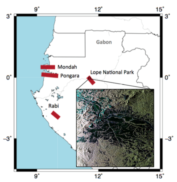
AfriSAR: Canopy Structure Derived from PolInSAR and Coherence TomoSAR NISAR tools
National Aeronautics and Space Administration —
This dataset contains forest vertical structure and associated uncertainty products derived by applying multi-baseline Polarimetric Interferometric Synthetic Aperture...

Official websites use .gov
A
.gov website belongs to an official government
organization in the United States.
Secure .gov websites use HTTPS
A
lock (
) or https:// means you’ve safely connected to
the .gov website. Share sensitive information only on official,
secure websites.