

10 datasets found
-
Federal
Summary Report of Community-Based Environmental and Species Observations from the Bering Sea Sub-Network, 2008-2009, Version 1
National Aeronautics and Space Administration —
The Bering Sea Sub-Network (BSSN) is comprised of a set of coastal communities representing six indigenous cultures: three in the Russian Federation and three in the... -
Federal
IPAB Antarctic Drifting Buoy Data, Version 1
National Aeronautics and Space Administration —
Through participating research organizations in various countries, the World Climate Research Programme's (WCRP) International Programme for Antarctic Buoys (IPAB)... -
Federal
Arctic Sea State 2015 Field Campaign, Version 1
National Aeronautics and Space Administration —
The U.S. Office of Naval Research (ONR) Sea State Departmental Research Initiative (DRI) field campaign was conducted during autumn of 2015 in the Beaufort Sea in... -
Federal
AWI Moored ULS Data, Greenland Sea and Fram Strait, 1991-2002, Version 1
National Aeronautics and Space Administration —
This data set consists of Upward Looking Sonar (ULS) data from 11 moorings in the Greenland Sea. Parameters in the processed data files include ice draft, water... -
Federal
Soil Moisture Active Passive (SMAP) L1-L3 Ancillary NOAA Data V001
National Aeronautics and Space Administration —
This ancillary SMAP product contains six dynamic data sets originally produced by NOAA or NOAA-affiliated organizations. 1) NCEP Geophysical Forecast System modeled... -
Federal
International Polar Year Historical Data and Literature, Version 1
National Aeronautics and Space Administration —
The International Polar Year Historical Data and Literature collection (formerly known as the Discovery and Access of Historic Literature from the IPYs (DAHLI)... -
Federal
SMMR/Nimbus-7 Color Images V001 (SMMRN7IM) at GES DISC
National Aeronautics and Space Administration —
SMMRN7IM is the Nimbus-7 Scanning Multichannel Microwave Radiometer (SMMR) Color Image data product scanned from 17" x 15" color prints and saved as JPEG-2000 files.... -
Federal
AWI Moored ULS Data, Weddell Sea (1990-1998), Version 1
National Aeronautics and Space Administration —
This data set consists of moored Upward Looking Sonar (ULS) data from 14 stations in the Weddell Sea. Parameters in the processed data files are water pressure, water... -
Federal
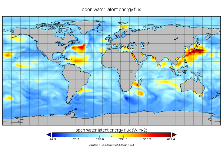
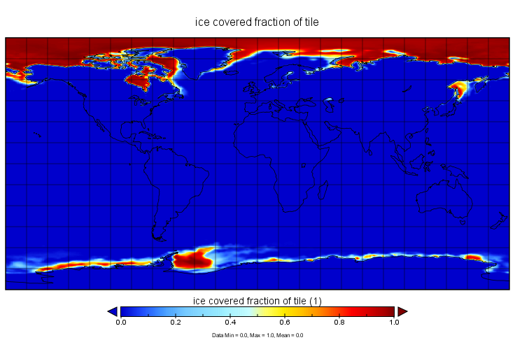
MERRA-2 tavg1_2d_ocn_Nx: 2d,1-Hourly,Time-Averaged,Single-Level,Assimilation,Ocean Surface Diagnostics 0.625 x 0.5 degree V5.12.4 (M2T1NXOCN) at GES DISC
National Aeronautics and Space Administration —
M2T1NXOCN (or tavg1_2d_ocn_Nx) is an hourly time-averaged 2-dimensional data collection in Modern-Era Retrospective analysis for Research and Applications version 2... -
Federal
MERRA-2 tavgU_2d_ocn_Nx: 2d,diurnal,Time-Averaged,Single-Level,Assimilation,Ocean Surface Diagnostics 0.625 x 0.5 degree V5.12.4 (M2TUNXOCN) at GES DISC
National Aeronautics and Space Administration —
M2TUNXOCN (or tavgU_2d_ocn_Nx) is a time-averaged 2-dimensional monthly diurnal means data collection in Modern-Era Retrospective analysis for Research and...
10 datasets found