
-
Federal
REGIONAL AIR-SEA INTERACTION (RASI) GAP WIND AND COASTAL UPWELLING EVENTS CLIMATOLOGY GULF OF PANAMA, PANAMA V1
National Aeronautics and Space Administration —
The Regional Air-Sea Interactions (RASI) Gap Wind and Coastal Upwelling Events Climatology Gulf of Panama, Panama dataset was created using an automated intelligent... -
Federal
REGIONAL AIR-SEA INTERACTION (RASI) GAP WIND AND COASTAL UPWELLING EVENTS CLIMATOLOGY GULF OF TEHUANTEPEC, MEXICO V1
National Aeronautics and Space Administration —
The Regional Air-Sea Interactions (RASI) Gap Wind and Coastal Upwelling Events Climatology Gulf of Tehuantepec, Mexico dataset was created using an automated... -
Federal
Soil Moisture Active Passive (SMAP) L1-L3 Ancillary GEOS Data V001
National Aeronautics and Space Administration —
This ancillary SMAP product contains three dynamic GMAO GEOS-5 modeled data sets. Each data set contains surface and atmospheric parameters pertinent to SMAP provided... -
Federal
AMSR-E/Aqua Weekly L3 Global Ascending/Descending .25x.25 deg Ocean Grids V002
National Aeronautics and Space Administration —
The Level-3 daily product (AE_DyOcn), weekly product (AE_WkOcn), and monthly product (AE_MoOcn) include SST, near-surface wind speed, columnar water vapor, and... -
Federal
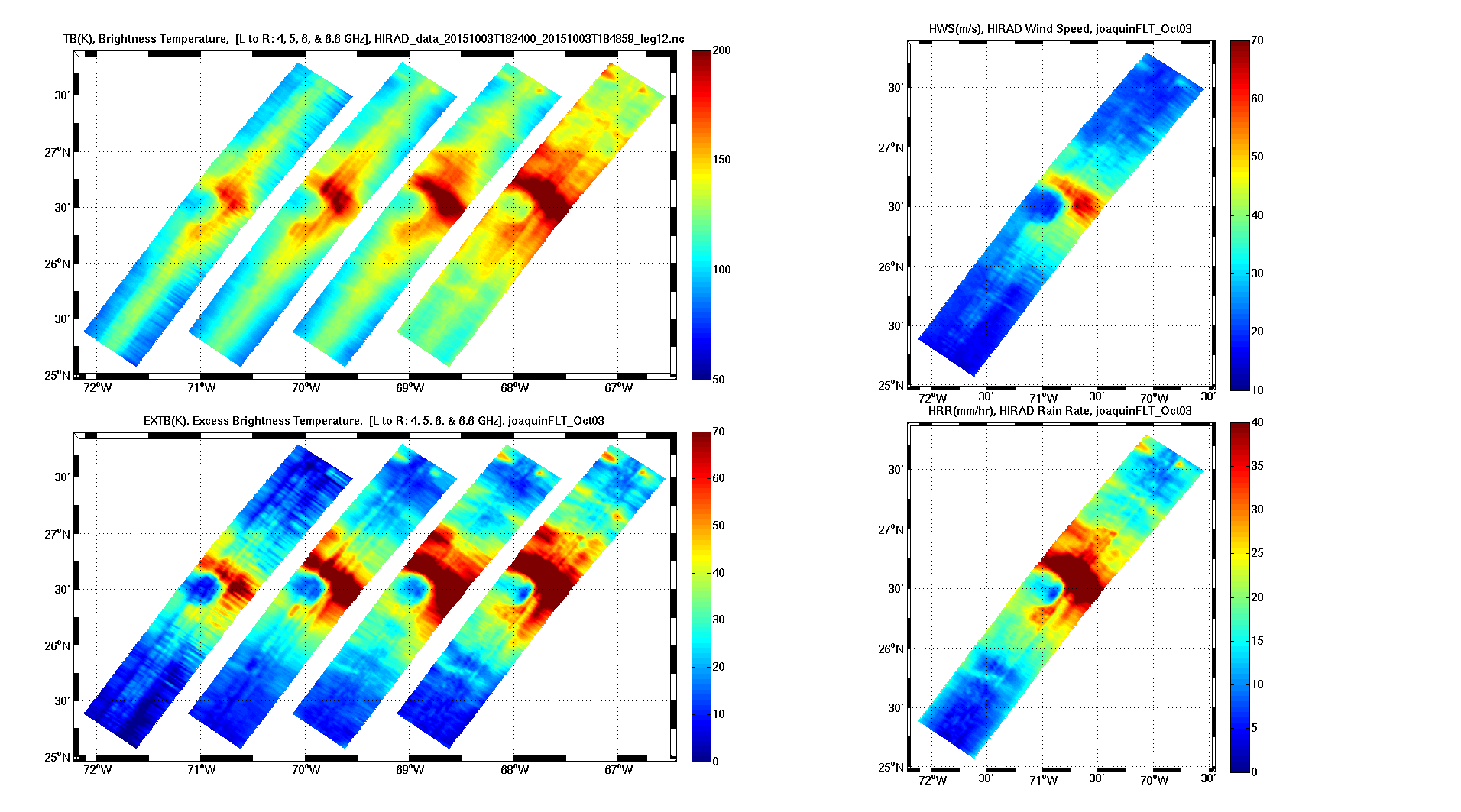
Tropical Cyclone Intensity (TCI) Hurricane Imaging Radiometer (HIRAD) V2.1
National Aeronautics and Space Administration —
The Tropical Cyclone Intensity (TCI) Hurricane Imaging Radiometer (HIRAD) dataset was created for the TCI field campaign from August 30, 2015 through October 23,... -
Federal
SASSIE Arctic Field Campaign Shipboard Meteorology Data Fall 2022
National Aeronautics and Space Administration —
The Salinity and Stratification at the Sea Ice Edge (SASSIE) project is a NASA experiment that aims to understand how salinity anomalies in the upper ocean generated... -
Federal
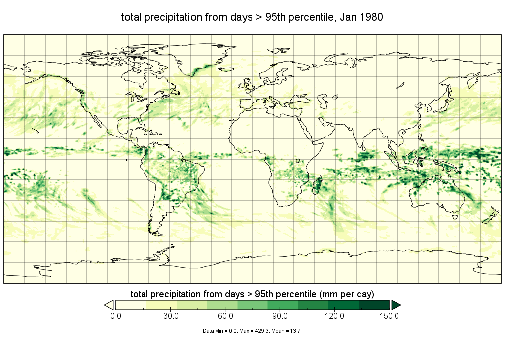
MERRA-2 statM_2d_edi_Nx: 2d, Single-Level, Monthly Extremes Detection Indices based on 1991-2020 V2 (M2SMNXEDI) at GES DISC
National Aeronautics and Space Administration —
M2SMNXEDI (or statM_2d_edi_Nx) is a 2-dimensional monthly data collection for extreme detection indices derived from daily Modern-Era Retrospective analysis for... -
Federal
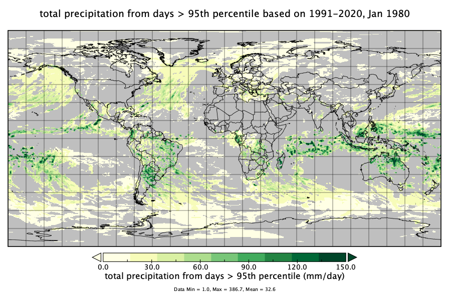
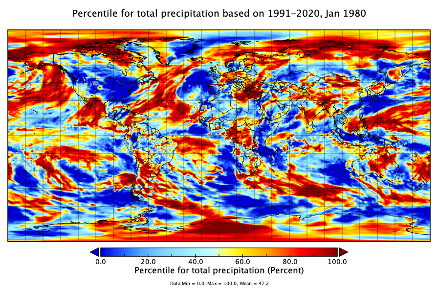
MERRA-2 statM_2d_pct_Nx: 2d, Single-Level, Monthly Percentiles based on 1991-2020 V2 (M2SMNXPCT) at GES DISC
National Aeronautics and Space Administration —
M2SMNXPCT (or statM_2d_pct_Nx) is a 2-dimensional monthly data collection for percentile statistics derived from monthly Modern-Era Retrospective analysis for... -
Federal
REGIONAL AIR-SEA INTERACTION (RASI) GAP WIND AND COASTAL UPWELLING EVENTS CLIMATOLOGY GULF OF PAPAGAYO, COSTA RICA V1
National Aeronautics and Space Administration —
The Regional Air-Sea Interactions (RASI) Gap Wind and Coastal Upwelling Events Climatology Gulf of Papagayo, Costa Rica dataset was created using an automated... -
Federal
ACCLIP WB-57 Aircraft In-situ Cloud Data
National Aeronautics and Space Administration —
ACCLIP_Cloud_AircraftInSitu_WB57_Data is the in-situ cloud data collection during the Asian Summer Monsoon Chemical & Climate Impact Project (ACCLIP). Data from... -
Federal
SeaFlux Data Products V1
National Aeronautics and Space Administration —
The SeaFlux Data Products dataset consists of estimates of ocean surface latent and sensible heat fluxes, 2m and 10m wind speed, 2m and 10m air temperature, 2m and... -
Federal
Export and Leaching of Carbon and Nitrogen from Mississippi River Basin, 1901-2099
National Aeronautics and Space Administration —
This dataset provides estimates for export and leaching of dissolved inorganic carbon (DIC), dissolved organic carbon (DOC), total organic carbon (TOC), particulate... -
Federal
MERRA-2 statM_2d_pct_Nx: 2d, Single-Level, Monthly Percentiles V1 (M2SMNXPCT) at GES DISC
National Aeronautics and Space Administration —
The Modern Era Retrospective analysis for Research and Applications, Version 2 (MERRA-2) contains a wealth of information that can be used for weather and climate... -
Federal
Geoecology: County-Level Environmental Data for the United States, 1941-1981
National Aeronautics and Space Administration —
The Geoecology database is a compilation of environmental data for the period 1941 to 1981. The Geoecology database contains selected data on terrain and soils, water... -
Federal
ATom: Cloud and Coarse Aerosol Measurements from CAPS Instrument, 2016-2018
National Aeronautics and Space Administration —
This dataset contains cloud type and coarse aerosol contents measured by the University of Vienna's second-generation Cloud Aerosol and Precipitation Spectrometer... -
Federal
MERRA-2 statM_2d_edi_Nx: 2d, Single-Level, Monthly Extremes Detection Indices V1 (M2SMNXEDI) at GES DISC
National Aeronautics and Space Administration —
The Modern Era Retrospective analysis for Research and Applications, Version 2 (MERRA-2) contains a wealth of information that can be used for weather and climate... -
Federal
ACCLIP WB-57 Aircraft Merge Data
National Aeronautics and Space Administration —
ACCLIP_Merge_WB57-Aircraft_Data is the pre-generated merge files created from a variety of in-situ instrumentation collecting measurements onboard the WB-57 aircraft... -
Federal
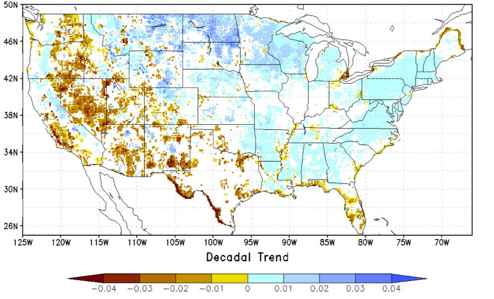
NCA-LDAS Noah-3.3 Land Surface Model L4 Trends 0.125 x 0.125 degree V2.0 (NCALDAS_NOAH0125_Trends) at GES DISC
National Aeronautics and Space Administration —
The National Climate Assessment - Land Data Assimilation System, or NCA-LDAS, is a terrestrial water reanalysis in support of the United States Global Change Research... -
Federal
Trends of Thermal, Wetness, and Vegetative Change in the Circumpolar Arctic
National Aeronautics and Space Administration —
This dataset provides estimates of trends in temperature, moisture, and vegetation changes over the circumpolar Arctic. Time series trends were measured by the Theil-...

Official websites use .gov
A
.gov website belongs to an official government
organization in the United States.
Secure .gov websites use HTTPS
A
lock (
) or https:// means you’ve safely connected to
the .gov website. Share sensitive information only on official,
secure websites.