
-
Federal
UARS High Resolution Doppler Imager (HRDI) Level 3AL V011 (UARHR3AL) at GES DISC 10 recent views
National Aeronautics and Space Administration —
The High Resolution Doppler Imager (HRDI) Level 3AL data product consists of daily, 4 degree increment latitude-ordered vertical profiles of meridional and zonal wind... -
Federal
UARS Correlative NMC Daily Gridded Stratospheric Assimilated Data V001 (UARZCNMC) at GES DISC
National Aeronautics and Space Administration —
The UARS Correlative assimilation data from NOAA's National Meteorological Center (NMC) consists of daily model runs at 12 GMT as a means of providing an independent... -
Federal
30 Minute Rainfall Data (FIFE)
National Aeronautics and Space Administration —
30 minute rainfall data for the Konza Prairie -
Federal
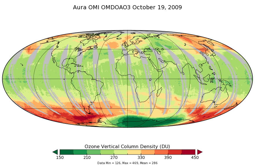
OMI/Aura Ozone (O3) DOAS Total Column Daily L3 1 day 0.25 degree x 0.25 degree V3 (OMDOAO3e) at GES DISC
National Aeronautics and Space Administration —
The OMI science team produces this Level-3 Aura/OMI Global OMDOAO3e Data Products (0.25deg Lat/Lon grids). This Level-3 global total column ozone product is derived... -
Federal
CAMEX-4 AEROSONDE V1
National Aeronautics and Space Administration —
The CAMEX-4 Aerosonde dataset contains temperature, humidity, and atmospheric pressure measurements collected to study the boundary layer below levels where... -
Federal
BOREAS TE-05 Leaf Carbon Isotope Data
National Aeronautics and Space Administration —
Contains leaf carbon isotope data collected by TE-05 during 1994. -
Federal
BOREAS/SRC AMS Suite A Surface Meteorological and Radiation Data: 1996
National Aeronautics and Space Administration —
Contains the data collected in 1996 by the AMS suite A instrument set operated by SRC and provided to BORIS. -
Federal
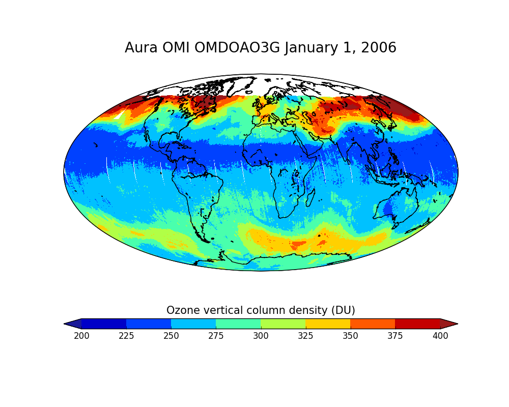
OMI/Aura Ozone (O3) DOAS Total Column Daily L2 Global Gridded 0.25 degree x 0.25 degree V3 (OMDOAO3G) at GES DISC
National Aeronautics and Space Administration —
This Level-2G daily global gridded product OMDOAO3G is based on the pixel level OMI Level-2 DOAO3 product OMDOAO3. This Level-2G global total column ozone product is... -
Federal
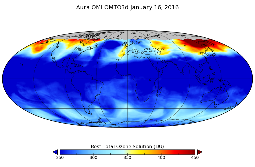
OMI/Aura TOMS-Like Ozone, Aerosol Index, Cloud Radiance Fraction L3 1 day 1 degree x 1 degree V3 (OMTO3d) at GES DISC
National Aeronautics and Space Administration —
The OMI science team produces this Level-3 daily global TOMS-Like Total Column Ozone gridded product OMTO3d (1 deg Lat/Lon grids). The OMTO3d product is produced by... -
Federal
OMI/Aura Multi-wavelength Aerosol Optical Depth and Single Scattering Albedo Daily L2 Global Gridded 0.25 degree x 0.25 degree V3 (OMAEROG) at GES DISC
National Aeronautics and Space Administration —
This Level-2G daily global gridded product OMAEROG is based on the pixel level OMI Level-2 Aerosol product OMAERO, based on the multi-wavelength algorithm that uses... -
Federal
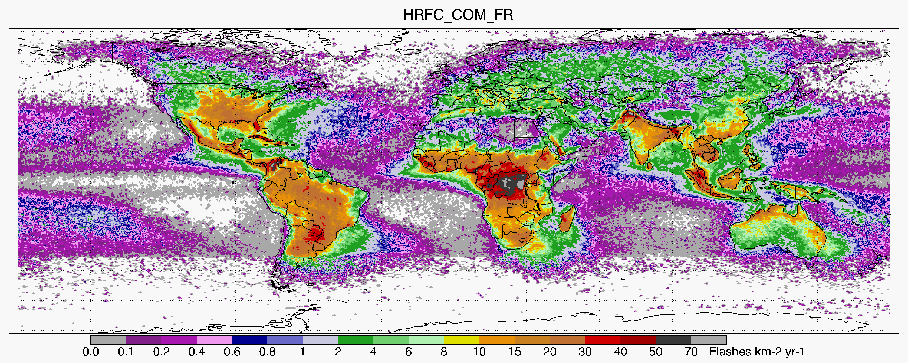
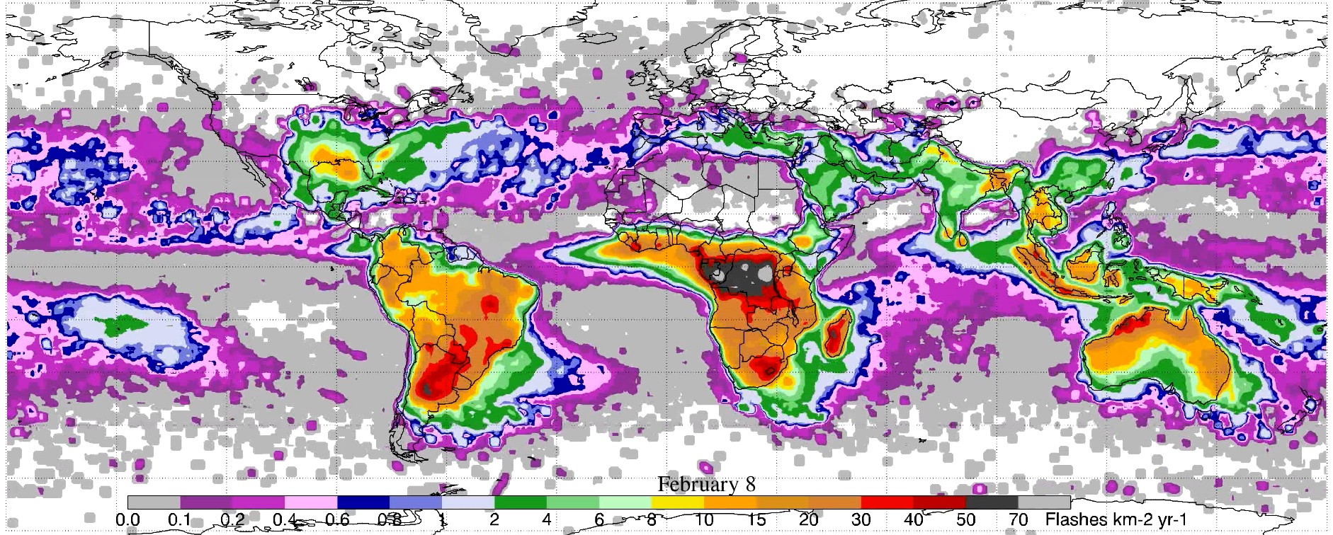
LIS/OTD 0.5 Degree High Resolution Full Climatology (HRFC) V2.3.2015
National Aeronautics and Space Administration —
The LIS/OTD 0.5 Degree High Resolution Full Climatology (HRFC) contains a variety of gridded climatologies of total lightning flash rates obtained from two lightning... -
Federal
Bowen Ratio Surface Flux: UNL (FIFE)
National Aeronautics and Space Administration —
Latent & sensible heat flux by Bowen Ratio & aerodynamic characterization of vegetation -
Federal
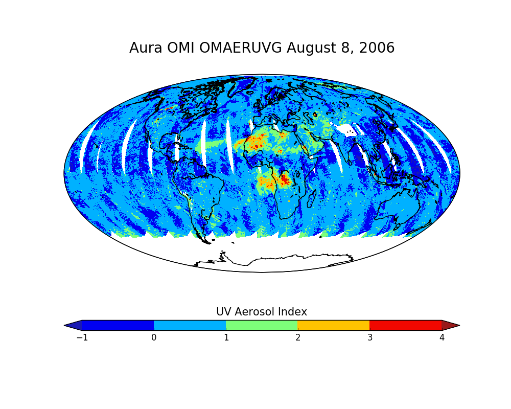
OMI/Aura Near UV Aerosol Optical Depth and Single Scattering Albedo Daily L2 Global Gridded 0.25 degree x 0.25 degree V3 (OMAERUVG) at GES DISC
National Aeronautics and Space Administration —
This Level-2G daily global gridded product OMAERUVG is based on the pixel level OMI Level-2 AERUV product OMAERUV. This Level-2G daily global gridded product OMAERUVG... -
Federal
BOREAS TGB-05 Biogenic Soil Emissions of NO and Nitrous Oxide
National Aeronautics and Space Administration —
Contains the TGB-05 NO and N2O flux data for sites in the Northern Study Area. -
Federal
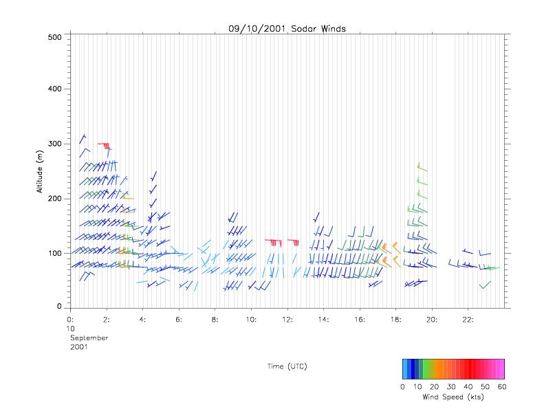
CAMEX-4 MIPS SODAR V1
National Aeronautics and Space Administration —
The University of Alabama in Huntsville (UAH) Mobile Integrated Profiling System (MIPS) is a mobile atmospheric profiling system. It includes a 915 MHz Doppler... -
Federal
GPM GROUND VALIDATION SATELLITE SIMULATED ORBITS MC3E V1
National Aeronautics and Space Administration —
The GPM Ground Validation Satellite Simulated Orbits MC3E dataset is available in the Orbital database , which takes account for the atmospheric profiles, the... -
Federal
BOREAS TE-06 1994 Soil and Air Temperatures in the NSA
National Aeronautics and Space Administration —
Contains soil temperature data collected by TE-06 during the BOREAS project. -
Federal
BOREAS RSS-14 GOES-7 Level-1a Visible, Infrared, and Water Vapor Images
National Aeronautics and Space Administration —
The level-1a BOREAS GOES-7 image data was collected by Remote Sensing Science Team-14 (RSS-14) personnel at Florida State University and processed to level-1a... -
Federal
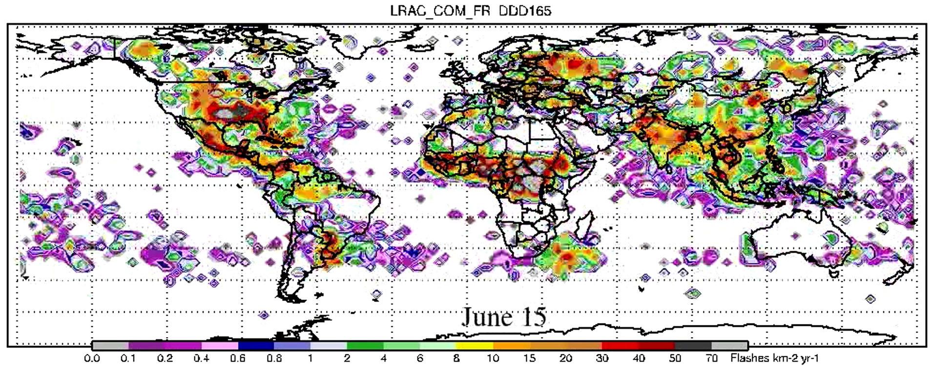
LIS/OTD 2.5 Degree Low Resolution Annual Climatology (LRAC) V2.3.2015
National Aeronautics and Space Administration —
The LIS/OTD 2.5 Degree Low Resolution Annual Climatology (LRAC) contains a variety of gridded climatologies of total lightning flash rates obtained from two lightning... -
Federal
LIS/OTD 0.5 Degree High Resolution Monthly Climatology (HRMC) V2.3.2015
National Aeronautics and Space Administration —
The LIS/OTD 0.5 Degree High Resolution Monthly Climatology (HRMC) contains a variety of gridded climatologies of total lightning flash rates obtained from two...

Official websites use .gov
A
.gov website belongs to an official government
organization in the United States.
Secure .gov websites use HTTPS
A
lock (
) or https:// means you’ve safely connected to
the .gov website. Share sensitive information only on official,
secure websites.