
-
Federal
Large Scale International Boundaries NGDA
Department of State —
Overview The Office of the Geographer and Global Issues at the U.S. Department of State produces the Large Scale International Boundaries (LSIB) dataset. The current... -
City
Seattle Shoreline
City of Seattle —
The shoreline essentially follows the 8 foot contour line, except where the ortho offered further clarification. That 8 foot contour line matches closest to what... -
City
Water Mains
City of Seattle —
A grouped feature layer that includes Water Mains, Water Services, Same Side Tap Only and No New Taps layers.Water Mains are large buried pipes that distribute water... -
Federal
EnviroAtlas - Potential Evapotranspiration 1950 - 2099 for the Conterminous United States
U.S. Environmental Protection Agency —
The EnviroAtlas Climate Scenarios were generated from NASA Earth Exchange (NEX) Downscaled Climate Projections (NEX-DCP30) ensemble averages (the average of over 30... -
City
Presumed Unlined
City of Seattle —
A grouped feature layer that includes Water Mains, Water Services, Same Side Tap Only and No New Taps layers.Water Mains are large buried pipes that distribute water... -
Federal
Navigable Waterway Network Lines NGDA
Federal Geographic Data Committee —
The Navigable Waterway Network Lines dataset is periodically updated by the United States Army Corp of Engineers (USACE) and is part of the U.S. Department of... -
Federal
OCS Marine Minerals Lease Areas NGDA
Department of the Interior —
The Federal Outer Continental Shelf (OCS) Marine Mineral (e.g. sand and gravel) Lease Areas layer is maintained by the Bureau of Ocean Energy Management (BOEM), part... -
State
Oregon Ecoregions
State of Oregon —
This data layer is an element of the Oregon GIS Framework. Ecoregions denote areas of general similarity in ecosystems and in the type quality, and quantity of... -
Federal
BLM Natl AIM Riparian and Wetland Indicators Hub
Department of the Interior —
This feature class includes monitoring data collected nationally to understand the status, condition, and trend of resources on BLM lands. Data are collected in... -
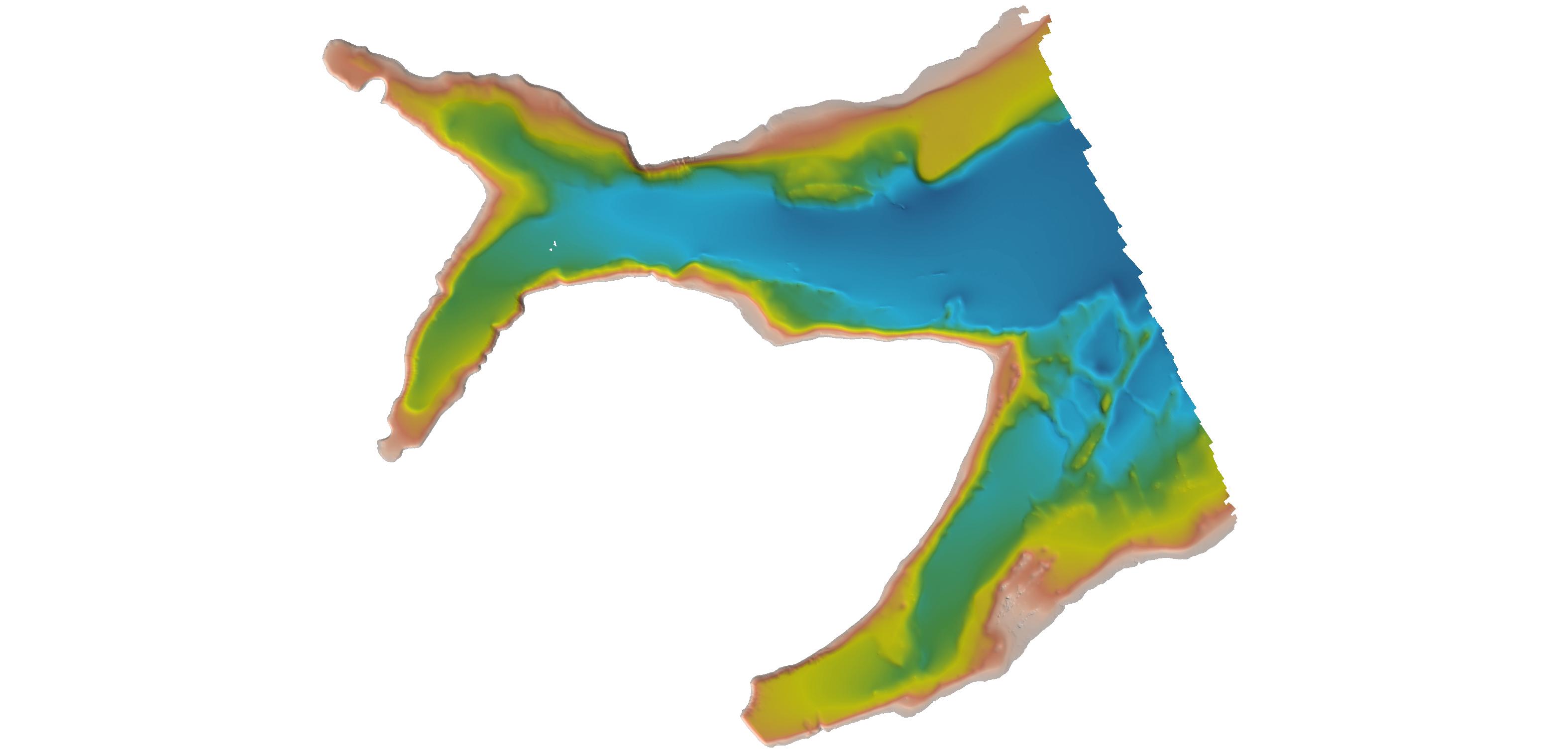
Federal
F00918: NOS Hydrographic Survey , 2025-05-07
National Oceanic and Atmospheric Administration, Department of Commerce —
The National Oceanic and Atmospheric Administration (NOAA) has the statutory mandate to collect hydrographic data in support of nautical chart compilation for safe... -
City
Water Services
City of Seattle —
A grouped feature layer that includes Water Mains, Water Services, Same Side Tap Only and No New Taps layers.Water Mains are large buried pipes that distribute water... -
City
Proposed Inlets
City of Seattle —
This layer displays all the catch basins, catch basin grated tops, sandboxes, junction boxes, inlets and trash racks within the City of Seattle (and the former... -
Federal
F00919: NOS Hydrographic Survey , 2025-06-03
National Oceanic and Atmospheric Administration, Department of Commerce —
The National Oceanic and Atmospheric Administration (NOAA) has the statutory mandate to collect hydrographic data in support of nautical chart compilation for safe... -
City
Inlets
City of Seattle —
This layer displays all the catch basins, catch basin grated tops, sandboxes, junction boxes, inlets and trash racks within the City of Seattle (and the former... -
Federal
H11195: NOS Hydrographic Survey , Southwest Alaska Peninsula, Alaska, 2003-06-06
National Oceanic and Atmospheric Administration, Department of Commerce —
The National Oceanic and Atmospheric Administration (NOAA) has the statutory mandate to collect hydrographic data in support of nautical chart compilation for safe... -
Federal
H06937: NOS Hydrographic Survey , 1944-12-31
National Oceanic and Atmospheric Administration, Department of Commerce —
The National Oceanic and Atmospheric Administration (NOAA) has the statutory mandate to collect hydrographic data in support of nautical chart compilation for safe... -
Federal
H06933: NOS Hydrographic Survey , 1943-12-31
National Oceanic and Atmospheric Administration, Department of Commerce —
The National Oceanic and Atmospheric Administration (NOAA) has the statutory mandate to collect hydrographic data in support of nautical chart compilation for safe... -
Federal
H06277: NOS Hydrographic Survey , 1937-12-31
National Oceanic and Atmospheric Administration, Department of Commerce —
The National Oceanic and Atmospheric Administration (NOAA) has the statutory mandate to collect hydrographic data in support of nautical chart compilation for safe... -
Federal
H04491: NOS Hydrographic Survey , 1925-12-31
National Oceanic and Atmospheric Administration, Department of Commerce —
The National Oceanic and Atmospheric Administration (NOAA) has the statutory mandate to collect hydrographic data in support of nautical chart compilation for safe... -
Federal
H02137: NOS Hydrographic Survey , 1892-12-31
National Oceanic and Atmospheric Administration, Department of Commerce —
The National Oceanic and Atmospheric Administration (NOAA) has the statutory mandate to collect hydrographic data in support of nautical chart compilation for safe...

Official websites use .gov
A
.gov website belongs to an official government
organization in the United States.
Secure .gov websites use HTTPS
A
lock (
) or https:// means you’ve safely connected to
the .gov website. Share sensitive information only on official,
secure websites.
.jpg)