
-
Federal
TRMM Precipitation Radar Rainfall Rate and Profile L2 1.5 hours V7 (TRMM_2A25) at GES DISC
National Aeronautics and Space Administration —
The new version of these data is in GPM-like format (consistent with the GPM Dual-frequency Radar data format), and can be found under the name GPM_2APR. The TRMM... -
Federal
TROPICS07 L2A Unified Resolution Brightness Temperatures V0.2
National Aeronautics and Space Administration —
The "Time-Resolved Observations of Precipitation structure and storm Intensity with a Constellation of Smallsats" (TROPICS) mission has a goal of providing nearly... -
Federal
TROPICS01 Pathfinder L2A Unified Resolution Brightness Temperatures V1.0
National Aeronautics and Space Administration —
The "Time-Resolved Observations of Precipitation structure and storm Intensity with a Constellation of Smallsats" (TROPICS) mission has a goal of providing nearly... -
Federal
AIRS/Aqua L2 Near Real Time (NRT) Support Retrieval (AIRS-only) V006 (AIRS2SUP_NRT) at GES DISC
National Aeronautics and Space Administration —
The Atmospheric Infrared Sounder (AIRS) Level 2 Near Real Time (NRT) Support Retrieval (AIRS-only) product (AIRS2SUP_NRT_006) differs from the routine product... -
Federal
AMSR-E L2 Rainfall Subset, collocated with CloudSat track V002 (AMSERR_CPR) at GES DISC
National Aeronautics and Space Administration —
This is a subset of AMSR-E rain rate product along CloudSat field of view track. The goal of the subset is to select and return AMSR-E data that are within -100 km... -
Federal
TOVS GLA MONTHLY GRIDS from NOAA-11 V01 (TOVSAMNH) at GES DISC
National Aeronautics and Space Administration —
This dataset (TOVSAMNH) contains the TIROS Operational Vertical Sounder (TOVS) level 3 geophysical parameters derived using data from NOAA-11 and the physical... -
Federal
TROPICS05 L2B Deep Multispectral INtensity (DMIN) of Tropical Cyclones Estimator Algorithm V0.2
National Aeronautics and Space Administration —
The "Time-Resolved Observations of Precipitation structure and storm Intensity with a Constellation of Smallsats" (TROPICS) mission has a goal of providing nearly... -
Federal
TROPICS03 L2B Deep Multispectral INtensity (DMIN) of Tropical cyclones estimator Algorithm V1.0
National Aeronautics and Space Administration —
The "Time-Resolved Observations of Precipitation structure and storm Intensity with a Constellation of Smallsats" (TROPICS) mission has a goal of providing nearly... -
Federal
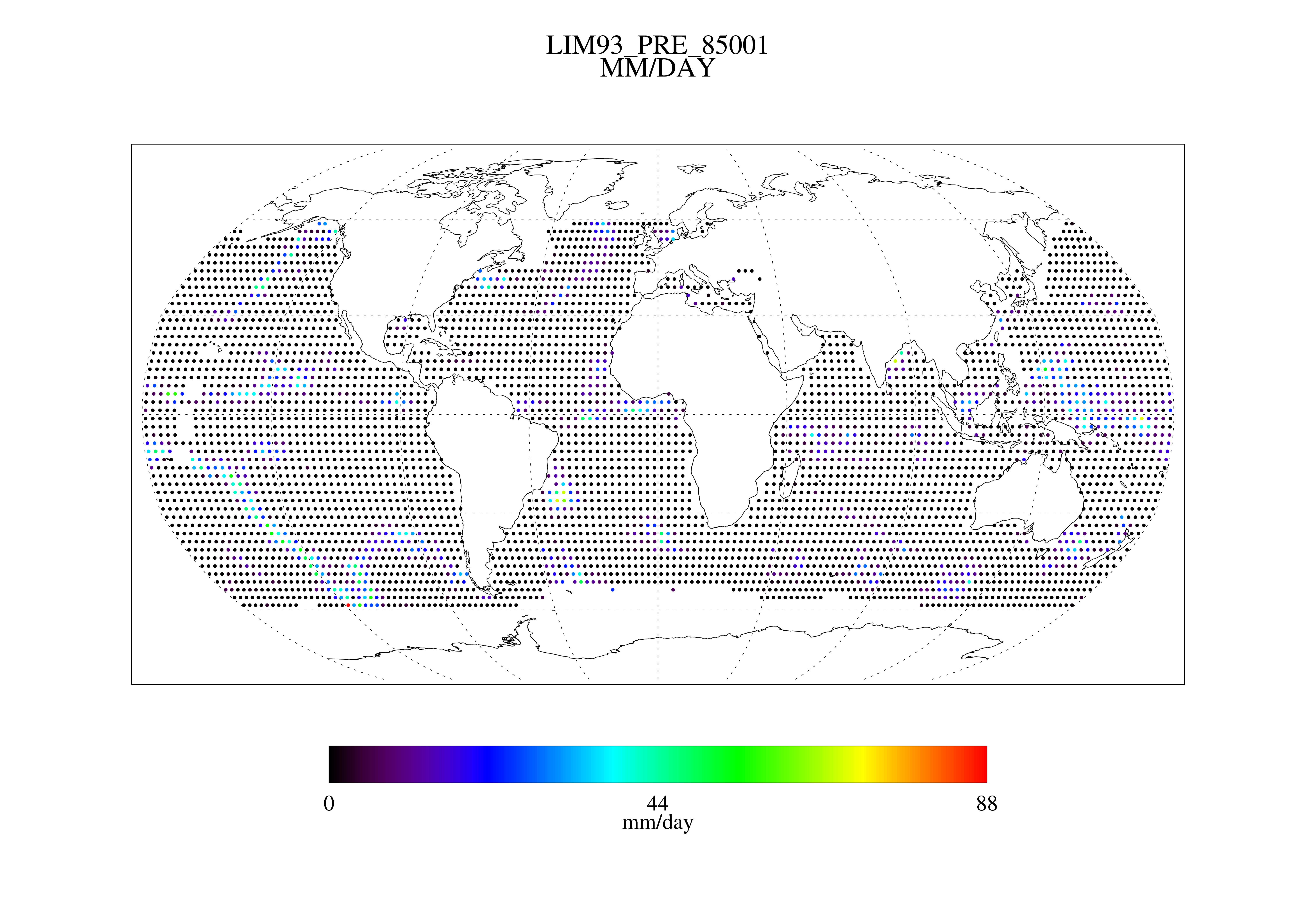
MSU Daily Oceanic Precipitation with Limb93 Correction L3 1 day 2.5 degree x 2.5 degree V001 (MSUOP) at GES DISC
National Aeronautics and Space Administration —
The Microwave Sounding Unit (MSU) Ocean Precipitation product (MSUOP) provides gridded upper tropospheric temperatures derived from MSU instruments on several... -
Federal
TOVS GLA MONTHLY GRIDS from NOAA-10 V01 (TOVSAMNG) at GES DISC
National Aeronautics and Space Administration —
This dataset (TOVSAMNG) contains the TIROS Operational Vertical Sounder (TOVS) level 3 geophysical parameters derived using data from NOAA-10 and the physical... -
Federal
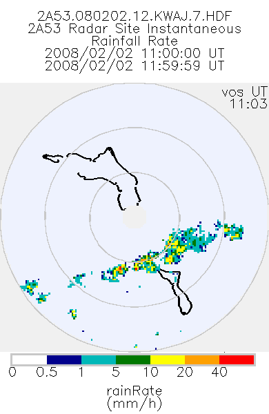
TRMM Ground Validation Radar Site Rain Rate Map L2 1 hour 2 km V7 (TRMM_2A53UW) at GES DISC
National Aeronautics and Space Administration —
This dataset is part of the University of Washington TRMM Ground Validation products. Instantaneous rain rate cartesian grid based on baseUW and 2A54UW. Units are... -
Federal
TRMM Precipitation Radar Rain Characteristics L2 1.5 hours V7 (TRMM_2A23) at GES DISC
National Aeronautics and Space Administration —
The new version of these data is in GPM-like format (consistent with the GPM Dual-frequency Radar data format), and can be found under the name GPM_2APR. The TRMM... -
Federal
TROPICS03 L2A Unified Resolution Brightness Temperatures V1.0
National Aeronautics and Space Administration —
The "Time-Resolved Observations of Precipitation structure and storm Intensity with a Constellation of Smallsats" (TROPICS) mission has a goal of providing nearly... -
Federal
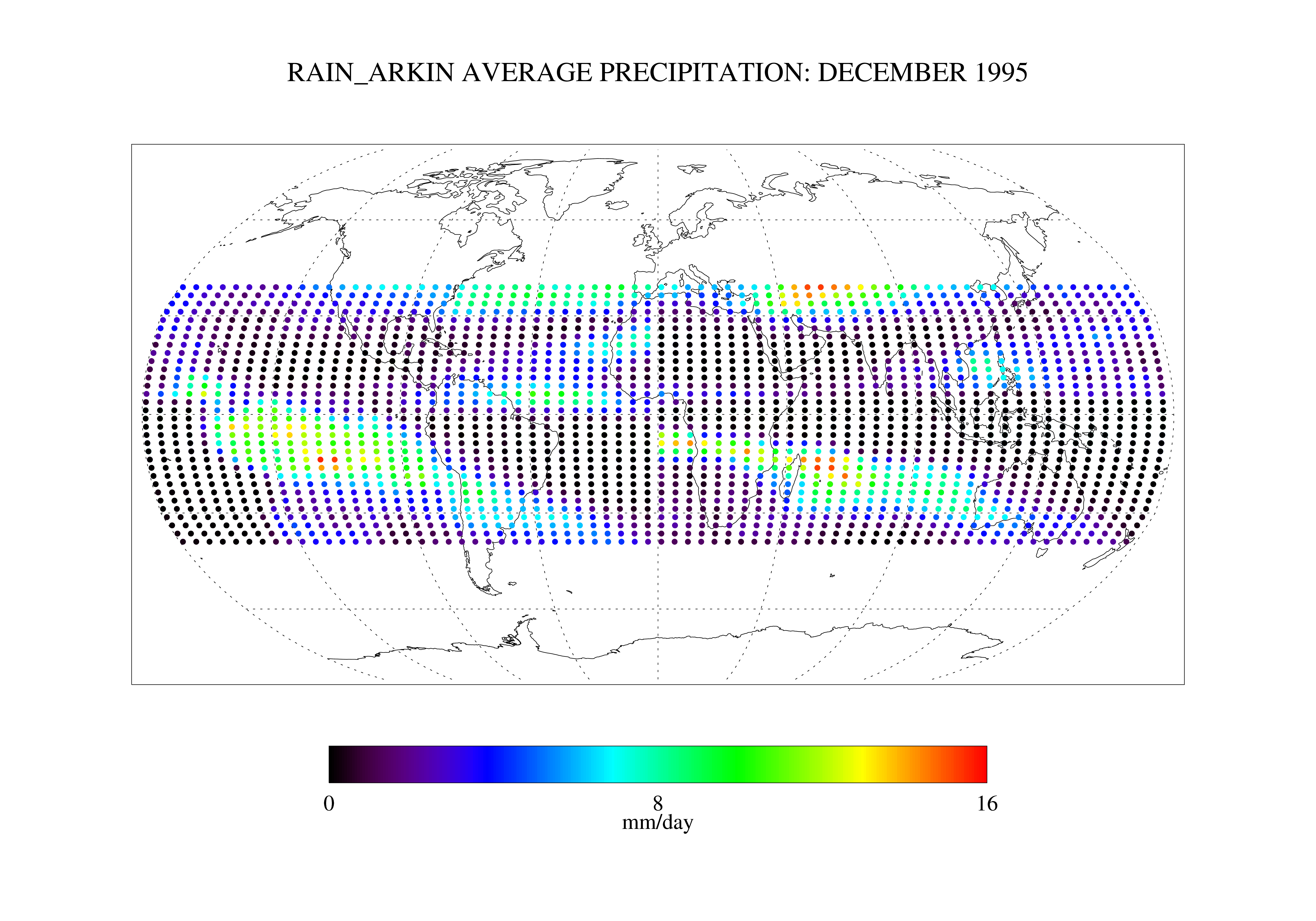
Arkin and Janowiak GPI: IR -Based Monthly Rainfall for the GPCP 2.5 x 2.5 degree V1 (RAIN_ARKIN) at GES DISC
National Aeronautics and Space Administration —
These data are transitioned to a state of permanent preservation. They are available upon request. More advanced datasets have been developed since. One recommended... -
Federal
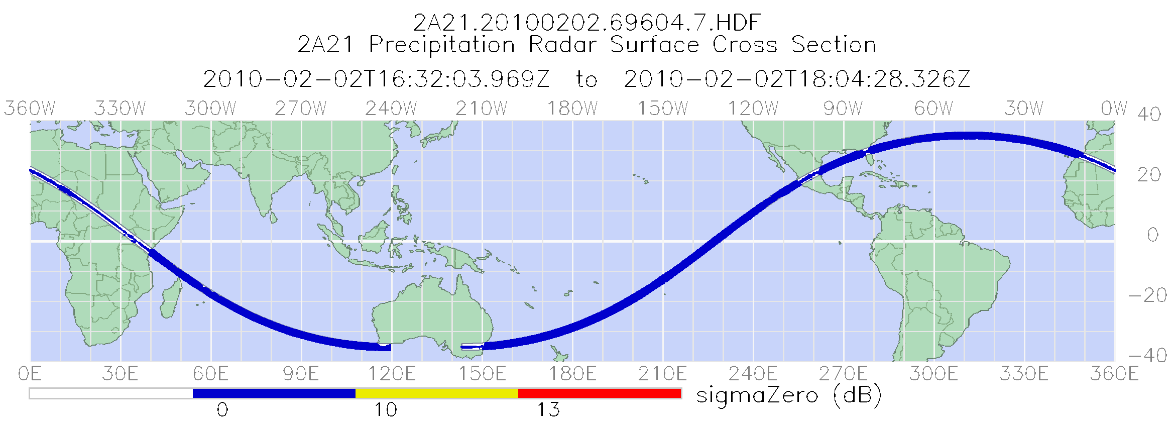
TRMM Precipitation Radar Surface Cross-Section L2 1.5 hours V7 (TRMM_2A21) at GES DISC
National Aeronautics and Space Administration —
The new version of these data is in GPM-like format (consistent with the GPM Dual-frequency Radar data format), and can be found under the name GPM_2APR. This is the... -
Federal
TOVS GLA 5 DAY GRIDS from NOAA-12 V01 (TOVSA5ND) at GES DISC
National Aeronautics and Space Administration —
This dataset (TOVSA5ND) contains the TIROS Operational Vertical Sounder (TOVS) level 3 geophysical parameters derived using data from NOAA-12 and the physical... -
Federal
TROPICS01 Pathfinder L1B Orbital Geolocated Native-Resolution Brightness Temperatures V1.0
National Aeronautics and Space Administration —
The "Time-Resolved Observations of Precipitation structure and storm Intensity with a Constellation of Smallsats" (TROPICS) mission has a goal of providing nearly... -
Federal
TOVS GLA 5 DAY GRIDS from NOAA-9 V01 (TOVSA5NF) at GES DISC
National Aeronautics and Space Administration —
This dataset (TOVSA5NF) contains the TIROS Operational Vertical Sounder (TOVS) level 3 geophysical parameters derived using data from NOAA-9 and the physical... -
Federal
Sounder SIPS: Suomi NPP CrIMSS Level 3 Specific Quality Control Gridded Daily CLIMCAPS Full Spectral Resolution V2 at GES DISC
National Aeronautics and Space Administration —
WARNING: To users of the derived product “co_mmr_midtrop” (carbon monoxide mass mixing ratio to dry air [kg/kg] at ~500 hPa). This variable has a significant bias due... -
Federal
TROPICS06 L2A Unified Resolution Brightness Temperatures V1.0
National Aeronautics and Space Administration —
The "Time-Resolved Observations of Precipitation structure and storm Intensity with a Constellation of Smallsats" (TROPICS) mission has a goal of providing nearly...

Official websites use .gov
A
.gov website belongs to an official government
organization in the United States.
Secure .gov websites use HTTPS
A
lock (
) or https:// means you’ve safely connected to
the .gov website. Share sensitive information only on official,
secure websites.