
-
Federal
Last of the Wild Project, Version 2, 2005 (LWP-2): Global Human Footprint Dataset (Geographic)
National Aeronautics and Space Administration —
The Global Human Footprint Dataset of the Last of the Wild Project, Version 2, 2005 (LWP-2) is the Human Influence Index (HII) normalized by biome and realm. The HII... -
Federal
Last of the Wild Project, Version 2, 2005 (LWP-2): Global Human Influence Index (HII) Dataset (Geographic)
National Aeronautics and Space Administration —
The Global Human Influence Index Dataset of the Last of the Wild Project, Version 2, 2005 (LWP-2) is a global dataset of 1-kilometer grid cells, created from nine... -
Federal
Global Grid of Probabilities of Urban Expansion to 2030
National Aeronautics and Space Administration —
The Global Grid of Probabilities of Urban Expansion to 2030 presents spatially explicit probabilistic forecasts of global urban land cover change from 2000 to 2030 at... -
Federal
Gridded Species Distribution: Global Amphibian Richness Grids, 2015 Release
National Aeronautics and Space Administration —
The 2015 Release of the Global Amphibian Richness Grids data set of the Gridded Species Distribution collection are aggregations of the presence grids data for the... -
Federal
Last of the Wild Project, Version 2, 2005 (LWP-2): Global Human Footprint Dataset (IGHP)
National Aeronautics and Space Administration —
The Global Human Footprint Dataset of the Last of the Wild Project, Version 2, 2005 (LWP-2) is the Human Influence Index (HII) normalized by biome. The HII is a... -
Federal
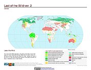
Last of the Wild Project, Version 2, 2005 (LWP-2): Last of the Wild Dataset (Geographic)
National Aeronautics and Space Administration —
The Last of the Wild Dataset of the Last of the Wild Project, Version 2, 2005 (LWP-2) is derived from the LWP-2 Human Footprint Dataset. The gridded data are... -
Federal
Central American Vegetation/Land Cover Classification and Conservation Status
National Aeronautics and Space Administration —
The Central American Vegetation/Land Cover Classification and Conservation Status consists of GIS coverages of vegetation classes (forests, woodlands, savannas,... -
Federal
Last of the Wild Project, Version 1, 2002 (LWP-1): Last of the Wild Dataset (IGHP)
National Aeronautics and Space Administration —
The Last of the Wild Dataset of the Last of the Wild Project, Version 1, 2002 (LWP-1) is derived from the LWP-1 Human Footprint Dataset. The gridded data are... -
Federal
West Africa Coastal Vulnerability Mapping: Subset of Global Mammal and Amphibian Richness Grids, 2015 Release
National Aeronautics and Space Administration —
The West Africa Coastal Vulnerability Mapping: Subset of Global Mammal and Amphibian Richness Grids, 2015 Release was extracted from the NASA Socioeconomic Data and... -
Federal
Last of the Wild Project, Version 1, 2002 (LWP-1): Top One Percent Wild Areas Dataset (IGHP)
National Aeronautics and Space Administration —
The Top One Percent Wild Areas Dataset of the Last of the Wild Project, Version 1, 2002 (LWP-1) is derived from the LWP-1 Human Footprint Dataset. The gridded data... -
Federal
Gridded Species Distribution: Global Mammal Richness Grids, 2015 Release
National Aeronautics and Space Administration —
The 2015 Release of the Global Mammal Richness Grids data set of the Gridded Species Distribution collection are aggregations of the presence grids data for the... -
Federal
Last of the Wild Project, Version 2, 2005 (LWP-2): Last of the Wild Dataset (IGHP)
National Aeronautics and Space Administration —
The Last of the Wild Dataset of the Last of the Wild Project, Version 2, 2005 (LWP-2) is derived from the LWP-2 Human Footprint Dataset. The gridded data are... -
Federal
Last of the Wild Project, Version 1, 2002 (LWP-1): Global Human Footprint Dataset (IGHP)
National Aeronautics and Space Administration —
The Global Human Footprint Dataset of the Last of the Wild Project, Version 1, 2002 (LWP-1) is the Human Influence Index (HII) normalized by biome and realm. The HII... -
Federal
Last of the Wild Project, Version 1, 2002 (LWP-1): Last of the Wild Dataset (Geographic)
National Aeronautics and Space Administration —
The Last of the Wild Dataset of the Last of the Wild Project, Version 1, 2002 (LWP-1) is derived from the LWP-1 Human Footprint Dataset. The gridded data are... -
Federal
Last of the Wild Project, Version 1, 2002 (LWP-1): Top One Percent Wild Areas Dataset (Geographic)
National Aeronautics and Space Administration —
The Top One Percent Wild Areas Dataset of the Last of the Wild Project, Version 1, 2002 (LWP-1) is derived from the LWP-1 Human Footprint Dataset. The gridded data... -
Federal
Last of the Wild Project, Version 2, 2005 (LWP-2): Global Human Influence Index (HII) Dataset (IGHP)
National Aeronautics and Space Administration —
The Global Human Influence Index Dataset of the Last of the Wild Project, Version 2, 2005 (LWP-2) is a global dataset of 1-kilometer grid cells, created from nine... -
Federal
Last of the Wild Project, Version 1, 2002 (LWP-1): Global Human Footprint Dataset (Geographic)
National Aeronautics and Space Administration —
The Global Human Footprint Dataset of the Last of the Wild Project, Version 1, 2002 (LWP-1) is the Human Influence Index (HII) normalized by biome and realm. The HII...

Official websites use .gov
A
.gov website belongs to an official government
organization in the United States.
Secure .gov websites use HTTPS
A
lock (
) or https:// means you’ve safely connected to
the .gov website. Share sensitive information only on official,
secure websites.