
-
Federal
Deciduous Fractional Cover and Tree Canopy Cover for Boreal North America, 1992-2015
National Aeronautics and Space Administration —
This dataset holds deciduous fraction and tree canopy cover at 30-m resolution over the North American boreal domain for 1992 to 2015. Deciduous fraction is the areal... -
Federal
Soil Matric Potential, Dielectric, and Physical Properties, Arctic Alaska, 2018
National Aeronautics and Space Administration —
This dataset provides lab-measured soil properties, including soil water matric potential, soil dielectric properties, soil electrical conductivity, corresponding... -
Federal
Spectral Reflectance and Ancillary Data, Tundra Transect, North Slope, AK, 2000-2022
National Aeronautics and Space Administration —
This dataset provides visible-near infrared spectral reflectance, descriptions of vegetation cover, surface temperature, the total fraction of absorbed... -
Federal
LBA-ECO LC-15 SRTM30 Digital Elevation Model Data, Amazon Basin: 2000
National Aeronautics and Space Administration —
This dataset provides a subset of the SRTM30 Digital Elevation Model (DEM) elevation and standard deviation data for the Amazon Basin. SRTM30 is a near-global digital... -
Federal
PalEON: Terrestrial Ecosystem Model Drivers for the Northeastern U.S., 0850-2010
National Aeronautics and Space Administration —
This dataset from the PalEON Ecosystem Model Intercomparison Project (PEMIP) provides harmonized regional environmental and meteorological drivers at a resolution of... -
Federal
CMS: Simulated Physical-Biogeochemical Data, SABGOM Model, Gulf of Mexico, 2005-2010
National Aeronautics and Space Administration —
This dataset contains monthly mean ocean surface physical and biogeochemical data for the Gulf of Mexico simulated by the South Atlantic Bight and Gulf of Mexico... -
Federal
CARVE: L2 Atmospheric CO2, CO and CH4 Concentrations, Harvard CRDS, Alaska, 2012-2014
National Aeronautics and Space Administration —
This data set provides atmospheric carbon dioxide (CO2), methane (CH4), and carbon monoxide (CO) concentrations from airborne campaigns over the Alaskan and Canadian... -
Federal
NAFD-ATT Forest Canopy Cover Loss from Landsat, CONUS, 1986-2010
National Aeronautics and Space Administration —
Characterizing the cause of forest canopy changes through time is fundamental to understanding current and future forest functions. A better understanding of forest... -
Federal
ABoVE: Environmental Conditions and Subsistence Resource Access, Alaska, 2016-2017
National Aeronautics and Space Administration —
This dataset provides descriptions and photos of environmental conditions that impacted availability to subsistence resources by residents in nine rural communities... -
Federal
NPP Grassland: Kurukshetra, India, 1970-1971, R1
National Aeronautics and Space Administration —
This data set contains two ASCII files (.txt format). One file contains above- and below-ground biomass (including standing dead material and litter) and productivity... -
Federal
ACT-America: L2 In Situ Atmospheric Gas Concentrations from Flasks, Eastern USA
National Aeronautics and Space Administration —
This dataset provides atmospheric carbon dioxide (CO2), methane (CH4), carbon monoxide (CO), molecular hydrogen (H2), nitrous oxide (N2O), sulfur hexafluoride (SF6),... -
Federal
BOREAS TE-05 Leaf Carbon Isotope Data
National Aeronautics and Space Administration —
Contains leaf carbon isotope data collected by TE-05 during 1994. -
Federal
NACP Site: Tower Meteorology, Flux Observations with Uncertainty, and Ancillary Data
National Aeronautics and Space Administration —
This data set contains meteorological, carbon cycle flux, phenology, and ancillary data measured at 47 eddy covariance flux tower sites across North America. The data... -
Federal
Probabilistic Freeze-Thaw Record for the Northern Hemisphere, 2016-2020
National Aeronautics and Space Administration —
This dataset provides a probabilistic freeze/thaw (FT) data record from 2016 to 2020 for the Northern Hemisphere derived using a deep learning model (U-Net). The... -
Federal
BOREAS RSS-02 Extracted Reflectance Factors Derived from ASAS Imagery
National Aeronautics and Space Administration —
Contains calculated bidirectional reflectance factor means derived from extractions of C130-based ASAS measurements made during BOREAS. -
Federal
BOREAS Landsat TM Level-3s Imagery: Scaled At-Sensor Radiance in LGSOWG Format
National Aeronautics and Space Administration —
For BOREAS, the level-3s Landsat TM data, along with the other remotely sensed images, were collected in order to provide spatially extensive information over the... -
Federal
BOREAS/SRC AMS Suite A Surface Meteorological and Radiation Data: 1996
National Aeronautics and Space Administration —
Contains the data collected in 1996 by the AMS suite A instrument set operated by SRC and provided to BORIS. -
Federal
Vulcan: High-Resolution Annual Fossil Fuel CO2 Emissions in USA, 2010-2015, Version 3
National Aeronautics and Space Administration —
The Vulcan version 3.0 annual dataset provides estimates of annual carbon dioxide (CO2) emissions from the combustion of fossil fuels (FF) and CO2 emissions from... -
Federal
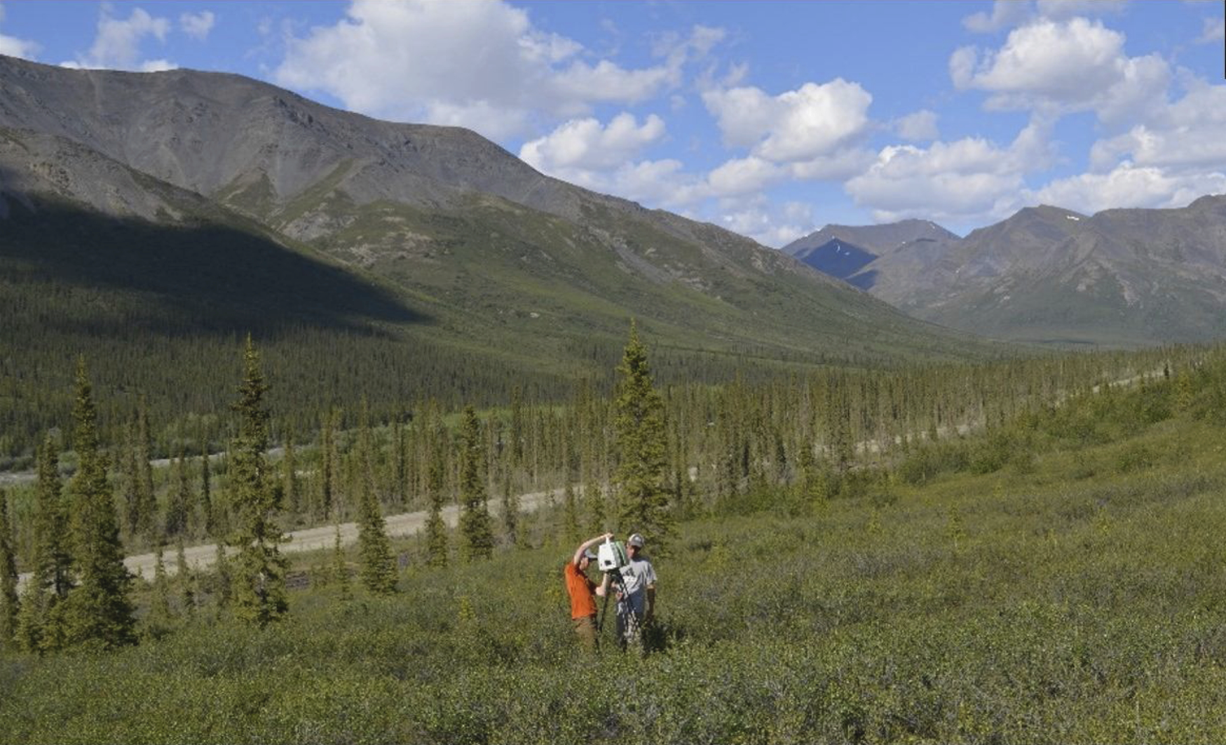
ABoVE: Terrestrial Lidar Scanning Forest-Tundra Ecotone, Brooks Range, Alaska, 2016
National Aeronautics and Space Administration —
This dataset provides terrestrial lidar scanning (TLS) point cloud data collected at 10 research plots along the forest-tundra ecotone (FTE) in the Brooks Range of...

Official websites use .gov
A
.gov website belongs to an official government
organization in the United States.
Secure .gov websites use HTTPS
A
lock (
) or https:// means you’ve safely connected to
the .gov website. Share sensitive information only on official,
secure websites.