

7 datasets found for ""Solar Radiation""
-
Federal
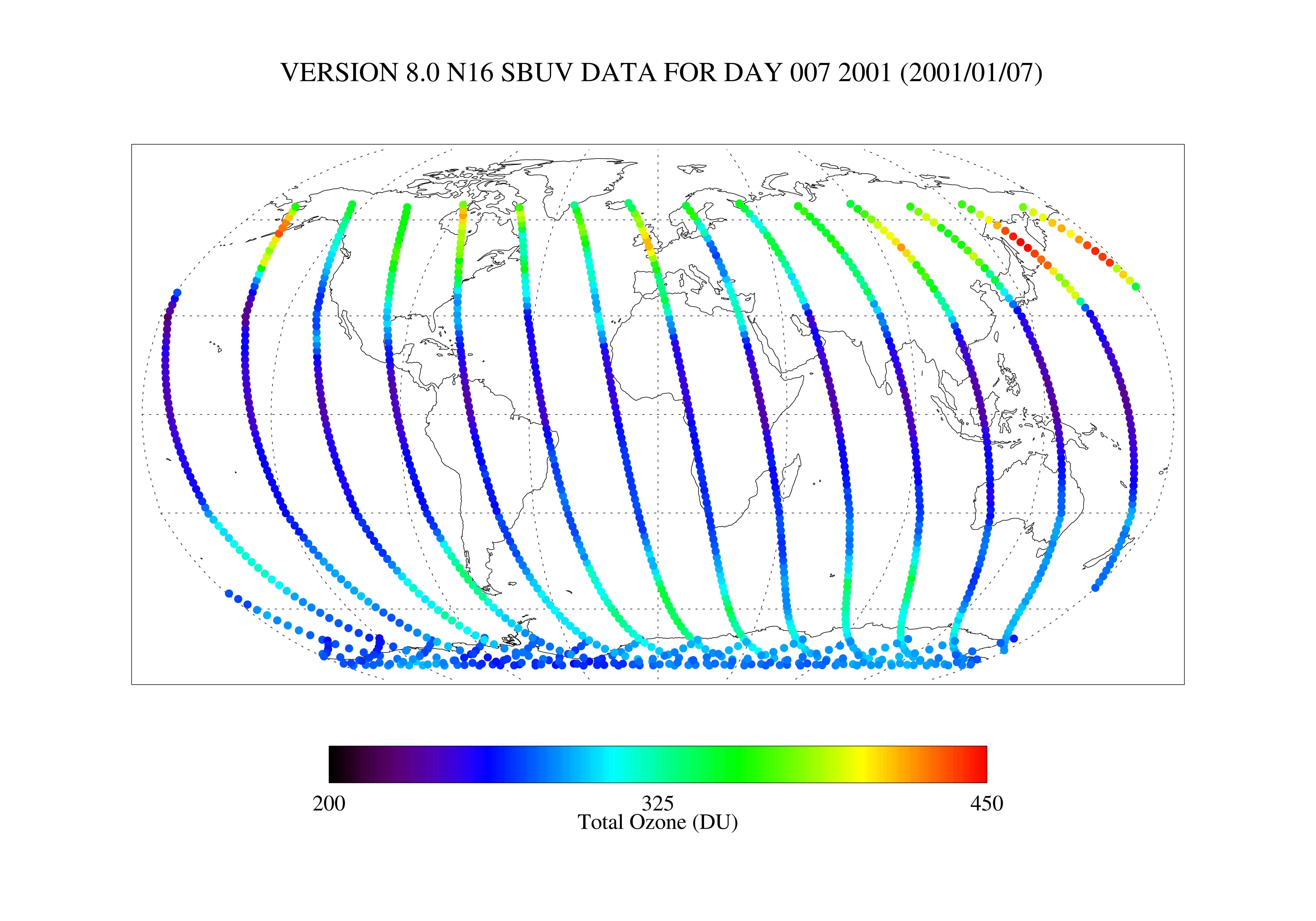
SBUV2/NOAA-16 Level 2 Daily Ozone Profile and Total Column from CD-ROM V008 (SBUV2N16O3) at GES DISC
National Aeronautics and Space Administration —
The version 8 SBUV/2 NOAA-16 ozone data were first released at the 2004 Quadrennial Ozone Symposium on DVD. The DVD contained all of the SBUV/2 data from NOAA-9,... -
Federal
SBUV2/NOAA-9 Level 2 Daily Ozone Profile and Total Column from CD-ROM V008 (SBUV2N09O3) at GES DISC
National Aeronautics and Space Administration —
The version 8 SBUV/2 NOAA-9 ozone data were first released at the 2004 Quadrennial Ozone Symposium on DVD. The DVD contained all of the SBUV/2 data from NOAA-9,... -
Federal
SBUV2/NOAA-11 Level 2 Daily Ozone Profile and Total Column from CD-ROM V008 (SBUV2N11O3) at GES DISC
National Aeronautics and Space Administration —
The version 8 SBUV/2 NOAA-11 ozone data were first released at the 2004 Quadrennial Ozone Symposium on DVD. The DVD contained all of the SBUV/2 data from NOAA-9,... -
Federal
HRIR/Nimbus-2 Level 1 Meteorological Radiation Data V001 (HRIRN2L1) at GES DISC
National Aeronautics and Space Administration —
HRIRN2L1 is the High Resolution Infrared Radiometer (HRIR) Nimbus-2 Level 1 Meteorological Radiance Data (NMRT) product and contains infrared radiances converted to... -
Federal
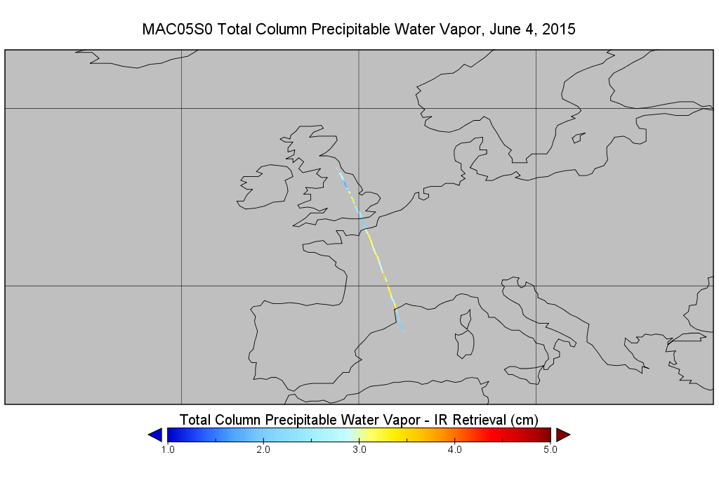
MODIS/Aqua Total Precip Water Vapor 1km and 5km 5-Min L2 Narrow Swath Subset along CloudSat V002 (MAC05S0) at GES DISC NGDA
National Aeronautics and Space Administration —
This is the narrow-swath MODIS/Aqua subset along CloudSat field of view track. The goal of the narrow-swath subset is to select and return MODIS data that are within... -
Federal
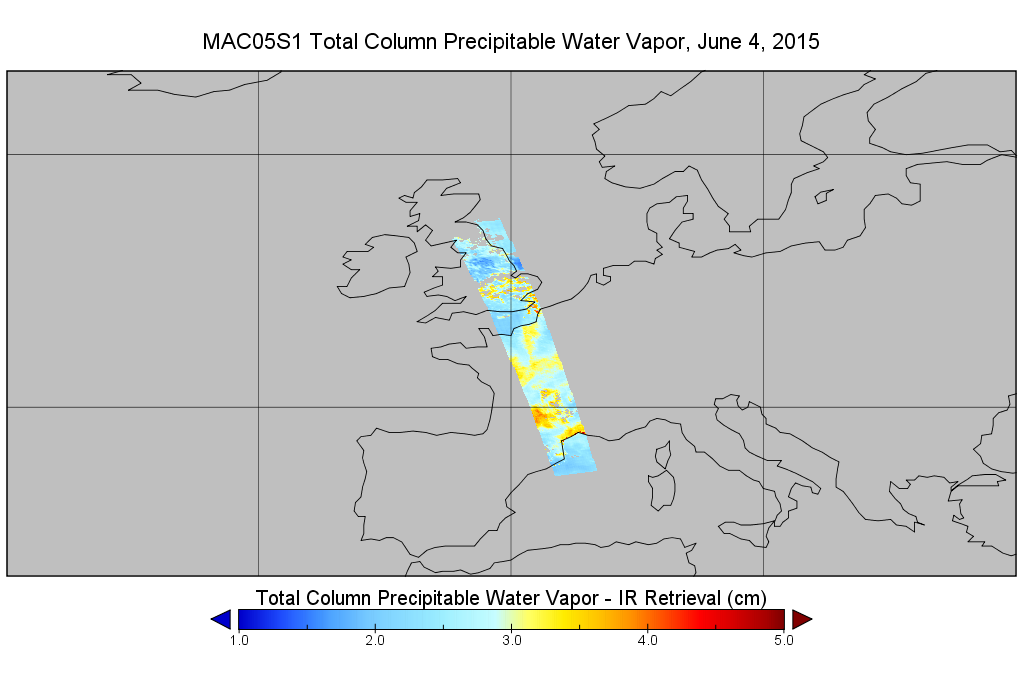
MODIS/Aqua Total Precip Water Vapor 1km and 5km 5-Min L2 Wide Swath Subset along CloudSat V002 (MAC05S1) at GES DISC NGDA
National Aeronautics and Space Administration —
This is the wide-swath MODIS/Aqua subset along CloudSat field of view track. The goal of the wide-swath subset is to select and return MODIS data that are within... -
Federal
MODIS/Aqua Total Precip Water Vapor 1km and 5km 5-Min L2 Swath Subset along MLS V002 (MAM05S0) at GES DISC NGDA
National Aeronautics and Space Administration —
This is the MODIS/Aqua subset along MLS field of view track. The goal of the subset is to select and return MODIS data that are within +-100 km across the MLS track....
7 datasets found for ""Solar Radiation""