

430 datasets found for "Volatile Organic Compounds"
-
Federal
Quality-Control Data for Volatile Organic Compounds and Environmental Sulfur-Hexafluoride Data for Groundwater Samples from the Williston Basin, USA
Department of the Interior —
In 2018, groundwater samples were collected from aquifers in the Williston Basin in parts of eastern Montana, western North Dakota, and northwestern South Dakota.... -
Federal
Reporting and detection limits for analyses of per- and polyfluoroalkyl substances in quality-control samples and in groundwater samples from the Great Miami buried-valley aquifer, southwestern Ohio, 2019–20
Department of the Interior —
The U.S. Geological Survey (USGS), in cooperation with the Miami Conservancy District, Dayton, Ohio, in 2019 and 2020 investigated concentrations of per- and... -
Federal
Pesticide datasets from the National Water Quality Laboratory, 2001-2016
Department of the Interior —
This data release includes all pesticide results from selected batches of water samples analyzed by the U.S Geological Survey National Water Quality Laboratory... -
Federal
Pesticides in polar organic chemical integrative samplers (POCIS) for 97 Midwest U.S. streams, 2013.
Department of the Interior —
In 2013, the U.S. Geological Survey and the U.S. Environmental Protection Agency characterized water-quality stressors and ecological conditions in 100 wadeable... -
Federal
Laboratory results for anthropogenic bioactive chemicals in the Illinois Waterway upstream and downstream of the bigheaded carp population front (2015; ver. 2.0, February 2020) Edition 2.0
Department of the Interior —
Two non-native bigheaded carp species have invaded the Illinois River system and are a potential threat to the Great Lakes ecosystem. Discharges from industry,... -
Federal
Concentrations of organic and inorganic constituents in tapwater samples from California in 2020-21 (ver. 3.1, March 2024)
Department of the Interior —
This dataset contains the trace elements, cations, anions, disinfection by-products, per- and polyfluoroalkyl substances (PFAS), pharmaceutical and pesticide... -
Federal
Groundwater-quality data in the Mokelumne, Cosumnes, and American River Watersheds Shallow Aquifer Study Unit, 2016-2017: Results from the California GAMA Priority Basin Project
Department of the Interior —
The U.S. Geological Survey collected groundwater samples from 67 wells and 1 spring used for domestic and small system drinking water supplies in Placer, El Dorado,... -
Federal
MODFLOW-NWT and MODPATH6 model use to analyze remedial scenarios affecting plume movement through a sole-source aquifer system, southeastern Nassau County, New York
Department of the Interior —
A three-dimensional steady-state groundwater flow model is coupled with the particle-tracking program, MODPATH, to assess the fate and transport of volatile organic... -
Federal
PDF format log books of data collection in Lake Mead in 2000
Department of the Interior —
Lake Mead is a large interstate reservoir located in the Mojave Desert of southeastern Nevada and northwestern Arizona. It was impounded in 1935 by the construction... -
Federal
Preliminary estimated annual agricultural pesticide use for counties of the conterminous United States, 2018
Department of the Interior —
This data release provides preliminary estimates of annual agricultural use of pesticide compounds in counties of the conterminous United States, for the year 2018,... -
Federal
Selected borehole geophysical logs from three contaminated sites in California, Wisconsin, and New Jersey
Department of the Interior —
Borehole geophysical logs were collected to characterize bedrock aquifers at three contamination sites located in California, Wisconsin, and New Jersey. The data were... -
Federal
Tables supporting optimization of on-line hydrogen stable isotope-ratio measurements of halogen- and sulfur-bearing organic compounds using elemental analyzer-chromium/high-temperature conversion-isotope-ratio mass spectrometry
Department of the Interior —
Tabular data demonstrates the performance of a modified reactor setup that enables high-quality hydrogen isotopic analysis of halogen- and sulfur-bearing organics... -
Federal
2018 Hydrologic Data Summary for the Central Pine Barrens Region, Suffolk County, New York (ver. 2.0, February 2024)
Department of the Interior —
This document provides a summary of surface water-quality, streamflow, and groundwater data collected by the U.S. Geological Survey (USGS) within the Central Pine... -
Federal
JPEG Images of Seismic-Reflection Profiles Collected in Lake Mead in 2001
Department of the Interior —
Lake Mead is a large interstate reservoir located in the Mojave Desert of southeastern Nevada and northwestern Arizona. It was impounded in 1935 by the construction... -
Federal
A comparison of four pore water sampling methods for mixed metals and dissolved organic carbon, and implications for sediment toxicity evaluations-Data
Department of the Interior —
These replicate data support the findings described in the publication, "A comparison of four pore water sampling methods for mixed metals and dissolved organic... -
Federal
Combined Resistivity and Sand Dominant Group Data
Department of the Interior —
The Wilcox Oil Company Superfund site (hereinafter referred to as “the site”) was formerly an oil refinery in northeast of Bristow in Creek County, Oklahoma.... -
Federal
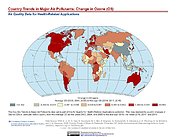
Country Trends in Major Air Pollutants
National Aeronautics and Space Administration —
The Country Trends in Major Air Pollutants data set is a framework of public-health-focused air quality indicators that quantifies over 200 countries' trends in... -
Federal
Benthic Sampling Adjacent to the Waianae Ocean Outfall, Oahu, Hawaii, 2001-2010 (NODC Accession 0084994)
National Oceanic and Atmospheric Administration, Department of Commerce —
Annual surveys are undertaken to sample bottom-sediment for biological and geochemical analyses at six stations at a depth of approximately 34 m in the vicinity of... -
Federal
Historical data sets including inorganic and organic chemistry of water, oil, and sediments, aquifer hydraulic conductivity, and sediment grain size distribution at the National Crude Oil Spill Fate and Natural Attenuation Research Site near Bemidji, Minnesota, USA, 1984-2010 (ver 2.0, September 2019)
Department of the Interior —
This U.S. Geological Survey (USGS) Data Release provides analytical data from samples and measurements completed at the National Crude Oil Spill Fate and Natural... -
Federal
Historical groundwater chemistry data compiled for the Poso Creek Oil Field and vicinity, Kern County, California
Department of the Interior —
This digital dataset contains historical geochemical and other information for 100 samples of groundwater from 71 wells located within 3 miles of the Poso Creek Oil...
430 datasets found for "Volatile Organic Compounds"