
-
Federal
Landsat 8
National Aeronautics and Space Administration —
The Operational Land Imager (OLI) and Thermal Infrared Sensor (TIRS) are onboard the Landsat 8 satellite, have acquired images of the Earth since February 2013. The... -
Federal
Global Roads Open Access Data Set, Version 1 (gROADSv1)
National Aeronautics and Space Administration —
The Global Roads Open Access Data Set, Version 1 (gROADSv1) was developed under the auspices of the CODATA Global Roads Data Development Task Group. The data set... -
Federal
General Archive Information from NASA CDDIS
National Aeronautics and Space Administration —
The Crustal Dynamics Data Information System (CDDIS) supports the space geodesy and geodynamics community through NASA's Space Geodesy Project as well as NASA's Earth... -
Federal
IRIS/Nimbus-4 Level 1 Radiance Data V001 (IRISN4RAD) at GES DISC
National Aeronautics and Space Administration —
The Nimbus-4 Infrared Interferometer Spectrometer (IRIS) Level 1 Radiance Data contain thermal emissions of the Earth's atmosphere at wave numbers between 400 and... -
Federal
MODIS/Terra Snow Cover Daily L3 Global 500m SIN Grid V061 NGDA
National Aeronautics and Space Administration —
This global Level-3 (L3) data set provides a daily composite of snow cover and albedo derived from the 'MODIS/Terra Snow Cover 5-Min L2 Swath 500m' data set... -
Federal
Ground-Based Satellite Laser Ranging (SLR) Observation Data (full-rate, daily, 24 hour files) from NASA CDDIS
National Aeronautics and Space Administration —
This dataset consists of ground-based Satellite Laser Ranging observation data (full-rate, daily 24 hour files) from the NASA Crustal Dynamics Data Information System... -
Federal
USGS High Resolution Orthoimagery
National Aeronautics and Space Administration —
High resolution orthorectified images combine the image characteristics of an aerial photograph with the geometric qualities of a map. An orthoimage is a uniform-... -
Federal
Poverty Mapping Project: Global Subnational Prevalence of Child Malnutrition
National Aeronautics and Space Administration —
The Poverty Mapping Project: Global Subnational Prevalence of Child Malnutrition data set consists of estimates of the percentage of children with weight-for-age... -
Federal
JPL TELLUS GRACE Level-3 Monthly Land Water-Equivalent-Thickness Surface Mass Anomaly Release 6.0 version 04 in netCDF/ASCII/GeoTIFF Formats
National Aeronautics and Space Administration —
The monthly land mass grids contain water mass anomalies given as equivalent water thickness derived from GRACE & GRACE-FO time-variable gravity observations... -
Federal
Global Reservoir and Dam Database, Version 1 (GRanDv1): Dams, Revision 01
National Aeronautics and Space Administration —
The Global Reservoir and Dam Database, Version 1, Revision 01 (v1.01) contains 6,862 records of reservoirs and their associated dams with a cumulative storage... -
Federal
UAVSAR_POLSAR_METADATA
National Aeronautics and Space Administration —
UAVSAR PolSAR Scene Metadata -
Federal
JPSS-2 CrIS Level 1B Beta Full Spectral Resolution V3 (SNDRJ2CrISL1B) at GES DISC
National Aeronautics and Space Administration —
The goal of creating this product is to allow users to begin working with data from the CrIS instrument on-board the recently launched NOAA-21 / JPSS-2 (J2)... -
Federal
ATLAS/ICESat-2 L2A Global Geolocated Photon Data V006
National Aeronautics and Space Administration —
This data set (ATL03) contains height above the WGS 84 ellipsoid (ITRF2014 reference frame), latitude, longitude, and time for all photons downlinked by the Advanced... -
Federal
Altimeter Corrected Elevations, Version 2 (ACE2)
National Aeronautics and Space Administration —
The Altimeter Corrected Elevations, Version 2 (ACE2) data set, is the Global Digital Elevation Model (GDEM) created by using multi-mission Satellite Radar Altimetry... -
Federal
MetOp-C ASCAT Level 2 25.0km Ocean Surface Wind Vectors in Full Orbit Swath
National Aeronautics and Space Administration —
This dataset contains operational near-real-time Level 2 ocean surface wind vector retrievals from the Advanced Scatterometer (ASCAT) on MetOp-C at 25 km sampling... -
Federal
CEOS Cal Val Test Site - Libya 1 - Pseudo-Invariant Calibration Site (PICS) NGDA
National Aeronautics and Space Administration —
On the background of these requirements for sensor calibration, intercalibration and product validation, the subgroup on Calibration and Validation of the Committee... -
Federal
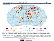
Water Security Indicator Model - Global Land Data Assimilation System (WSIM-GLDAS) Monthly Grids, Version 1
National Aeronautics and Space Administration —
The Water Security Indicator Model - Global Land Data Assimilation System (WSIM-GLDAS) Monthly Grids, Version 1 data set identifies and characterizes surpluses and... -
Federal
AIRS/Aqua L1B Near Real Time (NRT) AMSU (A1/A2) geolocated and calibrated brightness temperatures V005 (AIRABRAD_NRT) at GES DISC
National Aeronautics and Space Administration —
The AMSU-A Level 1B Near Real Time (NRT) product (AIRABRAD_NRT_005) differs from the routine product (AIRABRAD_005) in 2 ways to meet the three hour latency...

Official websites use .gov
A
.gov website belongs to an official government
organization in the United States.
Secure .gov websites use HTTPS
A
lock (
) or https:// means you’ve safely connected to
the .gov website. Share sensitive information only on official,
secure websites.