
-
Federal
Daily and Annual PM2.5, O3, and NO2 Concentrations at ZIP Codes for the Contiguous U.S., 2000-2016, v1.0 recent views
National Aeronautics and Space Administration —
The Daily and Annual PM2.5, O3, and NO2 Concentrations at ZIP Codes for the Contiguous U.S., 2000-2016, v1.0 data set contains daily and annual concentration... -
Federal
LBA-ECO LC-08 Soil, Vegetation, and Land Cover Maps for Brazil and South America recent views
National Aeronautics and Space Administration —
This data set provides (1) soil maps for Brazil that are digital versions of the MAPA DE SOLOS DO BRASIL (EMBRAPA, 1981) classified at three levels of detail,... -
Federal
Airborne Multi-angle Imaging SpectroRadiometer (AirMISR) Data from the SERC 2003 Campaign recent views
National Aeronautics and Space Administration —
The AIRMISR_SERC_2003 data were acquired during a flight over the Smithsonian Environmental Research Center, Maryland, USA, target as part of the AirMISR deployments... -
Federal
LBA-ECO LC-03 Hypsography, Rivers, Roads, and DEM, Four Areas across Brazilian Amazon recent views
National Aeronautics and Space Administration —
This data set provides four related spatial data products for four study areas across the Brazilian Amazon: Manaus, Amazonas; Tapajos National Forest, Para Western... -
Federal
ASTER Global Water Bodies Database V001 NGDA recent views
National Aeronautics and Space Administration —
The ASTER Global Water Bodies Database (ASTWBD) Version 1 data product provides global coverage of water bodies larger than 0.2 square kilometers at a spatial... -
Federal
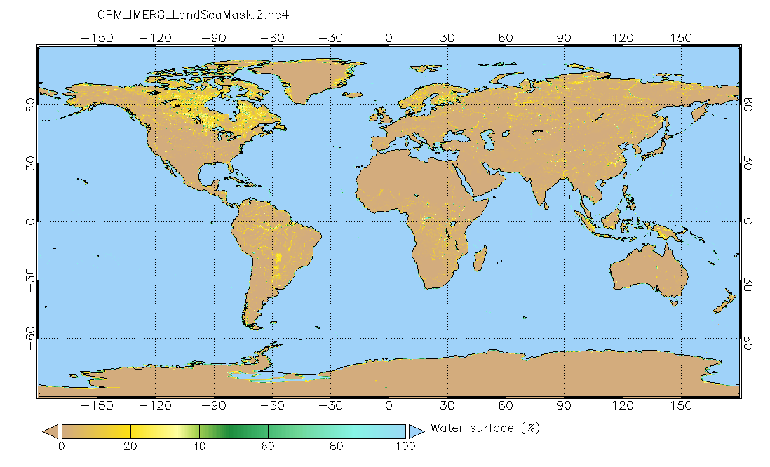
Land/Sea static mask relevant to IMERG precipitation 0.1x0.1 degree V2 (GPM_IMERG_LandSeaMask) at GES DISC recent views
National Aeronautics and Space Administration —
Version 2 is the current version of the data set. Older versions will no longer be available and have been superseded by Version 2. This land sea mask originated from... -
Federal
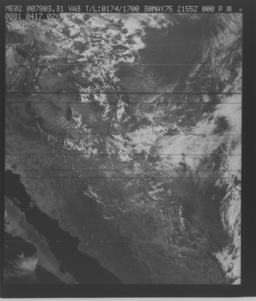
VISSR/SMS-2 Visible Imagery on 70mm Film V001 (VISSRSMS2IMVIS) at GES DISC recent views
National Aeronautics and Space Administration —
VISSRSMS2IMVIS is the Visible Infrared Spin-Scan Radiometer (VISSR) Visible Imagery on 70mm Film data product from the second Synchronous Meteorological Satellite... -
Federal
VISSR/GOES-3 Visible Imagery on 70mm Film V001 (VISSRGOES3IMVIS) at GES DISC recent views
National Aeronautics and Space Administration —
VISSRGOES3IMVIS is the Visible Infrared Spin-Scan Radiometer (VISSR) Visible Imagery on 70mm Film data product from the third Geostationary Operational Environmental... -
Federal
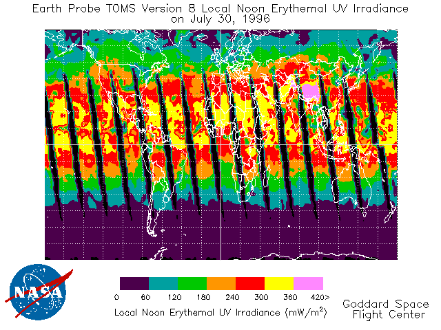
TOMS Earth Probe UV-B Erythemal Local Noon Irradiance Daily L3 Global 1 deg x 1.25 deg Lat/Lon Grid V008 (TOMSEPL3dery) at GES DISC recent views
National Aeronautics and Space Administration —
This Earth Probe (EP) Total Ozone Mapping Spectrometer (TOMS) version 8 daily global gridded data product contains UV-B erythemal local noon irradiance values. The... -
Federal
Archive of Census Related Products (ACRP): 1990 ZIP Equivalency Files recent views
National Aeronautics and Space Administration —
The 1990 Zip Equivalency Files portion of the Archive of Census Related Products (ACRP) contains population and housing data derived from the U.S. Census Bureau's... -
Federal
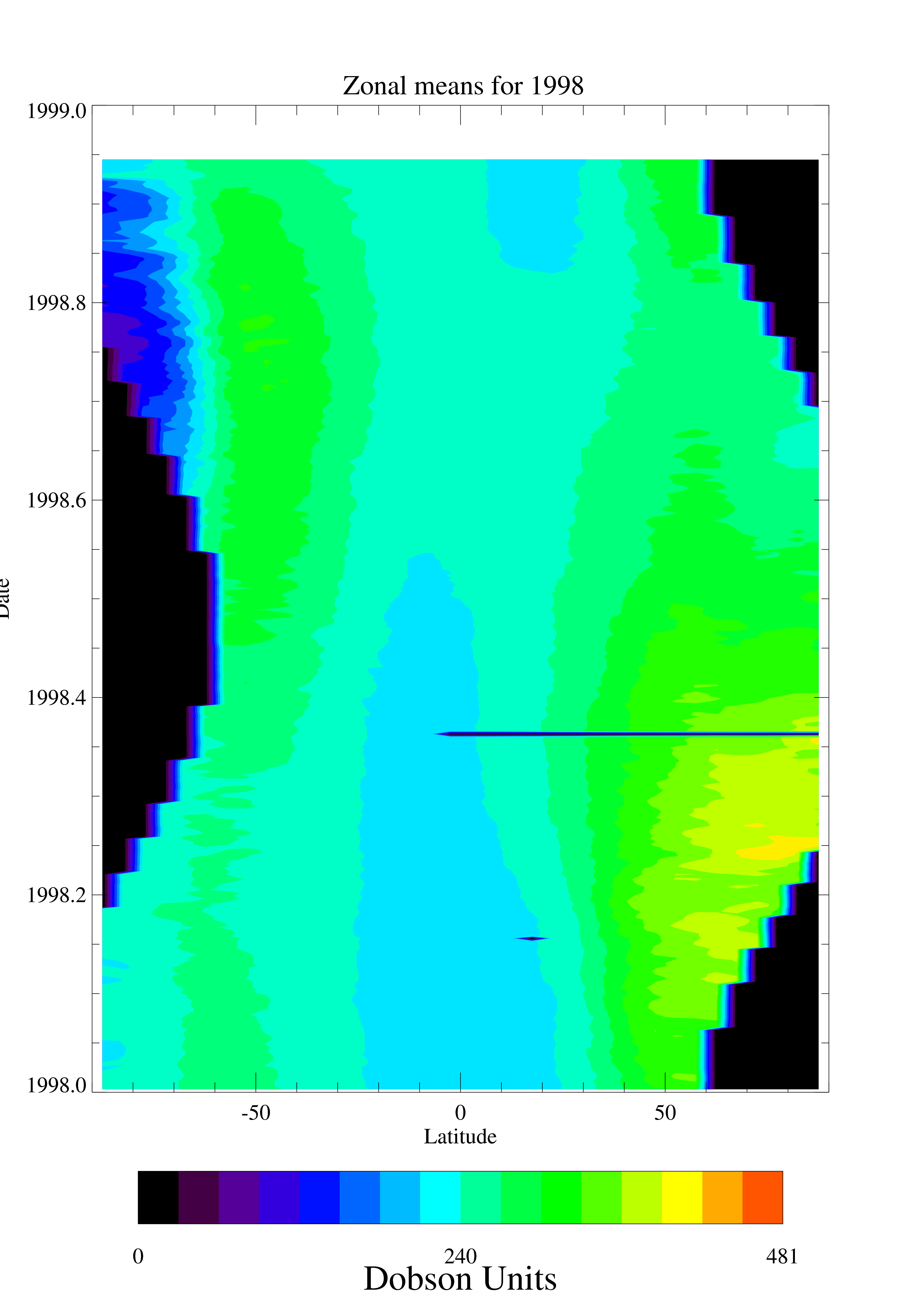
TOMS EP Total Column Ozone Daily and Monthly Zonal Means V008 (TOMSEPL3ztoz) at GES DISC recent views
National Aeronautics and Space Administration —
This Earth Probe (EP) Total Ozone Mapping Spectrometer (TOMS) version 8 daily zonal means data product contains total column ozone values. The data are averaged in 5... -
Federal
CERES Bidirectional Scans Aqua FM4 Edition4 recent views
National Aeronautics and Space Administration —
CER_BDS_Aqua-FM4_Edition4 is the Clouds and the Earth's Radiant Energy System (CERES) Bidirectional Scans (BDS) Aqua Flight Model 4 (FM4) Edition 4 data product,... -
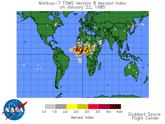
Federal
TOMS Earth Probe UV Aerosol Index Daily L3 Global 1 deg x 1.25 deg Lat/Lon Grid V008 (TOMSEPL3daer) at GES DISC recent views
National Aeronautics and Space Administration —
This Earth Probe (EP) Total Ozone Mapping Spectrometer (TOMS) version 8 daily global gridded data product contains UV aerosol index values. The data are mapped to a... -
Federal
Airborne Multi-angle Imaging SpectroRadiometer (AirMISR) Data from the Morgan Monore 2003 Campaign recent views
National Aeronautics and Space Administration —
The AIRMISR_MORGAN_MONROE_2003 data were acquired during a flight over the Morgan Monroe State Forest, Indiana, USA, target as part of the AirMISR deployments from... -
Federal
Airborne Multi-angle Imaging SpectroRadiometer (AirMISR) Data from the Harvard 2003 Campaign recent views
National Aeronautics and Space Administration —
The AIRMISR_HARVARD_2003 data set was asquired during a flight over the Harvard Forest, Massachusetts, USA, target as part of the AirMISR deployments from the Wallops... -
Federal
ASTER L2 Surface Radiance TIR V003 NGDA recent views
National Aeronautics and Space Administration —
The ASTER Surface Radiance TIR (AST_09T) is generated (https://lpdaac.usgs.gov/documents/996/ASTER_Earthdata_Search_Order_Instructions.pdf) using the five Thermal... -
Federal
SASSIE Arctic Field Campaign Summary Ice Concentration Rankings from ML analysis of SBAND Images Fall 2022 recent views
National Aeronautics and Space Administration —
This dataset contains ice concentration rankings of S-band images from the S-BAND marine navigation radar collected during the 2022 Salinity and Stratification at the... -
Federal
Airborne Multi-angle Imaging SpectroRadiometer (AirMISR) Data from the Bartlett 2003 Campaign recent views
National Aeronautics and Space Administration —
The AIRMISR_BARTLETT_2003 data were acquired during a flight over the Bartlett Experimental Forest, New Hampshire, USA, target as part of the AirMISR deployments from... -
Federal
S-MODE MASS Level 1 LWIR Version 1 recent views
National Aeronautics and Space Administration —
NOTICE: This dataset is currently undergoing maintenance to be repackaged as zip files of flight lines. The file count will decrease dramatically when new zip files... -
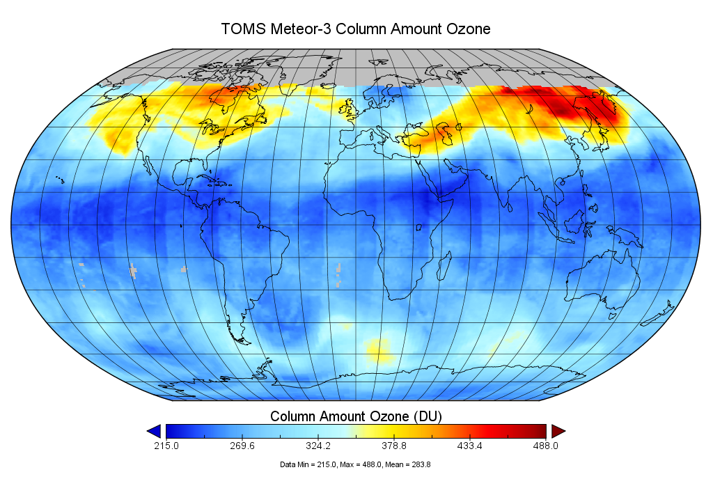
Federal
TOMS Meteor-3 Total Ozone UV-Reflectivity Daily L3 Global 1 deg x 1.25 deg V008 (TOMSM3L3) at GES DISC recent views
National Aeronautics and Space Administration —
The Meteor-3 Total Ozone Mapping Spectrometer (TOMS) version 8 daily global gridded data product contains total column ozone, UV aerosol index, Lambertian effective...

Official websites use .gov
A
.gov website belongs to an official government
organization in the United States.
Secure .gov websites use HTTPS
A
lock (
) or https:// means you’ve safely connected to
the .gov website. Share sensitive information only on official,
secure websites.