
-
Federal
GLDAS Catchment Land Surface Model L4 daily 0.25 x 0.25 degree GRACE-DA1 V2.2 (GLDAS_CLSM025_DA1_D_EP) at GES DISC recent views
National Aeronautics and Space Administration —
NASA Global Land Data Assimilation System Version 2 (GLDAS-2) has three components: GLDAS-2.0, GLDAS-2.1, and GLDAS-2.2. GLDAS-2.0 is forced entirely with the... -
Federal
GPM ATMS on NOAA-21 (GPROF) Climate-based Radiometer Precipitation Profiling L3 1 day 0.25 degree x 0.25 degree V07 (GPM_3GPROFNOAA21ATMS_DAY_CLIM) at GES DISC recent views
National Aeronautics and Space Administration —
Version 07 is the current version of the data set. Older versions are no longer available and have been superseded by Version 07. The "CLIM" products differ from... -
Federal
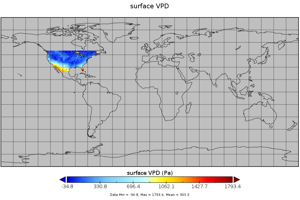
Spatial Statistical Data Fusion (SSDF) Level 3: CONUS Near-Surface Vapor Pressure Deficit from SNPP CrIMSS and Aqua AIRS, V2 (SNDR13IML3SSDFCVPD) recent views
National Aeronautics and Space Administration —
The Spatial Statistical Data Fusion (SSDF) surface continental United States (CONUS) products, fuse data from the Atmospheric InfraRed Sounder (AIRS) instrument on... -
Federal
GPM ATMS on NOAA-21 (GPROF) Radiometer Precipitation Profiling L2A 1.5 hours 17 km V07 (GPM_2AGPROFNOAA21ATMS) at GES DISC recent views
National Aeronautics and Space Administration —
Version 07 is the current version of the data set. The 2AGPROF (also known as, GPM GPROF (Level 2)) algorithm retrieves consistent precipitation and related science... -
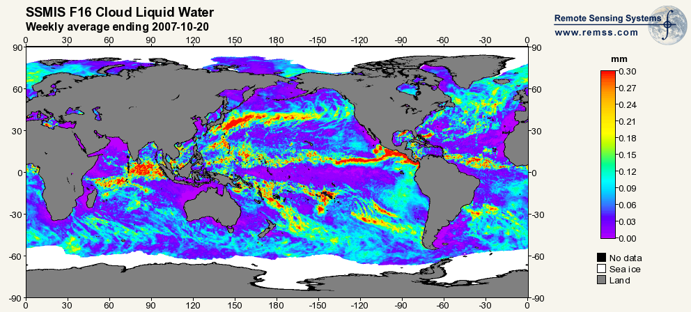
Federal
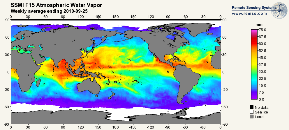
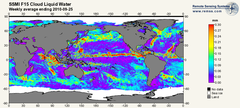
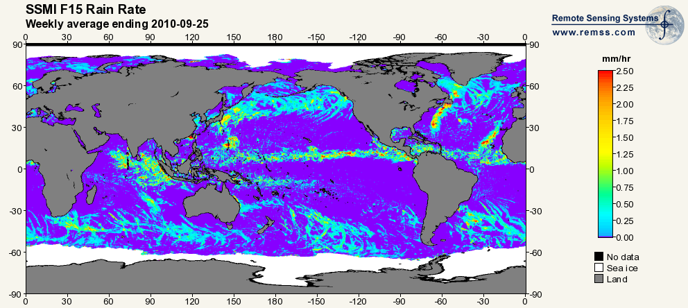
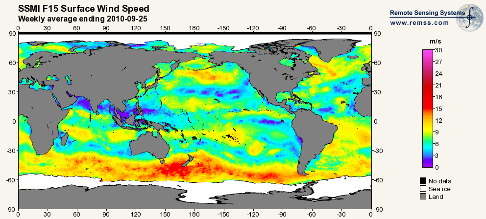
RSS SSM/I OCEAN PRODUCT GRIDS WEEKLY AVERAGE FROM DMSP F15 NETCDF V7 recent views
National Aeronautics and Space Administration —
The RSS SSM/I Ocean Product Grids Weekly Average from DMSP F15 netCDF dataset is part of the collection of Special Sensor Microwave/Imager (SSM/I) and Special Sensor... -
Federal
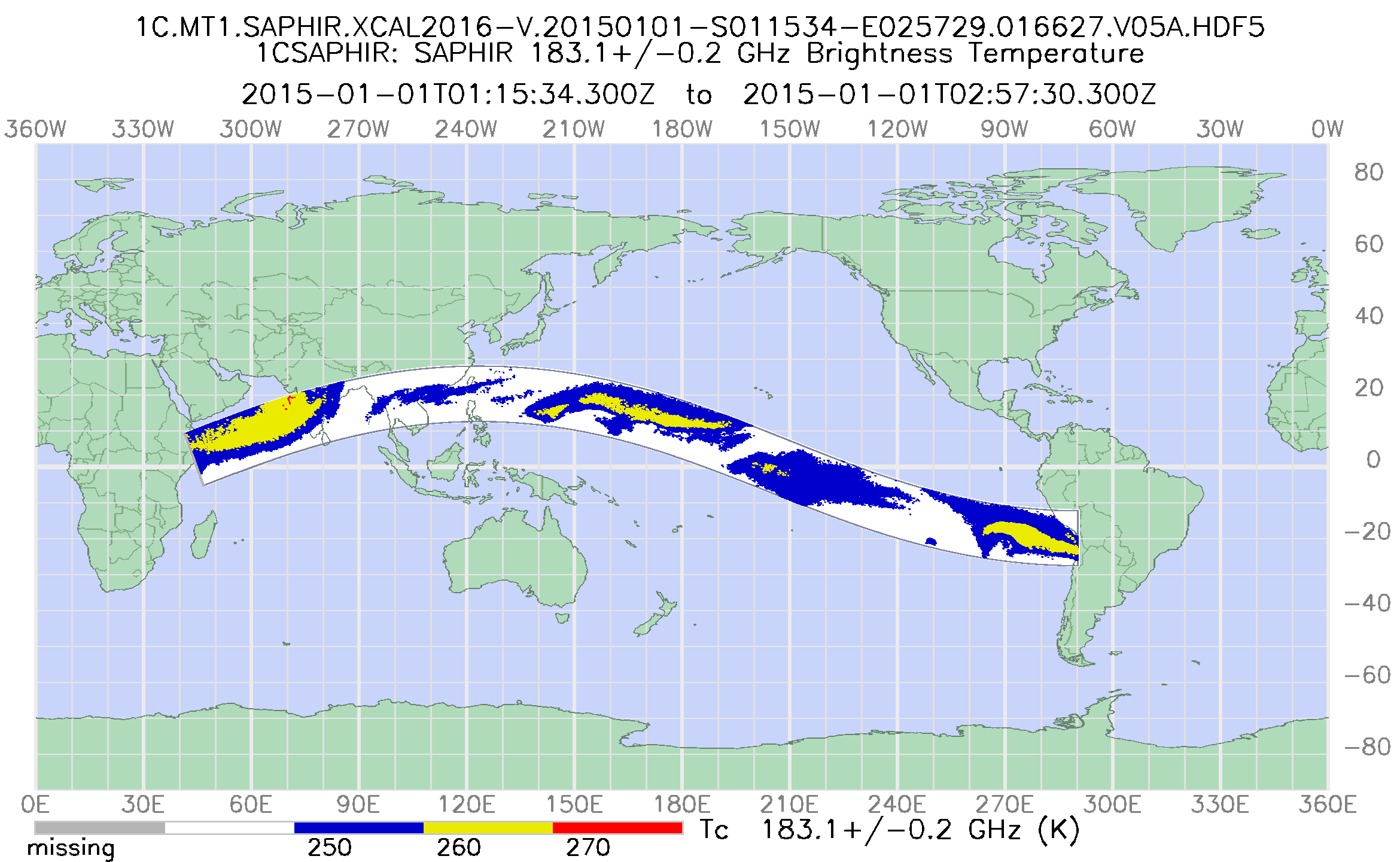
GPM SAPHIR on MT1 Common Calibrated Brightness Temperature L1C 1.5 hours 10 km V07 (GPM_1CMT1SAPHIR) at GES DISC recent views
National Aeronautics and Space Administration —
Version 07 is the current version of the data set. Older versions will no longer be available and have been superseded by Version 07. 1CAMSR2 contains common... -
Federal
GPM ATMS on NOAA-21 (GPROF) Climate-based Radiometer Precipitation Profiling L2A 1.5 hours 17 km V07 (GPM_2AGPROFNOAA21ATMS_CLIM) at GES DISC recent views
National Aeronautics and Space Administration —
Version 07 is the current version of the data set. The "CLIM" products differ from their "regular" counterparts (without the "CLIM" in the name) by the ancillary data... -
Federal
GPM ATMS on NOAA-21 (GPROF) Climate-based Radiometer Precipitation Profiling L3 1 month 0.25 degree x 0.25 degree V07 (GPM_3GPROFNOAA21ATMS_CLIM) at GES DISC recent views
National Aeronautics and Space Administration —
Version 07 is the current version of the data set. Older versions are no longer available and have been superseded by Version 07. The "CLIM" products differ from... -
Federal
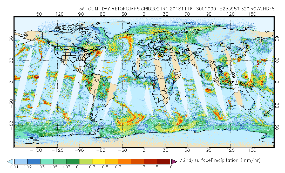
GPM MHS on METOP-C (GPROF) Climate-based Radiometer Precipitation Profiling L3 1 day 0.25 degree x 0.25 degree V07 (GPM_3GPROFMETOPCMHS_DAY_CLIM) at GES DISC recent views
National Aeronautics and Space Administration —
Version 07 is the current version of the data set. Older versions are no longer available and have been superseded by Version 07. The "CLIM" products differ from... -
Federal
GPM DPR and GMI Combined Convective Stratiform Heating L3 1 month 0.5 degree x 0.5 degree V07 (GPM_3HCSH) at GES DISC recent views
National Aeronautics and Space Administration —
The Gridded Convective Stratiform Heating (3HCSH) products contain latent heating, Q1-QR and Q2 profiles from DPR raindata. Version 07 is the current version of the... -
Federal
ATMOS L2 Trace Gases on Potential Temperature Grid, Tab Delimited Format V3 (ATMOSL2TT) at GES DISC recent views
National Aeronautics and Space Administration —
This is the version 3 Atmospheric Trace Molecule Spectroscopy (ATMOS) Level 2 product containing trace gases on a vertical potential temperature (theta) grid with... -
Federal
GPM MHS on METOP-C Common Calibrated Brightness Temperature L1C 1.5 hours 17 km V07 (GPM_1CMETOPCMHS) at GES DISC recent views
National Aeronautics and Space Administration —
Version 07 is the current version of the data set. 1CAMSR2 contains common calibrated brightness temperature from the AMSR2 passive microwave instrument flown on the... -
Federal
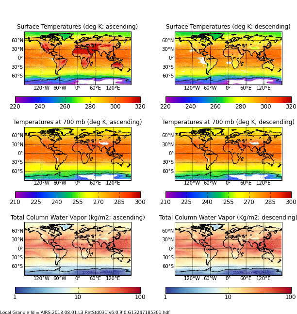
AIRS/Aqua L3 Monthly Standard Physical Retrieval (AIRS+AMSU) 1 degree x 1 degree V006 (AIRX3STM) at GES DISC recent views
National Aeronautics and Space Administration —
The Atmospheric Infrared Sounder (AIRS) is a grating spectrometer (R = 1200) aboard the second Earth Observing System (EOS) polar-orbiting platform, EOS Aqua. In... -
Federal
Sounder SIPS: JPSS-1 CrIS Level 3 Comprehensive Quality Control Gridded Monthly CLIMCAPS V2 (SNDRJ1IML3CMCCP) at GES DISC recent views
National Aeronautics and Space Administration —
WARNING: To users of the derived product “co_mmr_midtrop” (carbon monoxide mass mixing ratio to dry air [kg/kg] at ~500 hPa). This variable has a significant bias due... -
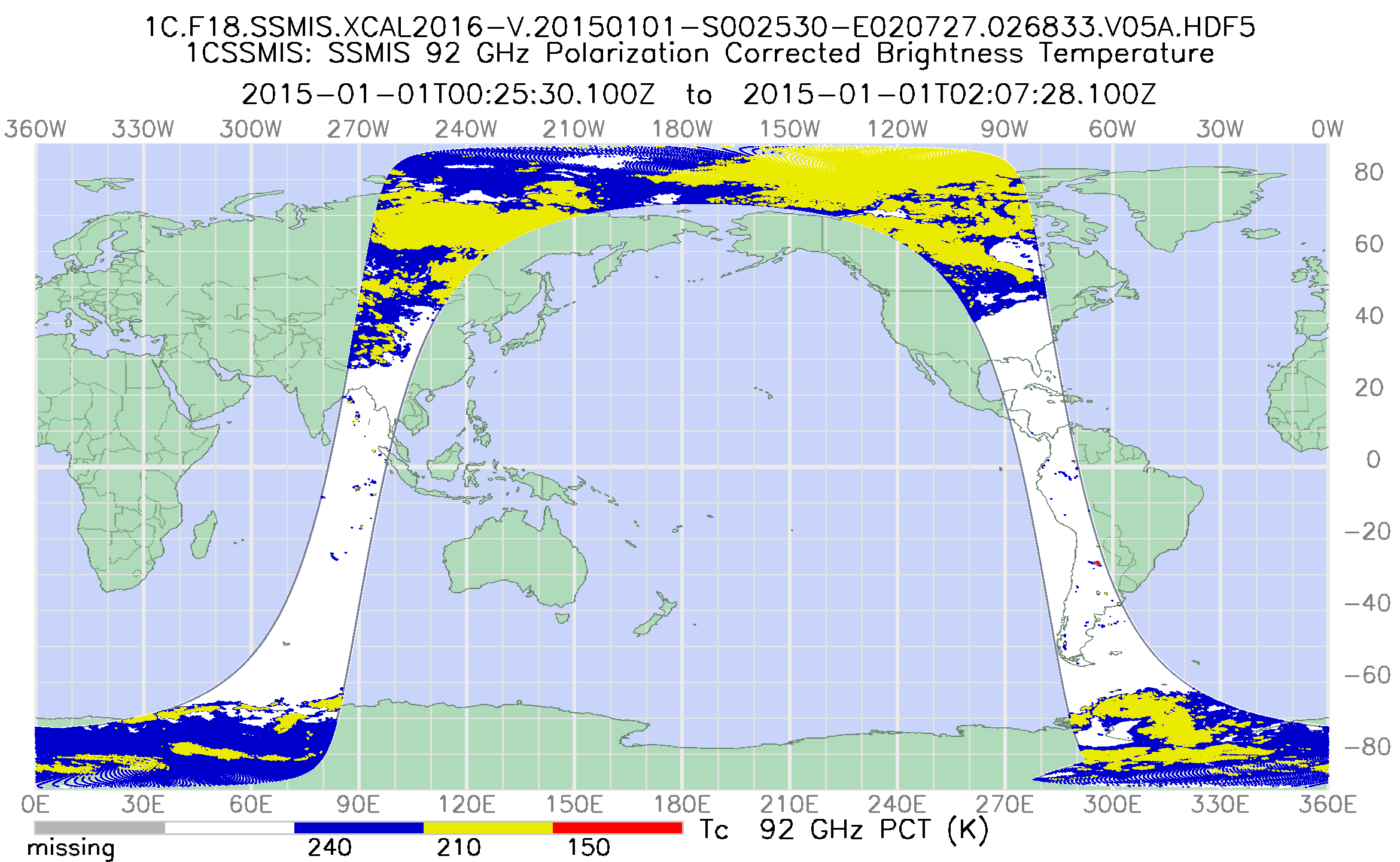
Federal
GPM SSMIS on F18 Common Calibrated Brightness Temperatures L1C 1.5 hours 12 km V07 (GPM_1CF18SSMIS) at GES DISC recent views
National Aeronautics and Space Administration —
Version 07 is the current version of the data set. Older versions will no longer be available and have been superseded by Version 07. All 1C products have a common... -
Federal
GPM MHS on METOP-C (GPROF) Climate-based Radiometer Precipitation Profiling L3 1 month 0.25 degree x 0.25 degree V07 (GPM_3GPROFMETOPCMHS_CLIM) at GES DISC recent views
National Aeronautics and Space Administration —
Version 07 is the current version of the data set. Older versions are no longer available and have been superseded by Version 07. The "CLIM" products differ from... -
Federal
TOVS GLA 5 DAY GRIDS from NOAA-10 V01 (TOVSA5NG) at GES DISC recent views
National Aeronautics and Space Administration —
This dataset (TOVSA5NG) contains the TIROS Operational Vertical Sounder (TOVS) level 3 geophysical parameters derived using data from NOAA-10 and the physical... -
Federal
GPM ATMS on NOAA-21 Common Calibrated Brightness Temperatures L1C 1.5 hours 17 km V07 (GPM_1CNOAA21ATMS) at GES DISC recent views
National Aeronautics and Space Administration —
Version 07 is the current version of the data set. Older versions will no longer be available and have been superseded by Version 07. 1CATMS contains common... -
Federal
GPM MHS on METOP-A (GPROF) Radiometer Precipitation Profiling L3 1 day 0.25 degree x 0.25 degree V07 (GPM_3GPROFMETOPAMHS_DAY_CLIM) at GES DISC recent views
National Aeronautics and Space Administration —
Version 07 is the current version of the data set. Older versions are no longer available and have been superseded by Version 07. The "CLIM" products differ from... -
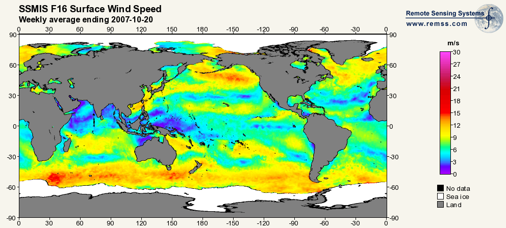
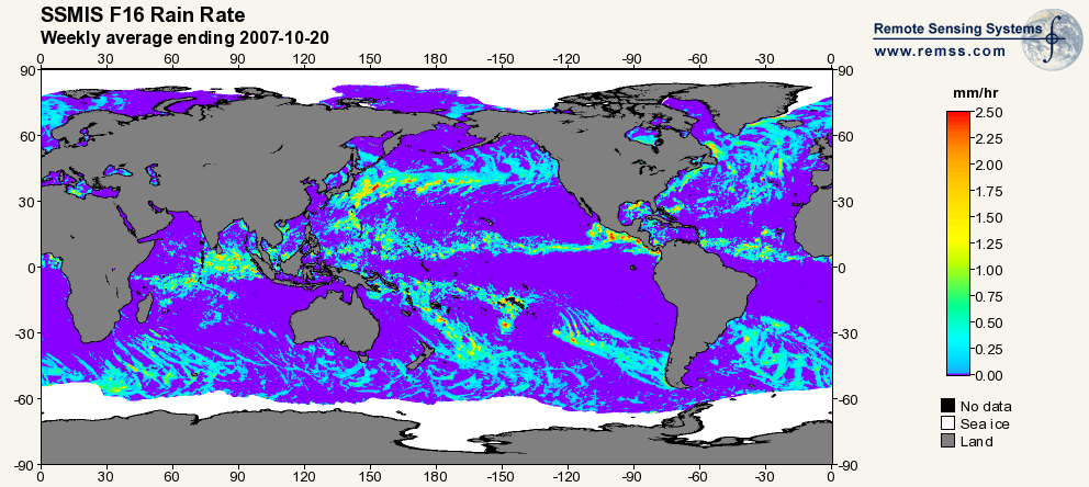
Federal
RSS SSMIS OCEAN PRODUCT GRIDS WEEKLY AVERAGE FROM DMSP F16 NETCDF V7 recent views
National Aeronautics and Space Administration —
The RSS SSMIS Ocean Product Grids Weekly Average from DMSP F16 netCDF dataset is part of the collection of Special Sensor Microwave/Imager (SSM/I) and Special Sensor...

Official websites use .gov
A
.gov website belongs to an official government
organization in the United States.
Secure .gov websites use HTTPS
A
lock (
) or https:// means you’ve safely connected to
the .gov website. Share sensitive information only on official,
secure websites.