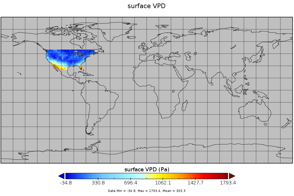
Spatial Statistical Data Fusion (SSDF) Level 3: CONUS Near-Surface Vapor Pressure Deficit from SNPP CrIMSS and Aqua AIRS, V2 (SNDR13IML3SSDFCVPD)
Access & Use Information
Downloads & Resources
-
Google Scholar search resultsHTML
Search results for publications that cite this dataset by its DOI.
-
Get a related visualizationPNG
SNDR13IML3SSDFCVPD_2.png
-
This dataset's landing pageHTML
SNDR13IML3SSDFCVPD_2.html
-
Download this dataset through a directory mapHTML
-
Use OPeNDAP to access the dataset's dataHTML
-
Download this dataset through Earthdata SearchHTML
-
View this dataset's read me documentPDF
Spatial Statistical Data Fusion (SSDF) Product User Guide:File Format and...
-
The dataset's project home pageHTML
AIRS home page at NASA/JPL. General information on the AIRS instrument,...
-
View this dataset's algorithm theoretical...PDF
ATBD
-
Landing PageLanding Page
Dates
| Metadata Created Date | May 30, 2023 |
|---|---|
| Metadata Updated Date | December 7, 2023 |
Metadata Source
- Data.json Data.json Metadata
Harvested from NASA Data.json
Graphic Preview

Additional Metadata
| Resource Type | Dataset |
|---|---|
| Metadata Created Date | May 30, 2023 |
| Metadata Updated Date | December 7, 2023 |
| Publisher | NASA/GSFC/SED/ESD/GCDC/GESDISC |
| Maintainer | |
| Identifier | C2284971212-GES_DISC |
| Data First Published | 2022-04-13 |
| Language | en-US |
| Data Last Modified | 2022-04-13 |
| Category | Aqua, geospatial |
| Public Access Level | public |
| Bureau Code | 026:00 |
| Metadata Context | https://project-open-data.cio.gov/v1.1/schema/catalog.jsonld |
| Metadata Catalog ID | https://data.nasa.gov/data.json |
| Schema Version | https://project-open-data.cio.gov/v1.1/schema |
| Catalog Describedby | https://project-open-data.cio.gov/v1.1/schema/catalog.json |
| Citation | Amy Braverman, Peter Kalmus, Hai Nguyen. SNDR13IML3SSDFCVPD. Version 2. Spatial Statistical Data Fusion (SSDF) Level 3: CONUS Near-Surface Vapor Pressure Deficit from SNPP CrIMSS and Aqua AIRS. Archived by National Aeronautics and Space Administration, U.S. Government, Goddard Earth Sciences Data and Information Services Center (GES DISC). https://doi.org/10.5067/55EOWAJ669WC. https://disc.gsfc.nasa.gov/datacollection/SNDR13IML3SSDFCVPD_2.html. Digital Science Data. |
| Creator | Amy Braverman, Peter Kalmus, Hai Nguyen |
| Data Presentation Form | Digital Science Data |
| Graphic Preview File | https://docserver.gesdisc.eosdis.nasa.gov/public/project/Images/SNDR13IML3SSDFCVPD_2.png |
| Harvest Object Id | 5b6e2062-2afa-4796-9c0a-31b4d956ebcc |
| Harvest Source Id | 58f92550-7a01-4f00-b1b2-8dc953bd598f |
| Harvest Source Title | NASA Data.json |
| Homepage URL | https://doi.org/10.5067/55EOWAJ669WC |
| Metadata Type | geospatial |
| Old Spatial | -180.0 -90.0 180.0 90.0 |
| Program Code | 026:001 |
| Series Name | SNDR13IML3SSDFCVPD |
| Source Datajson Identifier | True |
| Source Hash | b21630c8cc5604a3ac6e6c4e42979232e529be254ca6a26d0eafe6612a602e10 |
| Source Schema Version | 1.1 |
| Spatial | |
| Temporal | 2012-11-28T00:00:00Z/2020-12-31T23:59:59.999Z |
Didn't find what you're looking for? Suggest a dataset here.

