
-
Federal
Daily and Annual PM2.5, O3, and NO2 Concentrations at ZIP Codes for the Contiguous U.S., 2000-2016, v1.0
National Aeronautics and Space Administration —
The Daily and Annual PM2.5, O3, and NO2 Concentrations at ZIP Codes for the Contiguous U.S., 2000-2016, v1.0 data set contains daily and annual concentration... -
Federal
China Dimensions Data Collection: GuoBiao (GB) Codes for the Administrative Divisions of the Peoples Republic of China
National Aeronautics and Space Administration —
The GuoBiao (GB) Codes for the Administrative Divisions of the People's Republic of China consists of geographic codes for the administrative divisions of China. The... -
Federal
Yale Center for Earth Observation (YCEO) Surface Urban Heat Islands, Version 4, 2003-2018
National Aeronautics and Space Administration —
The Yale Center for Earth Observation (YCEO) Surface Urban Heat Islands, Version 4, 2003-2018 includes annual, summertime, and wintertime Surface Urban Heat Island... -
Federal
China Dimensions Data Collection: China County-Level Data from Provincial Economic Yearbooks, Keyed to 1:1M GIS Map
National Aeronautics and Space Administration —
The China County-Level Data on Provincial Economic Yearbooks, Keyed To 1:1M GIS Map consists of socioeconomic and boundary data for the administrative regions of... -
Federal
MLS/Aura Near-Real-Time L2 Water Vapor (H2O) Mixing Ratio V005 (ML2H2O_NRT) at GES DISC
National Aeronautics and Space Administration —
ML2H2O_NRT is the EOS Aura Microwave Limb Sounder (MLS) Near-Real-Time (NRT) product for water vapor (H2O). This product contains H2O profiles derived from the 190... -
Federal
MODIS/Terra+Aqua Land Cover Type Yearly L3 Global 0.05Deg CMG V061
National Aeronautics and Space Administration —
The Terra and Aqua combined Moderate Resolution Imaging Spectroradiometer (MODIS) Land Cover Climate Modeling Grid (CMG) (MCD12C1) Version 6.1 data product provides a... -
Federal
CAR INTEX-B Long-range Pollution Transportation L1 V1 (CAR_INTEXB_L1C) at GES DISC
National Aeronautics and Space Administration —
INTEX-B (Intercontinental Chemical Transport Experiment-Phase B) focuses on the long-range transport of pollution, global atmospheric photochemistry, and the effects... -
Federal
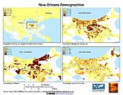
U.S. Population Grids (Summary File 3), 2000: New Orleans Metropolitan Statistical Area, Alpha Version
National Aeronautics and Space Administration —
The U.S. Population Grids (Summary File 3), 2000: New Orleans Metropolitan Statistical Area, Alpha Version data set contains an ARC/INFO Workspace with grids of... -
Federal
Altimeter Corrected Elevations, Version 2 (ACE2)
National Aeronautics and Space Administration —
The Altimeter Corrected Elevations, Version 2 (ACE2) data set, is the Global Digital Elevation Model (GDEM) created by using multi-mission Satellite Radar Altimetry... -
Federal
Aquarius Official Release Level 3 Rain-flagged Sea Surface Salinity Standard Mapped Image Seasonal Data V5.0
National Aeronautics and Space Administration —
Aquarius Level 3 sea surface salinity (SSS) rain-flagged standard mapped image data contains gridded 1 degree spatial resolution SSS averaged overdaily, 7 day,... -
Federal
Aquarius Official Release Level 3 Rain-flagged Sea Surface Salinity Standard Mapped Image Ascending Seasonal Data V5.0
National Aeronautics and Space Administration —
Aquarius Level 3 sea surface salinity (SSS) rain-flagged standard mapped image data contains gridded 1 degree spatial resolution SSS averaged over daily, 7 day,... -
Federal
IPCC Fifth Assessment Report (AR5) Observed Climate Change Impacts Database, Version 2.01
National Aeronautics and Space Administration —
The Intergovernmental Panel on Climate Change Fifth Assessment Report (AR5) Observed Climate Change Impacts Database, Version 2.01 contains observed responses to... -
Federal
2005 Environmental Sustainability Index (ESI)
National Aeronautics and Space Administration —
The 2005 Environmental Sustainability Index (ESI) is a measure of overall progress towards environmental sustainability, developed for 146 countries. The index... -
Federal
Global Volcano Total Economic Loss Risk Deciles
National Aeronautics and Space Administration —
Global Volcano Total Economic Loss Risk Deciles is a 2.5 minute grid of global volcano total economic loss risks. First, subnational distributions of Gross Domestic... -
Federal
U.S. Population Grids (Summary File 1), 2000: New Orleans Metropolitan Statistical Area, Alpha Version
National Aeronautics and Space Administration —
U.S. Population Grids (Summary File 1), 2000: New Orleans Metropolitan Statistical Area, Alpha Version contains an ARC/INFO Workspace with grids of demographic data... -
Federal
MASTER: California Fire-Burn Area Emergency Response, California, April 2008
National Aeronautics and Space Administration —
This dataset includes Level 1B (L1B) data products from the MODIS/ASTER Airborne Simulator (MASTER) instrument. The spectral data were collected as part of the... -
Federal
Global 3-Year Running Mean Ground-Level Nitrogen Dioxide (NO2) Grids from GOME, SCIAMACHY and GOME-2
National Aeronautics and Space Administration —
The Global 3-Year Running Mean Ground-Level Nitrogen Dioxide (NO2) Grids from GOME, SCIAMACHY and GOME-2 represent a series of three-year running mean grids... -
Federal
Delta-X: Digital Elevation Model, MRD, LA, USA, 2021
National Aeronautics and Space Administration —
This dataset provides an updated digital elevation model (DEM) for the Atchafalaya and Terrebonne basins in coastal Louisiana, USA. The DEM is updated from the Pre-...

Official websites use .gov
A
.gov website belongs to an official government
organization in the United States.
Secure .gov websites use HTTPS
A
lock (
) or https:// means you’ve safely connected to
the .gov website. Share sensitive information only on official,
secure websites.