
-
Federal
CYGNSS Level 3 Ocean Microplastic Concentration Version 3.2
National Aeronautics and Space Administration —
The CYGNSS L3 Ocean Microplastic Concentration V3.2 dataset is provided by the CYGNSS Science Team of the University of Michigan.CYGNSS was launched on 15 December... -
Federal
SWOT Level 2 River Single-Pass Vector Data Product, Version D
National Aeronautics and Space Administration —
The SWOT Level 2 River Single-Pass Vector Data Product (SWOT_L2_HR_RiverSP_D) provides hydrologic measurements for predefined river reaches and nodes, derived from... -
Federal
ECOSTRESS Evapotranspiration dis-ALEXI Daily L3 CONUS 70 m V001
National Aeronautics and Space Administration —
The ECOsystem Spaceborne Thermal Radiometer Experiment on Space Station (ECOSTRESS) mission measures the temperature of plants to better understand how much water... -
Federal
TOLNet NASA Langley Research Center Data
National Aeronautics and Space Administration —
TOLNet_LaRC_Data is the lidar data collected by the Langley Mobile Ozone Lidar (LMOL) at NASA Langley Research Center (LaRC) as part of the Tropospheric Ozone Lidar... -
Federal
ECOSTRESS Gridded Downscaled Meteorology Instantaneous L3 Global 70 m V002
National Aeronautics and Space Administration —
The ECOsystem Spaceborne Thermal Radiometer Experiment on Space Station (ECOSTRESS) mission measures the temperature of plants to better understand how much water... -
Federal
ECOSTRESS Evapotranspiration dis-ALEXI USDA Daily L3 Global 30m V001
National Aeronautics and Space Administration —
The ECOsystem Spaceborne Thermal Radiometer Experiment on Space Station (ECOSTRESS) mission measures the temperature of plants to better understand how much water... -
Federal
TOLNet NASA Jet Propulsion Laboratory Data
National Aeronautics and Space Administration —
TOLNet_JPL_Data are lidar data collected by several ozone Differential Absorption Lidar instruments developed at the NASA Jet Propulsion Laboratory Table Mountain... -
Federal
Pre-LBA ISLSCP Initiative I Data
National Aeronautics and Space Administration —
This data set contains hydrology, soils, radiation, cloud, and vegetation data from the International Satellite Land Surface Climatology Project (ISLSCP) Initiative... -
Federal
TOLNet Environment and Climate Change Canada Data
National Aeronautics and Space Administration —
TOLNet_ECCC_Data is the lidar data collected by the Autonomous Mobile Ozone LIDAR instrument for Tropospheric Experiments (AMOLITE) lidar at Environment and Climate... -
Federal
SWOT Level 2 River Single-Pass Vector Data Product, Version 2.0
National Aeronautics and Space Administration —
The SWOT Level 2 River Single-Pass Vector Data Product from the Surface Water Ocean Topography (SWOT) mission provides water surface elevation, slope, width, and... -
Federal
Maps of Vegetation Types and Physiographic Features, Imnavait Creek, Alaska
National Aeronautics and Space Administration —
This dataset provides the spatial distribution of vegetation types, soil carbon, and physiographic features in the Imnavait Creek area, Alaska. Specific attributes... -
Federal
TOLNet NOAA Chemical Sciences Laboratory Data
National Aeronautics and Space Administration —
TOLNet_CSL_Data is the lidar data collected by the Tunable Optical Profile for Aerosol and oZone (TOPAZ) lidar at the NOAA Chemical Sciences Laboratory (CSL) in... -
Federal
SOLVE I Balloonsondes and Ozonesondes Data
National Aeronautics and Space Administration —
SOLVE1_Sondes_Data is the balloonsonde and ozonesonde data collected during the SAGE III Ozone Loss and Validation Experiment (SOLVE). Data were collected by balloon... -
Federal
Pre-Delta-X: Total Suspended Solids of Surface Water across MRD, LA, USA, 2015-2016
National Aeronautics and Space Administration —
This dataset contains the total suspended solids (TSS) concentration of in situ water samples collected at selected sites across the Atchafalaya and Terrebonne Basins... -
Federal
MODIS/Terra+Aqua Land Cover Type Yearly L3 Global 500m SIN Grid V006
National Aeronautics and Space Administration —
The MCD12Q1 Version 6 data product was decommissioned on July 31, 2023. Users are encouraged to use the MCD12Q1 Version 6.1 data product.The Terra and Aqua combined... -
Federal
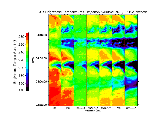
CAMEX-3 ER-2 Millimeter-wave Imaging Radiometer (MIR) V1
National Aeronautics and Space Administration —
The CAMEX-3 ER-2 Millimeter-wave Imaging Radiometer (MIR) dataset is a browse-only dataset containing plots of brightness temperature measurements collected by the... -
Federal
PEM Tropics B DC-8 In-Situ Trace Gas Data
National Aeronautics and Space Administration —
PEM-Tropics-B_TraceGas_AircraftInSitu_DC8_Data is the in-situ trace gas data collected onboard the DC-8 aircraft during the Pacific Exploratory Mission (PEM) Tropics... -
Federal
SWOT Level 2 Water Mask Raster Image 100m Data Product, Version D
National Aeronautics and Space Administration —
The SWOT Level 2 KaRIn High Rate Raster Product (SWOT_L2_HR_Raster_D) provides rasterized estimates of water surface elevation, inundation extent, and radar... -
Federal
SOLVE I Supplementary Satellite Data Products
National Aeronautics and Space Administration —
SOLVE1_Satellite_Data is the supplementary satellite data for the SAGE III Ozone Loss and Validation Experiment (SOLVE). Data were collected by instruments such as... -
Federal
ARCTAS DC-8 Aircraft In-situ Meteorological and Navigational Data
National Aeronautics and Space Administration —
ARCTAS_MetNav_AircraftInSitu_DC8_Data is the in-situ meteorological and navigational data for the DC-8 aircraft collected during the Arctic Research of the...

Official websites use .gov
A
.gov website belongs to an official government
organization in the United States.
Secure .gov websites use HTTPS
A
lock (
) or https:// means you’ve safely connected to
the .gov website. Share sensitive information only on official,
secure websites.