
-
Federal
CORONA Satellite Photography
National Aeronautics and Space Administration —
On February 24, 1995, President Clinton signed an Executive Order, directing the declassification of intelligence imagery acquired by the first generation of United... -
Federal
Shuttle Radar Topography Mission DTED Level 1 (3-arc second) Data (DTED-1)
National Aeronautics and Space Administration —
The Shuttle Radar Topography Mission (SRTM) successfully collected Interferometric Synthetic Aperture Radar (IFSAR) data over 80 percent of the landmass of the Earth... -
Federal
U.S. Geological Survey Aerial Photography
National Aeronautics and Space Administration —
The U.S. Geological Survey (USGS) Aerial Photography data set includes over 2.5 million film transparencies. Beginning in 1937, photographs were acquired for mapping... -
Federal
Georeferenced Population Datasets of Mexico (GEO-MEX): GIS of Mexican States, Municipalities and Islands
National Aeronautics and Space Administration —
The GIS of Mexican States, Municipalities and Islands consists of attribute and boundary data for 1990. The attribute data include population, language, education,... -
Federal
Shuttle Radar Topography Mission (SRTM) Images
National Aeronautics and Space Administration —
Culminating more than four years of processing data, NASA and the National Geospatial-Intelligence Agency (NGA) have completed Earth's most extensive global... -
Federal
Georeferenced Population Datasets of Mexico (GEO-MEX): Urban Place GIS Coverage of Mexico
National Aeronautics and Space Administration —
The Urban Place GIS Coverage of Mexico is a vector based point Geographic Information System (GIS) coverage of 696 urban places in Mexico. Each Urban Place is... -
Federal
Interferometric Synthetic Aperture Radar (IFSAR) Alaska
National Aeronautics and Space Administration —
The U.S. Geological Survey (USGS) National Geospatial Program (NGP) developed the Alaska Mapping Initiative (AMI) to collaborate with the State and other Federal... -
Federal
Sounder SIPS: Suomi NPP CrIMSS Level 3 Comprehensive Quality Control Gridded Daily CLIMCAPS Full Spectral Resolution V2 (SNDRSNIML3CDCCP) at GES DISC
National Aeronautics and Space Administration —
WARNING: To users of the derived product “co_mmr_midtrop” (carbon monoxide mass mixing ratio to dry air [kg/kg] at ~500 hPa). This variable has a significant bias due... -
Federal
GPM Ground Validation Daily Precipitation OLYMPEX
National Aeronautics and Space Administration —
The GPM Ground Validation Daily Precipitation Olympic Mountain Experiment (OLYMPEX) dataset consists of a single netCDF-4 data file containing estimates of daily... -
Federal
ACEPOL High Spectral Resolution Lidar 2 (HSRL-2) Remotely Sensed Data
National Aeronautics and Space Administration —
ACEPOL High Spectral Resolution Lidar 2 (HSRL-2) Remotely Sensed Data (ACEPOL_AircraftRemoteSensing_HSRL2_Data) are remotely sensed measurements collected by the... -
Federal
India Village-Level Geospatial Socio-Economic Data Set: 1991, 2001
National Aeronautics and Space Administration —
The India Village-Level Geospatial Socio-Economic Data Set: 1991, 2001 is a compilation of the finest level of administrative boundaries in India (village/town-level)... -
Federal
BOREAS TF-10 NSA-YJP Tower Flux, Meteorological, and Porometry Data
National Aeronautics and Space Administration —
The BOREAS TF-10 team collected tower flux and meteorological data at two sites, a fen and a young jack pine forest, near Thompson, Manitoba, Canada, as part of... -
Federal
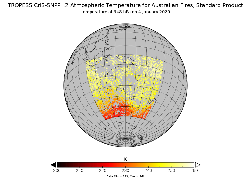
TROPESS CrIS-SNPP L2 Atmospheric Temperature for Australian Fires, Standard Product V1 (TRPSDL2TATMCRSAUS) at GES DISC
National Aeronautics and Space Administration —
The TROPESS CrIS-SNPP L2 Atmospheric Temperature for Australian Fires, Standard Product contains the vertical distribution of the retrieved atmospheric state of... -
Federal
Washington Double Star Catalog
National Aeronautics and Space Administration —
The Washington Double Star Catalog (WDS), maintained by the United States Naval Observatory (USNO), is the world's principal database of astrometric double and... -
Federal
ARISE C-130 Aircraft Merge Data Files
National Aeronautics and Space Administration —
ARISE_Merge_Data_1 is the Arctic Radiation - IceBridge Sea & Ice Experiment (ARISE) 2014 pre-generated aircraft (C-130) merge data files. This product is a result... -
Federal
TROPESS CrIS-SNPP L2 Ozone for Reanalysis Stream, Summary Product V1 (TRPSYL2O3CRSRS) at GES DISC
National Aeronautics and Space Administration —
The TROPESS CrIS-SNPP L2 Ozone for Reanalysis Stream, Summary Product contains the vertical distribution of the retrieved atmospheric state of ozone (O3), and formal... -
Federal
NICER Master Catalog
National Aeronautics and Space Administration —
This table records high-level information for the observations obtained with NICER (Neutron star Interior Composition ExploreR) and provides access to the NICER data... -
Federal
NACP Integrated Wildland and Cropland 30-m Fuel Characteristics Map, U.S.A., 2010
National Aeronautics and Space Administration —
The data set provides a 30-m comprehensive fuelbed characteristics map for both the wildland and cropland areas of the conterminous United States (CONUS) for 2010.... -
Federal
VIIRS/NPP Surface Reflectance 8-Day L3 Global 1km SIN Grid V001
National Aeronautics and Space Administration —
The 8-day Visible Infrared Imaging Radiometer Suite (VIIRS) surface reflectance (VNP09A1) Version 1 composite product provides an estimate of land surface reflectance... -
Federal
CAMP2Ex Miscellaneous Data
National Aeronautics and Space Administration —
CAMP2Ex_Miscellaneous_Data are miscellaneous data (satellite, model, analysis, merge data, etc.) collected during the Clouds, Aerosol and Monsoon Processes-...

Official websites use .gov
A
.gov website belongs to an official government
organization in the United States.
Secure .gov websites use HTTPS
A
lock (
) or https:// means you’ve safely connected to
the .gov website. Share sensitive information only on official,
secure websites.