
-
Federal
Daily and Annual PM2.5 Concentrations for the Contiguous United States, 1-km Grids, v1 (2000 - 2016)
National Aeronautics and Space Administration —
The Daily and Annual PM2.5 Concentrations for the Contiguous United States, 1-km Grids, v1 (2000 - 2016) data set includes predictions of PM2.5 concentrations in grid... -
Federal
LiDAR Surveys over Selected Forest Research Sites, Brazilian Amazon, 2008-2018
National Aeronautics and Space Administration —
This dataset provides the complete catalog of point cloud data collected during LiDAR surveys over selected forest research sites across the Amazon rainforest in... -
Federal
2015 Urban Extents from VIIRS and MODIS for the Continental U.S. Using Machine Learning Methods NGDA
National Aeronautics and Space Administration —
The 2015 Urban Extents from VIIRS and MODIS for the Continental U.S. Using Machine Learning Methods data set models urban settlements in the Continental United States... -
Federal
Daily and Annual NO2 Concentrations for the Contiguous United States, 1-km Grids, v1 (2000 - 2016)
National Aeronautics and Space Administration —
The Daily and Annual NO2 Concentrations for the Contiguous United States, 1-km Grids, v1 (2000-2016) data set contains daily predictions of Nitrogen Dioxide (NO2)... -
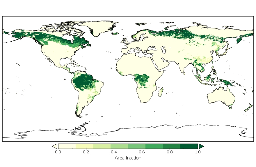
Federal
LUH2-GCB2019: Land-Use Harmonization 2 Update for the Global Carbon Budget, 850-2019
National Aeronautics and Space Administration —
This dataset, referred to as LUH2-GCB2019, includes 0.25-degree gridded, global maps of fractional land-use states, transitions, and management practices for the... -
Federal
GEDI-FIA Fusion: Training Lidar Models to Estimate Forest Attributes
National Aeronautics and Space Administration —
This dataset includes interpolated cumulative waveforms, with uncertainties, over national forest inventory (FIA) field plots across the contiguous United States. The... -
Federal
Daily and Annual PM2.5 Concentrations for the Contiguous United States, 1-km Grids, Version 1.10 (2000-2016)
National Aeronautics and Space Administration —
The Daily and Annual PM2.5 Concentrations for the Contiguous United States, 1-km Grids, Version 1.10 (2000-2016) data set includes predictions of PM2.5 concentration... -
Federal
Daily 8-Hour Maximum and Annual O3 Concentrations for the Contiguous United States, 1-km Grids, Version 1.10 (2000-2016)
National Aeronautics and Space Administration —
The Daily 8-Hour Maximum and Annual O3 Concentrations for the Contiguous United States, 1-km Grids, Version 1.10 (2000-2016) data set contains estimates of ozone... -
Federal
West Africa Coastal Vulnerability Mapping: Deforestation, 2000-2012
National Aeronautics and Space Administration —
The West Africa Coastal Vulnerability Mapping: Deforestation, 2000-2012, layer was created from the Global Forest Change data set which represents global tree cover... -
Federal
Daily and Annual NO2 Concentrations for the Contiguous United States, 1-km Grids, Version 1.10 (2000-2016)
National Aeronautics and Space Administration —
The Daily and Annual NO2 Concentrations for the Contiguous United States, 1-km Grids, Version 1.10 (2000-2016) data set contains daily predictions of Nitrogen Dioxide... -
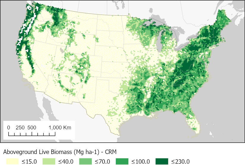
Federal
CMS: Forest Aboveground Biomass from FIA Plots across the Conterminous USA, 2009-2019
National Aeronautics and Space Administration —
This dataset provides forest biomass estimates for the conterminous United States based on data from the USDA Forest Inventory and Analysis (FIA) program. FIA... -
Federal
RLC Forest Stand Carbon Map of Russia
National Aeronautics and Space Administration —
This dataset is a 1:15 million scale map of forest stand carbon for the land area of Russia (Stone et al., 2000). The objective was to create a first approximation of... -
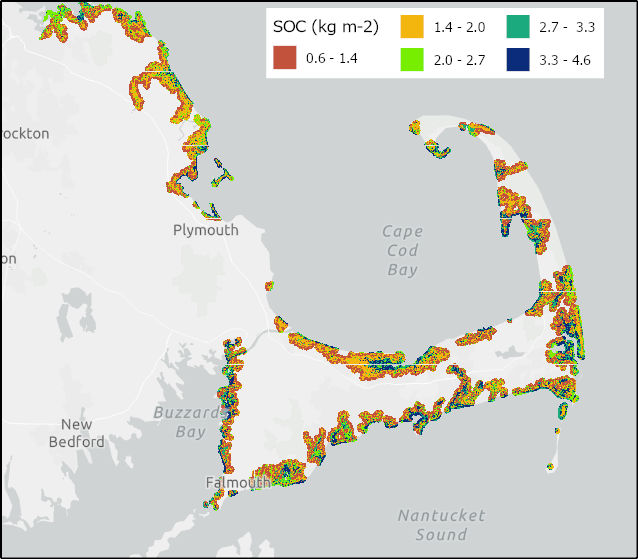
Federal
Soil Organic Carbon Distributions in Tidal Wetlands of the Northeastern USA
National Aeronautics and Space Administration —
This dataset provides estimates of soil organic carbon (SOC) in tidal wetlands for the northeastern United States. The data cover the period 1998-2018. Northeastern... -
Federal
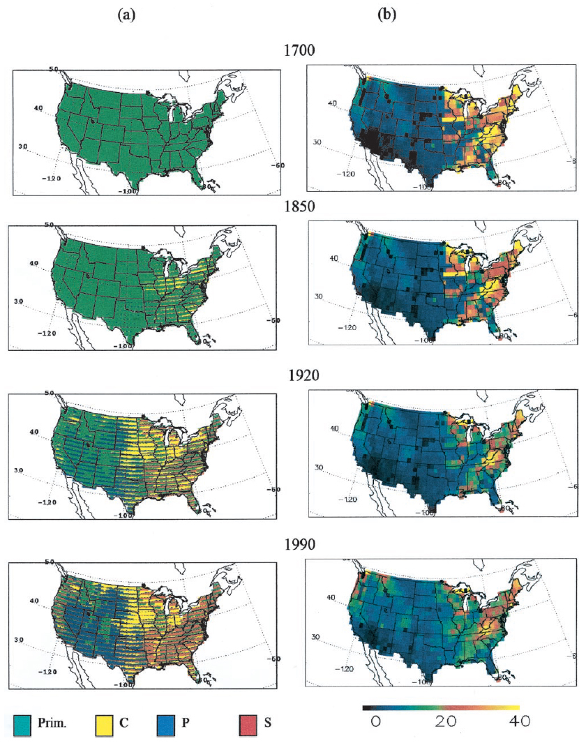
Ecosystem Demography Model: U.S. Ecosystem Carbon Stocks and Fluxes, 1700-1990
National Aeronautics and Space Administration —
This model product contains the source code for the Ecosystem Demography Model (ED version 1.0) as well as model input and output data files for the conterminous... -
Federal
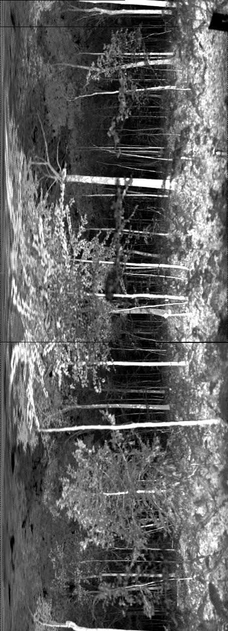
ECHIDNA LIDAR Campaigns: Forest Canopy Imagery and Field Data, U.S.A., 2007-2009
National Aeronautics and Space Administration —
This data set contains forest canopy scan data from the Echidna® Validation Instrument (EVI) and field measurements data from three campaigns conducted in the United... -
Federal
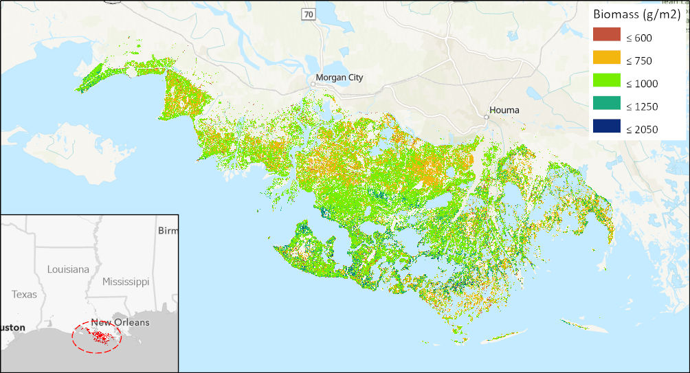
Aboveground Biomass High-Resolution Maps for Selected US Tidal Marshes, 2015
National Aeronautics and Space Administration —
This dataset provides maps of aboveground tidal marsh biomass (g/m2) at 30 m resolution for six estuarine regions of the conterminous United States: Cape Cod, MA;...

Official websites use .gov
A
.gov website belongs to an official government
organization in the United States.
Secure .gov websites use HTTPS
A
lock (
) or https:// means you’ve safely connected to
the .gov website. Share sensitive information only on official,
secure websites.