
-
Federal
Daily and Annual PM2.5, O3, and NO2 Concentrations at ZIP Codes for the Contiguous U.S., 2000-2016, v1.0
National Aeronautics and Space Administration —
The Daily and Annual PM2.5, O3, and NO2 Concentrations at ZIP Codes for the Contiguous U.S., 2000-2016, v1.0 data set contains daily and annual concentration... -
Federal
Poverty Mapping Project: Small Area Estimates of Poverty and Inequality
National Aeronautics and Space Administration —
The Poverty Mapping Project: Small Area Estimates of Poverty and Inequality data set consists of consumption-based poverty, inequality and related measures for... -
Federal
Extended Chandra Deep Field South 250-ks Improved Point Source Catalog
National Aeronautics and Space Administration —
This table contains the improved point-source catalog for the 250-ks Extended Chandra Deep Field-South (E-CDF-S) Survey, implementing a number of recent improvements... -
Federal
AIRS/Aqua L1B Near Real Time (NRT) Infrared (IR) geolocated and calibrated radiances in BUFR format V005 (AIRIBRAD_NRT_BUFR) at GES DISC
National Aeronautics and Space Administration —
WARNING: On 2021/09/23 the EOS Aqua executed a Deep Space Maneuver (DSM). In the DSM, the spacecraft is turned such that the normal Earth field of regard is deep... -
Federal
Swift TDRSS Messages
National Aeronautics and Space Administration —
This database table is derived from the Swift TDRSS messages sent on ground soon after a BAT trigger occurs on-board. For each trigger there are associated up to 14... -
Federal
MetOp-C ASCAT Level 2 Ocean Surface Wind Vectors Optimized for Coastal Ocean
National Aeronautics and Space Administration —
This dataset contains operational near-real-time Level 2 coastal ocean surface wind vector retrievals from the Advanced Scatterometer (ASCAT) on MetOp-C at 12.5 km... -
Federal
MetOp-B ASCAT Level 2 Ocean Surface Wind Vectors Optimized for Coastal Ocean
National Aeronautics and Space Administration —
This dataset contains operational near-real-time Level 2 coastal ocean surface wind vector retrievals from the Advanced Scatterometer (ASCAT) on MetOp-B at 12.5 km... -
Federal
Archive of Census Related Products (ACRP): 1990 Census Block Statistics
National Aeronautics and Space Administration —
The 1990 Census Block Statistics portion of the Archive of Census Related Products (ACRP) contains population and housing data from the U.S. Census Bureau's 1990... -
Federal
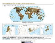
Gridded Population of the World, Version 4 (GPWv4): Administrative Unit Center Points with Population Estimates, Revision 11
National Aeronautics and Space Administration —
The Gridded Population of the World, Version 4 (GPWv4): Administrative Unit Center Points with Population Estimates, Revision 11 consists of UN WPP-adjusted... -
Federal
ABoVE: Lake Growing Season Green Surface Reflectance Trends, AK and Canada, 1984-2019
National Aeronautics and Space Administration —
This dataset provides an annual time series of Landsat green surface reflectance and the derived annual trend during the growing season (June and July) for 472,890... -
Federal
Indicators of Coastal Water Quality: Ancillary Data
National Aeronautics and Space Administration —
The Ancillary Data component of the Indicators of Coastal Water Quality Collection includes a 5 arc-minute (approximately 9 x 9 km at the equator) sequence grid, grid... -
Federal
Gridded Population of the World, Version 3 (GPWv3): Centroids
National Aeronautics and Space Administration —
The Gridded Population of the World, Version 3 (GPWv3): Centroids consists of estimates of human population counts and densities for the years 1990, 1995, 2000, 2005,... -
Federal
LMC N11 Giant HII Region Chandra X-Ray Point Source Catalog
National Aeronautics and Space Administration —
A very sensitive X-ray investigation of the giant H II region N11 in the Large Magellanic Cloud (LMC) was performed using the Chandra X-ray Observatory in which 165... -
Federal
AIRS/Aqua L1B Infrared (IR) geolocated and calibrated radiances V005 (AIRIBRAD) at GES DISC
National Aeronautics and Space Administration —
WARNING: On 2021/09/23 the EOS Aqua executed a Deep Space Maneuver (DSM). In the DSM, the spacecraft is turned such that the normal Earth field of regard is deep... -
Federal
Archive of Census Related Products (ACRP): 1990 ZIP Equivalency Files
National Aeronautics and Space Administration —
The 1990 Zip Equivalency Files portion of the Archive of Census Related Products (ACRP) contains population and housing data derived from the U.S. Census Bureau's... -
Federal
Updated Nearby Galaxy Catalog
National Aeronautics and Space Administration —
This table contains an all-sky catalog of 869 nearby galaxies having individual distance estimates within 11 Mpc or corrected radial velocities relative to the Local... -
Federal
Tropical Cloud-Precip (hybrid) Regime, Pr6x1 set
National Aeronautics and Space Administration —
Cloud-Precipitation Hybrid Regimes with MODIS C6.1 2D joint histogram of CTP and COT (total 42 bins) and IMERG v06B precipitation histogram (total 6 bins) derived in... -
Federal
Chandra Deep Field South 2-Megasecond Catalog
National Aeronautics and Space Administration —
This table contains point-source catalogs for the ~2 Ms exposure of the Chandra Deep Field-South (CDF-S) this is one of the two most sensitive X-ray surveys ever... -
Federal
Chandra Deep Field South 4-Megasecond Catalog
National Aeronautics and Space Administration —
This table contains the main Chandra source catalog for the 4 megasecond (Ms) Chandra Deep Field-South (CDF-S), which is the deepest Chandra survey to date and covers... -
Federal
TEMPO cloud pressure and fraction (O2-O2 dimer) V03 (PROVISIONAL)
National Aeronautics and Space Administration —
O2-O2 cloud Level 2 files provide cloud information at TEMPO’s native spatial resolution, ~10 km^2 at the center of the Field of Regard (FOR), for individual...

Official websites use .gov
A
.gov website belongs to an official government
organization in the United States.
Secure .gov websites use HTTPS
A
lock (
) or https:// means you’ve safely connected to
the .gov website. Share sensitive information only on official,
secure websites.