
-
Federal
Georeferenced Population Datasets of Mexico (GEO-MEX): GIS of Mexican States, Municipalities and Islands
National Aeronautics and Space Administration —
The GIS of Mexican States, Municipalities and Islands consists of attribute and boundary data for 1990. The attribute data include population, language, education,... -
Federal
National Agriculture Imagery Program (NAIP)
National Aeronautics and Space Administration —
The National Agriculture Imagery Program (NAIP) acquires aerial imagery during the agricultural growing seasons in the continental U.S. A primary goal of the NAIP... -
Federal
Combined GPS Broadcast Ephemeris Data (30-second sampling, hourly files) from NASA CDDIS
National Aeronautics and Space Administration —
This dataset consists of ground-based Global Navigation Satellite System (GNSS) Combined Broadcast Ephemeris Data (hourly files of all distinct navigation messages... -
Federal
China Dimensions Data Collection: GuoBiao (GB) Codes for the Administrative Divisions of the Peoples Republic of China
National Aeronautics and Space Administration —
The GuoBiao (GB) Codes for the Administrative Divisions of the People's Republic of China consists of geographic codes for the administrative divisions of China. The... -
Federal
Georeferenced Population Datasets of Mexico (GEO-MEX): Urban Place GIS Coverage of Mexico
National Aeronautics and Space Administration —
The Urban Place GIS Coverage of Mexico is a vector based point Geographic Information System (GIS) coverage of 696 urban places in Mexico. Each Urban Place is... -
Federal
Low Elevation Coastal Zone (LECZ) Global Delta Urban-Rural Population and Land Area Estimates, Version 1
National Aeronautics and Space Administration —
The Low Elevation Coastal Zone (LECZ) Global Delta Urban-Rural Population and Land Area Estimates, Version 1 data set provides country-level estimates of urban,... -
Federal
China Dimensions Data Collection: China County-Level Data from Provincial Economic Yearbooks, Keyed to 1:1M GIS Map
National Aeronautics and Space Administration —
The China County-Level Data on Provincial Economic Yearbooks, Keyed To 1:1M GIS Map consists of socioeconomic and boundary data for the administrative regions of... -
Federal
SOLVE I DC-8 Analysis Model Data
National Aeronautics and Space Administration —
SOLVE1_Analysis_DC8_Data contains modeled trajectories and meteorological data along the flight path for the DC-8 aircraft collected during the SAGE III Ozone Loss... -
Federal
CALIPSO Lidar Level 1.5 Profile, V1-01
National Aeronautics and Space Administration —
CAL_LID_L15-Standard-V1-01 is the Cloud-Aerosol Lidar and Infrared Pathfinder Satellite Observations (CALIPSO) Lidar Level 1.5 Profile, Version 1-01 data product.... -
Federal
Earth Radiation Budget Experiment (ERBE) Regional, Zonal, and Global Averages S-4 data in native format
National Aeronautics and Space Administration —
ERBE_S4_NAT_1 is the Earth Radiation Budget Experiment (ERBE) Regional, Zonal, and Global Averages S-4 data in native format data set, which contains space and time... -
Federal
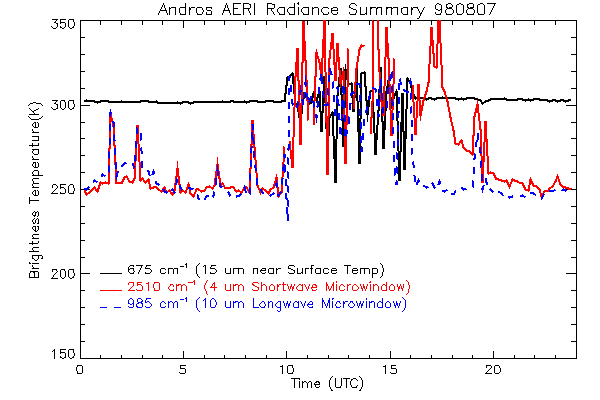
CAMEX-3 ATMOSPHERIC EMITTED RADIANCE INTERFEROMETER (AERI) V1
National Aeronautics and Space Administration —
The Atmospheric Emitted Radiance Interferometer (AERI) was used to make atmospheric temperature and moisture retrievals. AERI provides absolutely calibrated radiances... -
Federal
Global Soil Types, 0.5-Degree Grid (Modified Zobler)
National Aeronautics and Space Administration —
A global data set of soil types is available at 0.5-degree latitude by 0.5-degree longitude resolution. There are 106 soil units, based on Zobler?s (1986) assessment... -
Federal
Ground-Based Global Navigation Satellite System (GNSS) Quasi-Zenith Satellite System (QZSS) Broadcast Ephemeris Data (30-second sampling, hourly files) from NASA CDDIS
National Aeronautics and Space Administration —
This dataset consists of ground-based Global Navigation Satellite System (GNSS) Quasi-Zenith Satellite System (QZSS) Broadcast Ephemeris Data (hourly files) from the... -
Federal
China Dimensions Data Collection: China Administrative Regions GIS Data: 1:1M, County Level, 1990
National Aeronautics and Space Administration —
The China Administrative Regions GIS Data: 1:1M, County Level, 1990 consists of geographic boundary data for the administrative regions of China as of 31 December... -
Federal
China Dimensions Data Collection: China County-Level Data on Population (Census) and Agriculture, Keyed to 1:1M GIS Map
National Aeronautics and Space Administration —
The China County-Level Data on Population (Census) and Agriculture, Keyed To 1:1M GIS Map consists of census, agricultural economic, and boundary data for the... -
Federal
SatCORPS CERES GEO Edition 4 GOES-18 Northern Hemisphere Version 1.2
National Aeronautics and Space Administration —
CER_GEO_Ed4_GOE18_NH_V01.2 is the Satellite Cloud and Radiation Property retrieval System (SatCORPS) Clouds and the Earth's Radiant Energy System (CERES)... -
Federal
Aircraft Flux-Filtered: U of Wy. (FIFE)
National Aeronautics and Space Administration —
The University of Wyoming (UW) King Air atmospheric boundary layer measurement missions were flown in 1987 during IFCs 3 and 4. This Boundary Layer Fluxes data set... -
Federal
DISCOVER-AQ Maryland Deployment NOAA Delaware II Ship Data
National Aeronautics and Space Administration —
DISCOVERAQ_Maryland_Ship_NOAA-DelawareII_Data contains data collected onboard the NOAA Delaware II Ship during the Maryland (Baltimore-Washington) deployment of... -
Federal
Global Navigation Satellite System (GNSS) IGS Final Combined Orbit Solution Summary Product from NASA CDDIS
National Aeronautics and Space Administration —
This derived product set consists of Global Navigation Satellite System Final Orbit/Reference Frame Product Summary from the NASA Crustal Dynamics Data Information... -
Federal
First ISCCP Regional Experiment (FIRE) Atlantic Stratocumulus Transition Experiment (ASTEX) Malcolm Baldridge Radiosonde Data
National Aeronautics and Space Administration —
The First ISCCP Regional Experiments have been designed to improve data products and cloud/radiation parameterizations used in general circulation models (GCMs)....

Official websites use .gov
A
.gov website belongs to an official government
organization in the United States.
Secure .gov websites use HTTPS
A
lock (
) or https:// means you’ve safely connected to
the .gov website. Share sensitive information only on official,
secure websites.