
-
Federal
Norwegian North Polar Expedition 1893-1896: Oceanographic Data, Version 1
National Aeronautics and Space Administration —
This data set contains water depth, temperature, specific gravity, salinity, and density measurements from the North Polar Basin and the Barents Sea, gathered by... -
Federal
MEaSUREs BedMachine Antarctica V003
National Aeronautics and Space Administration —
This data set, part of the NASA Making Earth System Data Records for Use in Research Environments (MEaSUREs) program, contains a bed topography/bathymetry map of... -
Federal
SCICEX: Submarine Arctic Science Program, Version 1
National Aeronautics and Space Administration —
The Submarine Arctic Science Program, SCICEX, is a federal interagency collaboration among the operational Navy, research agencies, and the marine research community... -
Federal
Coordinated Eastern Arctic Experiment (CEAREX) Data, Version 1
National Aeronautics and Space Administration —
CEAREX was a multi-platform field program conducted in the Norwegian Seas and Greenland north to Svalbard from September 1988 through May 1989. Canada, Denmark,... -
Federal
ECCO Geometry Parameters for the 0.5 degree Lat-Lon Model Grid (Version 4 Release 4)
National Aeronautics and Space Administration —
This dataset provides geometric parameters for the regular 0.5-degree lat-lon grid from the ECCO Version 4 Release 4 (V4r4) ocean and sea-ice state estimate.... -
Federal
OMG Swath Gridded Singlebeam Echo Sounding (SBES) Bathymetry
National Aeronautics and Space Administration —
This dataset contains in situ depth measurements from Singlebeam Echo Sounder System (SBES) instruments. These depths were used to map the bathymetry around ocean... -
Federal
OMG Swath Gridded Multibeam Echo Sounding (MBES) Bathymetry
National Aeronautics and Space Administration —
This dataset contains level 2 in situ depth measurements from Multibeam Echo Sounder System (MBES) instruments. These depths were used to map the bathymetry around... -
Federal
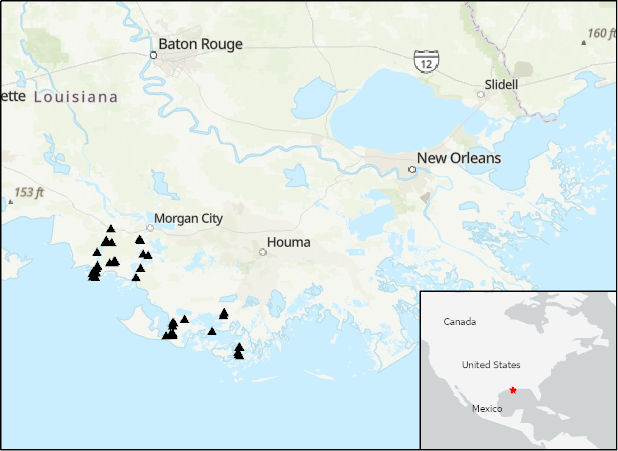
Delta-X: Acoustic Doppler Current Profiler Channel Surveys, MRD, Louisiana, 2021, V2
National Aeronautics and Space Administration —
This dataset provides river discharge measurements collected at selected locations in the Atchafalaya and Terrebonne Basins within the Mississippi River Delta (MRD)... -
Federal
Lake Bathymetry Maps derived from Landsat and Random Forest Modeling, North Slope, AK
National Aeronautics and Space Administration —
This dataset provides lake bathymetry maps derived from Landsat surface reflectance products for a portion of the North Slope area of Alaska. A random forest... -
Federal
IceBridge Sander AIRGrav L3 Bathymetry, Version 1
National Aeronautics and Space Administration —
This data set contains bathymetry of Antarctic ice shelves based on measurements from the Sander Geophysics Airborne Inertially Referenced Gravimeter (AIRGrav)... -
Federal
ECCO Geometry Parameters for the Lat-Lon-Cap 90 (llc90) Native Model Grid (Version 4 Release 4)
National Aeronautics and Space Administration —
This dataset provides geometric parameters for the lat-lon-cap 90 (llc90) native model grid from the ECCO Version 4 Release 4 (V4r4) ocean and sea-ice state estimate.... -
Federal
S-MODE NCOM Model Output Version 1
National Aeronautics and Space Administration —
This dataset contains model output from the Navy Coastal Ocean Model (NCOM) run during the Sub-Mesoscale Ocean Dynamics Experiment (S-MODE) field campaign. S-MODE... -
Federal
OMG Level 2 Airborne eXpendable Bathy Thermograph (AXBT) Profiles
National Aeronautics and Space Administration —
This dataset contains Level 2 in situ temperature profile measurements from the Airborne eXpendable BathyThermograph (AXBT) probes. It provides science quality... -
Federal
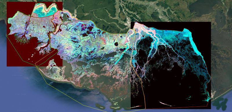
Delta-X: Ecogeomorphic Cell Products across the MRD, LA, USA, 2021
National Aeronautics and Space Administration —
This product delineates the Mississippi River Delta (MRD) landscape into distinct ecogeomorphic cells, which are small contiguous areas of land with similar... -
Federal
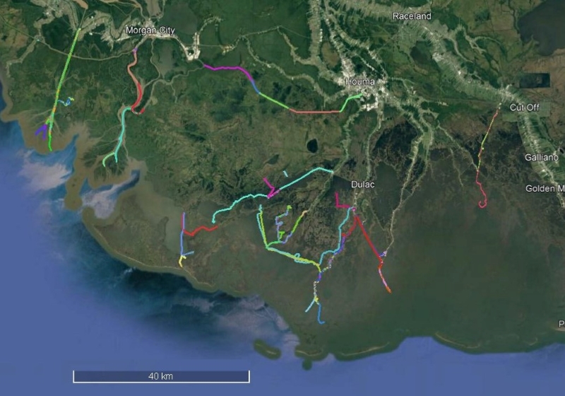
Delta-X: Sonar Bathymetry Survey of Channels, MRD, Louisiana, 2021
National Aeronautics and Space Administration —
This dataset includes bathymetry data for water channels in a portion of the Mississippi River Delta (MRD) of coastal Louisiana. The data were collected using sonar... -
Federal
Bio-optical properties of the different water masses in the Gulf of St. Lawrence
National Aeronautics and Space Administration —
The St. Lawrence ecosystem is a complex environment influenced by a variety of physical forces (runoff, winds, tides, bathymetry) that sustains a diverse food web... -
Federal
Pre-Delta-X: Channel Bathymetry of the Atchafalaya Basin, LA, USA, 2016
National Aeronautics and Space Administration —
This dataset provides water depths and water surface elevations collected during bathymetric surveys of the main channel of the Wax Lake Delta within the Mississippi... -
Federal
IceBridge Sander AIRGrav L4 Bathymetry V001
National Aeronautics and Space Administration —
This data set contains bathymetry of Arctic fjords and Antarctic ice shelves based on measurements from the Sander Geophysics Airborne Inertially Referenced...

Official websites use .gov
A
.gov website belongs to an official government
organization in the United States.
Secure .gov websites use HTTPS
A
lock (
) or https:// means you’ve safely connected to
the .gov website. Share sensitive information only on official,
secure websites.