
-
Federal
Forest Inventory and Biophysical Measurements, Brazilian Amazon, 2009-2018
National Aeronautics and Space Administration —
This dataset provides the complete catalog of forest inventory and biophysical measurements collected over selected forest research sites across the Amazon rainforest... -
Federal
PHM 2008 Challenge
National Aeronautics and Space Administration —
This dataset describes the degradation of an aircraft engine. The dataset was used for the prognostics challenge competition at the International Conference on... -
Federal
Daily Rainfall Data (FIFE)
National Aeronautics and Space Administration —
The FIFE Daily Rainfall Data Set contains daily precipitation values for 42 rain gauge stations within the Konza LTER portion of the FIFE site (i.e., Northwest... -
Federal
Randomized Battery Usage 2: Room Temperature Random Walk
National Aeronautics and Space Administration —
This dataset is part of a series of datasets, where batteries are continuously cycled with randomly generated current profiles. Reference charging and discharging... -
Federal
Global Distribution of Plant-Extractable Water Capacity of Soil (Dunne)
National Aeronautics and Space Administration —
Plant-extractable water capacity of soil is the amount of water that can be extracted from the soil to fulfill evapotranspiration demands. It is often assumed to be... -
Federal
Aquarius Official Release Level 3 Rain-flagged Sea Surface Salinity Standard Mapped Image Mission Cumulative Data V5.0
National Aeronautics and Space Administration —
Aquarius Level 3 sea surface salinity (SSS) standard mapped image data contains gridded 1 degree spatial resolution SSS averaged overdaily, 7 day, monthly, and... -
Federal
ABoVE: Boreal Forest Resilience Study 2020-2022, Fairbanks AK
National Aeronautics and Space Administration —
This dataset includes five metrics of forest resilience (recruitment, invasives, permafrost change, tree damage, and radial growth) at five recently burned forest... -
Federal
SAFARI 2000 Stem and Canopy Characterization, Kalahari Transect, 1995-2000
National Aeronautics and Space Administration —
This data set provides species distribution, basal area, height, and crown cover of woody stems at 10 sites along the Kalahari Transect where a large gradient in both... -
Federal
SHIFT: Wetland Spectra, Salinity, and Fractional Cover, Devereux Slough, CA, 2022
National Aeronautics and Space Administration —
This dataset includes field data, analysis code, and corresponding airborne imagery collected and generated during the 2022 NASA Surface Biology Geology (SBG) High... -
Federal
NACP Aboveground Biomass and Carbon Baseline Data, V.2 (NBCD 2000), U.S.A., 2000
National Aeronautics and Space Administration —
The NBCD 2000 (National Biomass and Carbon Dataset for the Year 2000) data set provides a high-resolution (30 m) map of year-2000 baseline estimates of basal area-... -
Federal
Urban Land Cover Maps for Mekelle, Ethiopia and Polokwane, South Africa, 2020
National Aeronautics and Space Administration —
This dataset consists of very high resolution urban land cover maps for two African cities, Mekelle, Ethiopia and Polokwane, South Africa for 2020. Maps were... -
Federal
LBA-ECO TG-10 Fire Emission Factors in Mato Grosso, Para, and Amazonas, Brazil: 2004
National Aeronautics and Space Administration —
This data set provides derived emission factors (EFs), reported in grams of compound emitted per kilogram of dry fuel (g/kg), for PM10 (particulate matter up to 10... -
Federal
LBA-ECO LC-04 THMB Model Simulations for the Amazon and Tocantins Basins: 1939-1998
National Aeronautics and Space Administration —
The model output data provided were generated by the THMB 1.2 (Terrestrial Hydrology Model with Biogeochemistry) model which simulates the flow of water through... -
Federal
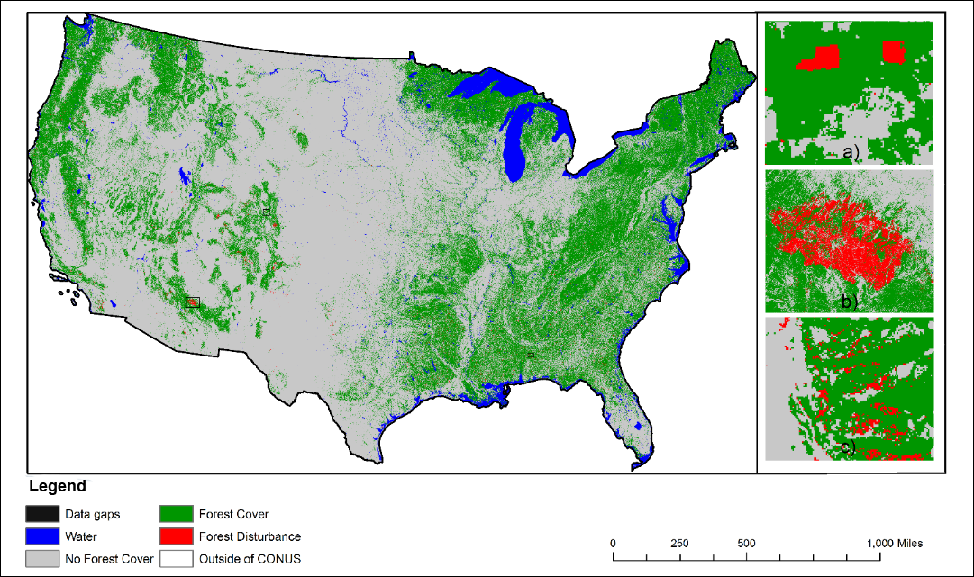
NACP NAFD Project: Forest Disturbance History from Landsat, 1986-2010
National Aeronautics and Space Administration —
The North American Forest Dynamics (NAFD) products provided in this data set consist of 25 annual and two time-integrated forest disturbance maps for the conterminous... -
Federal
ABoVE: Ignitions, Burned Area, and Emissions of Fires in AK, YT, and NWT, 2001-2018
National Aeronautics and Space Administration —
This dataset provides estimates of daily burned area, carbon emissions, and uncertainty, and daily fire ignition locations for boreal fires in Alaska, U.S., and in... -
Federal
Bowen Ratio Surface Flux: USGS (FIFE)
National Aeronautics and Space Administration —
The Bowen Ratio Surface Flux Observations (USGS) Data Set contains surface flux and micrometeorological collected from one location within the Northwest quadrant of... -
Federal
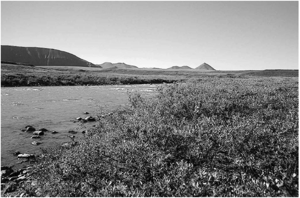
Arctic Vegetation Plots in Willow Communities, North Slope, Alaska, 1997
National Aeronautics and Space Administration —
This data set provides environmental, soil, and vegetation data collected in July and August 1997 from 85 study plots in willow shrub communities located along a... -
Federal
BOREAS TE-04 Branch Bag Data from Boreal Tree Species
National Aeronautics and Space Administration —
The BOREAS TE-04 team collected continuous records of gas exchange under ambient conditions from intact boreal forest trees in the BOREAS NSA from 23-Jul-1996 until... -
Federal
BOREAS Follow-On HMet-02 Area and Regional Hourly Gridded Met. Data, 1994-1996
National Aeronautics and Space Administration —
Phase II and III gridded data sets have been generated by an objective analysis scheme using all of the surface meteorological station data over BOREAS region for...

Official websites use .gov
A
.gov website belongs to an official government
organization in the United States.
Secure .gov websites use HTTPS
A
lock (
) or https:// means you’ve safely connected to
the .gov website. Share sensitive information only on official,
secure websites.