
-
Federal
UARS Improved Stratospheric and Mesospheric Sounder (ISAMS) Level 3AL V010 (UARIS3AL) at GES DISC
National Aeronautics and Space Administration —
The Improved Stratospheric and Mesospheric Sounder (ISAMS) Level 3AL data product consists of daily, 4 degree increment latitude-ordered vertical profiles of... -
Federal
Sentinel-5P TROPOMI Tropospheric NO2 1-Orbit L2 7km x 3.5km V1 (S5P_L2__NO2___) at GES DISC
National Aeronautics and Space Administration —
Starting from August 6th in 2019, Sentinel-5P TROPOMI along-track high spatial resolution (~5.5km at nadir) has been implemented. For data after August 6th of 2019,... -
Federal
TRMM Precipitation Radar Rainfall Rate and Profile L2 1.5 hours V7 (TRMM_2A25) at GES DISC
National Aeronautics and Space Administration —
The new version of these data is in GPM-like format (consistent with the GPM Dual-frequency Radar data format), and can be found under the name GPM_2APR. The TRMM... -
Federal
UARS Solar Ultraviolet Spectral Irradiance Monitor (SUSIM) Level 3BS V022 (UARSU3BS) at GES DISC
National Aeronautics and Space Administration —
The Solar Ultraviolet Spectral Irradiance Monitor (SUSIM) Level 3BS data product consists of daily, 1 nm resolution, solar spectral irradiances and selected solar... -
Federal
OCO-3 Level 2 CO2 prior based on CO2 monthly flask record, global meteorology, and age of air, Forward Processing V11 (OCO3_L2_CO2Prior) at GES DISC
National Aeronautics and Space Administration —
Version 11 is the current version of the data set. Older versions will no longer be available and are superseded by Version 11. The Orbiting Carbon Observatory -3... -
Federal
UARS Halogen Occultation Experiment (HALOE) Level 3AT V019 (UARHA3AT) at GES DISC
National Aeronautics and Space Administration —
The Halogen Occultation Experiment (HALOE) Level 3AT data product consists of daily vertical profiles of temperature, aerosol extinction and concentrations of HCl,... -
Federal
OCO-3 Level 1B calibrated, geolocated calibration spectra, Retrospective Processing V10r (OCO3_L1B_Calibration) at GES DISC
National Aeronautics and Space Administration —
Version 10r is the current version of the data set. Older versions will no longer be available and are superseded by Version 10r. The Orbiting Carbon Observatory -3... -
Federal
TROPESS Chemical Reanalysis Ozone Monthly 3-dimensional Product V1 (TRPSCRO3M3D) at GES DISC
National Aeronautics and Space Administration —
The TROPESS Chemical Reanalysis O3 Monthly 3-dimensional Product contains vertical concentrations of ozone. The data are part of the Tropospheric Chemical Reanalysis... -
Federal
OCO-3 Level 2 spatially ordered geolocated retrievals screened using the A-band Preprocessor, Forward Processing V11 (OCO3_L2_ABand) at GES DISC
National Aeronautics and Space Administration —
Version 11 is the current version of the data set. Older versions will no longer be available and are superseded by Version 11. The Orbiting Carbon Observatory -3... -
Federal
TROPESS Chemical Reanalysis Ozone 6-Hourly 3-dimensional Product V1 (TRPSCRO36H3D) at GES DISC
National Aeronautics and Space Administration —
The TROPESS Chemical Reanalysis O3 6-Hourly 3-dimensional Product contains vertical concentrations of ozone. The data are part of the Tropospheric Chemical Reanalysis... -
Federal
LIMS/Nimbus-7 Level 1 Radiance Data V001 (LIMSN7L1PROFILER) at GES DISC
National Aeronautics and Space Administration —
LIMSN7L1PROFILER is the Nimbus-7 Limb Infrared Monitor of the Stratosphere (LIMS) Level-1 Profiles of Radiance Data product and contains selected daily vertical... -
Federal
MLS/Aura Near-Real-Time L2 Ozone (O3) Mixing Ratio V005 (ML2O3_NRT) at GES DISC
National Aeronautics and Space Administration —
ML2O3_NRT is the EOS Aura Microwave Limb Sounder (MLS) Near-Real-Time (NRT) product for ozone (O3). This product contains O3 profiles derived from the 240 GHz region.... -
Federal
Sentinel-5P TROPOMI Methane CH4 1-Orbit L2 7km x 7km V1 (S5P_L2__CH4___) at GES DISC
National Aeronautics and Space Administration —
Starting from August 6th in 2019, Sentinel-5P TROPOMI along-track high spatial resolution (~5.5km at nadir) has been implemented. For data after August 6th of 2019,... -
Federal
OCO-2 Level 2 geolocated XCO2 retrievals results, physical model V11.2 (OCO2_L2_Standard) at GES DISC
National Aeronautics and Space Administration —
Version 11.2 is the current version of the data set. Older versions will no longer be available and are superseded by Version 11.2. The Orbiting Carbon Observatory is... -
Federal
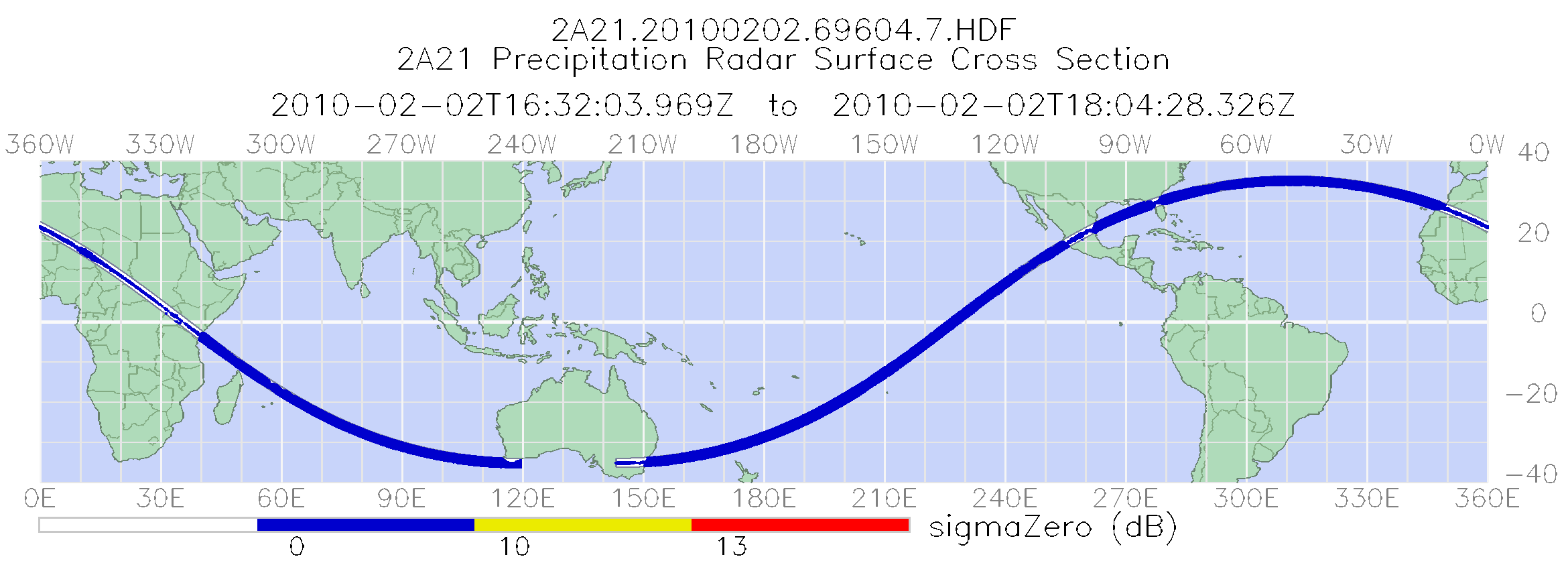
TRMM Precipitation Radar Surface Cross-Section L2 1.5 hours V7 (TRMM_2A21) at GES DISC
National Aeronautics and Space Administration —
The new version of these data is in GPM-like format (consistent with the GPM Dual-frequency Radar data format), and can be found under the name GPM_2APR. This is the... -
Federal
Legates Surface and Ship Observations of Precipitation Climatology 0.5 x 0.5 degree V1 (RAIN_LEGATES) at GES DISC
National Aeronautics and Space Administration —
The Legates Surface and Shipboard Rain Gauge Observations data set consists of a global climatology of monthly mean precipitation values. A global climatology of mean... -
Federal
UARS Cryogenic Limb Array Etalon Spectrometer (CLAES) Level 3AT V009 (UARCL3AT) at GES DISC
National Aeronautics and Space Administration —
The Cryogenic Limb Array Etalon Spectrometer (CLAES) Level 3AT data product consists of daily, 65.536 second interval time-ordered vertical profiles of temperature... -
Federal
OMI/Aura and MODIS/Aqua Merged Cloud Product 1-Orbit L2 Swath 13x24 km V003 (OMMYDCLD) at GES DISC NGDA
National Aeronautics and Space Administration —
The OMI/Aura and MODIS/Aqua Merged Cloud Product 1-Orbit L2 Swath 13x24 km (OMMYDCLD) is a Level-2 orbital product that combines cloud parameters retrieved by the... -
Federal
OCO-3 Level 2 geolocated XCO2 retrievals results, physical model, Forward Processing V10 (OCO3_L2_Standard) at GES DISC
National Aeronautics and Space Administration —
Version 10 is the current version of the data set. Older versions will no longer be available and are superseded by Version 10. The Orbiting Carbon Observatory -3... -
Federal
LIMS/Nimbus-7 Level 2 Vertical Profiles of O3, NO2, H2O, HNO3, Geopotential Height, and Temperature V006 (LIMSN7L2) at GES DISC
National Aeronautics and Space Administration —
The Limb Infrared Monitor of the Stratosphere (LIMS) version 6 Level-2 data product consists of daily, geolocated, vertical profiles of temperature, geopotential...

Official websites use .gov
A
.gov website belongs to an official government
organization in the United States.
Secure .gov websites use HTTPS
A
lock (
) or https:// means you’ve safely connected to
the .gov website. Share sensitive information only on official,
secure websites.