
-
Federal
Global Forest Ecosystem Structure and Function Data For Carbon Balance Research
National Aeronautics and Space Administration —
A comprehensive global database has been assembled to quantify CO2 fluxes and pathways across different levels of integration (from photosynthesis up to net ecosystem... -
Federal
BOREAS RSS-14 GOES-8 Level-1a Visible, Infrared and Water Vapor Images
National Aeronautics and Space Administration —
The BOREAS RSS-14 team collected and processed several GOES-7 and GOES-8 image data sets that covered the BOREAS study region. The level-1a GOES-8 images were created... -
Federal
BOREAS TGB-01 CH4 Concentration and Flux Data from NSA Tower Sites
National Aeronautics and Space Administration —
The BOREAS TGB-01 team made numerous measurements of trace gas concentrations and fluxes at various NSA sites. This data set contains half-hourly averages of ambient... -
Federal
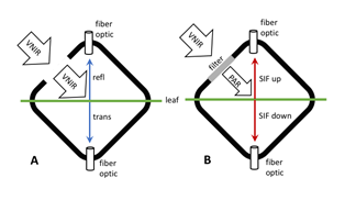
Tundra Plant Leaf-level Spectral Reflectance and Chlorophyll Fluorescence, 2019-2021
National Aeronautics and Space Administration —
This dataset provides leaf-level visible-near infrared spectral reflectance, chlorophyll fluorescence spectra, species, plant functional type (PFT), and chlorophyll... -
Federal
Global Organic Soil Carbon and Nitrogen (Zinke et al.)
National Aeronautics and Space Administration —
This package contains worldwide soil carbon and nitrogen data for more than 3,500 soil profiles. The database was begun about 40 years ago with the collection and... -
Federal
HAQAST Sentinel-5P TROPOMI Nitrogen Dioxide (NO2) GLOBAL Annual Level 3 0.1 x 0.1 Degree Gridded Data Version 2.4 (HAQ_TROPOMI_NO2_GLOBAL_A_L3) at GES DISC
National Aeronautics and Space Administration —
This product provides level 3 annual averages of tropospheric Nitrogen dioxide (NO2) vertical column density derived from the level 2 Tropospheric Monitoring... -
Federal
Stream Flow Daily Data: USGS (FIFE)
National Aeronautics and Space Administration —
The Daily Stream Flow Amounts Data Set contains daily measurements of stream flow for the four LTER stations and for the USGS stream-flow station located on... -
Federal
ABoVE: Burn Severity of Soil Organic Matter, Northwest Territories, Canada, 2014-2015
National Aeronautics and Space Administration —
This dataset provides maps at 30-m resolution of landscape surface burn severity (surface litter and soil organic layers) from the 2014-2015 fires in the Northwest... -
Federal
TEMPO gridded formaldehyde total column V03 (PROVISIONAL)
National Aeronautics and Space Administration —
Formaldehyde Level 3 files provide trace gas information on a regular grid covering the TEMPO field of regard for nominal TEMPO observations. Level 3 files are... -
Federal
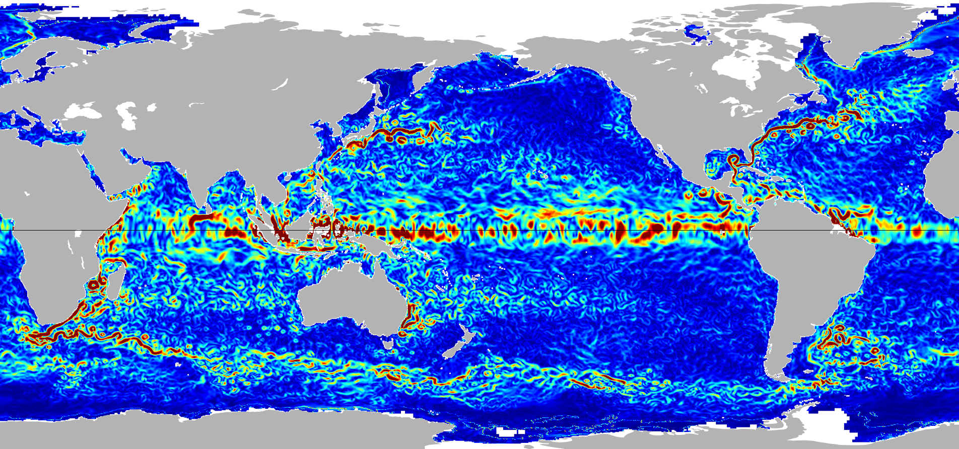
Ocean Surface Current Analyses Real-time (OSCAR) Surface Currents - Near Real Time 0.25 Degree (Version 2.0)
National Aeronautics and Space Administration —
Ocean Surface Current Analyses Real-time (OSCAR) is a global surface current database and NASA funded research project. OSCAR ocean mixed layer velocities are... -
Federal
GPM SSMIS on F16 (GPROF) Climate-based Radiometer Precipitation Profiling L3 1 month 0.25 degree x 0.25 degree V07 (GPM_3GPROFF16SSMIS_CLIM) at GES DISC
National Aeronautics and Space Administration —
Version 07 is the current version of the data set. Older versions will no longer be available and have been superseded by Version 07. The "CLIM" products differ from... -
Federal
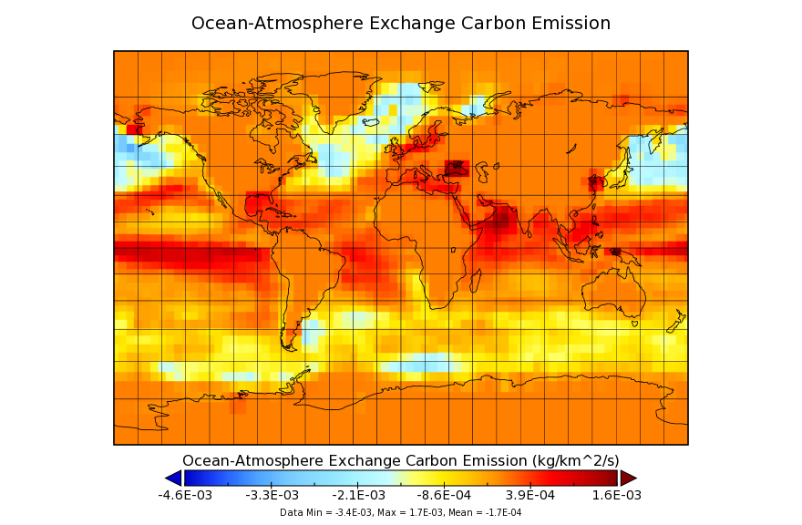
Carbon Monitoring System Flux for Ocean Carbon L4 V1 (CMSFluxOcean) at GES DISC
National Aeronautics and Space Administration —
This dataset provides the Carbon Flux for Ocean Carbon.The NASA Carbon Monitoring System (CMS) is designed to make significant contributions in characterizing,... -
Federal
MRIR/Nimbus-3 Images of Daytime Brightness Temperature on 4 x 5 inch Film Sheets V001 (MRIRN3IM) at GES DISC
National Aeronautics and Space Administration —
MRIRN3IM is the Nimbus-3 Medium Resolution Infrared Radiometer (MRIR) data product consisting of 4 x 5 inch photographic film sheets. Each film sheet contains an... -
Federal
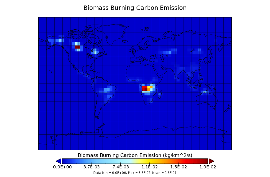
Carbon Monitoring System Carbon Flux for Fire L4 V1 (CMSFluxFire) at GES DISC
National Aeronautics and Space Administration —
This dataset provides the Carbon Flux for Fires.The NASA Carbon Monitoring System (CMS) is designed to make significant contributions in characterizing, quantifying,... -
Federal
TROPICS03 L2B Tropical Cyclone Intensity Estimate (TCIE) Algorithm V1.0
National Aeronautics and Space Administration —
The "Time-Resolved Observations of Precipitation structure and storm Intensity with a Constellation of Smallsats" (TROPICS) mission has a goal of providing nearly... -
Federal
TROPICS05 L2A Unified Resolution Brightness Temperatures V0.2
National Aeronautics and Space Administration —
The "Time-Resolved Observations of Precipitation structure and storm Intensity with a Constellation of Smallsats" (TROPICS) mission has a goal of providing nearly... -
Federal
Global River Discharge, 1807-1991, V[ersion]. 1.1 (RivDIS)
National Aeronautics and Space Administration —
The Global Monthly River Discharge Data Set (RivDIS) contains monthly averaged discharge measurements for 1,018 stations located throughout the world from 1807-1991.... -
Federal
MLS/Aura Level 3 Daily Binned Geopotential Height (GPH) on Zonal and Similar Grids V005 (ML3DZGPH) at GES DISC
National Aeronautics and Space Administration —
ML3DZGPH is the EOS Aura Microwave Limb Sounder (MLS) daily binned on zonal and assorted vertical grids product for geopotential height (GPH) derived from radiances... -
Federal
TSIS TIM Level 3 Total Solar Irradiance 24-Hour Means V04 (TSIS_TSI_L3_24HR) at GES DISC
National Aeronautics and Space Administration —
Version 04 is the current release of this data product, and supercedes all previous versions.The TSIS TIM Level 3 Total Solar Irradiance (TSI) 24-Hour Means data...

Official websites use .gov
A
.gov website belongs to an official government
organization in the United States.
Secure .gov websites use HTTPS
A
lock (
) or https:// means you’ve safely connected to
the .gov website. Share sensitive information only on official,
secure websites.