
-
Federal
OPERA Dynamic Surface Water Extent from Harmonized Landsat Sentinel-2 provisional product (Version 1)
National Aeronautics and Space Administration —
This dataset contains Level-3 Dynamic OPERA provisional surface water extent product version 1. The data are provisional surface water extent observations beginning... -
Federal
Spitzer Deep Wide-Field Survey 4.5 micron Epoch 4 Catalog
National Aeronautics and Space Administration —
The Spitzer Deep, Wide-Field Survey (SDWFS) is a four-epoch infrared survey of 10 square degrees in the Boötes field of the NOAO Deep Wide-Field Survey using the IRAC... -
Federal
Maintenance Action Recommendation
National Aeronautics and Space Administration —
This data set deals with Maintenance Action Recommendations -
Federal
JPL Photojournal
National Aeronautics and Space Administration —
View detailed images of the planets, the sun, small bodies, and the Universe from various NASA exploration programs. -
Federal
Real System Failures
National Aeronautics and Space Administration —
This resource area contains descriptions of actual electronic systems failure scenarios with an emphasis on the diversity of failure modes and effects that can befall... -
Federal
SDG Indicator 7.1.1: Access to Electricity, 2023 Release
National Aeronautics and Space Administration —
The SDG Indicator 7.1.1: Access to Electricity, 2023 Release data set, part of the Sustainable Development Goal Indicators (SDGI) collection, measures the proportion... -
Federal
Amazon Web Services: NASA Earth Exchange (NEX) Global Daily Downscaled Projections (NEX-GDDP)
National Aeronautics and Space Administration —
The NASA Earth Exchange (NEX) Global Daily Downscaled Projections (NEX-GDDP) dataset is comprised of downscaled climate scenarios that are derived from the General... -
Federal
ODYSSEY THEMIS IR BTR V1.0
National Aeronautics and Space Administration —
The THEMIS IR-BTR data set contains the brightness temperature records, derived from the calibrated thermal infrared observations. Each image header includes basic... -
Federal
MISR L2 FIRSTLOOK TOA/Cloud Stereo Product subset for the ARCTAS region V001
National Aeronautics and Space Administration —
ATSM2STF_001 is the Multi-angle Imaging SpectroRadiometer (MISR) Level 2 FIRSTLOOK TOA/Cloud Stereo Product subset for the ARCTAS region version 1. It contains the... -
Federal
CERES MODIS Cloud Retrievals in ISCCP-D2like Format Nit Terra FM1 Edition3A
National Aeronautics and Space Administration —
CER_ISCCP-D2like-Nit_Terra-FM1-MODIS_Edition3A is the Clouds and the Earth's Radiant Energy System (CERES) Moderate Resolution Imaging Spectroradiometer (MODIS) Cloud... -
Federal
MODIS/Terra Vegetation Indices 16-Day L3 Global 250m SIN Grid V061
National Aeronautics and Space Administration —
The Terra Moderate Resolution Imaging Spectroradiometer (MODIS) Vegetation Indices (MOD13Q1) Version 6.1 data are generated every 16 days at 250 meter (m) spatial... -
Federal
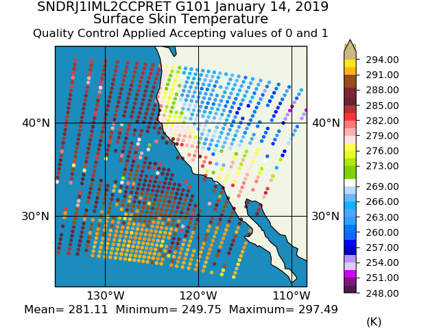
Sounder SIPS: JPSS-1 CrIS Level 2 CLIMCAPS: Atmosphere cloud and surface geophysical state V2 (SNDRJ1IML2CCPRET) at GES DISC
National Aeronautics and Space Administration —
WARNING: To users of the derived product “co_mmr_midtrop” (carbon monoxide mass mixing ratio to dry air [kg/kg] at ~500 hPa). This variable has a significant bias due... -
Federal
JPSS-2 CrIS Level 1B Beta Full Spectral Resolution V3 (SNDRJ2CrISL1B) at GES DISC
National Aeronautics and Space Administration —
The goal of creating this product is to allow users to begin working with data from the CrIS instrument on-board the recently launched NOAA-21 / JPSS-2 (J2)... -
Federal
High Mountain Asia MAR V3.5 Regional Climate Model Output V001
National Aeronautics and Space Administration —
This data set provides modeled surface and atmospheric fields from the Modèle Atmosphérique Régionale (MAR) regional climate model (version 3.5) over the Himalayan... -
Federal
Terra MODIS Level-3 Global Mapped 11µm Nighttime Sea Surface Temperature (NSST) - Near Real-time (NRT) Data, version R2019.0 NGDA
National Aeronautics and Space Administration —
The Ocean Biology DAAC produces near real-time (quicklook) products using the best-available combination of ancillary data from meteorological and ozone data. As... -
Federal
SatCORPS CERES GEO Edition 4 GOES-15 Southern Hemisphere Version 1.0
National Aeronautics and Space Administration —
CER_GEO_Ed4_GOE15_SH_V01 is the Satellite Cloud and Radiation Property retrieval System (SatCORPS) Clouds and the Earth's Radiant Energy System (CERES) Geostationary... -
Federal
NOAA-20 VIIRS Global Binned Diffuse Attenuation Coefficient for Downwelling Irradiance (KD) - Near Real Time (NRT) Data, version R2022.0
National Aeronautics and Space Administration —
The Ocean Biology DAAC produces near real-time (quicklook) products using the best-available combination of ancillary data from meteorological and ozone data. As... -
Federal
ROSETTA-ORBITER 67P/CAL ALICE 4 ESC1 V3.0
National Aeronautics and Space Administration —
This data set contains CODMAC Level 4 data acquired by the Rosetta Orbiter ALICE UV Spectrometer during the comet 67P/Churyumov-Gerasimenko Comet Escort 1 mission... -
Federal
CMOR METEOROID STREAM SURVEY V1.0
National Aeronautics and Space Administration —
A seven-year radar survey of meteor showers has been carried out with the Canadian Meteor Orbit Radar (CMOR) from 2002-2006 (Brown et al. 2008). This survey resulted... -
Federal
ROSETTA-ORBITER 67P OSIWAC 4 PRL-MTP006 RDR-INFLDSTR V1.0
National Aeronautics and Space Administration —
This CODMAC level 4 data set contains solar stray-light corrected, in-field stray-light corrected, radiometric calibrated and geometric distortion corrected...

Official websites use .gov
A
.gov website belongs to an official government
organization in the United States.
Secure .gov websites use HTTPS
A
lock (
) or https:// means you’ve safely connected to
the .gov website. Share sensitive information only on official,
secure websites.