
-
Federal
Global Food Security Support Analysis Data (GFSAD) Crop Dominance 2010 Global 1 km V001
National Aeronautics and Space Administration —
The NASA Making Earth System Data Records for Use in Research Environments (MEaSUREs) Global Food Security Support Analysis Data (GFSAD) Crop Dominance Global 1... -
Federal
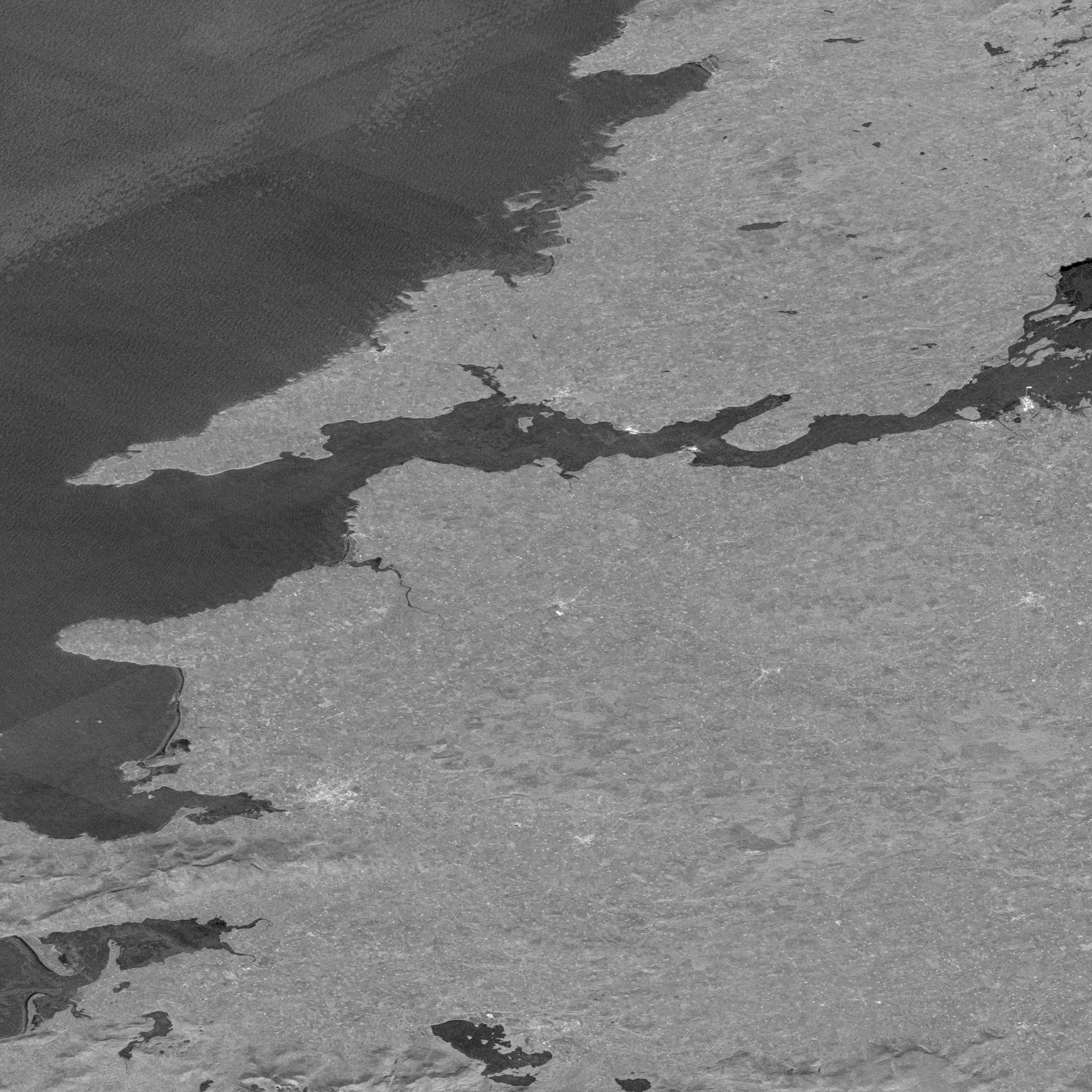
ASTER L2 Surface Reflectance SWIR and ASTER L2 Surface Reflectance VNIR V003
National Aeronautics and Space Administration —
The Terra Advanced Spaceborne Thermal Emission and Reflection Radiometer (ASTER) Surface Reflectance VNIR and SWIR (AST_07) data product contains measures of the... -
Federal
MODIS/Terra Land Water Mask Derived from MODIS and SRTM L3 Global 250m SIN Grid V006
National Aeronautics and Space Administration —
The MOD44W Version 6 data product was decommissioned on July 18, 2024. Users are encouraged to use the MOD44W Version 6.1 data product... -
Federal
NASADEM SRTM Image Mosaic Global 1 arc second V001
National Aeronautics and Space Administration —
The Land Processes Distributed Active Archive Center (LP DAAC) is responsible for the archive and distribution of NASA Making Earth System Data Records for Use in... -
Federal
ECOSTRESS Tiled Ancillary NDVI and Albedo L2 Global 70 m V002
National Aeronautics and Space Administration —
The ECOsystem Spaceborne Thermal Radiometer Experiment on Space Station (ECOSTRESS) mission measures the temperature of plants to better understand how much water... -
Federal
EMIT L4 Earth System Model Products V001
National Aeronautics and Space Administration —
The Earth Surface Mineral Dust Source Investigation (EMIT) instrument measures surface mineralogy, targeting the Earth’s arid dust source regions. EMIT is installed... -
Federal
NorthAmerica(NGC7000)&Pelican(IC5070)NebulaeX-RaySourceCatalog
National Aeronautics and Space Administration —
This table contains some of the results from the first extensive X-ray study of the North-America and Pelican star-forming region (NGC 7000/IC 5070), with the aim of... -
Federal
Aquarius Celestial Sky Microwave Emission Map Ancillary Dataset V1.0
National Aeronautics and Space Administration —
This datasets contains three maps of L-band (wavelength = 21 cm) brightness temperature of the celestial sky ("Galaxy") used in the processing of the NASA Aquarius... -
Federal
MEaSUREs Grounding Zone of the Antarctic Ice Sheet V001
National Aeronautics and Space Administration —
This data set provides a comprehensive map for the Antarctic Ice Sheet of the short-term zone of migration of the grounding line (i.e., the transition boundary... -
Federal
Annual Land Use and Urban Land Cover: Ethiopia, Nigeria, and South Africa, 2016-2020
National Aeronautics and Space Administration —
This dataset provides a two-tier annual Land Use (LU) and Urban Land Cover (LC) product suite over three African countries, Ethiopia, Nigeria, and South Africa,... -
Federal
GRACE-FO Level-2 Monthly Geopotential Spherical Harmonics JPL Release 6.3 (RL06.3)
National Aeronautics and Space Administration —
FOR EXPERT USE ONLY. This dataset contains estimates of the total month-by-month geopotential of the Earth, derived from the Gravity Recovery and Climate Experiment... -
Federal
GIBS Web Map Tile Service (WMTS)
National Aeronautics and Space Administration —
The WMTS implementation standard provides a standards-based solution for serviing digital maps using predefined image tiles. Through the constructs of the... -
Federal
VIIRS/NPP Active Fires 6-Min L2 Swath 375m V002
National Aeronautics and Space Administration —
The Visible Infrared Imaging Radiometer Suite (VIIRS) Active Fires (VNP14IMG) Version 2 product is produced in 6-minute temporal satellite increments (swaths) at 375... -
Federal
JPL TELLUS GRACE Level-3 Monthly Land Water-Equivalent-Thickness Surface Mass Anomaly Release 6.0 version 04 in netCDF/ASCII/GeoTIFF Formats
National Aeronautics and Space Administration —
The monthly land mass grids contain water mass anomalies given as equivalent water thickness derived from GRACE & GRACE-FO time-variable gravity observations... -
Federal
VO1/VO2 MARS INFRARED THERMAL MAPPER RESAMPLED DATA V1.0
National Aeronautics and Space Administration —
This data set contains the Infrared Thermal Mapping (IRTM) data of Mars acquired by the Viking orbiters. The database contains the time, geometry, and radiative... -
Federal
ATLAS/ICESat-2 L2A Global Geolocated Photon Data V006
National Aeronautics and Space Administration —
This data set (ATL03) contains height above the WGS 84 ellipsoid (ITRF2014 reference frame), latitude, longitude, and time for all photons downlinked by the Advanced... -
Federal
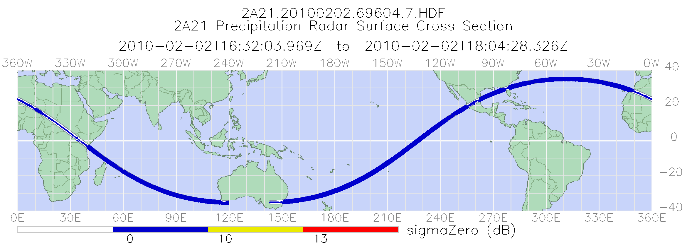
TRMM Precipitation Radar Surface Cross-Section L2 1.5 hours V7 (TRMM_2A21) at GES DISC
National Aeronautics and Space Administration —
The new version of these data is in GPM-like format (consistent with the GPM Dual-frequency Radar data format), and can be found under the name GPM_2APR. This is the... -
Federal
A Compilation of Global Soil Microbial Biomass Carbon, Nitrogen, and Phosphorus Data
National Aeronautics and Space Administration —
This data set provides the concentrations of soil microbial biomass carbon (C), nitrogen (N) and phosphorus (P), soil organic carbon, total nitrogen, and total... -
Federal
GHRSST NOAA/STAR GOES-16 ABI L2P America Region SST v2.70 dataset in GDS2
National Aeronautics and Space Administration —
GOES-16 (G16) is the first satellite in the US NOAA third generation of Geostationary Operational Environmental Satellites (GOES), a.k.a. GOES-R series (which will... -
Federal
ASTER L2 Surface Reflectance VNIR and Crosstalk Corrected SWIR V003
National Aeronautics and Space Administration —
The Terra Advanced Spaceborne Thermal Emission and Reflection Radiometer (ASTER) Surface Reflectance VNIR and Crosstalk Corrected SWIR (AST_07XT) dataset contains...

Official websites use .gov
A
.gov website belongs to an official government
organization in the United States.
Secure .gov websites use HTTPS
A
lock (
) or https:// means you’ve safely connected to
the .gov website. Share sensitive information only on official,
secure websites.