
-
Federal
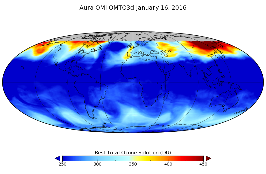
OMI/Aura TOMS-Like Ozone, Aerosol Index, Cloud Radiance Fraction L3 1 day 1 degree x 1 degree V3 (OMTO3d) at GES DISC recent views
National Aeronautics and Space Administration —
The OMI science team produces this Level-3 daily global TOMS-Like Total Column Ozone gridded product OMTO3d (1 deg Lat/Lon grids). The OMTO3d product is produced by... -
Federal
OMI/Aura Multi-wavelength Aerosol Optical Depth and Single Scattering Albedo Daily L2 Global Gridded 0.25 degree x 0.25 degree V3 (OMAEROG) at GES DISC recent views
National Aeronautics and Space Administration —
This Level-2G daily global gridded product OMAEROG is based on the pixel level OMI Level-2 Aerosol product OMAERO, based on the multi-wavelength algorithm that uses... -
Federal
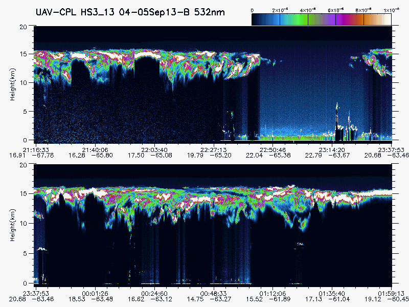
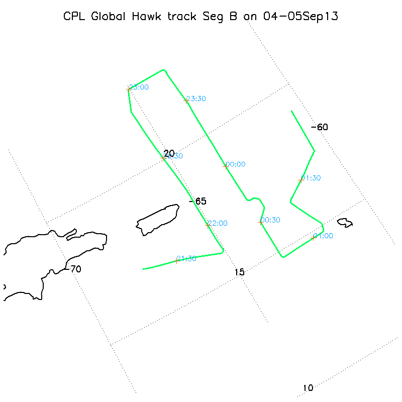
HURRICANE AND SEVERE STORM SENTINEL (HS3) GLOBAL HAWK CLOUD PHYSICS LIDAR (CPL) V1 recent views
National Aeronautics and Space Administration —
The Hurricane and Severe Storm Sentinel (HS3) Global Hawk Cloud Physics Lidar (CPL) dataset includes measurements gathered by the CPL instrument during the HS3... -
Federal
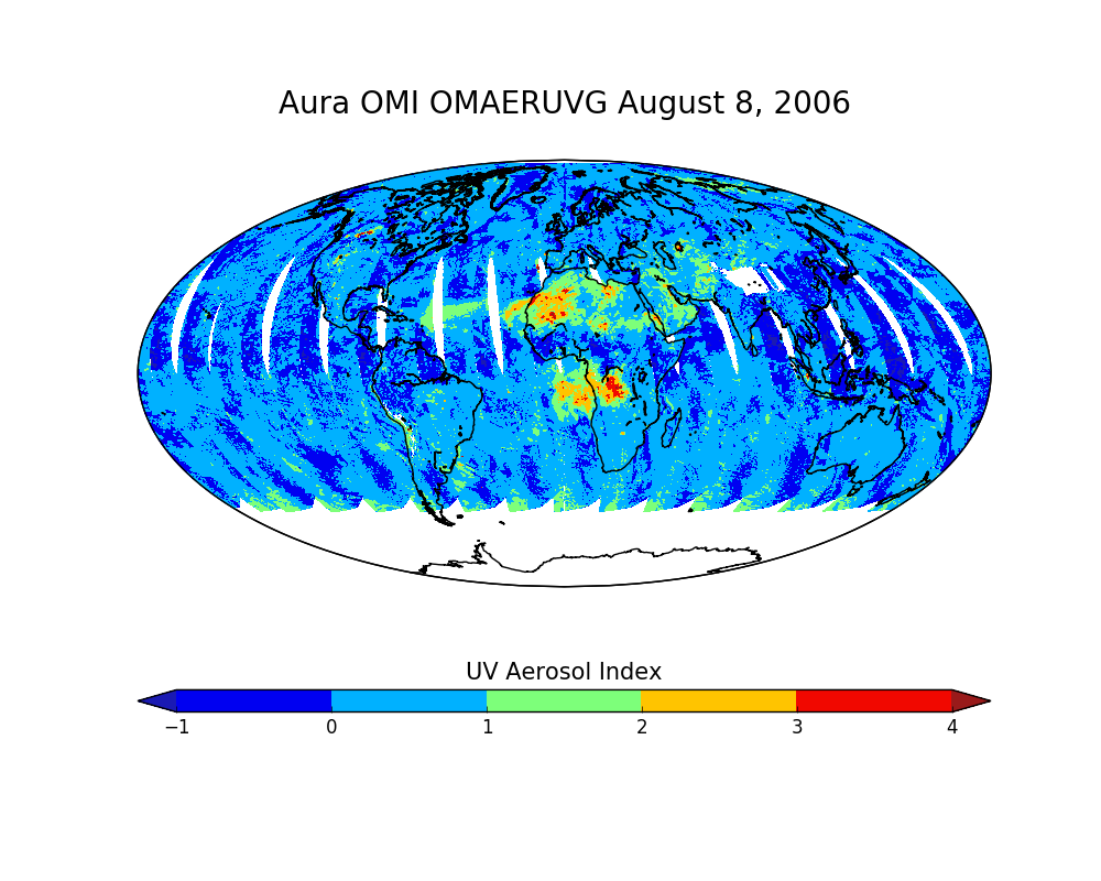
OMI/Aura Near UV Aerosol Optical Depth and Single Scattering Albedo Daily L2 Global Gridded 0.25 degree x 0.25 degree V3 (OMAERUVG) at GES DISC recent views
National Aeronautics and Space Administration —
This Level-2G daily global gridded product OMAERUVG is based on the pixel level OMI Level-2 AERUV product OMAERUV. This Level-2G daily global gridded product OMAERUVG... -
Federal
NARSTO EPA Supersite (SS) Los Angeles Size-Fractionated Particulate Matter (PM) Composition - micro-orifice uniform deposit impactors (MOUDI) Data recent views
National Aeronautics and Space Administration —
The NARSTO_EPA_SS_LOS_ANGELES_MOUDI_DATA is the North American Research Strategy for Tropospheric Ozone (NARSTO) Environmental Protection Agency (EPA) Supersite (SS)... -
Federal
UARS Improved Stratospheric and Mesospheric Sounder (ISAMS) Level 3AL V010 (UARIS3AL) at GES DISC recent views
National Aeronautics and Space Administration —
The Improved Stratospheric and Mesospheric Sounder (ISAMS) Level 3AL data product consists of daily, 4 degree increment latitude-ordered vertical profiles of... -
Federal
Optical Thickness Data: Fraser (FIFE) recent views
National Aeronautics and Space Administration —
Aerosol optical thickness data reported by Robert Fraser -
Federal
Optical Thickness Cross-Calib. (FIFE) recent views
National Aeronautics and Space Administration —
Cross referenced calibration optical thickness data from C-130 and KSU staff -
Federal
BOREAS RSS-12 Automated Ground Sunphotometer Measurements in the SSA recent views
National Aeronautics and Space Administration —
This table contains measurements from the ground sun photometers operated by RSS12 (Wrigley). -
Federal
BOREAS RSS-11 Ground Sunphotometer Data recent views
National Aeronautics and Space Administration —
This table contains measurements from the automatic sun photometers operated by RSS-11 (Markham). -
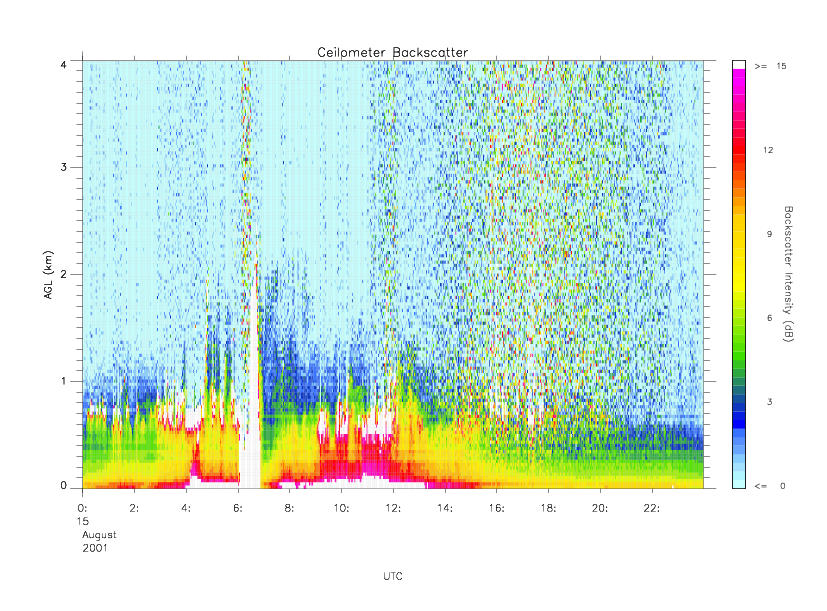
Federal
CAMEX-4 MIPS CEILOMETER V1 recent views
National Aeronautics and Space Administration —
The CAMEX-4 MIPS Ceilometer dataset was collected by the University of Alabama in Huntsville (UAH) Mobile Integrated Profiling System (MIPS), which is a mobile... -
Federal
BOREAS RSS-12 Airborne Tracking Sunphotometer Measurements (C-130) recent views
National Aeronautics and Space Administration —
Contains measurements from the airborne auto tracking sun photometers on board the NASA Ames C-130 aircraft, operated by RSS12 (Wrigley). -
Federal
UARS Improved Stratospheric and Mesospheric Sounder (ISAMS) Level 3AT V010 (UARIS3AT) at GES DISC recent views
National Aeronautics and Space Administration —
The Improved Stratospheric and Mesospheric Sounder (ISAMS) Level 3AT data product consists of daily, 65.536 second interval time-ordered vertical profiles of... -
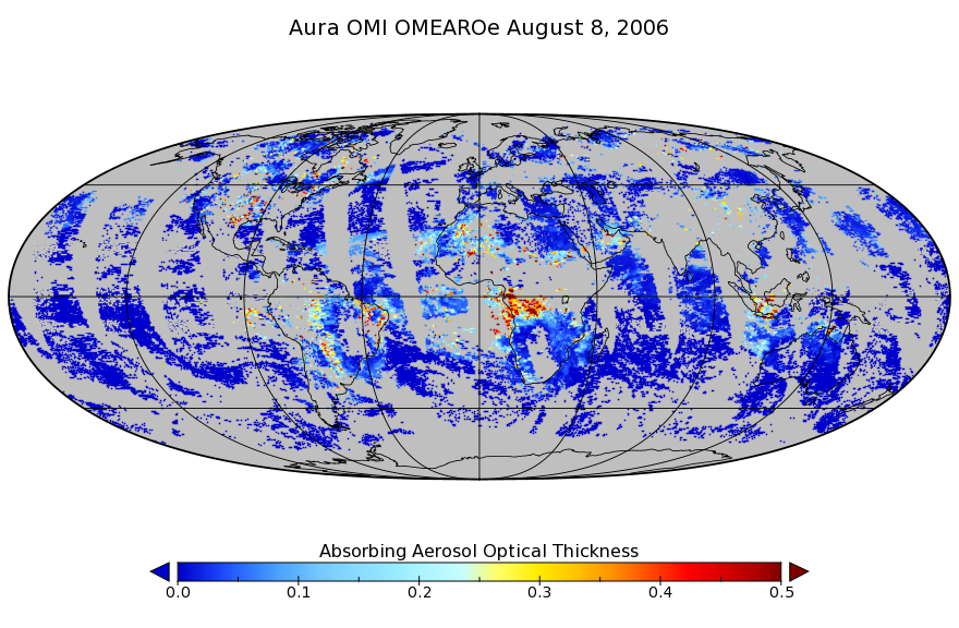
Federal
OMI/Aura Multi-wavelength Aerosol Optical Depth and Single Scattering Albedo L3 1 day Best Pixel in 0.25 degree x 0.25 degree V3 (OMAEROe) at GES DISC recent views
National Aeronautics and Space Administration —
The OMI science team produces this Level-3 Aura/OMI Global Aerosol Data Products OMAEROe (0.25deg Lat/Lon grids). The OMAEROe product selects best aerosol value from... -
Federal
UARS Cryogenic Limb Array Etalon Spectrometer (CLAES) Level 3AL V009 (UARCL3AL) at GES DISC recent views
National Aeronautics and Space Administration —
The Cryogenic Limb Array Etalon Spectrometer (CLAES) Level 3AL data product consists of daily, 4 degree increment latitude-ordered vertical profiles of temperature... -
Federal
UARS Cryogenic Limb Array Etalon Spectrometer (CLAES) Level 3AT V009 (UARCL3AT) at GES DISC recent views
National Aeronautics and Space Administration —
The Cryogenic Limb Array Etalon Spectrometer (CLAES) Level 3AT data product consists of daily, 65.536 second interval time-ordered vertical profiles of temperature... -
Federal
UARS Halogen Occultation Experiment (HALOE) Level 2 V019 (UARHA2FN) at GES DISC recent views
National Aeronautics and Space Administration —
The Halogen Occultation Experiment (HALOE) Level 2 data product consists of daily vertical profiles of temperature, aerosol extinciton and pressure, as well as... -
Federal
Optical Thickness Data: Bruegge (FIFE) recent views
National Aeronautics and Space Administration —
Optical thickness data from Dr. Carol Bruegge, JPL -
Federal
Optical Thickness Data: Staff (FIFE) recent views
National Aeronautics and Space Administration —
Optical thickness data from KSU staff science -
Federal
BOREAS RSS-03 Atmospheric Conditions from a Helicopter-Mounted Sunphotometer recent views
National Aeronautics and Space Administration —
Contains Helicopter-based measurements of atmospheric conditions acquired during the BOReal Ecosystem-Atmosphere Study (BOREAS) processed to estimates of aerosol...

Official websites use .gov
A
.gov website belongs to an official government
organization in the United States.
Secure .gov websites use HTTPS
A
lock (
) or https:// means you’ve safely connected to
the .gov website. Share sensitive information only on official,
secure websites.