
-
Federal
U.S. Geological Survey Aerial Photography
National Aeronautics and Space Administration —
The U.S. Geological Survey (USGS) Aerial Photography data set includes over 2.5 million film transparencies. Beginning in 1937, photographs were acquired for mapping... -
Federal
UARS Improved Stratospheric and Mesospheric Sounder (ISAMS) Level 3AL V010 (UARIS3AL) at GES DISC
National Aeronautics and Space Administration —
The Improved Stratospheric and Mesospheric Sounder (ISAMS) Level 3AL data product consists of daily, 4 degree increment latitude-ordered vertical profiles of... -
Federal
TES/Aura L2 Ancillary Special Observation Product V007
National Aeronautics and Space Administration —
TL2ANCS_7 is the Tropospheric Emission Spectrometer (TES)/Aura Level 2 Ancillary Special Observation Product Version 7 data product. TES was an instrument aboard... -
Federal
National High Altitude Photography
National Aeronautics and Space Administration —
The National High Altitude Photography (NHAP) program, which was operated from 1980 - 1989, was coordinated by the U.S. Geological Survey as an interagency project to... -
Federal
UARS Cryogenic Limb Array Etalon Spectrometer (CLAES) Level 3AL V009 (UARCL3AL) at GES DISC
National Aeronautics and Space Administration —
The Cryogenic Limb Array Etalon Spectrometer (CLAES) Level 3AL data product consists of daily, 4 degree increment latitude-ordered vertical profiles of temperature... -
Federal
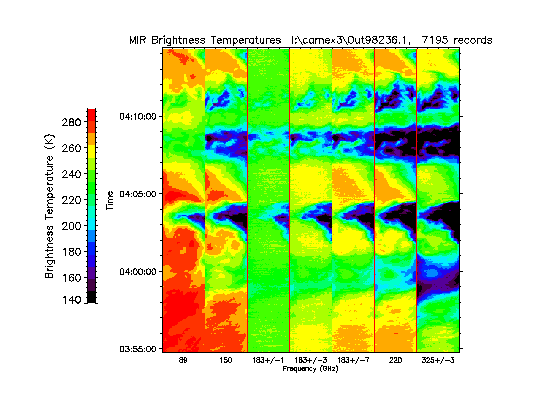
CAMEX-3 ER-2 Millimeter-wave Imaging Radiometer (MIR) V1
National Aeronautics and Space Administration —
The CAMEX-3 ER-2 Millimeter-wave Imaging Radiometer (MIR) dataset is a browse-only dataset containing plots of brightness temperature measurements collected by the... -
Federal
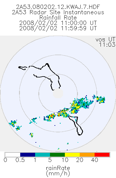
TRMM Ground Validation Radar Site Rain Rate Map L2 1 hour 2 km V7 (TRMM_2A53UW) at GES DISC
National Aeronautics and Space Administration —
This dataset is part of the University of Washington TRMM Ground Validation products. Instantaneous rain rate cartesian grid based on baseUW and 2A54UW. Units are... -
Federal
GPM Ground Validation NASA ER-2 Navigation Data OLYMPEX V1
National Aeronautics and Space Administration —
The GPM Ground Validation NASA ER-2 Navigation Data OLYMPEX dataset supplies navigation data collected by the NASA ER-2 aircraft for flights that occurred during... -
Federal
AIRS/Aqua L2 Near Real Time (NRT) Support Retrieval (AIRS-only) V006 (AIRS2SUP_NRT) at GES DISC
National Aeronautics and Space Administration —
The Atmospheric Infrared Sounder (AIRS) Level 2 Near Real Time (NRT) Support Retrieval (AIRS-only) product (AIRS2SUP_NRT_006) differs from the routine product... -
Federal
Sentinel-5P TROPOMI Aerosol Layer Height 1-Orbit L2 7km x 3.5km V1 (S5P_L2__AER_LH) at GES DISC
National Aeronautics and Space Administration —
Starting from August 6th in 2019, Sentinel-5P TROPOMI along-track high spatial resolution (~5.5km at nadir) has been implemented. For data after August 6th of 2019,... -
Federal
NASA Aerial Photography
National Aeronautics and Space Administration —
The National Aeronautics and Space Administration (NASA) Aerial Photography data set is a film archive of photographs from the Lyndon B. Johnson Space Center (JSC) in... -
Federal
GOES-R PLT Lightning Instrument Package (LIP) V1
National Aeronautics and Space Administration —
The GOES-R PLT Lightning Instrument Package (LIP) dataset consists of electrical field measurements of lightning and navigation data collected by the Lightning... -
Federal
UARS Wind Imaging Interferometer (WINDII) Level 3AT V011 (UARWI3AT) at GES DISC
National Aeronautics and Space Administration —
The Wind Imaging Interferometer (WINDII) Level 3AT data product consists of daily, 65.536 second interval time-ordered vertical profiles of meridional and zonal wind... -
Federal
OMI/Aura Ozone (O3) Total Column 1-Orbit L2 Swath 13x24 km V003 NRT
National Aeronautics and Space Administration —
The OMI/Aura Level-2 Total Column Ozone Data Product OMTO3 Near Real Time data is made available from the OMI SIPS NASA for the public access. The Ozone Monitoring... -
Federal
SAGE III Meteor-3M L2 Solar Event Species Profiles (Native) V003
National Aeronautics and Space Administration —
SAGE III Meteor-3M L2 Solar Event Species Profiles are Level 2 data files containing all the species products for a single solar event. The Stratospheric Aerosol and... -
Federal
GOES-R PLT Airborne Visible/Infrared Imaging Spectrometer (AVIRIS) V1
National Aeronautics and Space Administration —
The GOES-R PLT Airborne Visible/Infrared Imaging Spectrometer (AVIRIS) dataset consists of radiance, reflectance, water phase, and navigation data delivered by the... -
Federal
Polar Ozone and Aerosol Measurement II Version 6
National Aeronautics and Space Administration —
POAM2_VER6 data are Polar Ozone and Aerosol Measurement II Version 6.0 data. The Polar Ozone and Aerosol Measurement (POAM) II instrument measures the vertical... -
Federal
UARS Correlative UKMO Daily Gridded Stratospheric Assimilated Data V001 (UARZCUKM) at GES DISC
National Aeronautics and Space Administration —
The UARS Correlative assimilation data from the U.K. Meteorological Office (UKMO) consists of daily model runs at 12:00 GMT as a means of providing an independent... -
Federal
Sounder SIPS: Suomi NPP CrIMSS Level 3 Comprehensive Quality Control Gridded Monthly CLIMCAPS Full Spectral Resolution V2 at GES DISC
National Aeronautics and Space Administration —
WARNING: To users of the derived product “co_mmr_midtrop” (carbon monoxide mass mixing ratio to dry air [kg/kg] at ~500 hPa). This variable has a significant bias due...

Official websites use .gov
A
.gov website belongs to an official government
organization in the United States.
Secure .gov websites use HTTPS
A
lock (
) or https:// means you’ve safely connected to
the .gov website. Share sensitive information only on official,
secure websites.