

6 datasets found for ""Growing Season""
-
Federal
National Agriculture Imagery Program (NAIP)
National Aeronautics and Space Administration —
The National Agriculture Imagery Program (NAIP) acquires aerial imagery during the agricultural growing seasons in the continental U.S. A primary goal of the NAIP... -
Federal
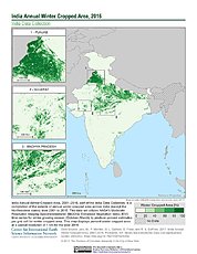
India Annual Winter Cropped Area, 2001-2016 NGDA
National Aeronautics and Space Administration —
The India Annual Winter Cropped Area, 2001 - 2016 consists of annual winter cropped areas for most of India (except the Northeastern states) from 2000-2001 to... -
Federal
Alaska AVHRR Twice-Monthly Composites
National Aeronautics and Space Administration —
The goal of the Alaska Advanced Very High Resolution Radiometer (AVHRR) project is to compile a time series data set of calibrated, georegistered daily observations... -
Federal
SMAPVEX19-22 Massachusetts Vegetation Optical Depth V001
National Aeronautics and Space Administration —
As part of the SMAPVEX19-22 campaign, an L-band radiometer was deployed on top of a tower at Harvard Forest,Massachusetts, looking down at a stand of red oak forest.... -
Federal
ICESat-2 Derived 30 m Along-Track Boreal Aboveground Biomass Density V001
National Aeronautics and Space Administration —
This data set provides a quality-filtered set of ATLAS/ICESat-2 L3A Land and Vegetation Height, Version 5 (ATL08) observations of relative canopy heights and... -
Federal
SMAPVEX19-22 Massachusetts Vegetation Optical Depth V001
National Aeronautics and Space Administration —
As part of the SMAPVEX19-22 campaign, an L-band radiometer was deployed on top of a tower at Harvard Forest,Massachusetts, looking down at a stand of red oak forest....
6 datasets found for ""Growing Season""