
-
Federal
BOREAS Scanning Lidar Imager of Canopies by Echo Recovery (SLICER): Level-3 Data recent views
National Aeronautics and Space Administration —
Scanning Lidar Imager of Canopies by Echo Recovery (SLICER) data were acquired in support of BOReal Ecosystem-Atmosphere Study (BOREAS) at all of the Tower Flux (TF)... -
Federal
LBA-ECO CD-01 Meteorological Data, Tapajos and Amazon Rivers, Santarem, Brazil: 2001 recent views
National Aeronautics and Space Administration —
This data set contains meteorological data collected around the confluence of the Tapajos River with the Amazon River in the Amazon Basin near Santarem, Brazil, in... -
Federal
Pre-LBA CABARE Mapped Land Surface and Vegetation Characteristics, Rondonia, Brazil recent views
National Aeronautics and Space Administration —
Surface parameter digital maps of vegetation, soil, and topography were obtained for Rondonia, Brazil, covering the 5x5 degree region bounded by 13-8 degrees S and... -
Federal
Global Historical Climatology Network, 1753-1990 recent views
National Aeronautics and Space Administration —
This data set contains monthly temperature, precipitation, sea-level pressure, and station-pressure data for thousands of meteorological stations worldwide. The... -
Federal
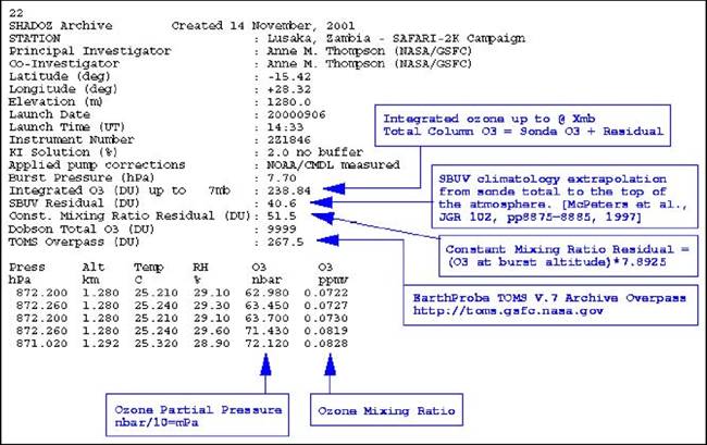
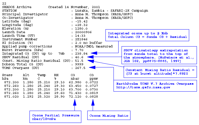
SAFARI 2000 SHADOZ Ozonesonde Data, Zambia and Regional Sites, Dry Season 2000 recent views
National Aeronautics and Space Administration —
Ozonesonde launches were made by the Southern Hemisphere ADditional OZonesondes (SHADOZ) group as part of the SAFARI 2000 Dry Season Campaign in September 2000... -
Federal
RLC Forest Stand Carbon Map of Russia recent views
National Aeronautics and Space Administration —
This dataset is a 1:15 million scale map of forest stand carbon for the land area of Russia (Stone et al., 2000). The objective was to create a first approximation of... -
Federal
Global Soil Types, 1-Degree Grid (Zobler) recent views
National Aeronautics and Space Administration —
A global digital data base of soil properties is available at 1 degree longitude resolution. For each land cell, the data base includes major and associated soil... -
Federal
BOREAS HYD-03 Subcanopy Radiation Data recent views
National Aeronautics and Space Administration —
This table contains the sub-canopy radiation data collected by HYD-3. -
Federal
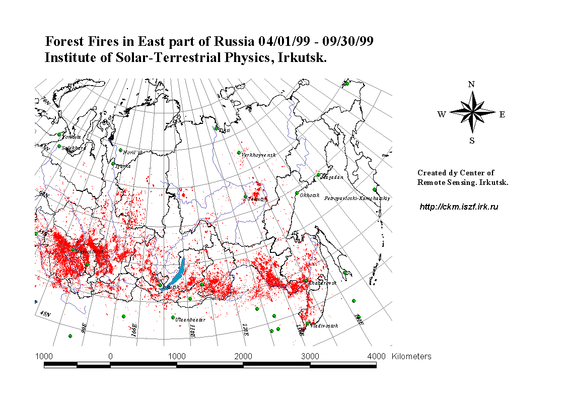
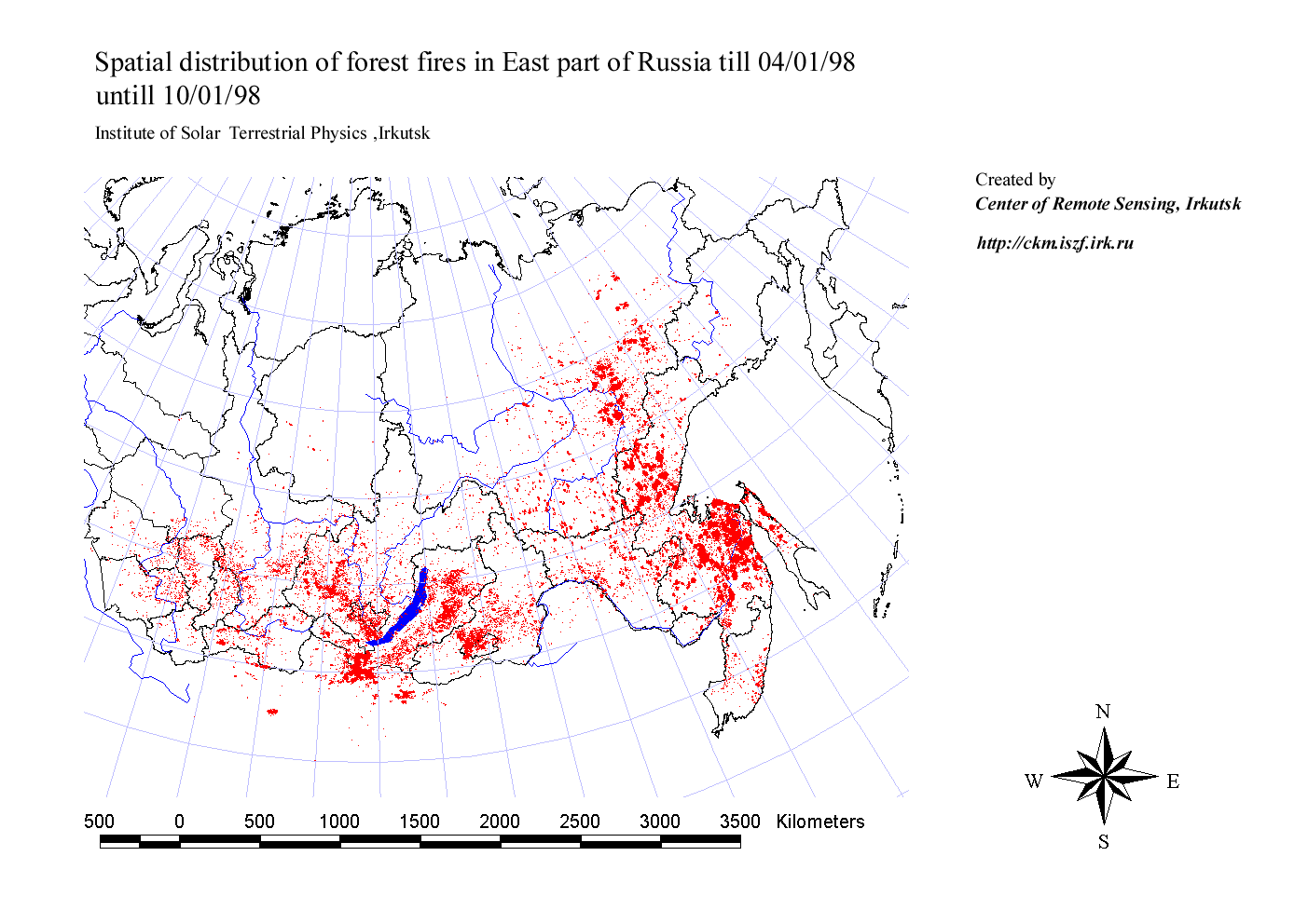
RLC Forest Fire Locations in Eastern Russia, 1998-1999 recent views
National Aeronautics and Space Administration —
This dataset is derived from Russian forest fire imagery from the National Forest Fire Center of Russia archive that was collected by the Center of Remote Sensing,... -
Federal
ISLSCP II Global River Fluxes of Carbon and Sediments to the Oceans recent views
National Aeronautics and Space Administration —
The River Carbon Flux data set represents estimates for the riverine export of carbon and of sediments. This data set includes the amounts of carbon and of sediments... -
Federal
SAFARI 2000 SeaWiFS Images for Core Study Sites, 2000-2001 recent views
National Aeronautics and Space Administration —
This data set contains Sea-viewing Wide Field-of-view Sensor (SeaWiFS) imagery for the eight core study sites of Mongu, Etosha, Kasangu, Skukuza, Mutoko, Mzola,... -
Federal
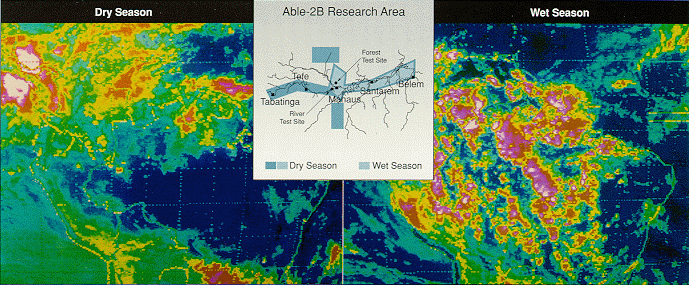
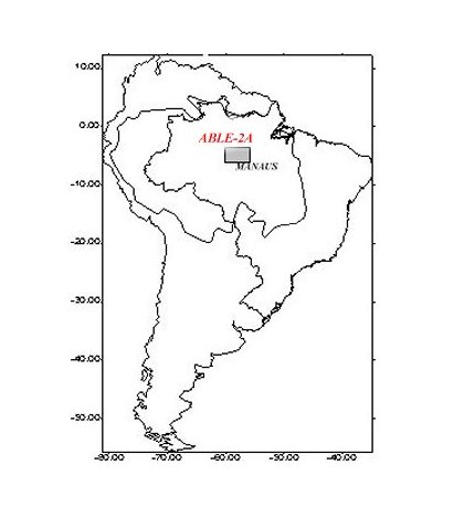
Pre-LBA ABLE-2A and ABLE-2B Expedition Data recent views
National Aeronautics and Space Administration —
The ABLE 2A and 2B (Atmospheric Boundary Layer Experiments) data consists of estimates of the rate of exchange of a wide variety of aerosols and gases between the... -
Federal
JERS-1 Synthetic Aperture Radar, 100-m Mosaics, South America: 1995-1996, R1 recent views
National Aeronautics and Space Administration —
This data set provides ~100-m resolution image mosaics of South America acquired during the low flood season between September and December 1995 and during the high... -
Federal
BOREAS/SRC AMS Suite A Surface Meteorological and Radiation Data: 1994 recent views
National Aeronautics and Space Administration —
Contains the data collected in 1994 by the AMS suite A instrument set operated by SRC and provided to BORIS. -
Federal
BOREAS/SRC AMS Suite A Surface Meteorological and Radiation Data: 1996 recent views
National Aeronautics and Space Administration —
Contains the data collected in 1996 by the AMS suite A instrument set operated by SRC and provided to BORIS. -
Federal
ISLSCP II Atmospheric Carbon Dioxide Consumption by Continental Erosion recent views
National Aeronautics and Space Administration —
The Continental Atmospheric CO2 Consumption data set represents gridded estimates for the riverine export of carbon and of sediments based on empirical models. All... -
Federal
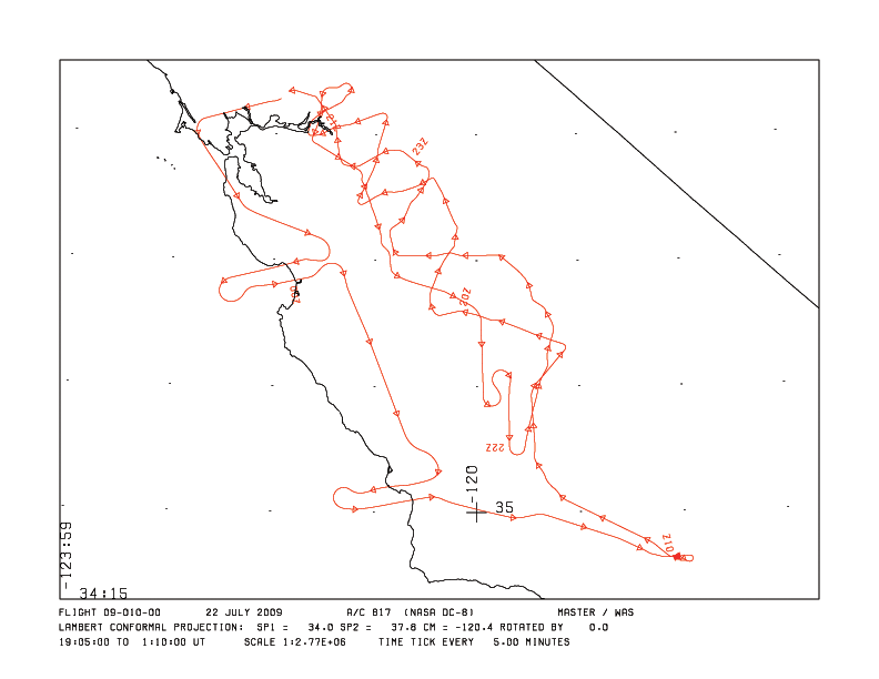
MASTER: HyspIRI Airborne Campaign, California and Nevada, Summer 2016 recent views
National Aeronautics and Space Administration —
This dataset includes Level 1B (L1B) and Level 2 (L2) data products from the MODIS/ASTER Airborne Simulator (MASTER) instrument. The data were collected as part of... -
Federal
BOREAS RSS-04 1994 Southern Study Area Jack Pine LAI & FPAR Data recent views
National Aeronautics and Space Administration —
Contains Decagon Ceptometer estimates of LAI and fPAR. Contains LI-COR LAI-2000 estimates of leaf area index and mean tip angle. -
Federal
BOREAS/SRC AMS Suite B Surface Meteorological and Radiation Data: 1994 recent views
National Aeronautics and Space Administration —
Contains the data collected in 1994 by the AMS suite B instrument set operated by SRC and provided to BORIS. -
Federal
BOREAS/SRC AMS Suite B Surface Meteorological and Radiation Data: 1996 recent views
National Aeronautics and Space Administration —
Contains the data collected in 1996 by the AMS suite B instrument set operated by SRC and provided to BORIS.

Official websites use .gov
A
.gov website belongs to an official government
organization in the United States.
Secure .gov websites use HTTPS
A
lock (
) or https:// means you’ve safely connected to
the .gov website. Share sensitive information only on official,
secure websites.