

15 datasets found for "C#结构化电子病历oracle数据库完全源码编辑器✅项目合作 二开均可 TG:saolei44✅.DqLifdkpJRotrkR"
-
Federal
2023 National Offshore Wind data set (NOW-23)
Department of Energy —
The 2023 National Offshore Wind data set (NOW-23) is the latest wind resource data set for offshore regions in the United States, which supersedes, for its offshore... -
Federal
United States Offshore Wind Supply Curves 2024
Department of Energy —
This data packet contains supply curves, hourly generation profiles, and composite siting exclusion TIFFs for offshore wind (OSW) in the waters of the EEZ off the... -
Federal
Utah FORGE 3-2417: Low Frequency Distributed Acoustic Sensing Data from 16A/16B Stimulation - April, 2024
Department of Energy —
This dataset contains processed low-frequency Distributed Acoustic Sensing (LF-DAS) data collected between April 2 and April 12, 2024, during the Utah FORGE... -
Federal
EGS Collab Experiment 2: Core Logs
Department of Energy —
Core logs and photos from the EGS Collab project Experiment 2 for the Top Vertical well (TV4100) and the Top Horizontal well (TV 4100) on the 4100 Level of SURF (the... -
Federal
Snake River Plain Geothermal Play Fairway Analysis Heat, Permeability, and Seal CRS Map Raster Files
Department of Energy —
Snake River Plain Play Fairway Analysis - Phase 1 CRS Raster Files. This dataset contains raster files created in ArcGIS. These raster images depict Common Risk... -
Federal
Snake River Plain Geothermal Play Fairway Analysis Project Active Source Seismic Data
Department of Energy —
This archive contains seismic shot field records for 10 profiles located in Camas Prairie, Idaho. The eight numbered .sgy files were acquired using a seismic land... -
Federal
UNH TDP - Concurrent Measurements of Inflow, Power Performance, and Loads for a Grid-Synchronized Vertical Axis Cross-Flow Turbine Operating in a Tidal Estuary
Department of Energy —
This data was collected between October 12 and December 15 of 2021 at the University of New Hampshire (UNH) and Atlantic Marine Energy Center (AMEC) turbine... -
Federal
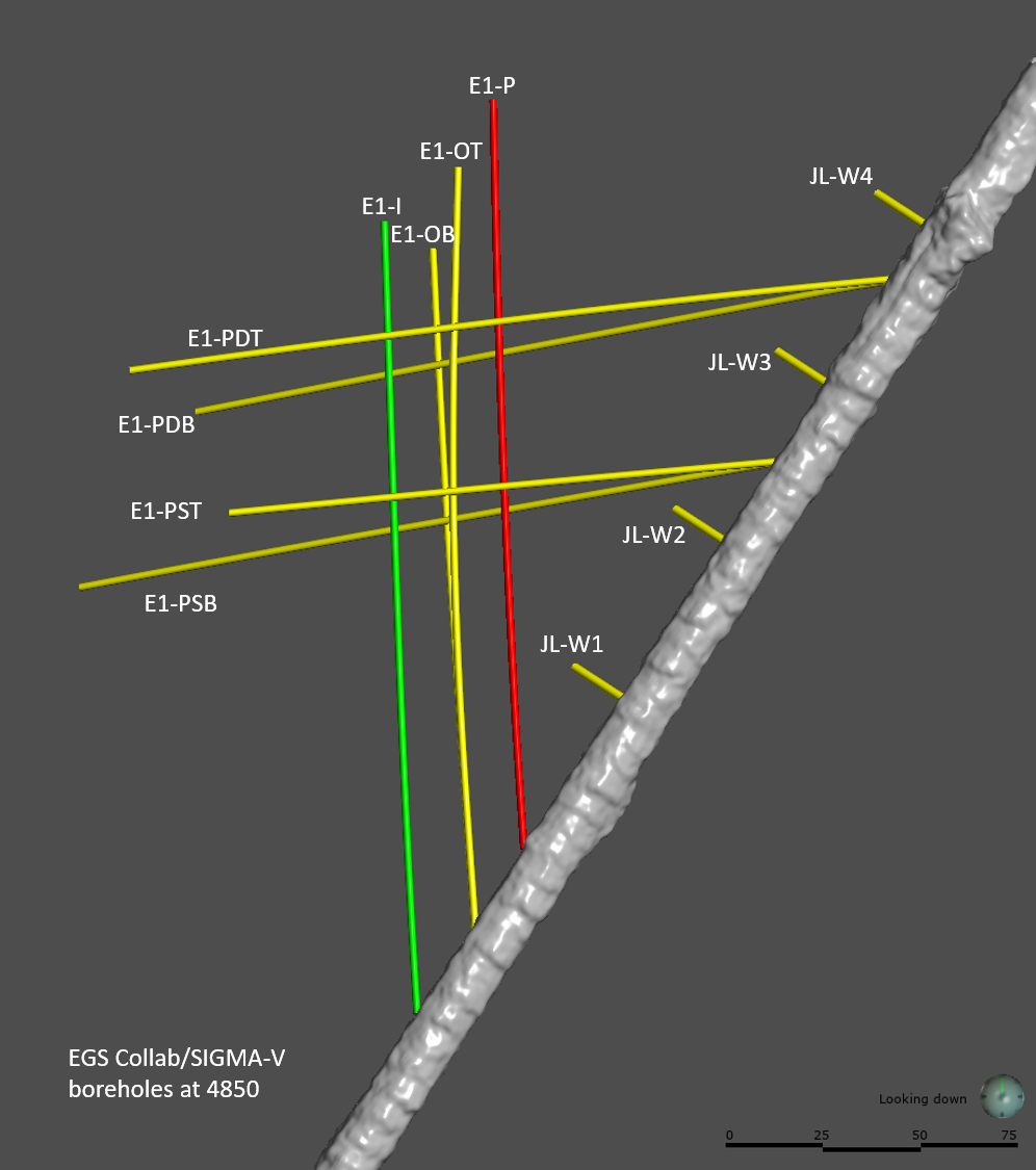
EGS Collab Experiment 1: Well Locations and Orientations.
Department of Energy —
The EGS Collab is conducting experiments in hydraulic fracturing at a depth of 1.5 km in the Sanford Underground Research Facility (SURF) on the 4850 Level. A total... -
Federal
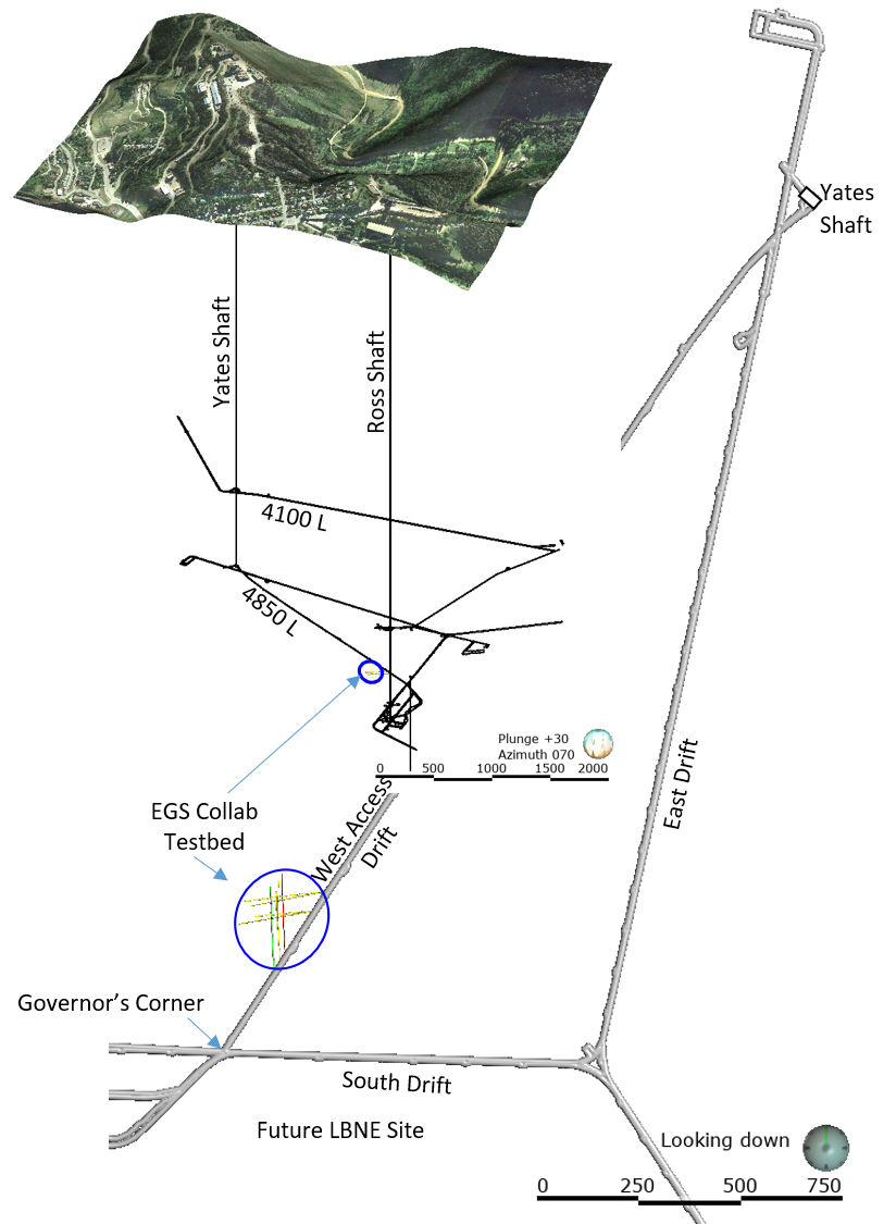
EGS Collab Experiment 2: Laser Scanned 4100 L Drift Map
Department of Energy —
The EGS Collab project is evaluating a site for Experiment 2 (hydraulic fracturing/shearing) at a depth of 1.25 km in the Sanford Underground Research Facility (SURF)... -
Federal
USU Camas-1 Test Well: Documentation
Department of Energy —
This submission contains documents that describe the USU Camas-1 test well, drilled in Camas Prairie, Idaho, in Fall 2018 and Fall 2019. The purpose of this well is... -
Federal
Kilauea Magnetotelluric Dataset
Department of Energy —
In 2002 and 2003 a collaborative effort was undertaken between Lawrence Berkeley National Laboratory, Sandia National Laboratories, the USGS Menlo Park, the USGS...
15 datasets found for "C#结构化电子病历oracle数据库完全源码编辑器✅项目合作 二开均可 TG:saolei44✅.DqLifdkpJRotrkR"