
-
Federal
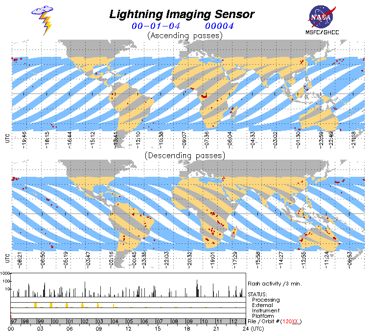
Lightning Imaging Sensor (LIS) on TRMM Science Data V4
National Aeronautics and Space Administration —
The Lightning Imaging Sensor (LIS) Science Data was collected by the LIS instrument on the Tropical Rainfall Measuring Mission (TRMM) satellite used to detect the... -
Federal
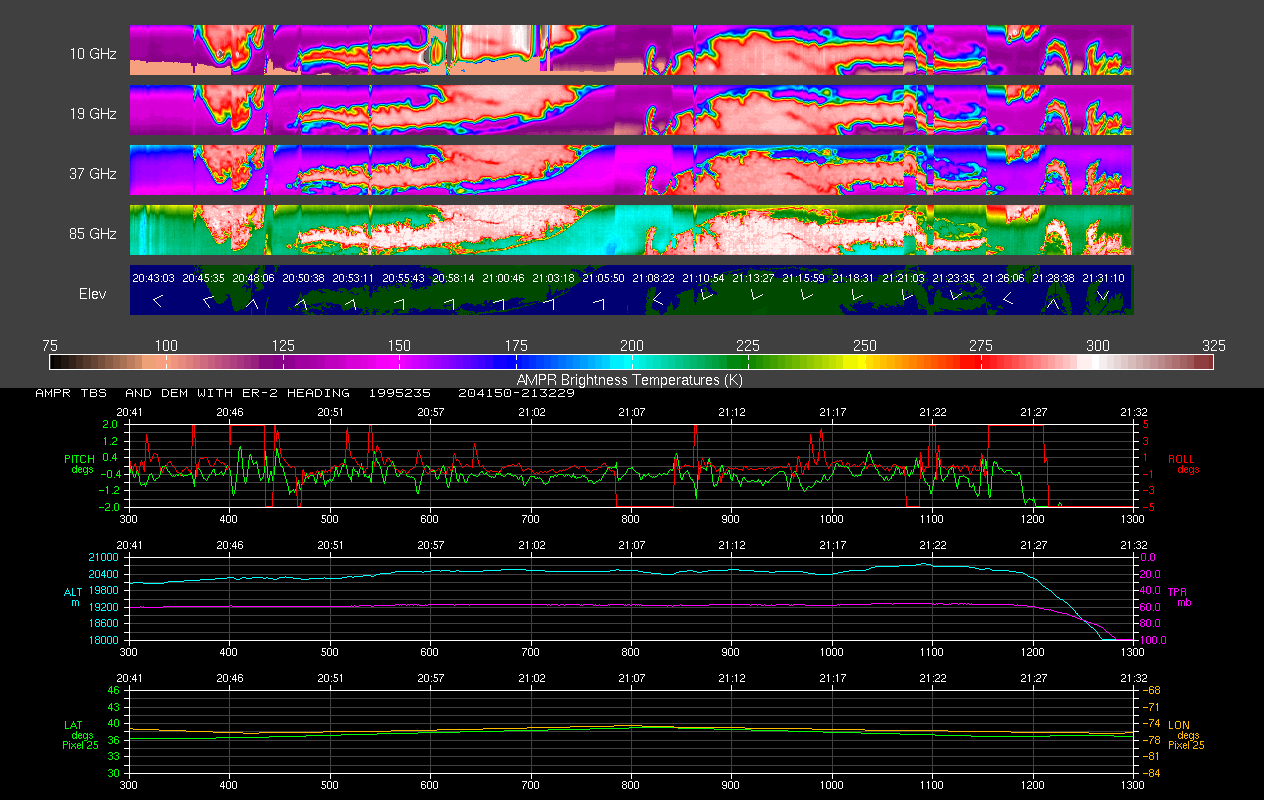
AMPR FIRE III ACE V1
National Aeronautics and Space Administration —
The Advanced Microwave Precipitation Radiometer (AMPR) was deployed during the First ISCCP Regional Experiment-III Arctic Cloud Experiment (FIRE-III/ACE). AMPR data... -
Federal
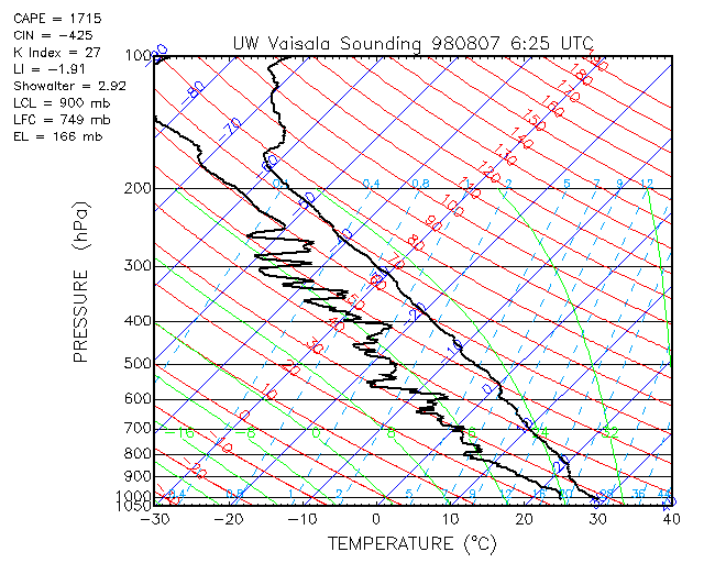
CAMEX-3 LiDAR Atmospheric Sensing Experiment (LASE) Imagery V1
National Aeronautics and Space Administration —
The CAMEX-3 LiDAR Atmospheric Sensing Experiment (LASE) Imagery dataset is a browse-only dataset that consists of plotted reflectivity data collected by the LiDAR... -
Federal
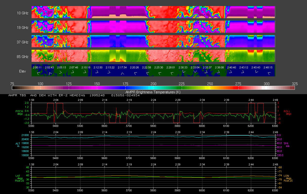
AMPR BRIGHTNESS TEMPERATURE CAMEX-2 V2
National Aeronautics and Space Administration —
The Advanced Microwave Precipitation Radiometer (AMPR) was deployed during the Convection and Moisture Experiment 2 (CAMEX-2). AMPR data were collected at a... -
Federal
MODIS/Terra Monthly mean Day-Time Land Surface Temperature at 1x1 degree V005 (MOD11CM1D) at GES DISC NGDA
National Aeronautics and Space Administration —
The dataset contains global monthly day-time land surface temperature averaged within 1 by 1 degree grid cells. The source for the data is MODIS/Terra MOD11C3... -
Federal
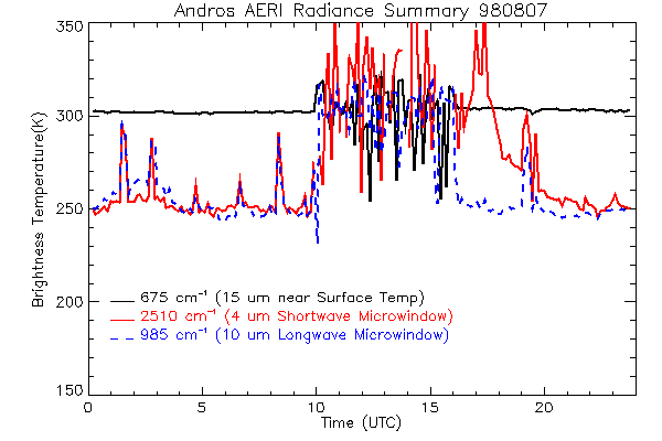
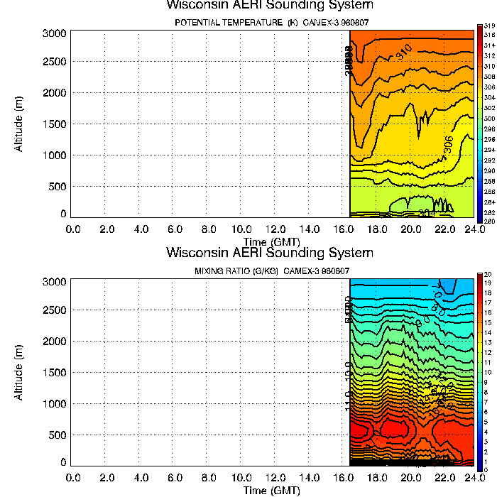
CAMEX-3 ATMOSPHERIC EMITTED RADIANCE INTERFEROMETER (AERI) V1
National Aeronautics and Space Administration —
The Atmospheric Emitted Radiance Interferometer (AERI) was used to make atmospheric temperature and moisture retrievals. AERI provides absolutely calibrated radiances... -
Federal
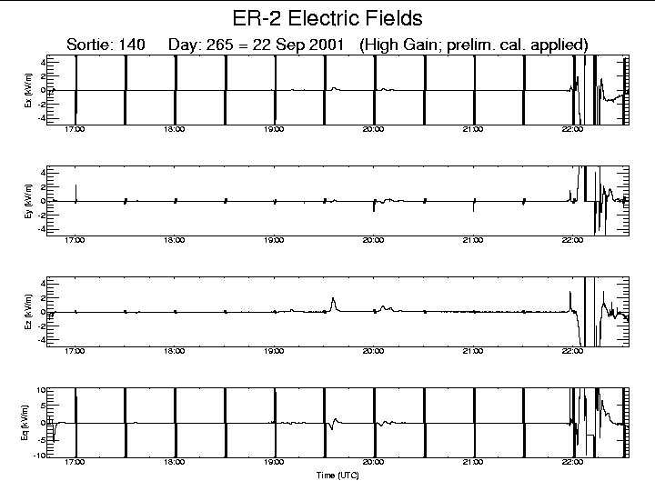
CAMEX-4 ER-2 LIGHTNING INSTRUMENT PACKAGE (LIP) V1
National Aeronautics and Space Administration —
The CAMEX-4 ER-2 Lightning Instrument Package (LIP) dataset was collected by the ER-2 LIP, which allows the vector components of the electric field (i.e, Ex, Ey, Ez )... -
Federal
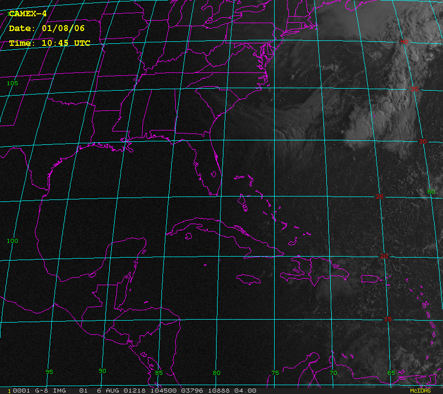
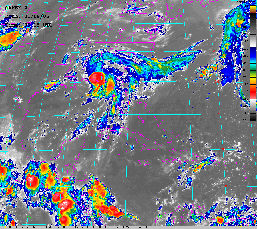
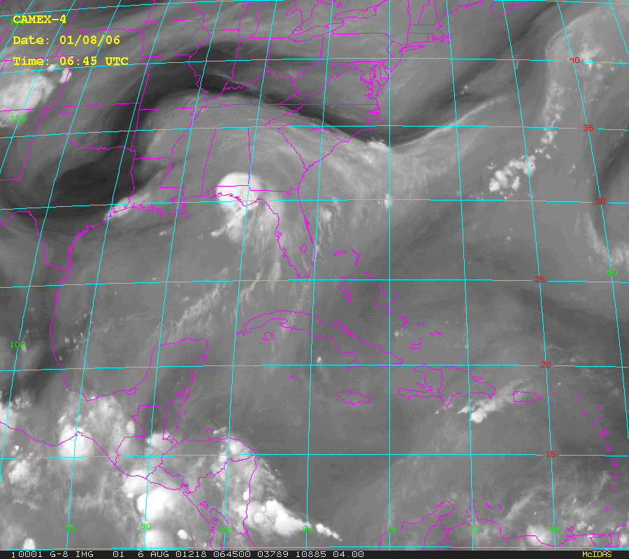
CAMEX-4 GOES-8 PRODUCTS V1
National Aeronautics and Space Administration —
The CAMEX-4 GOES-8 Products dataset was collected during the CAMEX-4 field campaign, which ocused on the study of tropical cyclone (hurricane) development, tracking,... -
Federal
AIRS/Aqua L3 Monthly Quantization in Physical Units (AIRS+AMSU+HSB) 5 degrees x 5 degrees V006 (AIRH3QPM) at GES DISC
National Aeronautics and Space Administration —
The Atmospheric Infrared Sounder (AIRS) is a grating spectrometer (R = 1200) aboard the second Earth Observing System (EOS) polar-orbiting platform, EOS Aqua. In... -
Federal
GPM GROUND VALIDATION HIGH ALTITUDE IMAGING WIND AND RAIN AIRBORNE PROFILER (HIWRAP) MC3E V1
National Aeronautics and Space Administration —
The GPM Ground Validation High Altitude Imaging Wind and Rain Airborne Profiler (HIWRAP) MC3E dataset was collected by the High-Altitude Imaging Wind and Rain... -
Federal
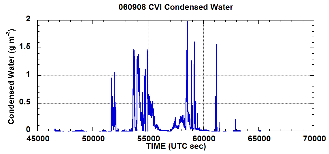
NAMMA CVI CLOUD CONDENSED WATER CONTENT V1
National Aeronautics and Space Administration —
In the NAMMA CVI Cloud Condensed Water Content dataset the counterflow virtual impactor (CVI) was used to measure condensed water content (liquid water or ice in... -
Federal
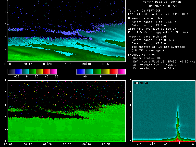
GPM GROUND VALIDATION MCGILL VERTICAL POINTING X-BAND (VERTIX) RADAR GCPEX V1
National Aeronautics and Space Administration —
The GPM Ground Validation McGill Vertical Pointing X-Band (VertiX) Radar GCPEx dataset consists of radar reflectivity and Doppler velocity data collected by the... -
Federal
CAMEX-3 CLOUD AND AEROSOL PARTICLE CHARACTERIZATION (CAPAC) V1
National Aeronautics and Space Administration —
CAPAC is a series of three instruments: the Forward Scattering Spectrometer Probe model 300 (FSSP-300), the Two Dimensional Optical Array Probes [Cloud and... -
Federal
Real System Failures
National Aeronautics and Space Administration —
This resource area contains descriptions of actual electronic systems failure scenarios with an emphasis on the diversity of failure modes and effects that can befall... -
Federal
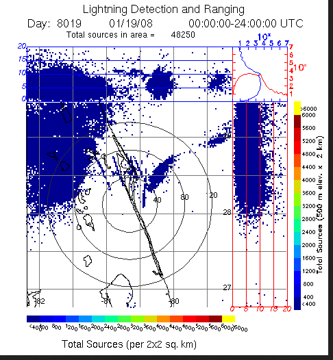
LIGHTNING DETECTION AND RANGING (LDAR) RAW DATA V1
National Aeronautics and Space Administration —
Lightning Detection and Ranging (LDAR) Raw data consists of level 1 lightning data collected from February 25, 1997 through June 11, 2008. The LDR system is located... -
Federal
BOREAS/SRC AMS Suite A Surface Meteorological and Radiation Data: 1996
National Aeronautics and Space Administration —
Contains the data collected in 1996 by the AMS suite A instrument set operated by SRC and provided to BORIS. -
Federal
BOREAS Scanning Lidar Imager of Canopies by Echo Recovery (SLICER): Level-3 Data
National Aeronautics and Space Administration —
Scanning Lidar Imager of Canopies by Echo Recovery (SLICER) data were acquired in support of BOReal Ecosystem-Atmosphere Study (BOREAS) at all of the Tower Flux (TF)... -
Federal
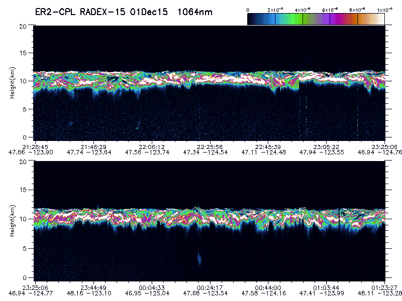
GPM Ground Validation Cloud Physics LiDAR (CPL) OLYMPEX V1
National Aeronautics and Space Administration —
The GPM Ground Validation Cloud Physics Lidar (CPL) OLYMPEX dataset consists of extinction profiles, layer optical depth, layer lidar ratio, and aircraft parameter... -
Federal
AMPR BRIGHTNESS TEMPERATURE CAMEX-1 V2
National Aeronautics and Space Administration —
The Advanced Microwave Precipitation Radiometer (AMPR) was deployed during the Convection and Moisture Experiments (CAMEX-1) conducted at Wallops Island, VA. AMPR... -
Federal
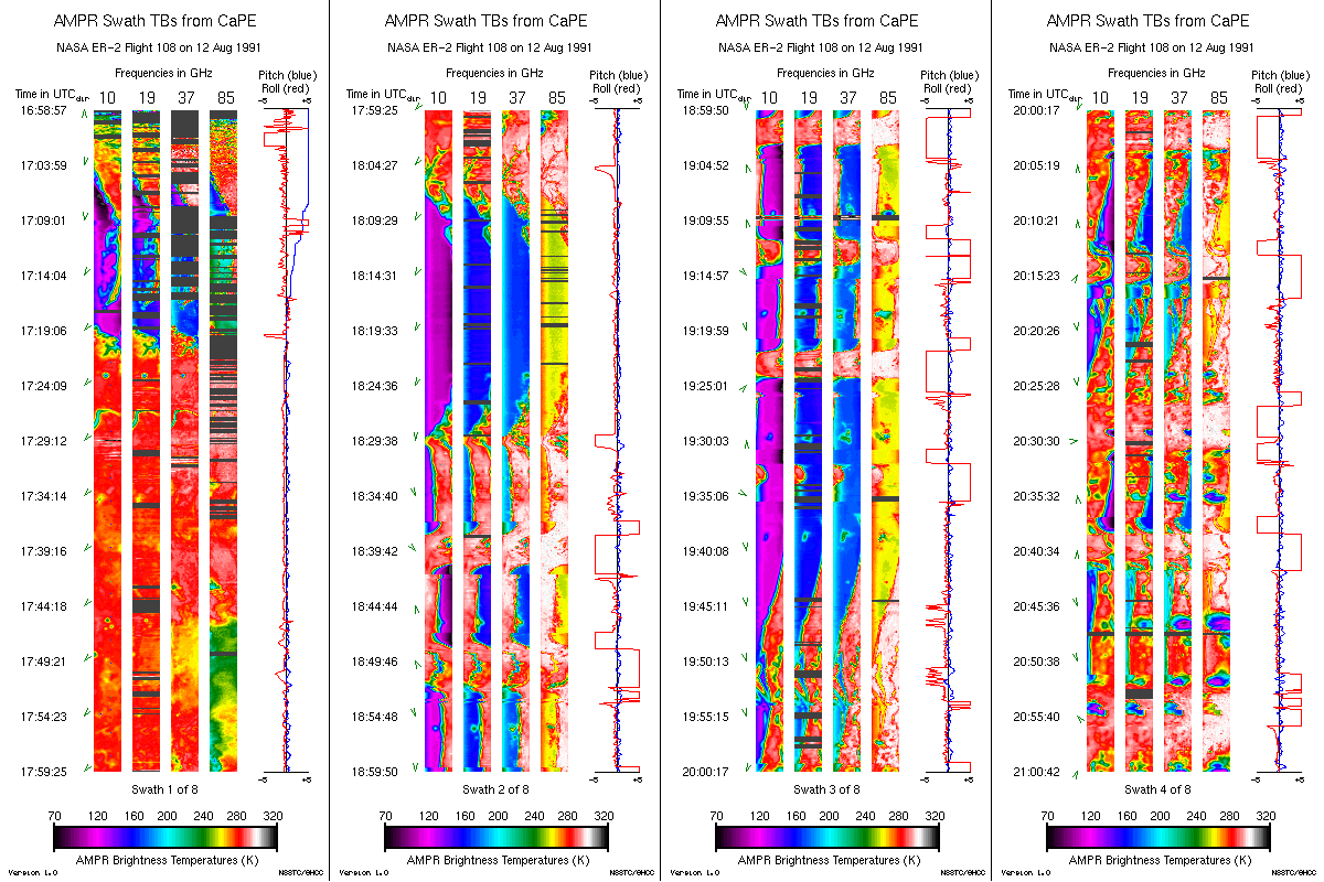
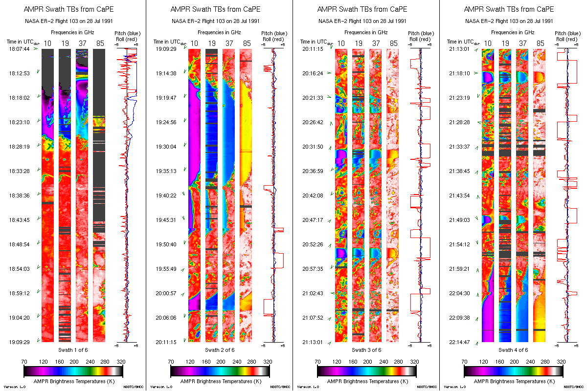
AMPR BRIGHTNESS TEMPERATURE CAPE EXPERIMENT V2
National Aeronautics and Space Administration —
The Advanced Microwave Precipitation Radiometer (AMPR) was deployed during the Convection and Precipitation/Electrification Experiment (CaPE). AMPR data werecollected...

Official websites use .gov
A
.gov website belongs to an official government
organization in the United States.
Secure .gov websites use HTTPS
A
lock (
) or https:// means you’ve safely connected to
the .gov website. Share sensitive information only on official,
secure websites.