

Get a related visualization
URL: https://daac.ornl.gov/ASCENDS/guides/ASCENDS_AVOCET_CA_NV_Feb_2016_Fig1.png
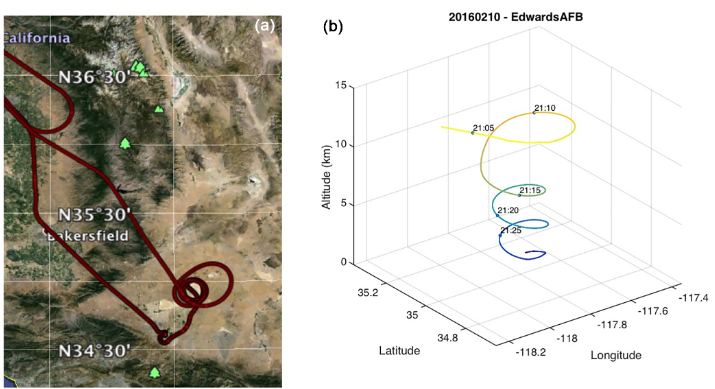
(a) Flight track for 10 February 2016 flight over Edwards AFB, California. (b) Time-tagged location and altitude plot for the spiral-down maneuver over Edwards AFB for the same flight (Abshire et al., 2018).
Source: ASCENDS: Active Sensing of CO2 With AVOCET, California and Nevada, 2016
About this Resource
| Last updated | unknown |
|---|---|
| Created | unknown |
| Name | Get a related visualization |
| Format | PNG Image File |
| License | License not specified |
| Created | 10 months ago |
| Media type | image/png |
| has views | True |
| id | f3763d1a-611a-4d40-a7b8-74f994fcccca |
| metadata modified | 10 months ago |
| package id | 70dfd363-8c7c-4edd-9af1-b2255b9fb329 |
| position | 8 |
| state | active |