
-
EMAG2: Earth Magnetic Anomaly Grid (2-arc-minute resolution)
EMAG2 is a global Earth Magnetic Anomaly Grid compiled from satellite, ship, and airborne magnetic measurements. It is a significant update of our previous candidate grid for... -
42012 - Orange Beach AL Buoy
GCOOS 52North Sensor Observation Service This station provides the following variables: Air pressure, Air temperature, Sea water temperature, Wind speed, Wind speed of gust,... -
H12829: NOS Hydrographic Survey , 2015-08-12
The National Oceanic and Atmospheric Administration (NOAA) has the statutory mandate to collect hydrographic data in support of nautical chart compilation for safe navigation... -
F00491: NOS Hydrographic Survey , Taunton River, Massachusetts, 2002-08-12
The National Oceanic and Atmospheric Administration (NOAA) has the statutory mandate to collect hydrographic data in support of nautical chart compilation for safe navigation... -
F00508: NOS Hydrographic Survey , Wildcat Knoll Mapping Project, Massachusetts, 2005-08-08
The National Oceanic and Atmospheric Administration (NOAA) has the statutory mandate to collect hydrographic data in support of nautical chart compilation for safe navigation... -
H12305: NOS Hydrographic Survey , Central Chesapeake Bay, 2013-12-10
The National Oceanic and Atmospheric Administration (NOAA) has the statutory mandate to collect hydrographic data in support of nautical chart compilation for safe navigation... -
SGOF1 - Tyndall AFB Tower C (N4), FL
GCOOS 52North Sensor Observation Service This station provides the following variables: Air pressure, Air temperature, Sea water temperature, Wind speed, Wind speed of gust,... -
H11801: NOS Hydrographic Survey , Oak Harbor to Saratoga Passage, Washington, 2009-02-18
The National Oceanic and Atmospheric Administration (NOAA) has the statutory mandate to collect hydrographic data in support of nautical chart compilation for safe navigation... -
Marco Polo - Green Canyon 608
GCOOS 52North Sensor Observation Service This station provides the following variables: Direction of sea water velocity, Sea water speed, Upward sea water velocity -
H13384: NOS Hydrographic Survey , 2021-03-10
The National Oceanic and Atmospheric Administration (NOAA) has the statutory mandate to collect hydrographic data in support of nautical chart compilation for safe navigation... -
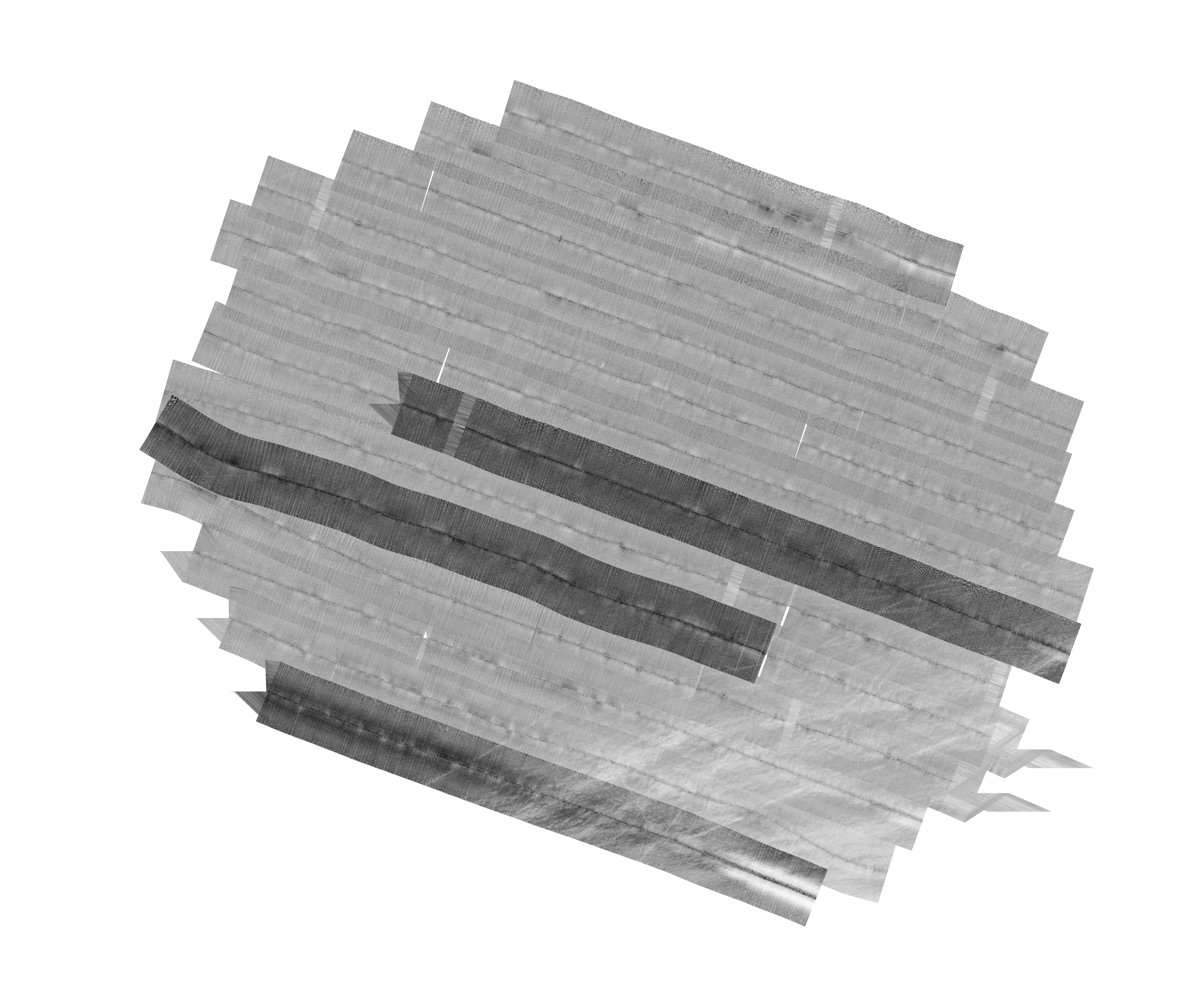
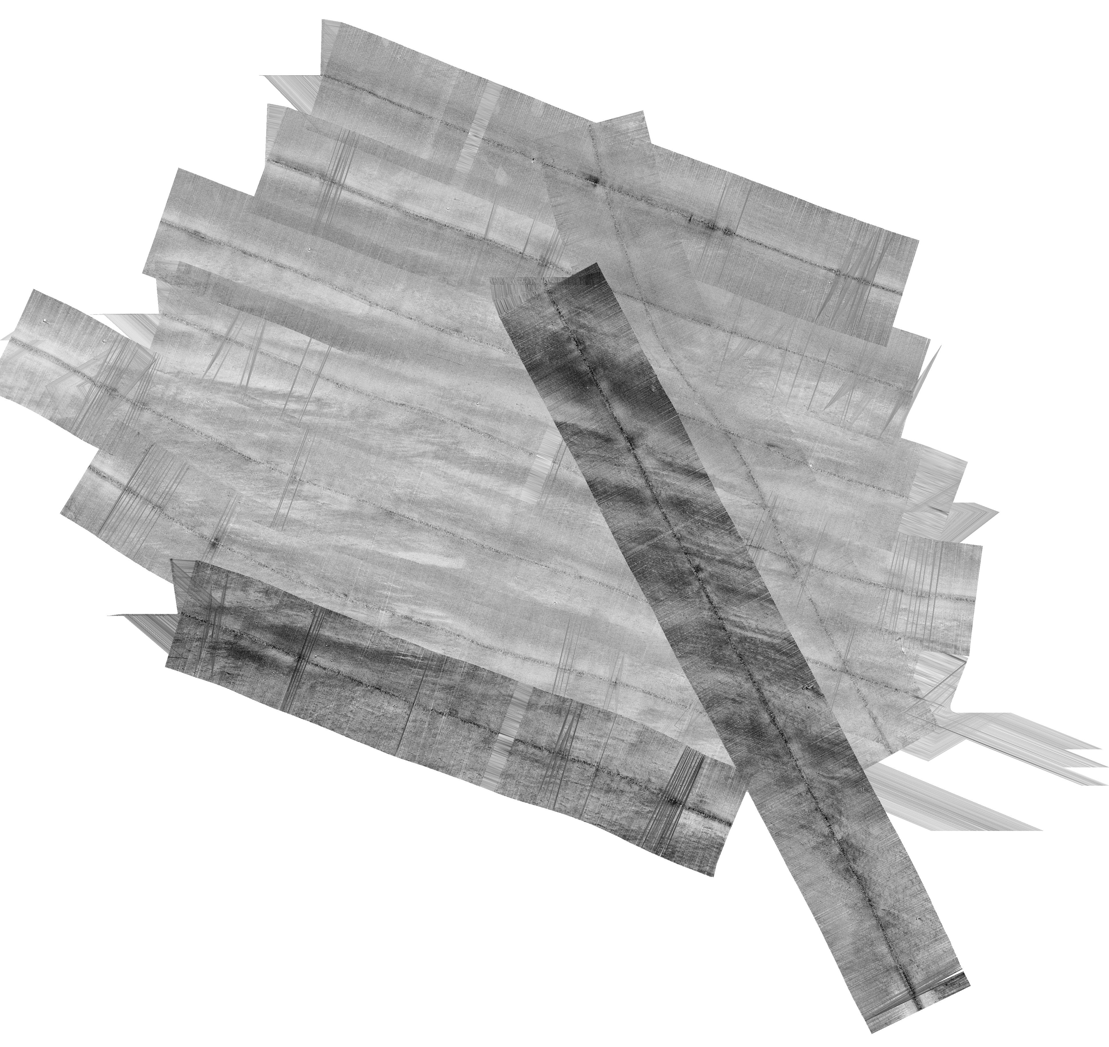
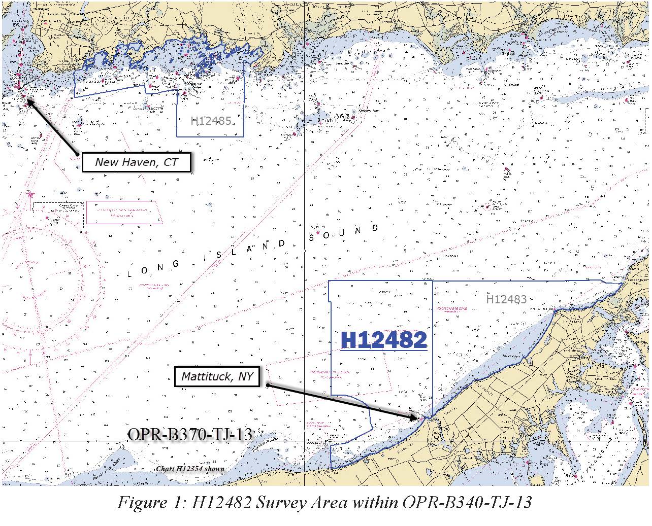
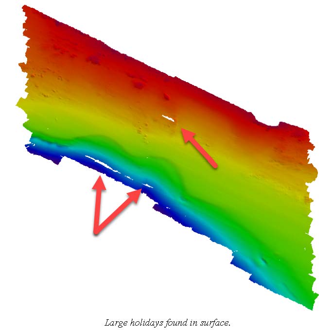
H12482: NOS Hydrographic Survey , Eastern Long Island Sound, 2013-04-20
The National Oceanic and Atmospheric Administration (NOAA) has the statutory mandate to collect hydrographic data in support of nautical chart compilation for safe navigation... -
H12084: NOS Hydrographic Survey , Southern Portion of Cook Inlet, Alaska, 2009-09-08
The National Oceanic and Atmospheric Administration (NOAA) has the statutory mandate to collect hydrographic data in support of nautical chart compilation for safe navigation... -
H12047: NOS Hydrographic Survey , Honolulu Harbor, Hawaii, 2009-05-03
The National Oceanic and Atmospheric Administration (NOAA) has the statutory mandate to collect hydrographic data in support of nautical chart compilation for safe navigation... -
F00337: NOS Hydrographic Survey , Safety Fairways, Gulf of Mexico, Louisiana and Texas, 1973-08-31
The National Oceanic and Atmospheric Administration (NOAA) has the statutory mandate to collect hydrographic data in support of nautical chart compilation for safe navigation... -
Shell Point, FL
GCOOS 52North Sensor Observation Service This station provides the following variables: Air pressure, Air temperature, Relative humidity, Sea surface height above sea level,... -
H12932: NOS Hydrographic Survey , 2016-11-08
The National Oceanic and Atmospheric Administration (NOAA) has the statutory mandate to collect hydrographic data in support of nautical chart compilation for safe navigation... -
H11147D: NOS Hydrographic Survey , Shumagin Islands, Alaska, 2003-08-29
The National Oceanic and Atmospheric Administration (NOAA) has the statutory mandate to collect hydrographic data in support of nautical chart compilation for safe navigation... -
W00461: NOS Hydrographic Survey , 2003-06-25
The National Oceanic and Atmospheric Administration (NOAA) has the statutory mandate to collect hydrographic data in support of nautical chart compilation for safe navigation... -
H11290: NOS Hydrographic Survey , Approaches to Atchafalaya River and Bay, Louisiana, 2005-07-31
The National Oceanic and Atmospheric Administration (NOAA) has the statutory mandate to collect hydrographic data in support of nautical chart compilation for safe navigation... -
H02249A: NOS Hydrographic Survey
The National Oceanic and Atmospheric Administration (NOAA) has the statutory mandate to collect hydrographic data in support of nautical chart compilation for safe navigation...

Official websites use .gov
A
.gov website belongs to an official government
organization in the United States.
Secure .gov websites use HTTPS
A
lock (
) or https:// means you’ve safely connected to
the .gov website. Share sensitive information only on official,
secure websites.
.jpg)
.jpg)
.jpg)
.jpg)
.jpg)