
-
NOAA Electronic Navigational Charts (ENC) NGDA
The Office of Coast Survey (OCS) has been involved in the development of a NOAA Electronic Navigational Chart (NOAA ENC) suite to support the marine transportation... -
USGS 10-m Digital Elevation Model (DEM): Hawaii: Big Island: Hillshade
A 10-meter resolution land surface digital elevation model (DEM) grayscale hillshade for Big Island in Hawaii derived from United States Geological Survey (USGS) 1/3 arc-second... -
USGS 10-m Digital Elevation Model (DEM): Hawaii: Oahu: Hillshade
A 10-meter resolution land surface digital elevation model (DEM) grayscale hillshade for the island of Oahu in Hawaii derived from United States Geological Survey (USGS) 1/3... -
Marine Mammals and Sea Turtles data for the Deepwater Horizon Response and Assessment in the Gulf of Mexico, dating from 2001-06-19 to 2016-02-16
These Marine Mammals and Sea Turtles data were gathered and utilized during the Response and Assessment phases of the Deepwater Horizon oil spill in the Gulf of Mexico. These... -
USGS 10-m Digital Elevation Model (DEM): Hawaii: Maui: Hillshade
A 10-meter resolution land surface digital elevation model (DEM) grayscale hillshade for the island of Maui in Hawaii derived from United States Geological Survey (USGS) 1/3... -
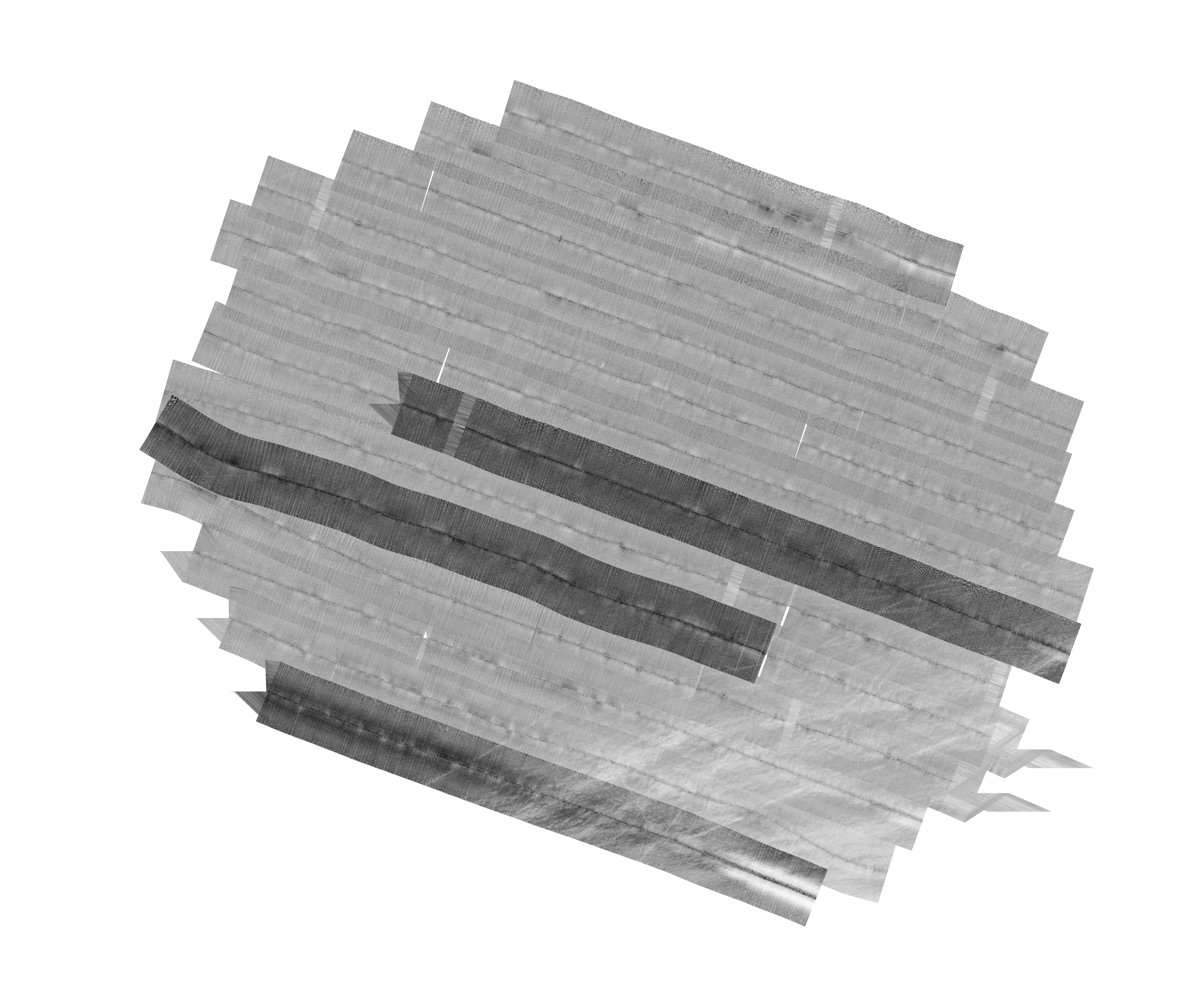
H13992: NOS Hydrographic Survey , 2025-03-14
The National Oceanic and Atmospheric Administration (NOAA) has the statutory mandate to collect hydrographic data in support of nautical chart compilation for safe navigation... -
Vegetation - Guam
Vegetation (USFS) of Guam, Mariana Islands. -
Water Level Data from Pacific Tsunami Warning Center Tide Gauges in Hawaii
The Pacific Tsunami Warning Center (PTWC) of the National Weather Service (NWS), an organizational element of NOAA, operates and maintains a network of approximately 12 coastal... -
Soil Types - Guam
Natural Resources Conservation Service (NRCS) soil types of Guam, Mariana Islands. -
F00491: NOS Hydrographic Survey , Taunton River, Massachusetts, 2002-08-12
The National Oceanic and Atmospheric Administration (NOAA) has the statutory mandate to collect hydrographic data in support of nautical chart compilation for safe navigation... -
USGS 10-m Digital Elevation Model (DEM): CNMI: Saipan: Hillshade
A 10-meter resolution land surface digital elevation model (DEM) grayscale hillshade for the island of Saipan in the Commonwealth of the Northern Mariana Islands (CNMI) derived... -
H12829: NOS Hydrographic Survey , 2015-08-12
The National Oceanic and Atmospheric Administration (NOAA) has the statutory mandate to collect hydrographic data in support of nautical chart compilation for safe navigation... -
Marine Fish data for the Deepwater Horizon Response and Assessment in the Gulf of Mexico, dating from 2010-04-30 to 2015-04-24
These Marine Fish data were gathered and utilized during the Response and Assessment phases of the Deepwater Horizon oil spill in the Gulf of Mexico. These data are for the... -
EX2206: Voyage to the Ridge 3 (ROV and Mapping)
From August 6 - September 2, 2022 (Horta, Faial, Azores to San Juan, Puerto Rico) NOAA Ocean Exploration completed the Voyage to the Ridge 3 expedition (EX-22-06), a combined... -
H12305: NOS Hydrographic Survey , Central Chesapeake Bay, 2013-12-10
The National Oceanic and Atmospheric Administration (NOAA) has the statutory mandate to collect hydrographic data in support of nautical chart compilation for safe navigation... -
Municipal Boundaries - Guam
Municipal boundaries of Guam, Mariana Islands. -
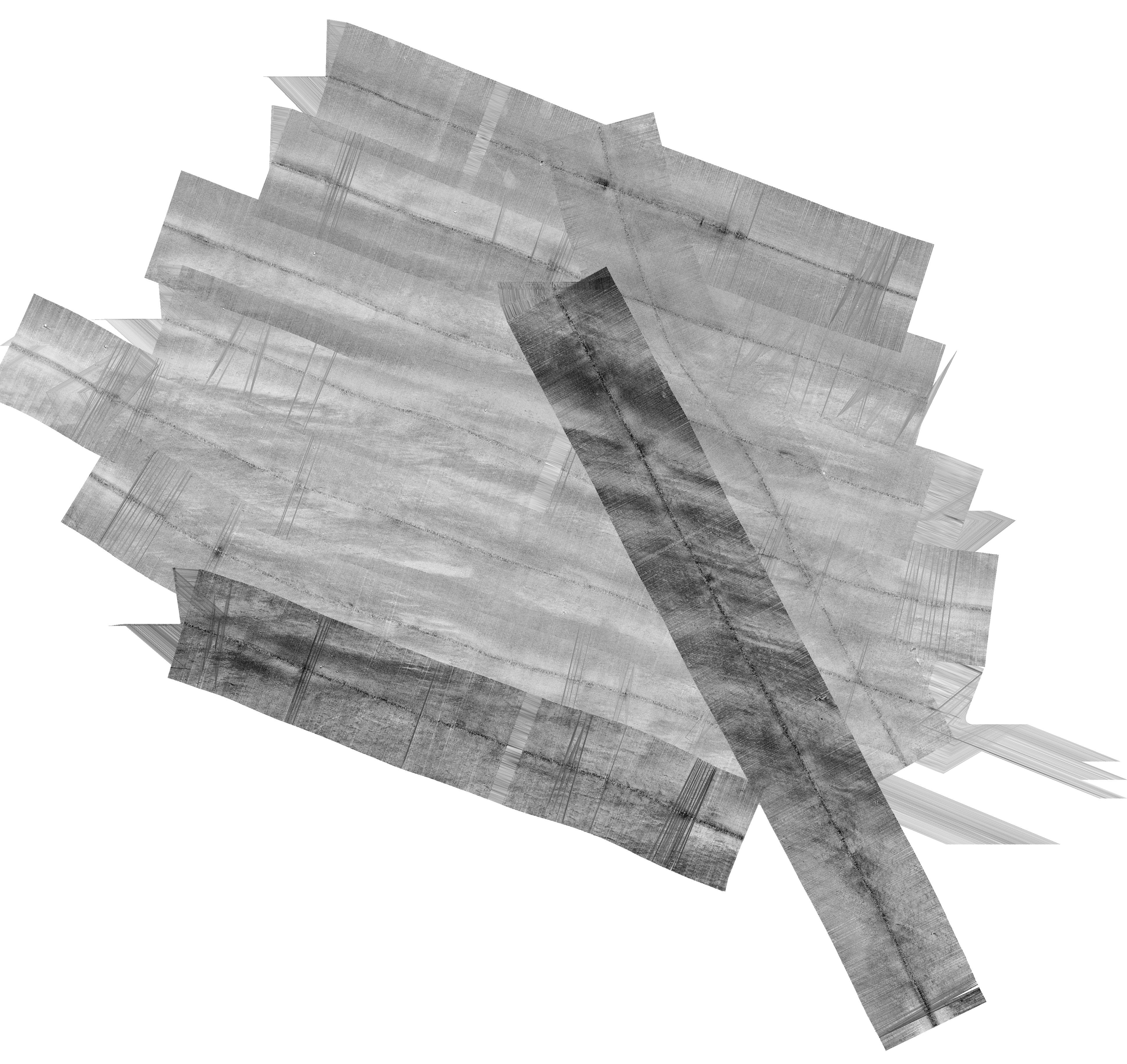
H13995: NOS Hydrographic Survey , 2025-03-15
The National Oceanic and Atmospheric Administration (NOAA) has the statutory mandate to collect hydrographic data in support of nautical chart compilation for safe navigation... -
H02609: NOS Hydrographic Survey , 1902-12-31
The National Oceanic and Atmospheric Administration (NOAA) has the statutory mandate to collect hydrographic data in support of nautical chart compilation for safe navigation... -
Geology - Guam
Geology of Guam, Mariana Islands -
F00508: NOS Hydrographic Survey , Wildcat Knoll Mapping Project, Massachusetts, 2005-08-08
The National Oceanic and Atmospheric Administration (NOAA) has the statutory mandate to collect hydrographic data in support of nautical chart compilation for safe navigation...

Official websites use .gov
A
.gov website belongs to an official government
organization in the United States.
Secure .gov websites use HTTPS
A
lock (
) or https:// means you’ve safely connected to
the .gov website. Share sensitive information only on official,
secure websites.
.jpg)