
-
Black Sea High Resolution SST L4 Analysis 0.0625 deg Resolution NGDA recent views
CNR MED Sea Surface Temperature provides daily gap-free maps (L4) at 0.0625 deg. x 0.0625 deg. horizontal resolution over the Black Sea. The data are obtained from infra-red... -
GHRSST NOAA/STAR GOES-17 ABI L3C America Region SST v2.71 dataset in GDS2 recent views
The ACSPO G17/ABI L3C (Level 3 Collated) product is a gridded version of the ACSPO G17/ABI L2P product available at https://podaac.jpl.nasa.gov/dataset/ABI_G17-STAR-L2P-v2.71.... -
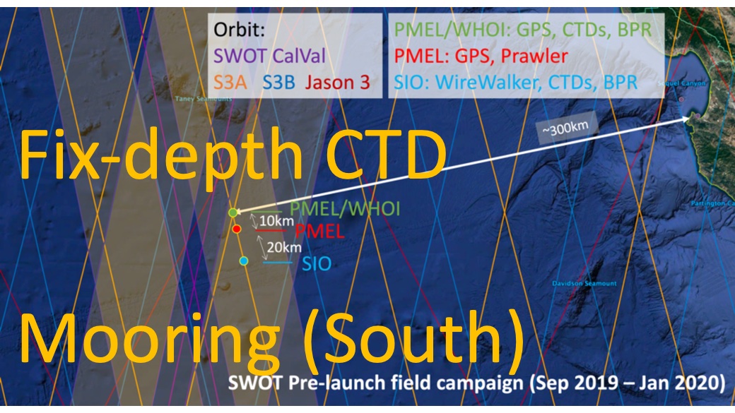
SWOT 2019-2020 Prelaunch Oceanography Field Campaign SIO Moored Fixed-Depth CTDs recent views
This dataset provides the conductivity, temperature and depth (CTD) measurements from the fixed-depth CTD sensors mounted on a full-depth mooring deployed by the SWOT prelaunch... -
GHRSST NOAA/STAR Metop-A AVHRR FRAC ACSPO v2.80 1km L2P Dataset (GDS v2) recent views
The MetOp First Generation (FG) is a European multi-satellite program jointly established by ESA and EUMETSAT, comprising three satellites, MetOp-A, -B and -C. The primary... -
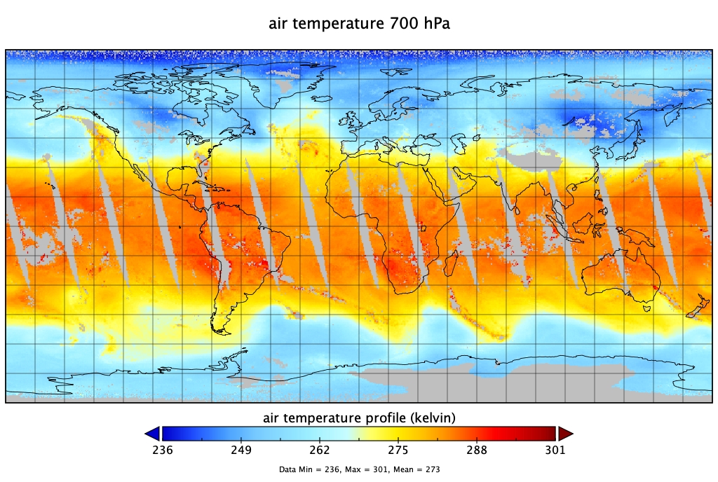
Sounder SIPS: Suomi NPP CrIMSS Level 3 Specific Quality Control Gridded Daily SiFSAP V2 (SNDRSNIML3SDSFSP) at GES DISC recent views
The SIFSAP (Single Field-of-View Sounder Atmospheric Products) algorithm provides retrieval for each sounder Field of View (FOV), therefore, it has 3-times higher horizontal... -
MODIS Terra Level 3 SST MID-IR Daily 9km Nighttime V2019.0 NGDA recent views
Day and night spatially gridded (L3) global NASA skin sea surface temperature (SST) products from the Moderate-resolution Imaging Spectroradiometer (MODIS) onboard the Terra... -
CYGNSS Level 2 Ocean Surface Heat Flux Climate Data Record Version 1.1 recent views
This dataset contains the first release, Version 1.1, of the CYGNSS Level 2 Ocean Surface Heat Flux Climate Data Record (CDR), which provides the time-tagged and geolocated... -
GRIP HURRICANE IMAGING RADIOMETER (HIRAD) V1 recent views
The GRIP Hurricane Imaging Radiometer (HIRAD) V1 dataset contains measurements of brightness temperature taken at 4, 5, 6 and 6.6 GHz, as well as MERRA 2 m wind speed data and... -
GHRSST NOAA/STAR Metop-C AVHRR FRAC ACSPO v2.80 0.02 L3U Dataset (GDS v2) recent views
This L3U (Level 3 Uncollated) dataset contains global daily Sea Surface Temperature (SST) on a 0.02 degree grid resolution. It is produced by the National Oceanic and... -
MODIS Aqua Level 3 SST MID-IR Daily 4km Nighttime V2019.0 NGDA recent views
Day and night spatially gridded (L3) global NASA skin sea surface temperature (SST) products from the Moderate-resolution Imaging Spectroradiometer (MODIS) onboard the Aqua... -
MODIS Aqua Level 3 SST MID-IR Monthly 4km Nighttime V2019.0 NGDA recent views
Day and night spatially gridded (L3) global NASA skin sea surface temperature (SST) products from the Moderate-resolution Imaging Spectroradiometer (MODIS) onboard the Aqua... -
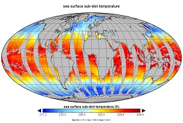
GHRSST Level 2P Global Subskin Sea Surface Temperature from the Advanced Scanning Microwave Radiometer - Earth Observing System (AMSR-E) on the NASA Aqua Satellite recent views
The Advanced Microwave Scanning Radiometer (AMSR-E) was launched on 4 May 2002, aboard NASA's Aqua spacecraft. The National Space Development Agency of Japan (NASDA) provided... -
GHRSST NOAA/STAR GOES-16 ABI L3C America Region SST v2.70 dataset in GDS2 recent views
The ACSPO G16/ABI L3C (Level 3 Collated) product is a gridded version of the ACSPO G16/ABI L2P product available at https://podaac.jpl.nasa.gov/dataset/ABI_G16-STAR-L2P-v2.70.... -
GHRSST Level 3U Global Near-Real-Time Subskin Sea Surface Temperature version 8a from the Advanced Microwave Scanning Radiometer 2 on the GCOM-W satellite recent views
GDS2 Version -The Advanced Microwave Scanning Radiometer 2 (AMSR2) was launched on 18 May 2012, onboard the Golbal Change Observation Mission - Water (GCOM-W) satellite... -
MODIS Aqua Level 3 SST Thermal IR Annual 4km Nighttime V2019.0 NGDA recent views
Day and night spatially gridded (L3) global NASA skin sea surface temperature (SST) products from the Moderate-resolution Imaging Spectroradiometer (MODIS) onboard the Aqua... -
Aquarius Official Release Level 3 Ancillary Reynolds Sea Surface Temperature Standard Mapped Image Descending Seasonal Data V5.0 recent views
Aquarius Level 3 ancillary sea surface temperature (SST) standard mapped image data are the ancillary SST data used in the Aquarius calibration for salinity retrieval. They are... -
MODIS Aqua Level 3 SST Thermal IR 8 Day 4km Daytime V2019.0 NGDA recent views
Day and night spatially gridded (L3) global NASA skin sea surface temperature (SST) products from the Moderate-resolution Imaging Spectroradiometer (MODIS) onboard the Aqua... -
Aquarius Official Release Level 3 Ancillary Reynolds Sea Surface Temperature Standard Mapped Image Descending Mission Cumulative Data V5.0 recent views
Aquarius Level 3 ancillary sea surface temperature (SST) standard mapped image data are the ancillary SST data used in the Aquarius calibration for salinity retrieval. They are... -
GHRSST Level 3C North Atlantic Regional (NAR) subskin Sea Surface Temperature from Metop/AVHRR (GDS V2) produced by OSI SAF recent views
A Group for High Resolution Sea Surface Temperature (GHRSST) dataset for the North Atlantic Region (NAR) derived from the Advanced Very High Resolution Radiometer (AVHRR) on the... -
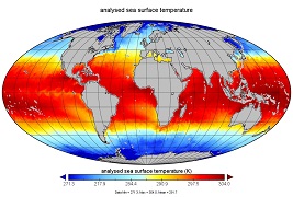
GHRSST Level 4 MW_OI Global Foundation Sea Surface Temperature analysis version 5.1 from REMSS recent views
A Group for High Resolution Sea Surface Temperature (GHRSST) global Level 4 sea surface temperature analysis produced daily on a 0.25-degree grid at Remote Sensing Systems. This...

Official websites use .gov
A
.gov website belongs to an official government
organization in the United States.
Secure .gov websites use HTTPS
A
lock (
) or https:// means you’ve safely connected to
the .gov website. Share sensitive information only on official,
secure websites.