
-
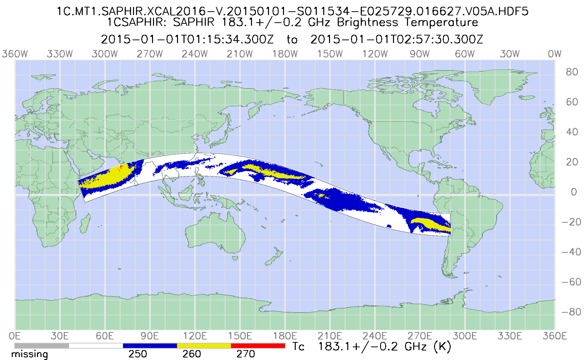
GPM SAPHIR on MT1 Common Calibrated Brightness Temperature L1C 1.5 hours 10 km V07 (GPM_1CMT1SAPHIR) at GES DISC recent views
Version 07 is the current version of the data set. Older versions will no longer be available and have been superseded by Version 07. 1CAMSR2 contains common calibrated... -
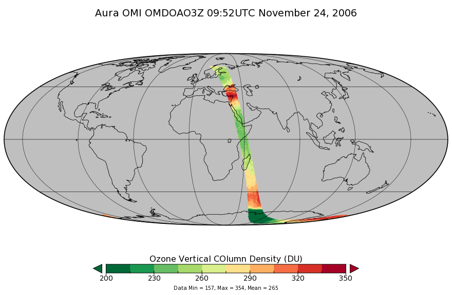
OMI/Aura DOAS Total Column Ozone Zoomed 1-Orbit L2 Swath 13x12km V003 (OMDOAO3Z) at GES DISC recent views
The reprocessed Aura Ozone Monitoring Instrument (OMI) Level-2 Zoomed Ozone data product OMDOAO3Z at 13x12 km resolution is now available from the NASA Goddard Earth Sciences... -
FLDAS Noah Land Surface Model L4 Global Monthly Anomaly 0.1 x 0.1 degree (MERRA-2 and CHIRPS) V001 (FLDAS_NOAH01_C_GL_MA) at GES DISC recent views
The monthly anomaly data set contains a series of land surface parameters simulated from the Noah 3.6.1 model in the Famine Early Warning Systems Network (FEWS NET) Land Data... -
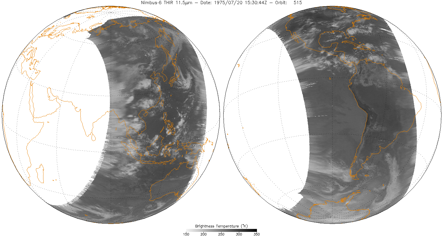
THIR/Nimbus-6 Level 1 Meteorological Radiation Data at 11.5 microns V001 (THIRN6L1CH115) at GES DISC recent views
THIRN6L1CH115 is the Nimbus-6 Temperature-Humidity Infrared Radiometer (THIR) Level 1 Meteorological Radiation Data at 11.5 microns product and contains radiances expressed in... -
GOZCARDS Source Ozone 1 month L3 10 degree Zonal Means on a Vertical Pressure Grid V1 (GozSmlpO3) at GES DISC recent views
The GOZCARDS Source Data for Ozone 1 month L3 10 degree Zonal Averages on a Vertical Pressure Grid product (GozSmlpO3) contains zonal means and related information (standard... -
TROPESS OMI-Aura L2 Ozone for Forward Stream, Standard Product V1 (TRPSDL2O3OMIFS) at GES DISC recent views
The TROPESS OMI-Aura L2 Ozone for Forward Stream, Standard Product contains the vertical distribution of the retrieved atmospheric state of ozone (O3), formal uncertainties, and... -
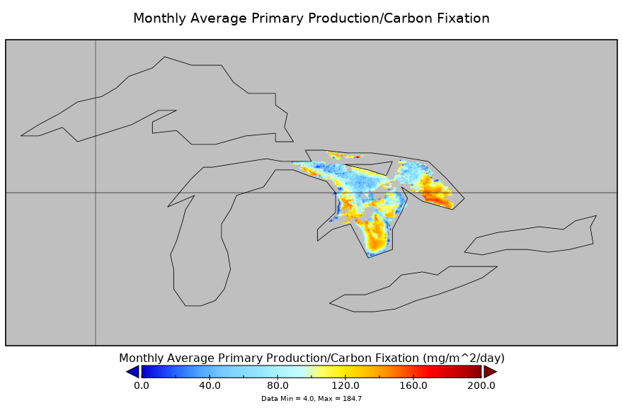
Carbon Monitoring System Lake Huron Primary Production Monthly V1 (CMSLakeHuronPPM) at GES DISC NGDA recent views
Monthly Average primary production/carbon fixation data for Lake Huron. The primary production data is derived using MODIS imagery with model data. The NASA Carbon Monitoring... -
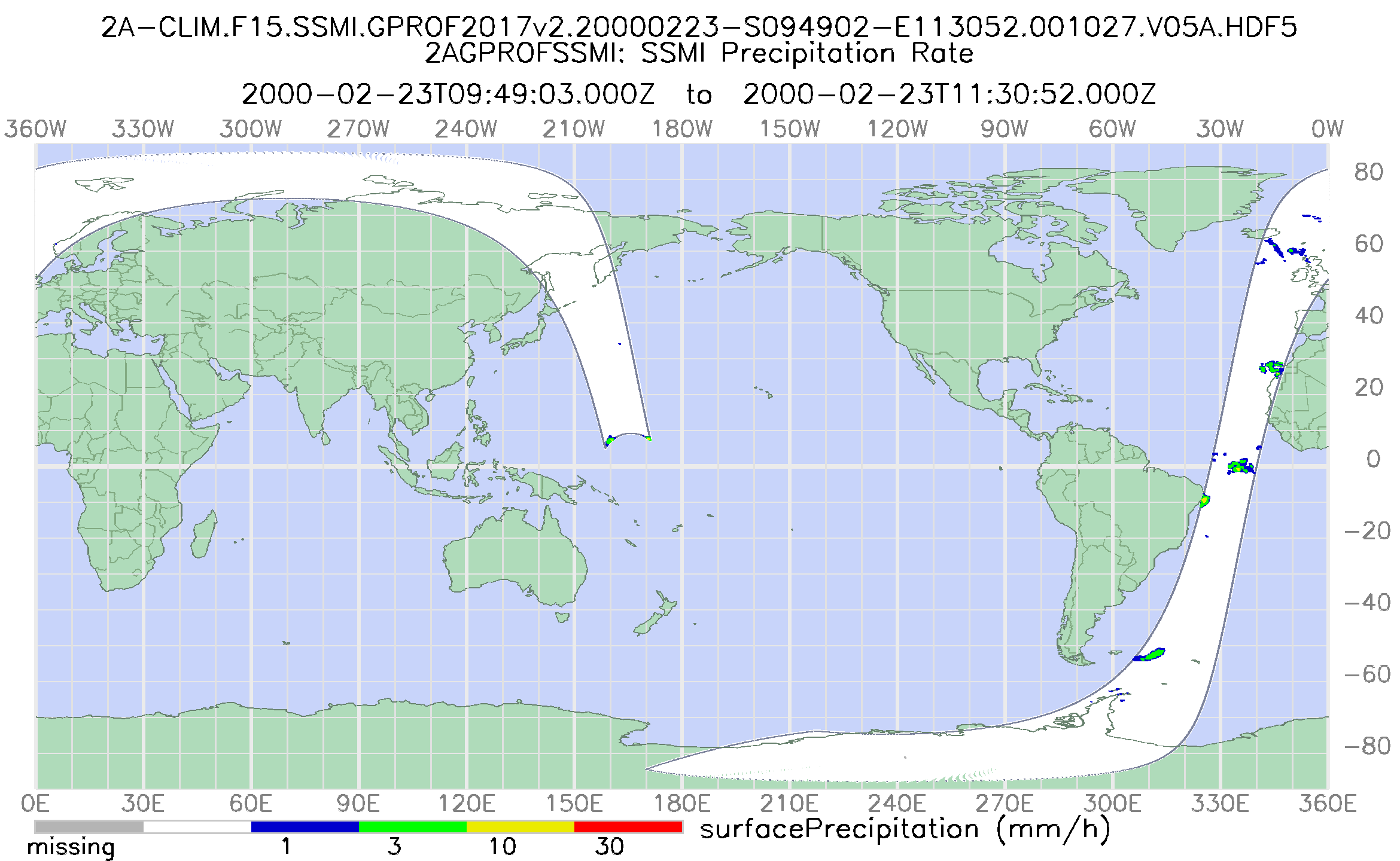
GPM SSM/I on F15 (GPROF) Climate-based Radiometer Precipitation Profiling L2 1.5 hours 12 km V07 (GPM_2AGPROFF15SSMI_CLIM) at GES DISC recent views
Version 07 is the current version of the data set. Older versions will no longer be available and have been superseded by Version 07. The 'CLIM' products differ from their... -
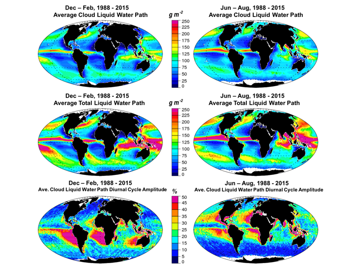
Multisensor Advanced Climatology Total Liquid Water Path L3 Monthly 1 degree x 1 degree V1 (MACTWP_mean) at GES DISC recent views
The Multi-Sensor Advanced Climatology of Liquid Water Path (MAC-LWP) data set contains monthly 1.0-degree ocean-only estimates of cloud liquid water path (MACLWP_mean), total... -
GPM ATMS on NOAA-21 (GPROF) Climate-based Radiometer Precipitation Profiling L2A 1.5 hours 17 km V07 (GPM_2AGPROFNOAA21ATMS_CLIM) at GES DISC recent views
Version 07 is the current version of the data set. The "CLIM" products differ from their "regular" counterparts (without the "CLIM" in the name) by the ancillary data they use.... -
MLS/Aura Level 3 Daily Binned Nitrous Oxide (N2O) Mixing Ratio on Zonal and Similar Grids V005 (ML3DZN2O) at GES DISC recent views
ML3DZN2O is the EOS Aura Microwave Limb Sounder (MLS) daily binned on zonal and assorted vertical grids product for nitrous oxide (N2O) derived from radiances measured primarily... -
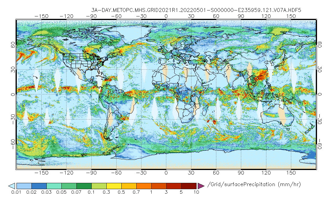
GPM MHS on METOP-C (GPROF) Radiometer Precipitation Profiling L3 1 day 0.25 degree x 0.25 degree V07 (GPM_3GPROFMETOPCMHS_DAY) at GES DISC recent views
Version 07 is the current version of the data set. 3GPROF products provide global gridded monthly/daily precipitation averages from multiple satellites that can be used for... -
NASA MEASURES Precipitation Ensemble based on SSM/I DMSP F13 NASA PPS L1C V06 Tbs 1-orbit L2 Swath 12x12km V1 (PRECIP_SSMI_F13) at GES DISC recent views
The data presented in this level 2 orbital product are rain rate estimates expressed as mm/hour determined from brightness temperatures (Tbs) obtained from the Special Sensor... -
GPM ATMS on NOAA-21 (GPROF) Climate-based Radiometer Precipitation Profiling L3 1 month 0.25 degree x 0.25 degree V07 (GPM_3GPROFNOAA21ATMS_CLIM) at GES DISC recent views
Version 07 is the current version of the data set. Older versions are no longer available and have been superseded by Version 07. The "CLIM" products differ from their "regular"... -
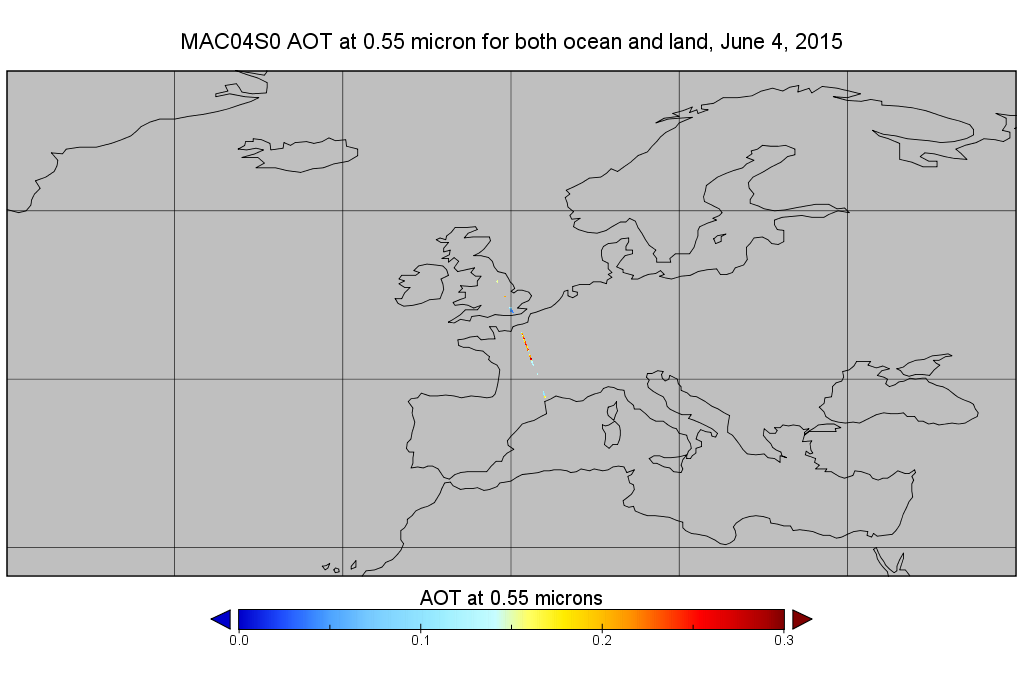
MODIS/Aqua Aerosol 10km 5-Min L2 Narrow Swath Subset along CloudSat V002 (MAC04S0) at GES DISC NGDA recent views
This is the narrow-swath MODIS/Aqua subset along CloudSat field of view track. The goal of the narrow-swath subset is to select and return MODIS data that are within +-5 km... -
TROPESS CrIS-SNPP L2 for Beijing Megacity, Summary Product V1 (TRPSYL2ALLCRSMGBEI) at GES DISC recent views
The TROPESS CrIS-SNPP L2 for Beijing Megacity, Summary Product contains the vertical distribution of six retrieved atmospheric gases (CH4, CO, HDO, NH3, O3 and PAN), along with... -
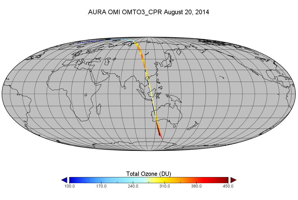
OMI/Aura Level 2 Ozone (O3) Total Column 1-Orbit Subset and Collocated Swath along CloudSat track 200-km wide at 13x24 km2 resolution recent views
This is a CloudSat-collocated subset of the original product OMTO3, for the purposes of the A-Train mission. The goal of the subset is to select and return OMI data that are... -
WindSat/Coriolis surface soil moisture (LPRM) L2 V001 (LPRM_WINDSAT_SOILM2) at GES DISC recent views
WindSat/Coriolis surface soil moisture (LPRM) L2 V001 is a Level 2 (swath) data set. Its land surface parameters, surface soil moisture, land surface (skin) temperature, and... -
MLS/Aura Level 2 Ozone (O3) Mixing Ratio V004 (ML2O3) at GES DISC recent views
ML2O3 is the EOS Aura Microwave Limb Sounder (MLS) standard product for ozone derived from radiances measured by the 240 GHz radiometer. The data version is 4.2. Spatial... -
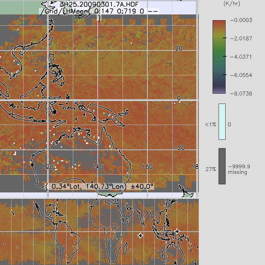
TRMM Precipitation Radar Spectral Latent Heating L3 1 month 0.5 degree x 0.5 degree V7 (TRMM_3H25) at GES DISC recent views
3H25, "Monthly Spectral Latent Heating", produces 0.5 degree x 0.5 degree latent heating, Q1-QR, and Q2 profiles from PR rain

Official websites use .gov
A
.gov website belongs to an official government
organization in the United States.
Secure .gov websites use HTTPS
A
lock (
) or https:// means you’ve safely connected to
the .gov website. Share sensitive information only on official,
secure websites.