
-
U.S. Social Vulnerability Index Grids, Revision 01
The U.S. Social Vulnerability Index Grids, Revision 01 data set contains gridded layers for the overall Centers for Disease Control and Prevention (CDC) Social Vulnerability... -
MEaSUREs Greenland Ice Mapping Project (GrIMP) Digital Elevation Model from GeoEye and WorldView Imagery V002
This data set consists of an enhanced resolution digital elevation model (DEM) for the Greenland Ice Sheet, derived from sub-meter resolution, panchromatic stereoscopic imagery... -
MODIS/Terra+Aqua Land Cover Type Yearly L3 Global 500m SIN Grid V061
The Terra and Aqua combined Moderate Resolution Imaging Spectroradiometer (MODIS) Land Cover Type (MCD12Q1) Version 6.1 data product provides global land cover types at yearly... -
Catalog of Gamma-Ray Bursts
This GRBs Catalog (GRBCAT) records high level information of the GRBs detected since their discovery in 1967. The catalog has been created using publications that report lists... -
Fermi LAT 14-Year Point Source Catalog (4FGL-DR4)
The Fermi Point Source Catalog (4FGL) is a catalog of high-energy gamma-ray sources detected by the Large Area Telescope (LAT) on the Fermi Gamma-ray Space Telescope. The... -
SDG Indicator 11.2.1: Urban Access to Public Transport, 2023 Release
The SDG Indicator 11.2.1: Urban Access to Public Transport, 2023 Release, part of the SDGI collection, measures the proportion of the population in a city that has convenient... -
Global Population Density Grid Time Series Estimates
The Global Population Density Grid Time Series Estimates provide a back-cast time series of population density grids based on the year 2000 population grid from SEDAC's Global... -
Last of the Wild Project, Version 2, 2005 (LWP-2): Global Human Influence Index (HII) Dataset (Geographic)
The Global Human Influence Index Dataset of the Last of the Wild Project, Version 2, 2005 (LWP-2) is a global dataset of 1-kilometer grid cells, created from nine global data... -
VIIRS/NPP Thermal Anomalies/Fire 6-Min L2 Swath 750m V002
The Visible Infrared Imaging Radiometer Suite (VIIRS) Thermal Anomalies (VNP14) Version 2 product is produced in 6-minute temporal satellite increments (swaths) at 750 meter... -
Potential Impacts of Climate Change on World Food Supply: Datasets from a Major Crop Modeling Study
The Potential Impacts of Climate Change on World Food Supply: Datasets from a Major Crop Modeling Study contain projected country and regional changes in grain crop yields due... -
Sentinel-5P TROPOMI Tropospheric NO2 1-Orbit L2 7km x 3.5km V1 (S5P_L2__NO2___) at GES DISC
Starting from August 6th in 2019, Sentinel-5P TROPOMI along-track high spatial resolution (~5.5km at nadir) has been implemented. For data after August 6th of 2019, please check... -
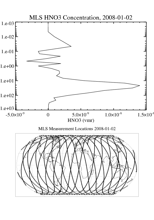
MLS/Aura Level 2 Sulfur Dioxide (SO2) Mixing Ratio V005 (ML2SO2) at GES DISC
ML2SO2 is the EOS Aura Microwave Limb Sounder (MLS) standard product for sulfur dioxide derived from radiances measured by the 240 GHz radiometer. The data version is 5.0.... -
Global Volcano Hazard Frequency and Distribution
Global Volcano Hazard Frequency and Distribution is a 2.5 minute gridded data set based upon the National Geophysical Data Center (NGDC) Volcano Database spanning the period of... -
GEOS-Carb CASA-GFED Daily Fire and Fuel Emissions 0.5 degree x 0.5 degree V3 (GEOS_CASAGFED_D_FIRE) at GES DISC
This product provides Daily average wildfire emissions (FIRE) andfuel wood burning emissions (FUEL) derived from the Carnegie-Ames-Stanford-Approach – Global Fire Emissions... -
USGS Digital Orthophoto Quadrangles
A Digital Orthophoto Quadrangle (DOQ) is a computer-generated image of an aerial photograph in which the image displacement caused by terrain relief and camera tilt has been... -
Milky Way Star Clusters Catalog
Although they are the main constituents of the Galactic disk population, for half of the open clusters in the Milky Way reported in the literature nothing is known except the... -
Landsat Level-2 Surface Reflectance Collection 2
Landsat Level-2 Surface Reflectance Collection 2 products contain atmospherically corrected spectral reflectance data derived from Level-1 products and are available for the... -
Ground-Based Global Navigation Satellite System (GNSS) Quasi-Zenith Satellite System (QZSS) Broadcast Ephemeris Data (30-second sampling, hourly files) from NASA CDDIS
This dataset consists of ground-based Global Navigation Satellite System (GNSS) Quasi-Zenith Satellite System (QZSS) Broadcast Ephemeris Data (hourly files) from the NASA...

Official websites use .gov
A
.gov website belongs to an official government
organization in the United States.
Secure .gov websites use HTTPS
A
lock (
) or https:// means you’ve safely connected to
the .gov website. Share sensitive information only on official,
secure websites.