
-
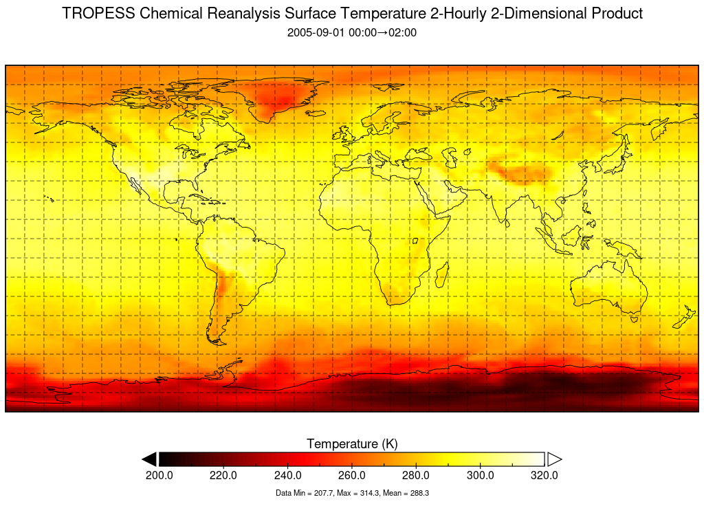
TROPESS Chemical Reanalysis Surface Temperature 2-Hourly 2-dimensional Product V1 (TRPSCRT2H2D) at GES DISC recent views
The TROPESS Chemical Reanalysis Surface Temperature 2-Hourly 2-dimensional Product contains surface temperature values, a meteorological field. The data are part of the... -
MERRA-2 tavg3_3d_rad_Np: 3d,3-Hourly,Time-Averaged,Pressure-Level,Assimilation,Radiation Diagnostics 0.625 x 0.5 degree V5.12.4 (M2T3NPRAD) at GES DISC recent views
M2T3NPRAD (or tavg3_3d_rad_Np) is a 3-dimensional 3-hourly time averaged data collection in Modern-Era Retrospective analysis for Research and Applications version 2 (MERRA-2).... -
GEOS-Carb CASA-GFED Monthly Fire Fuel NPP Rh NEE Fluxes 0.5 degree x 0.5 degree V2 (GEOS_CASAGFED_M_FLUX) at GES DISC recent views
This product provides Monthly average Net Primary Production (NPP), heterotrophic respiration (Rh), wildfire emissions (FIRE), and fuel wood burning emissions (FUEL) derived... -
OCO-2 Level 2 bias-corrected XCO2 and other select fields from the full-physics retrieval aggregated as daily files, Retrospective processing V11.1r (OCO2_L2_Lite_FP) at GES DISC recent views
Version 11r is the current version of the data set. Older versions will no longer be available and are superseded by Version 11r. The OCO-2 Lite files contain bias-corrected... -
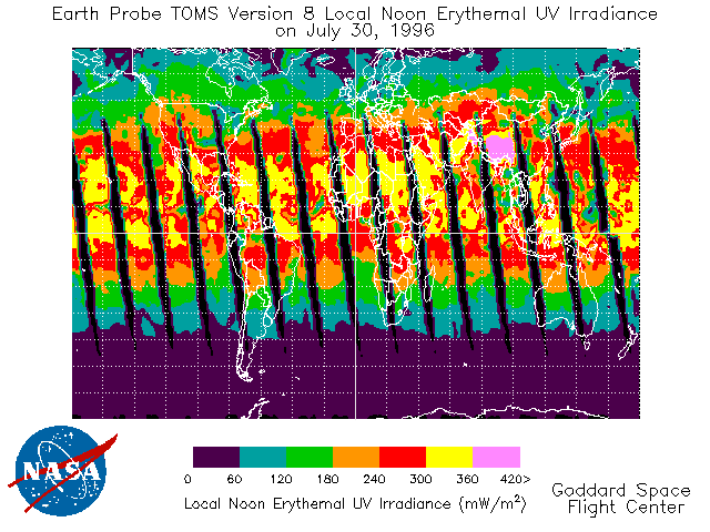
TOMS Earth Probe UV-B Erythemal Local Noon Irradiance Daily L3 Global 1 deg x 1.25 deg Lat/Lon Grid V008 (TOMSEPL3dery) at GES DISC recent views
This Earth Probe (EP) Total Ozone Mapping Spectrometer (TOMS) version 8 daily global gridded data product contains UV-B erythemal local noon irradiance values. The data are... -
HIRDLS/Aura Level 3 Dinitrogen Pentoxide (N2O5) 1deg Lat Zonal Fourier Coefficients V007 (H3ZFCN2O5) at GES DISC recent views
The "HIRDLS/Aura Level 3 Dinitrogen Pentoxide (N2O5) Zonal Fourier Coefficients" version 7 data product (H3ZFCN2O) contains the entire mission (~3 years) of HIRDLS data... -
MLS/Aura Level 3 Daily Binned Relative Humidity With Respect To Ice (RHI) on Zonal and Similar Grids V005 (ML3DZRHI) at GES DISC recent views
ML3DZRHI is the EOS Aura Microwave Limb Sounder (MLS) daily binned on zonal and assorted vertical grids product for relative humidity with respect to ice (RHI) derived from... -
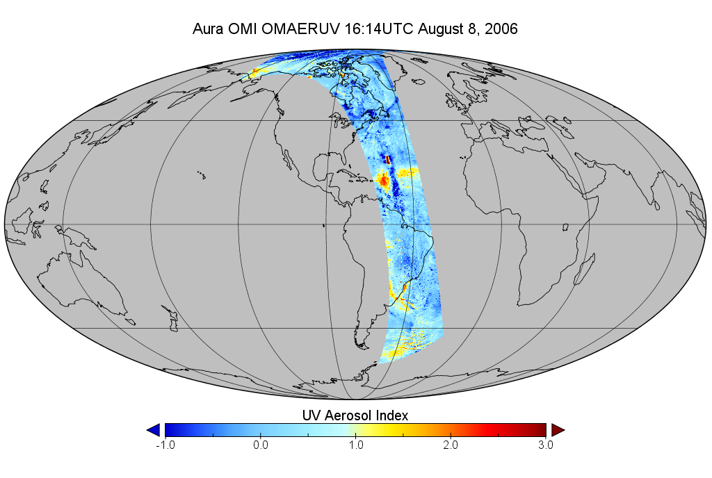
OMI/Aura Near UV Aerosol Optical Depth and Single Scattering Albedo 1-orbit L2 Swath 13x24 km V003 (OMAERUV) at GES DISC recent views
The Aura Ozone Monitoring Instrument level-2 near UV Aerosol data product 'OMAERUV', recently re-processed using an enhanced algorithm, is now released (April 2012) to the... -
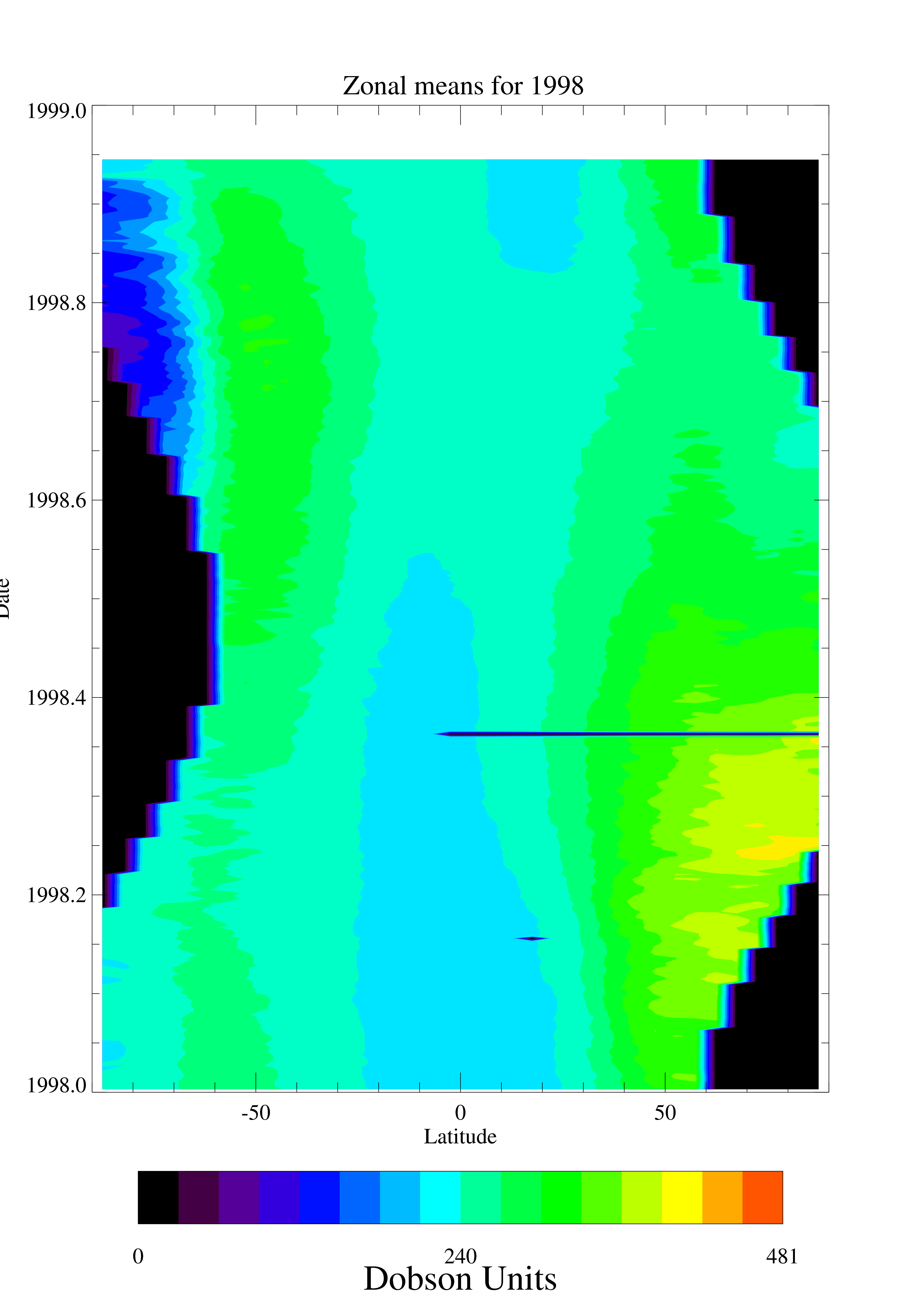
TOMS EP Total Column Ozone Daily and Monthly Zonal Means V008 (TOMSEPL3ztoz) at GES DISC recent views
This Earth Probe (EP) Total Ozone Mapping Spectrometer (TOMS) version 8 daily zonal means data product contains total column ozone values. The data are averaged in 5 degree... -
MLS/Aura Level 3 Daily Binned Cloud Ice (IWC) on Zonal and Similar Grids V005 (ML3DZIWC) at GES DISC recent views
ML3DZIWC is the EOS Aura Microwave Limb Sounder (MLS) daily binned on zonal and assorted vertical grids product for cloud ice water content (IWC) derived from radiances measured... -
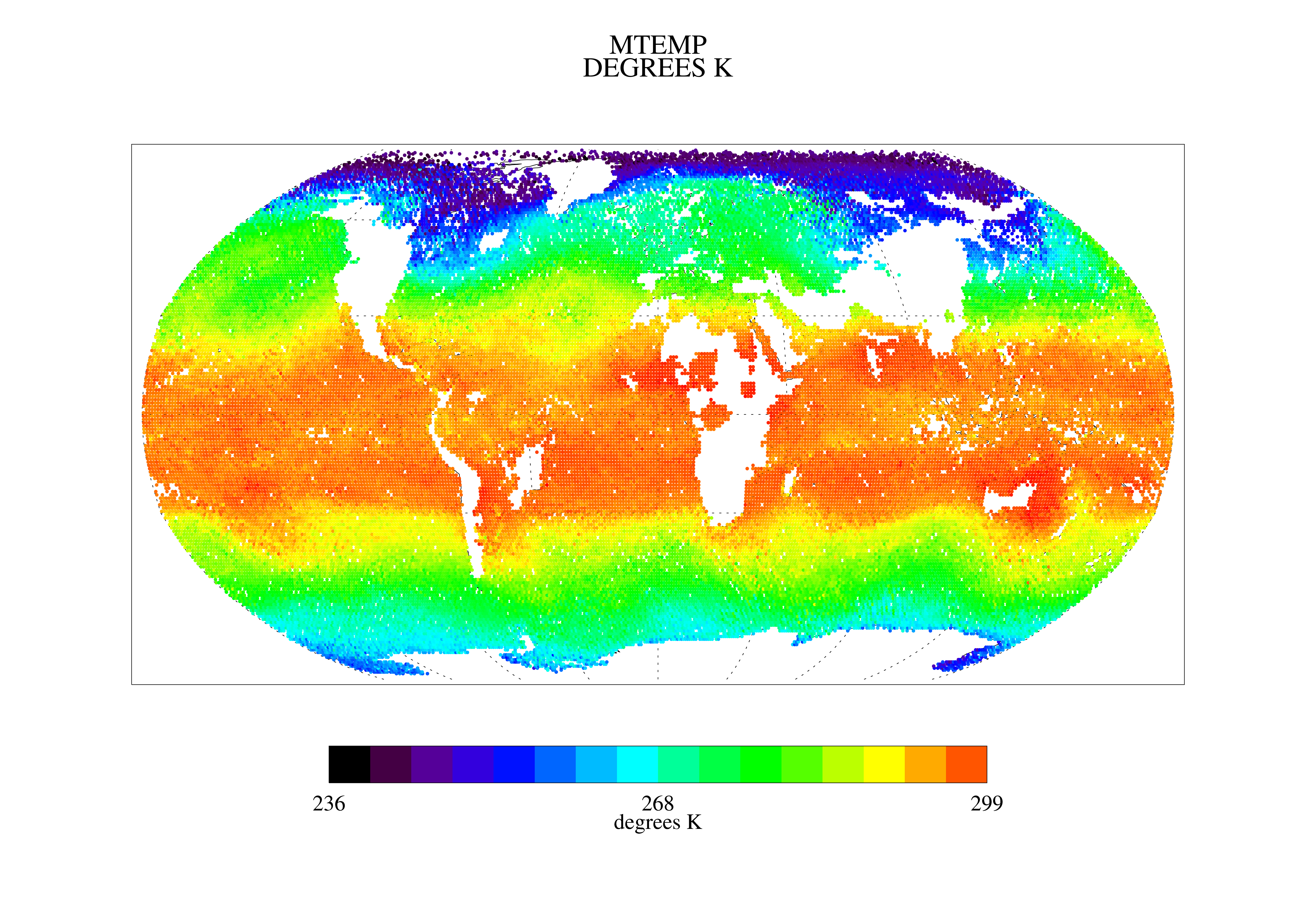
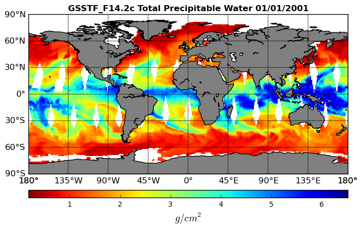
Goddard Satellite-Based Surface Turbulent Fluxes, 0.25 x 0.25 deg, Daily Grid F14 V3 (GSSTF_F14) at GES DISC recent views
These data are part of the Goddard Satellite-based Surface Turbulent Fluxes Version 3 (GSSTF3) Dataset recently produced through a MEaSURES funded project led by Dr. Chung-Lin... -
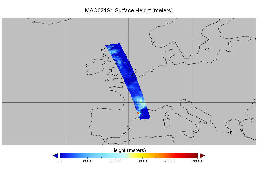
MODIS/Aqua Calibrated Radiances 250m 5-Min L1B Wide Swath Subset along CloudSat V002 (MAC02QS1) at GES DISC NGDA recent views
This is the wide-swath MODIS/Aqua subset along CloudSat field of view track. The goal of the wide-swath subset is to select and return MODIS data that are within +-100 km across... -
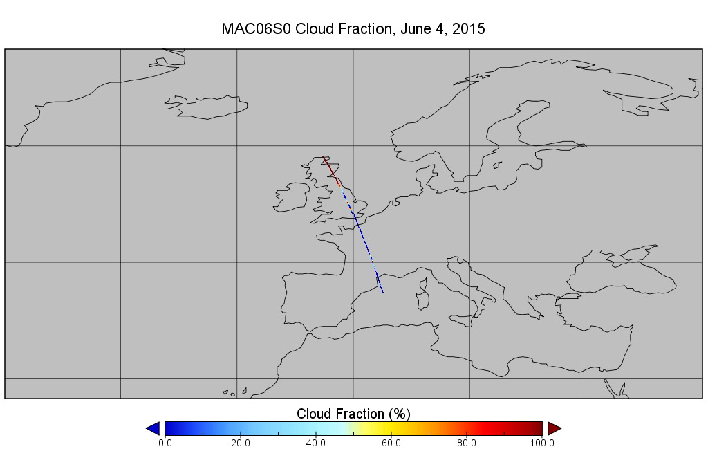
MODIS/Aqua Clouds 1km and 5km 5-Min L2 Narrow Swath Subset along CloudSat V002 (MAC06S0) at GES DISC NGDA recent views
This is the narrow-swath MODIS/Aqua subset along CloudSat field of view track. The goal of the narrow-swath subset is to select and return MODIS data that are within +-5 km... -
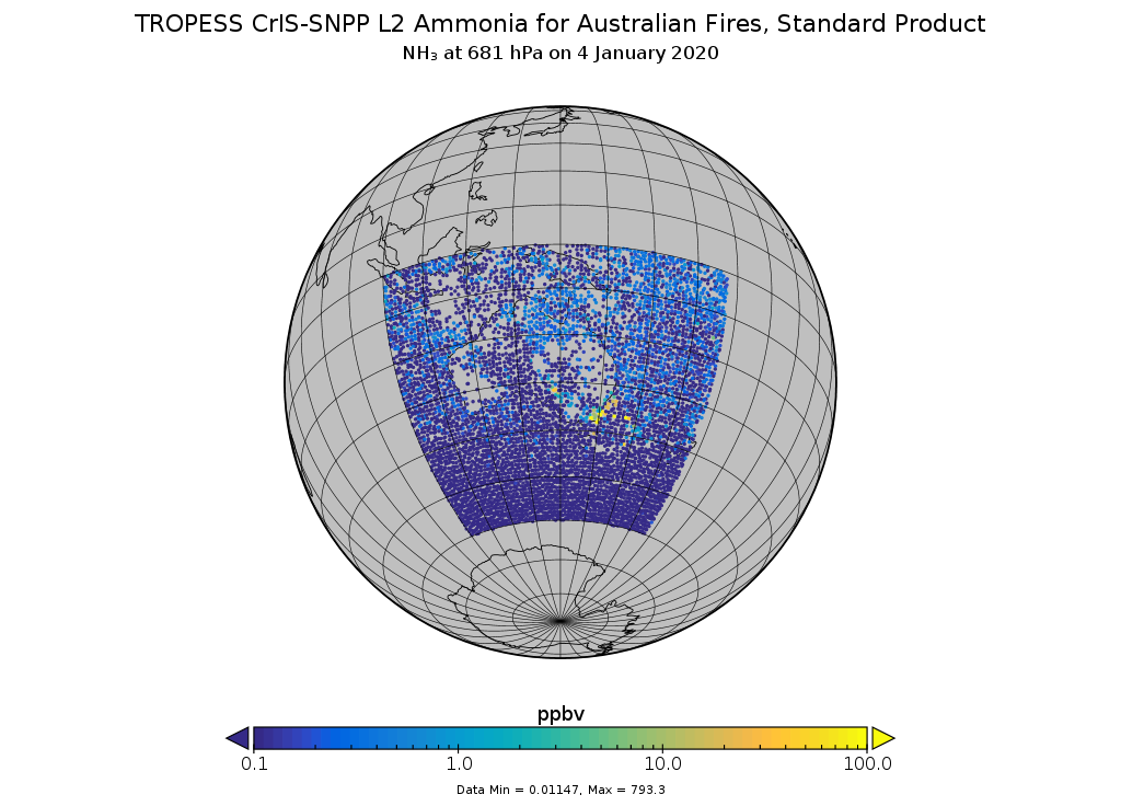
TROPESS CrIS-SNPP L2 Ammonia for Australian Fires, Standard Product V1 (TRPSDL2NH3CRSAUS) at GES DISC recent views
The TROPESS CrIS-SNPP L2 Ammonia for Australian Fires, Standard Product contains the vertical distribution of the retrieved atmospheric state of ammonia (NH3), formal... -
MLS/Aura Level 3 Monthly Binned Nitric Acid (HNO3) Mixing Ratio on Assorted Grids V004 (ML3MBHNO3) at GES DISC recent views
ML3MBHNO3 is the EOS Aura Microwave Limb Sounder (MLS) monthly binned on various vertical grids product for nitric acid (HNO3) derived from radiances measured by the 240 GHz... -
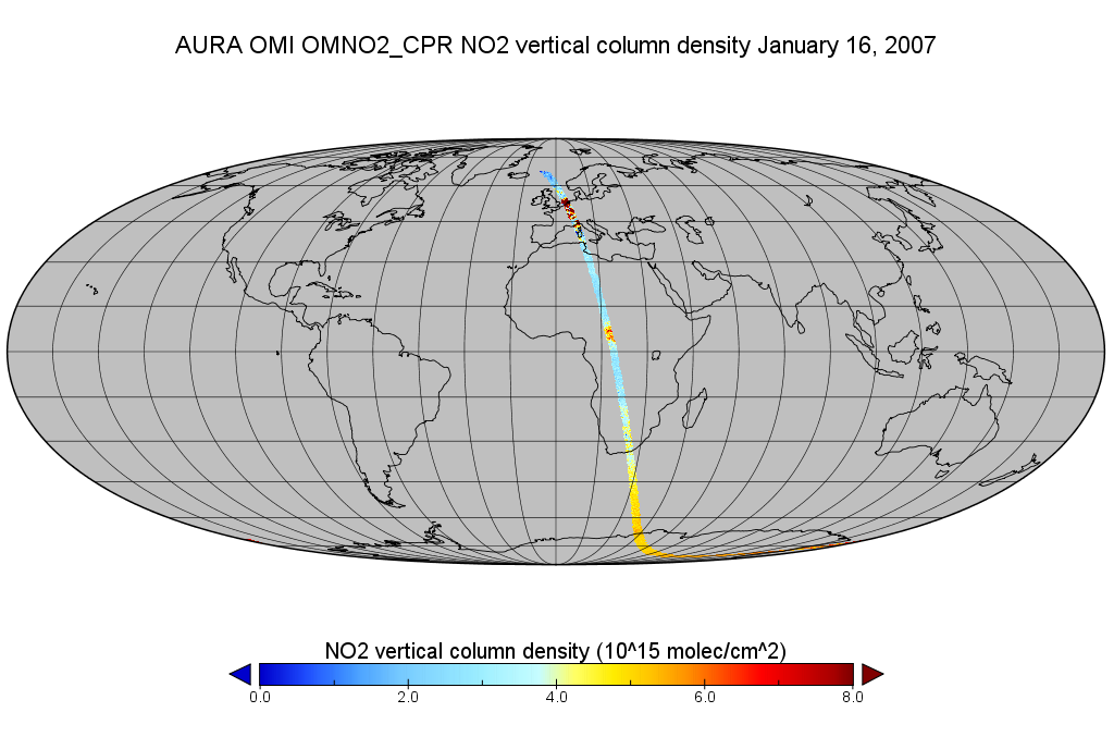
OMI/Aura Level 2 Nitrogen Dioxide (NO2) Trace Gas Column Data 1-Orbit subset Swath along CloudSat track 1-Orbit Swath 13x24 km recent views
This is a CloudSat-collocated subset of the original product OMNO2, for the purposes of the A-Train mission. The goal of the subset is to select and return OMI data that are... -
BUV/Nimbus-4 Level 2 Compressed Ozone Profile Data V005 (BUVN4L2CPOZ) at GES DISC recent views
The Nimbus-4 BUV Level 2 Compressed Ozone Profile Data collection or CPOZ contains total ozone, reflectivities, ozone mixing ratios and layer ozone amounts measured every 32... -
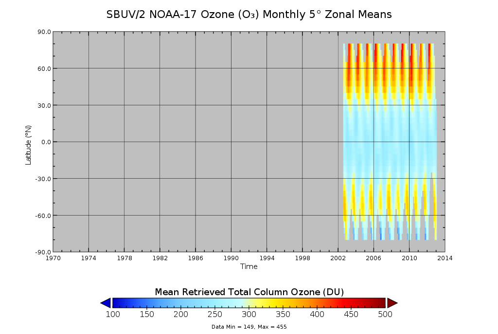
SBUV2/NOAA-17 Ozone (O3) Profile and Total Column Ozone 1 Month Zonal Mean L3 Global 5.0 degree Latitude Zones V1 (SBUV2N17L3zm) at GES DISC recent views
The Solar Backscattered Ultraviolet (SBUV) from NOAA-17 Level-3 monthly zonal mean (MZM) product (SBUV2N17L3zm) is derived from the Level-2 retrieved ozone profiles. Ozone... -
GPM SSMI on F10 (GPROF) Climate-based Radiometer Precipitation Profiling L3 1 day 0.25 degree x 0.25 degree V07 (GPM_3GPROFF10SSMI_DAY_CLIM) at GES DISC recent views
Version 7 is the current version of the data set. Older versions will no longer be available and have been superseded by the current version. The "CLIM" products differ from...

Official websites use .gov
A
.gov website belongs to an official government
organization in the United States.
Secure .gov websites use HTTPS
A
lock (
) or https:// means you’ve safely connected to
the .gov website. Share sensitive information only on official,
secure websites.