
-
AIRS/Aqua L3 8-day Standard Physical Retrieval (AIRS-only) 1 degree X 1 degree V006 (AIRS3ST8) at GES DISC recent views
The Atmospheric Infrared Sounder (AIRS) is a grating spectrometer (R = 1200) aboard the second Earth Observing System (EOS) polar-orbiting platform, EOS Aqua. In combination... -
Aqua/AIRS L3 Monthly Standard Physical Retrieval (AIRS-only) 1 degree x 1 degree V7.0 at GES DISC recent views
The Atmospheric Infrared Sounder (AIRS) is a grating spectrometer (R = 1200) aboard the second Earth Observing System (EOS) polar-orbiting platform, EOS Aqua. The AIRS Only... -
FLDAS Noah Land Surface Model L4 Global Monthly 0.1 x 0.1 degree (MERRA-2 and CHIRPS) V001 (FLDAS_NOAH01_C_GL_M) at GES DISC recent views
This dataset contains a series of land surface parameters simulated from the Noah 3.6.1 model in the Famine Early Warning Systems Network (FEWS NET) Land Data Assimilation... -
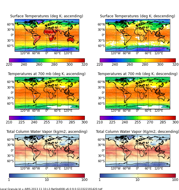
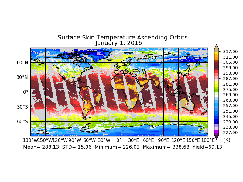
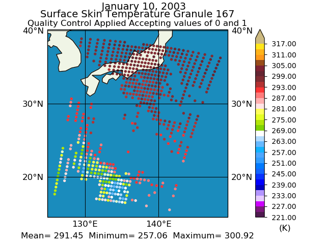
Aqua/AIRS L3 Daily Standard Physical Retrieval (AIRS-only) 1 degree x 1 degree V7.0 at GES DISC recent views
The Atmospheric Infrared Sounder (AIRS) is a grating spectrometer (R = 1200) aboard the second Earth Observing System (EOS) polar-orbiting platform, EOS Aqua. The AIRS Level 3... -
AMSR2/GCOM-W1 surface soil moisture (LPRM) L3 1 day 25 km x 25 km ascending V001 (LPRM_AMSR2_A_SOILM3) at GES DISC recent views
AMSR2/GCOM-W1 surface soil moisture (LPRM) L3 1 day 25 km x 25 km ascending V001 is a Level 3 (gridded) data set. Its land surface parameters, surface soil moisture, land... -
AIRS/Aqua L2 Support Retrieval (AIRS+AMSU) V006 (AIRX2SUP) at GES DISC recent views
The Atmospheric Infrared Sounder (AIRS) is a grating spectrometer (R = 1200) aboard the second Earth Observing System (EOS) polar-orbiting platform, EOS Aqua. In combination... -
MODIS/Aqua Monthly mean Night-Time Land Surface Temperature at 1x1 degree V005 (MYD11CM1N) at GES DISC NGDA recent views
The dataset contains global monthly night-time land surface temperature averaged within 1 by 1 degree grid cells. The source for the data is MODIS/Aqua MYD11C3 Collection 005... -
Aqua/AIRS L2 Support Retrieval (AIRS+AMSU) V7.0 at GES DISC recent views
The Atmospheric Infrared Sounder (AIRS) is a grating spectrometer (R = 1200) aboard the second Earth Observing System (EOS) polar-orbiting platform, EOS Aqua. In combination... -
NLDAS Secondary Forcing Data L4 Monthly Climatology 0.125 x 0.125 degree V2.0 (NLDAS_FORB0125_MC) at GES DISC recent views
This data set contains the monthly climatology (MC) data of the secondary forcing data for Phase 2 of the North American Land Data Assimilation System (NLDAS-2). The data are in... -
WLDAS Noah-MP 3.6 Land Surface Model L4 Daily 0.01 degree x 0.01 degree Version D1.0 (WLDAS_NOAHMP001_DA1) at GES DISC recent views
The Western Land Data Assimilation System (WLDAS), developed at Goddard Space Flight Center (GSFC) and funded by the NASA Western Water Applications Office, provides water... -
NLDAS VIC Land Surface Model L4 Monthly 0.125 x 0.125 degree V2.0 (NLDAS_VIC0125_M) at GES DISC recent views
This data set contains forty-three fields simulated from the VIC land-surface model (LSM) for Phase 2 of the North American Land Data Assimilation System (NLDAS-2). The data are... -
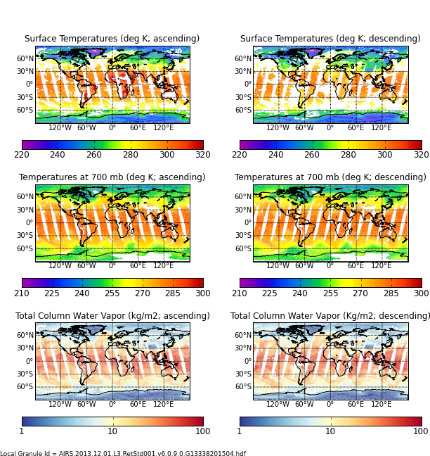
Aqua/AIRS L3 Daily Standard Physical Retrieval (AIRS+AMSU) 1 degree x 1 degree V7.0 at GES DISC recent views
The Atmospheric Infrared Sounder (AIRS) is a grating spectrometer (R = 1200) aboard the second Earth Observing System (EOS) polar-orbiting platform, EOS Aqua. In combination... -
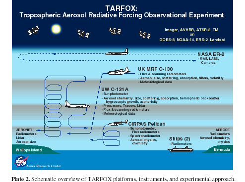
CAR TARFOX Tropospheric Aerosol Radiative Forcing Observational Experiment L1 V1 (CAR_TARFOX_L1C) at GES DISC recent views
CAR TARFOX mission collected data in the western Atlantic Ocean on the effects of tropospheric aerosols on radiation budgets in cloud free skies. The mission also measured the... -
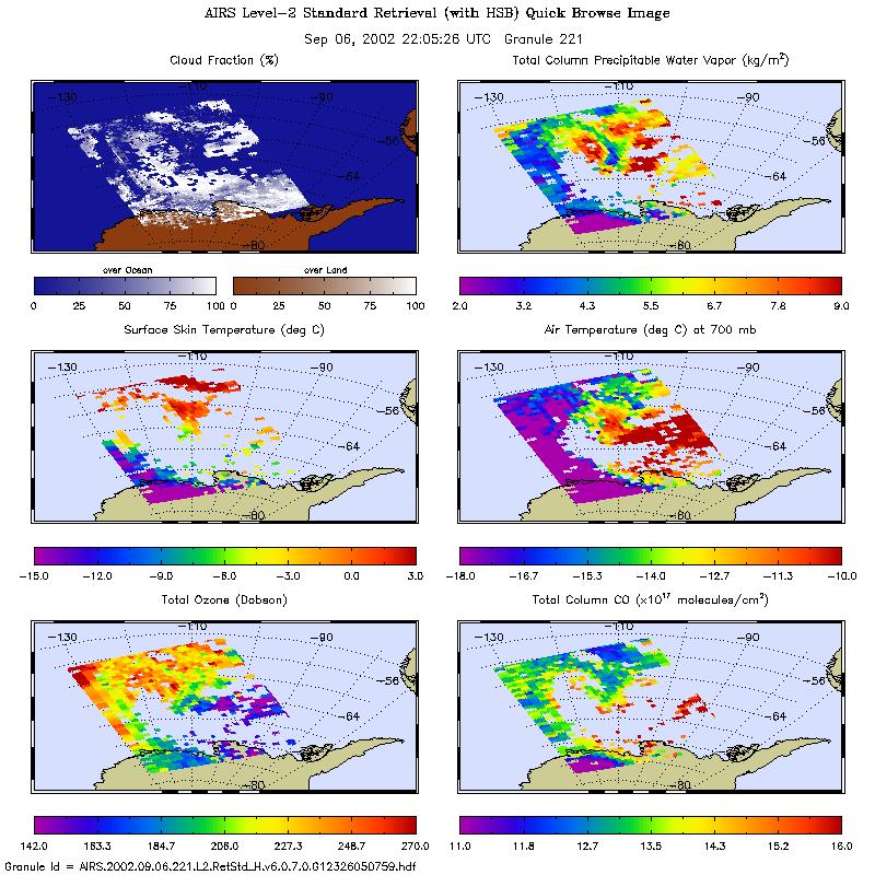
AIRS/Aqua L2 Standard Physical Retrieval (AIRS+AMSU+HSB) V006 (AIRH2RET) at GES DISC recent views
The Atmospheric Infrared Sounder (AIRS) is a grating spectrometer (R = 1200) aboard the second Earth Observing System (EOS) polar-orbiting platform, EOS Aqua. In combination... -
CAR INTEX-B Long-range Pollution Transportation L1 V1 (CAR_INTEXB_L1C) at GES DISC recent views
INTEX-B (Intercontinental Chemical Transport Experiment-Phase B) focuses on the long-range transport of pollution, global atmospheric photochemistry, and the effects of aerosols... -
GLDAS Noah Land Surface Model L4 3 hourly 1.0 x 1.0 degree V2.1 (GLDAS_NOAH10_3H) at GES DISC recent views
NASA Global Land Data Assimilation System Version 2 (GLDAS-2) has three components: GLDAS-2.0, GLDAS-2.1, and GLDAS-2.2. GLDAS-2.0 is forced entirely with the Princeton... -
CAR SnowEx17 Snow Mass and Energy Measurements L1 V1 (CAR_SNOWEX17_L1C) at GES DISC recent views
SnowEx is a multi-year airborne project to help advance capabilities, and plan for a near-future space mission to monitor global seasonal snow water equivalent — currently an... -
TOVS GLA 5 DAY GRIDS from NOAA-10 V01 (TOVSA5NG) at GES DISC recent views
This dataset (TOVSA5NG) contains the TIROS Operational Vertical Sounder (TOVS) level 3 geophysical parameters derived using data from NOAA-10 and the physical retrieval method... -
AIRS/Aqua L3 Daily Support Daily Product (AIRS+AMSU+HSB) 1 degree x 1 degree V006 (AIRH3SPD) at GES DISC recent views
The Atmospheric Infrared Sounder (AIRS) is a grating spectrometer (R = 1200) aboard the second Earth Observing System (EOS) polar-orbiting platform, EOS Aqua. In combination... -
Aqua/AIRS L2 Standard Physical Retrieval (AIRS+AMSU+HSB) V7.0 at GES DISC recent views
The Atmospheric Infrared Sounder (AIRS) is a grating spectrometer (R = 1200) aboard the second Earth Observing System (EOS) polar-orbiting platform, EOS Aqua. In combination...

Official websites use .gov
A
.gov website belongs to an official government
organization in the United States.
Secure .gov websites use HTTPS
A
lock (
) or https:// means you’ve safely connected to
the .gov website. Share sensitive information only on official,
secure websites.