
-
MODIS/Terra Calibrated Radiances 5-Min L1B Swath 1km NGDA recent views
The MODIS/Terra Calibrated Radiances 5Min L1B Swath 1km data set contains calibrated and geolocated at-aperture radiances for 36 discrete bands located in the 0.4 to 14.4 micron... -
CALIPSO Lidar Level 2 5 km Merged Layer, V4-20 recent views
CAL_LID_L2_05kmMLay-Standard-V4-20 is the Cloud-Aerosol Lidar and Infrared Pathfinder Satellite Observations (CALIPSO) Lidar Level 2 5 km Merged Layer, Version 4-20 data... -
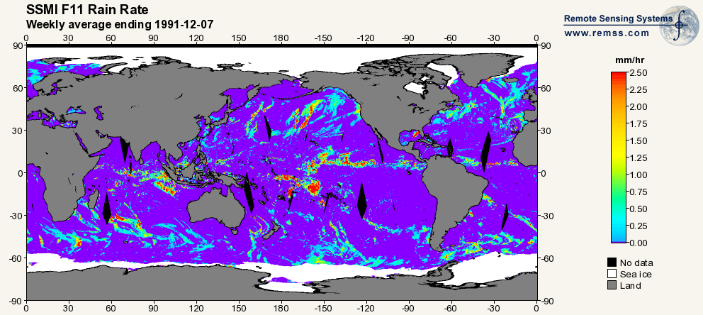
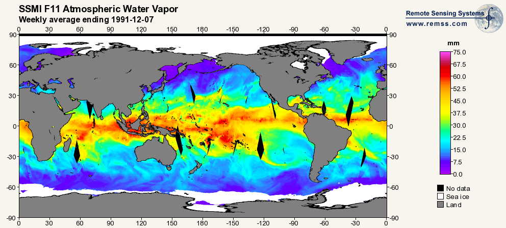
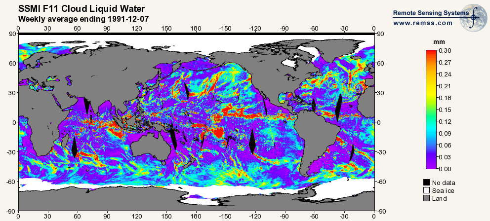
RSS SSM/I OCEAN PRODUCT GRIDS WEEKLY AVERAGE FROM DMSP F11 NETCDF V7 recent views
The RSS SSM/I Ocean Product Grids Weekly Average from DMSP F11 netCDF dataset is part of the collection of Special Sensor Microwave/Imager (SSM/I) and Special Sensor Microwave... -
OMG Narwhals Shipboard Conductivity, Temperature, and Depth (CTD) profiles, 2018-2020 recent views
This OMG Narwhals dataset contains measurements from the ship based full water column CTD profiles that were obtained during summer mooring deployment/recovery cruises. NASA’s... -
West Africa Coastal Vulnerability Mapping: Point and Gridded Locations of Fatalities, 2008-2013 recent views
The West Africa Coastal Vulnerability Mapping: Point and Gridded Locations of Fatalities, 2008-2013 data set consists of two layers: points representing the location of conflict... -
GLDAS CLM Land Surface Model L4 3 hourly 1.0 x 1.0 degree Subsetted V001 (GLDAS_CLM10SUBP_3H) at GES DISC recent views
With the upgraded Land Surface Models (LSMs) and updated forcing data sets, the GLDAS version 2.1 (GLDAS-2.1) production stream serves as a replacement for GLDAS-001. The entire... -
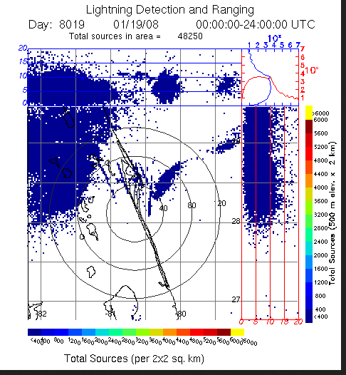
LIGHTNING DETECTION AND RANGING (LDAR) RAW DATA V1 recent views
Lightning Detection and Ranging (LDAR) Raw data consists of level 1 lightning data collected from February 25, 1997 through June 11, 2008. The LDR system is located at the... -
National Aggregates of Geospatial Data Collection: Population, Landscape, And Climate Estimates, Version 4 (PLACE IV) recent views
The National Aggregates of Geospatial Data Collection: Population, Landscape, And Climate Estimates, Version 4 (PLACE IV) provides measures of population (head counts) and land... -
Global 3-Year Running Mean Ground-Level Nitrogen Dioxide (NO2) Grids from GOME, SCIAMACHY and GOME-2 recent views
The Global 3-Year Running Mean Ground-Level Nitrogen Dioxide (NO2) Grids from GOME, SCIAMACHY and GOME-2 represent a series of three-year running mean grids (1996-2012) of... -
VIIRS/NPP BRDF/Albedo Parameter 1 DNB Daily L3 Global 30 ArcSec CMG V001 recent views
The NASA/NOAA Suomi National Polar-orbiting Partnership (Suomi NPP) Visible Infrared Imaging Radiometer Suite (VIIRS) Bidirectional Reflectance Distribution Function (BRDF) and... -
MODIS/Terra+Aqua BRDF/Albedo Parameter 1 Band 1 Daily L3 Global 30 ArcSec CMG V061 NGDA recent views
The MCD43D01 Version 6.1 Bidirectional Reflectance Distribution Function and Albedo (BRDF/Albedo) Model Parameter data set is a daily 16-day product. This product incorporates... -
MODIS/Terra+Aqua BRDF/Albedo White Sky Albedo Band1 Daily L3 Global 30ArcSec CMG V061 NGDA recent views
The MCD43D52 Version 6.1 Bidirectional Reflectance Distribution Function and Albedo (BRDF/Albedo) White-Sky Albedo dataset is produced daily using 16 days of Terra and Aqua... -
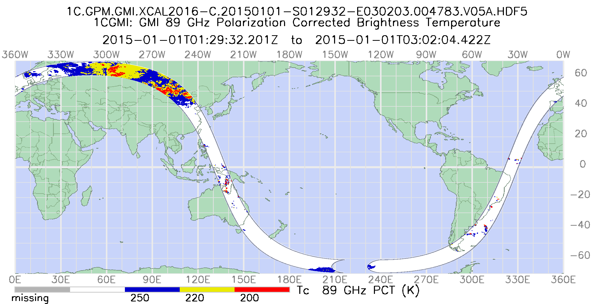
GPM GMI Common Calibrated Brightness Temperatures Collocated L1C 1.5 hours 13 km V07 (GPM_1CGPMGMI) at GES DISC recent views
Version 07 is the current version of the data set. Older versions will no longer be available and have been superseded by Version 07. All 1C products have a common L1C data... -
MetOp-A ASCAT Scatterometer Inter-Calibrated ESDR Level 2 Ocean Surface Equivalent Neutral Wind Vectors and Wind Stress Vectors Version 1.1 recent views
This dataset contains ocean surface wind vectors (equivalent neutral and true 10m) and wind stress vectors derived from satellite-based scatterometer observations (the MetOp-A... -
Ground-Based Global Navigation Satellite System (GNSS) Compact Observation Data (30-second sampling, hourly files) from NASA CDDIS recent views
This dataset consists of ground-based Global Navigation Satellite System (GNSS) Observation Data (30-second sampling, hourly files) from the NASA Crustal Dynamics Data...

Official websites use .gov
A
.gov website belongs to an official government
organization in the United States.
Secure .gov websites use HTTPS
A
lock (
) or https:// means you’ve safely connected to
the .gov website. Share sensitive information only on official,
secure websites.