
-
Tree Inventory and Biometry Measurements, Tapajos National Forest, Para, Brazil, 2010 recent views
This dataset provides tree inventory, tree height, diameter at breast height (DBH), and estimated crown measurements from 30 plots located in the Tapajos National Forest, Para,... -
Gazetteer of Planetary Nomenclature recent views
Planetary nomenclature, like terrestrial nomenclature, is used to uniquely identify a feature on the surface of a planet or satellite so that the feature can be easily located,... -
ABoVE: Annual Thaw Slump Expansion on East Fork Chandalar River, Alaska, 2008-2017 recent views
This dataset provides a time series of spatial data showing the expansion of a thaw slump on the East Fork Chandalar River near the community of Venetie, Alaska, from 2008... -
Gazetteer of Planetary Nomenclature recent views
Planetary nomenclature, like terrestrial nomenclature, is used to uniquely identify a feature on the surface of a planet or satellite so that the feature can be easily located,... -
Arctic Circumpolar Distribution and Soil Carbon of Thermokarst Landscapes, 2015 recent views
This data set provides the distribution of thermokarst landscapes in the boreal and tundra ecoregions within the northern circumpolar permafrost zones. This dataset provides an... -
NARSTO EPA Supersite (SS) Atlanta 1999 Air Chemistry, Particulate Matter (PM), and Meteorological Data recent views
The NARSTO_EPA_SS_ATLANTA_1999_CHEM_PM_MET_DATA is the North American Research Strategy for Tropospheric Ozone (NARSTO) Environmental Protection Agency (EPA) Supersite (SS)... -
Gazetteer of Planetary Nomenclature recent views
Planetary nomenclature, like terrestrial nomenclature, is used to uniquely identify a feature on the surface of a planet or satellite so that the feature can be easily located,... -
Pre-ABoVE: Active Layer Thickness and Soil Water Content, Barrow, Alaska, 2013 recent views
This data set provides estimates of Active Layer Thickness (ALT) determined with ground-based measurements, and calculated soil volumetric water content (VWC) at four selected... -
NARSTO EPA Supersite (SS) Atlanta 1999 Rapid Single-Particle Mass Spectrometer (SPMS) Data. recent views
NARSTO_EPA_SS_ATLANTA_RAPID_SPMS_DATA is the North American Research Strategy for Tropospheric Ozone (NARSTO) Environmental Protection Agency (EPA) Supersite (SS) Atlanta 1999... -
ABoVE: Directory of Field Sites Associated with 2017 ABoVE Airborne Campaign recent views
This dataset provides a listing of the ~6,700 field sites used in planning the ABoVE Airborne Campaign (AAC) for 2017. The sites included point, polygon, and line locations that... -
NDVI, Species Cover, and LAI, Burned and Unburned sites, Interior Alaska, 2017-2018 NGDA recent views
This dataset provides leaf area index (LAI), tree species and canopy cover, normalized difference vegetation index (NDVI), and NDVI trends for boreal forests in interior Alaska,... -
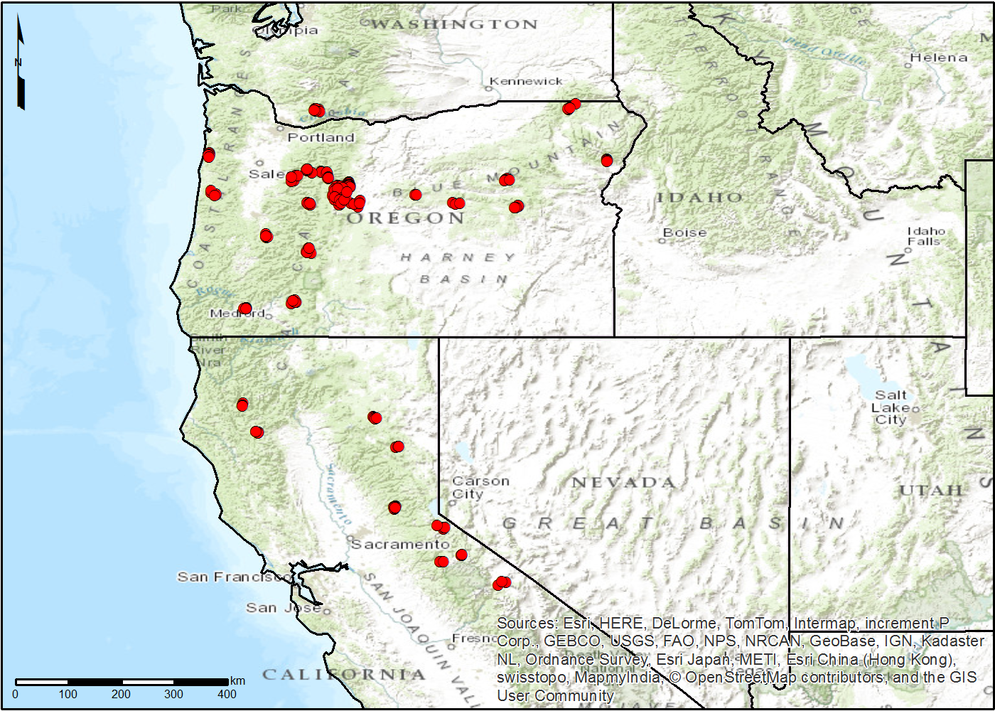
LiDAR Derived Forest Aboveground Biomass Maps, Northwestern USA, 2002-2016 recent views
This dataset provides maps of aboveground forest biomass (AGB) of living trees and standing dead trees in Mg/ha across portions of Northwestern United States, including... -
NACP Greenhouse Gases Multi-Source Data Compilation, 2000-2009 recent views
This data set is a collection of measurements of carbon dioxide (CO2) and non-CO2 greenhouse gases made across North America by nine independent atmospheric monitoring networks... -
CERES and MISR Along-Track Footprint Radiances, Fluxes, and Clouds Terra-FM2 NGDA recent views
CERES-MISR-MODIS_SSF-SSFM_Terra-FM2_1 is the is the Clouds and the Earth's Radiant Energy System (CERES) and Multi-angle Imaging SpectroRadiometer (MISR) Along-Track Footprint... -
LiDAR Data, DEM, and Maximum Vegetation Height Product from Southern Idaho, 2014 recent views
This dataset provides the point cloud data derived from small footprint waveform LiDAR data collected in August 2014 over Reynolds Creek Experimental Watershed and Hollister in... -
Sources of Methane Emissions (Vista-CA), State of California, USA recent views
This dataset provides spatial data products with identified and organized locations of potential methane (CH4) emitting facilities and infrastructure spanning the State of... -
Timeseries of Arctic-Boreal Lake Area Derived from CubeSat Imagery, 2017 recent views
This dataset provides near-daily lake area timeseries for 85,358 lakes across four study areas in Northern Canada and Alaska, USA, between May 1 and October 1, 2017. These lake... -
Gazetteer of Planetary Nomenclature recent views
Planetary nomenclature, like terrestrial nomenclature, is used to uniquely identify a feature on the surface of a planet or satellite so that the feature can be easily located,... -
NACP TERRA-PNW: Forest Plant Traits, NPP, Biomass, and Soil Properties, 1999-2014 recent views
This data set contains measurements and estimates of leaf, tree, and soil data from six projects conducted by the Terrestrial Ecosystem Research and Regional Analysis- Pacific... -
Gazetteer of Planetary Nomenclature recent views
Planetary nomenclature, like terrestrial nomenclature, is used to uniquely identify a feature on the surface of a planet or satellite so that the feature can be easily located,...

Official websites use .gov
A
.gov website belongs to an official government
organization in the United States.
Secure .gov websites use HTTPS
A
lock (
) or https:// means you’ve safely connected to
the .gov website. Share sensitive information only on official,
secure websites.