
-
LUH2-ISIMIP2b Harmonized Global Land Use for the Years 2015-2100 recent views
This dataset provides 0.25-degree gridded, global, annual estimates of fractional land use and land cover patterns for the period 2015-2100, designed to support the ISIMIP2b... -
Aqua MODIS Global Binned Inherent Optical Properties (IOP) Data, version R2022.0 NGDA recent views
MODIS (or Moderate-Resolution Imaging Spectroradiometer) is a key instrument aboard the Terra (EOS AM) and Aqua (EOS PM) satellites. Terra's orbit around the Earth is timed so... -
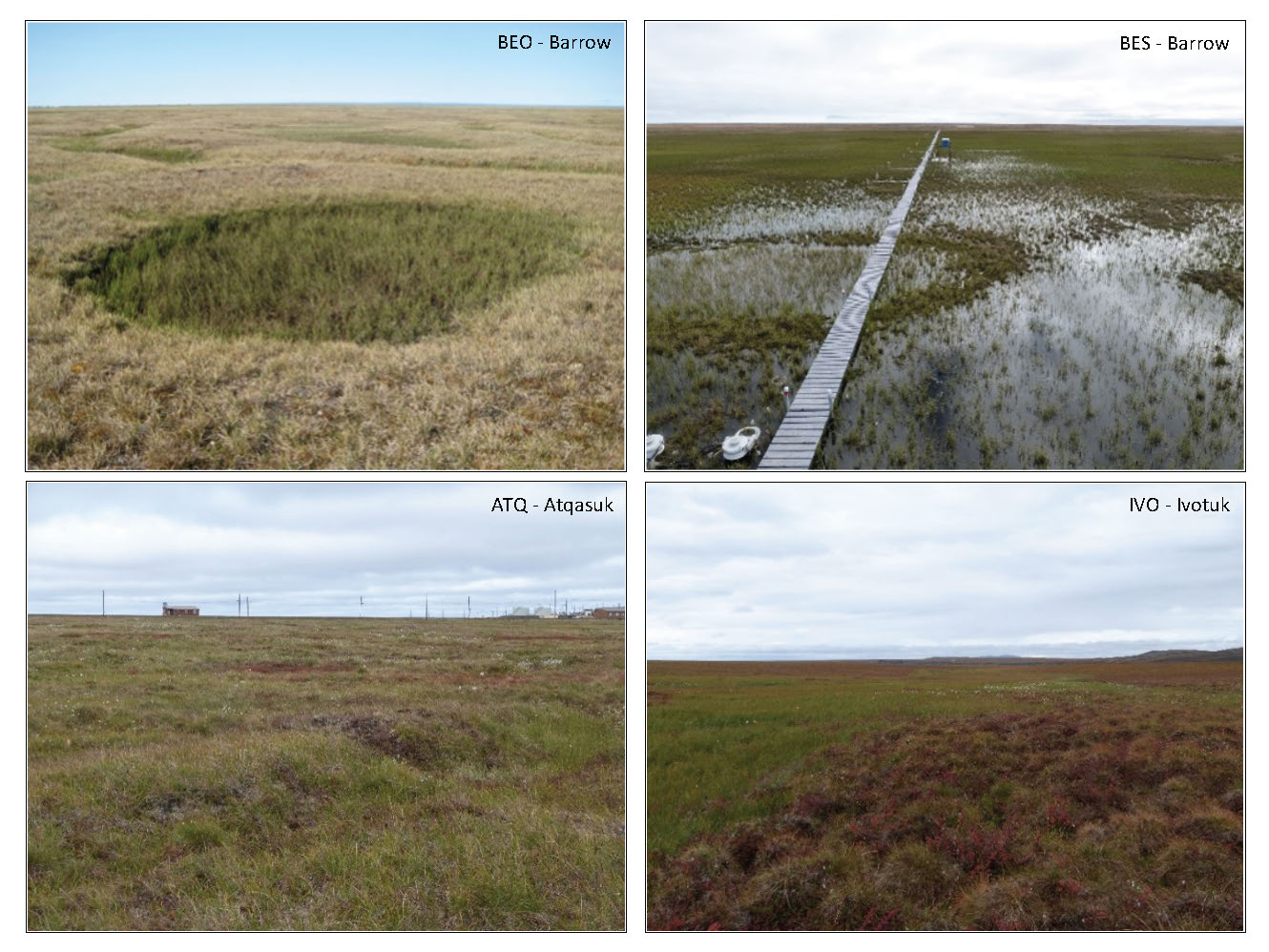
Tundra Plant Reflectance, CO2 Exchange, PAM Fluorometry, and Pigments, AK, 2001-2002 recent views
This dataset provides measurements at tundra plots collected near Utqiagvik and Atqasuk, AK, including visible-near infrared spectral reflectance, chamber gas exchange... -
Upper soil temperatures in the Kolyma Highland, Version 1 recent views
This data set contains soil temperature and meteorological data for various sampling locations near the Aborigen research station in the Kolyma Highland, Northeastern Russia.... -
Relative Tidal Marsh Elevation Maps with Uncertainty for Conterminous USA, 2010 recent views
This dataset provides maps of the elevation of coastal wetlands relative to tidal ranges for the conterminous United States (CONUS) at 30 m resolution for 2010. It also includes... -
Global-Gridded Daily Methane Emissions from Inland Dam-Reservoir Systems recent views
This dataset includes global maps of methane (CH4) emissions from inland dam-reservoir systems at 0.25-degree spatial resolution. Daily emission rates (as grams of CH4 per day... -
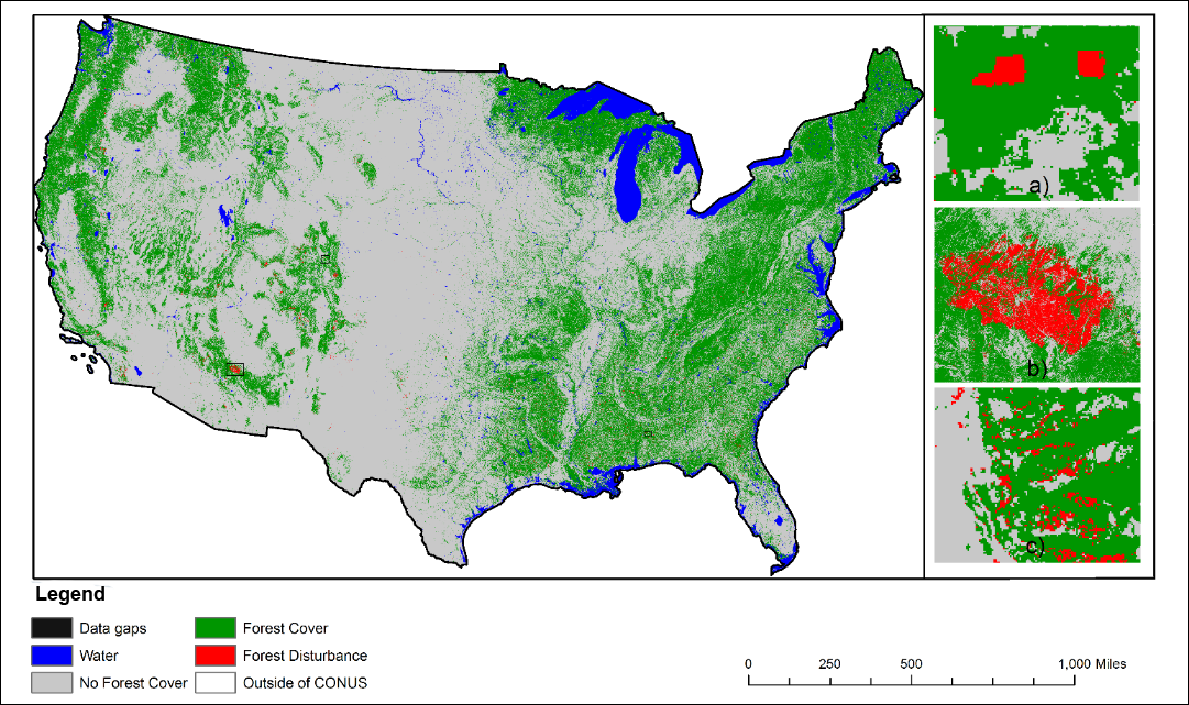
NACP NAFD Project: Forest Disturbance History from Landsat, 1986-2010 recent views
The North American Forest Dynamics (NAFD) products provided in this data set consist of 25 annual and two time-integrated forest disturbance maps for the conterminous United... -
Aqua MODIS Global Mapped Normalized Difference Vegetation Index Land Reflectance Data, version R2022.0 NGDA recent views
MODIS (or Moderate-Resolution Imaging Spectroradiometer) is a key instrument aboard the Terra (EOS AM) and Aqua (EOS PM) satellites. Terra's orbit around the Earth is timed so... -
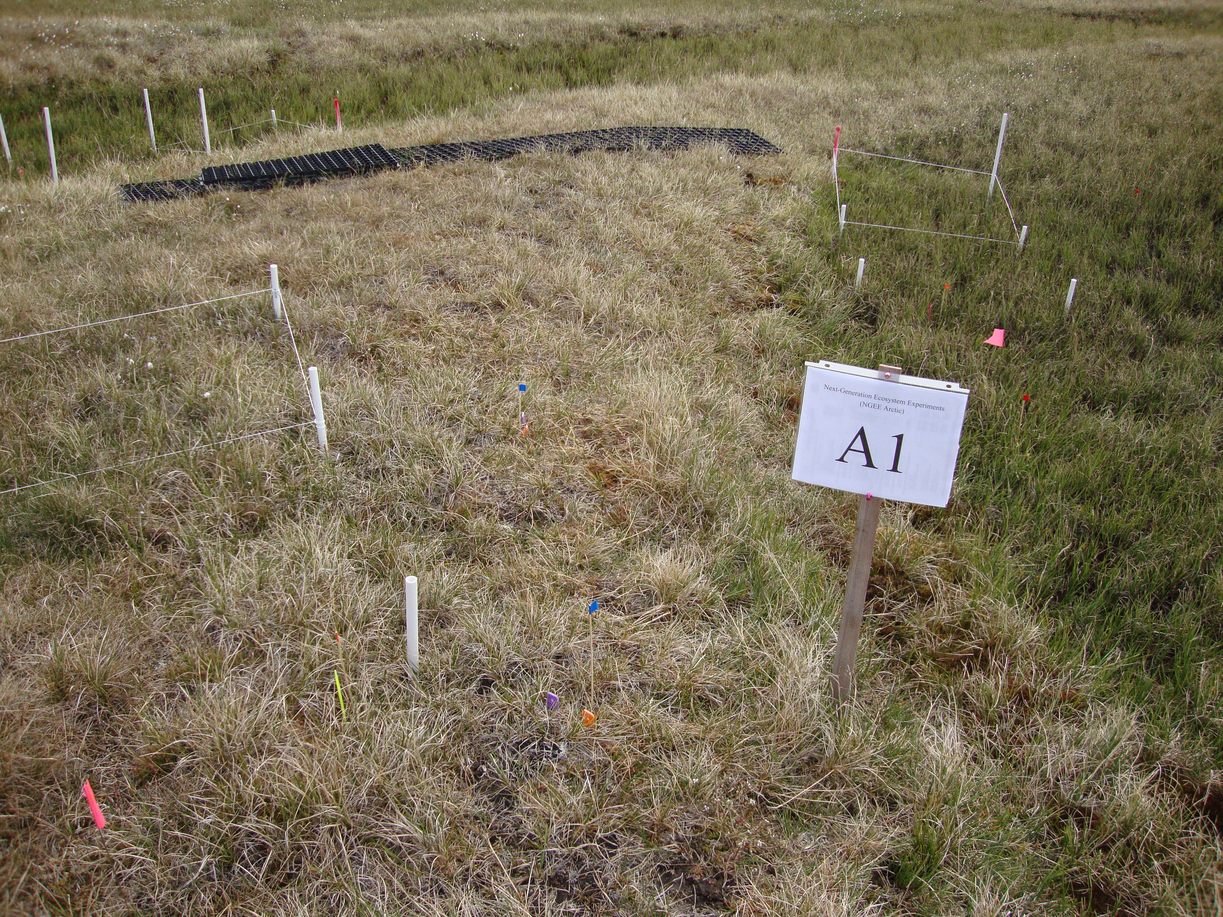
Burned and Unburned Field Site Data, Noatak, Seward, and North Slope, AK, 2016-2018 recent views
This dataset includes field measurements from unburned and burned 10 m x 10 m and 1 m x 1 m plots in the Noatak, Seward, and North Slope regions of the Alaskan tundra during... -
Arctic Vegetation Plots at Umiat, North Slope, Alaska, 1951 recent views
This data set provides vegetation cover and plot data collected during the periods of July and August, 1951, from 51 stands (areas of homogeneous vegetation communities) in the... -
Arctic Vegetation Plots for NGEE-Arctic at Barrow, Alaska, 2012 recent views
This data set provides vegetation cover and environmental plot data collected on the Barrow Environmental Observatory (BEO), Barrow, Alaska in 2012. Forty-eight 1 x 1 m plots... -
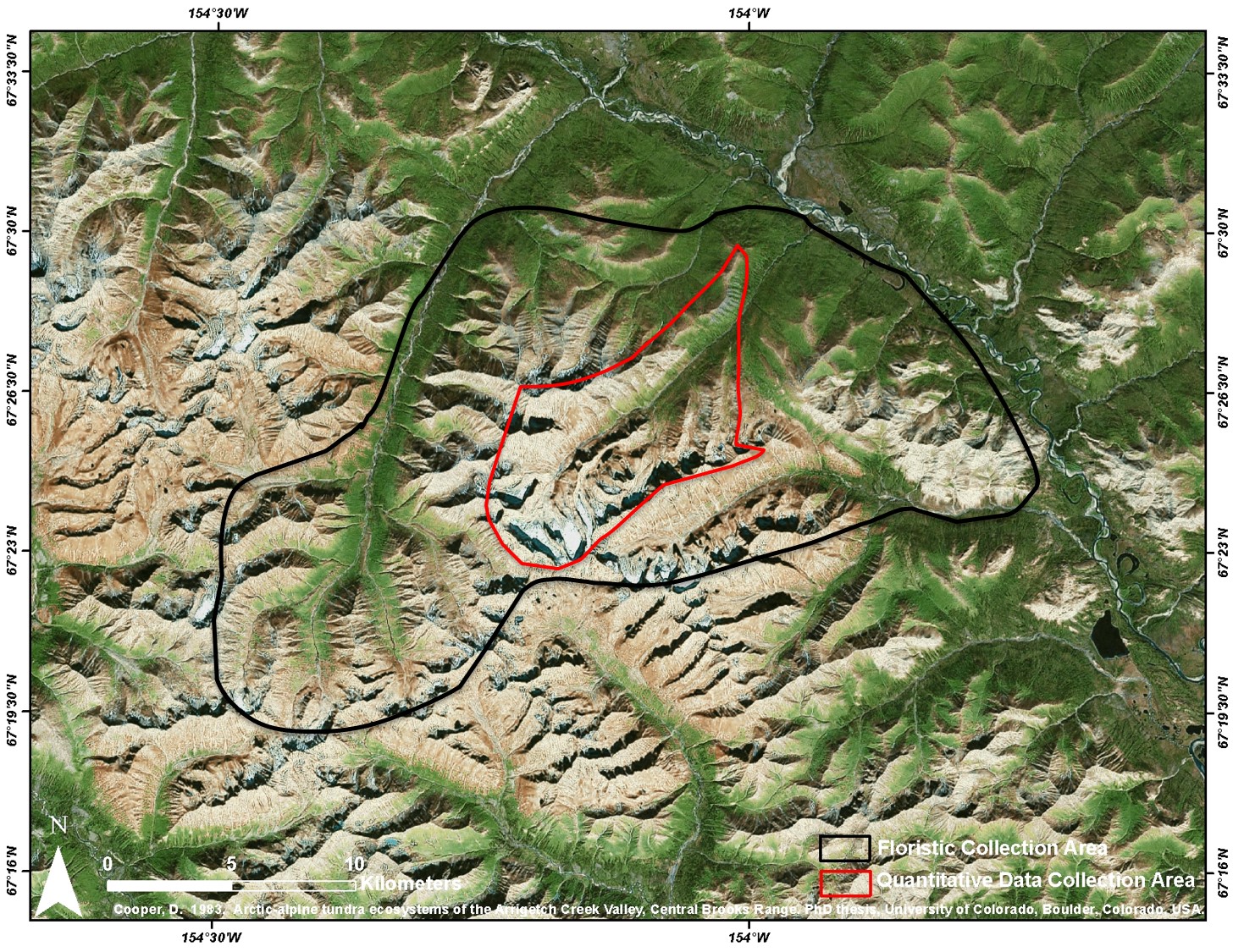
Arctic Vegetation Plots at Arrigetch Peaks, Alaska, 1978-1981 recent views
This data set provides environmental and vegetation data collected between 1978 and 1981 from 439 study plots at Arrigetch Peaks research site, located in the Gates of the... -
Suomi-NPP VIIRS Global Binned Inherent Optical Properties (IOP) - Near Real-time (NRT) Data, version R2022.0 recent views
The Ocean Biology DAAC produces near real-time (quicklook) products using the best-available combination of ancillary data from meteorological and ozone data. As such, the... -
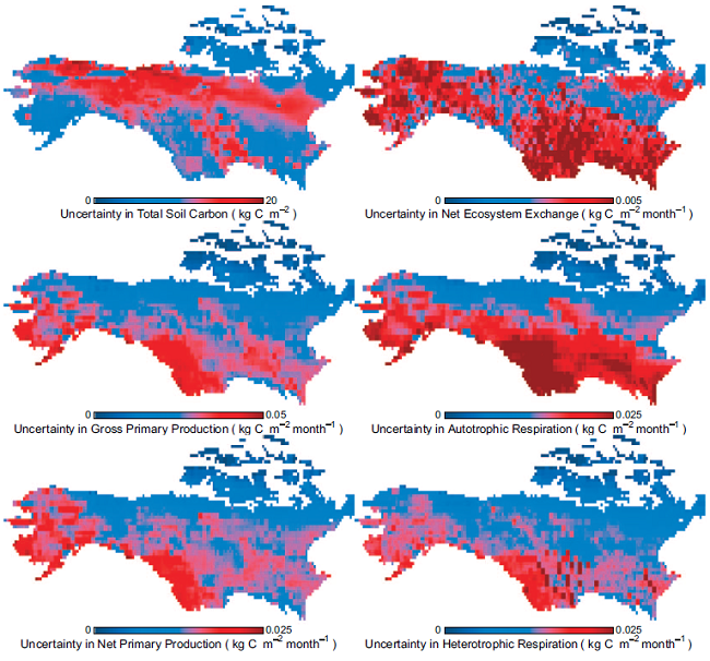
ABoVE: Multi-model Uncertainty of Carbon Stocks and Fluxes across ABoVE Domain, 2003 recent views
This dataset provides estimates of the uncertainty in components of the carbon cycle including: soil carbon stock, autotrophic respiration (Ra), heterotrophic respiration (Rh),... -
SENTINEL-1B_DUAL_POL_GRD_MEDIUM_RES recent views
Sentinel-1B Dual-pol ground projected medium resolution images -
Arctic Vegetation Plots in Flux Tower Footprints, North Slope, Alaska, 2014 recent views
This data set provides vegetation, environmental, and soil data collected from plots located in the footprints of eddy covariance flux towers along a 300 km north-south... -
Arctic Vegetation Plots, Prudhoe Bay ArcSEES Road Study, Lake Colleen, Alaska, 2014 recent views
This dataset provides environmental, soil, and vegetation data collected from study plots in the vicinity of Lake Colleen off the Spine Road at Prudhoe Bay, Alaska, during... -
ABoVE: Synthesis of Burned and Unburned Forest Site Data, AK and Canada, 1983-2016 recent views
This dataset is a synthesis of field plot characterization data, derived above-ground and below-ground combusted carbon, and acquired Fire Weather Index (FWI) System components...

Official websites use .gov
A
.gov website belongs to an official government
organization in the United States.
Secure .gov websites use HTTPS
A
lock (
) or https:// means you’ve safely connected to
the .gov website. Share sensitive information only on official,
secure websites.