
-
National Agriculture Imagery Program (NAIP) recent views
The National Agriculture Imagery Program (NAIP) acquires aerial imagery during the agricultural growing seasons in the continental U.S. A primary goal of the NAIP program is to... -
Landsat 8 recent views
The Operational Land Imager (OLI) and Thermal Infrared Sensor (TIRS) are onboard the Landsat 8 satellite, have acquired images of the Earth since February 2013. The sensors... -
U.S. Geological Survey Aerial Photography recent views
The U.S. Geological Survey (USGS) Aerial Photography data set includes over 2.5 million film transparencies. Beginning in 1937, photographs were acquired for mapping purposes at... -
ASTER Global DEM NGDA recent views
ASTER is capable of collecting in-track stereo using nadir- and aft-looking near infrared cameras. Since 2001, these stereo pairs have been used to produce single-scene (60- x... -
Global Multi-resolution Terrain Elevation Data 2010 (GMTED2010) recent views
The USGS and the NGA have collaborated on the development of a notably enhanced global elevation model named the GMTED2010 that replaces GTOPO30 as the elevation dataset of... -
Global Land Survey recent views
The U.S. Geological Survey (USGS) and the National Aeronautics and Space Administration (NASA) collaborated on the creation of the global land datasets using Landsat data from... -
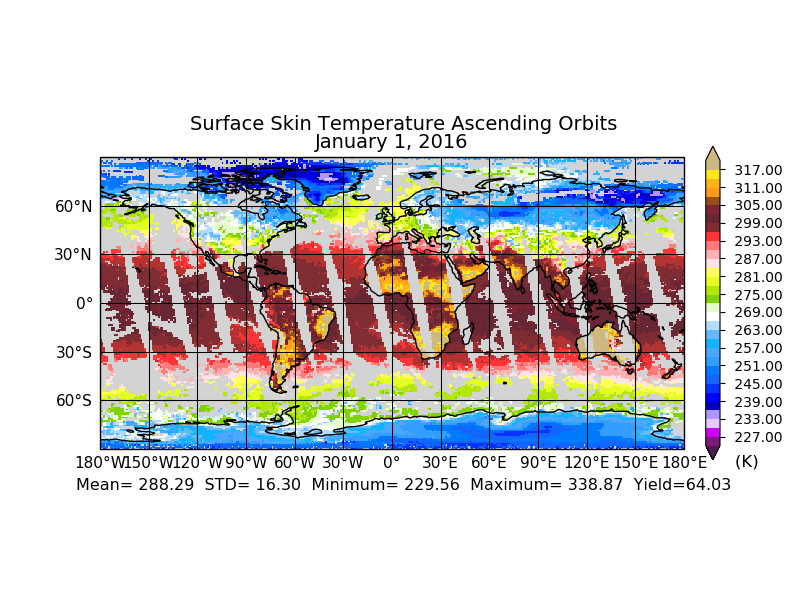
Aqua/AIRS L2 Standard Physical Retrieval (AIRS+AMSU) V7.0 at GES DISC recent views
The Atmospheric Infrared Sounder (AIRS) is a grating spectrometer (R = 1200) aboard the second Earth Observing System (EOS) polar-orbiting platform, EOS Aqua. The AIRS... -
National Land Cover Data set 1992 (NLCD1992) recent views
National Land Cover Dataset 1992 (NLCD1992) is a 21-class land cover classification scheme that has been applied consistently across the lower 48 United States at a spatial... -
Spaceborne Imaging Radar C-band (SIR-C) recent views
Spaceborne Imaging Radar-C (SIR-C) is part of an imaging radar system that was flown on board two Space Shuttle flights (9 - 20 April, 1994 and 30 September - 11 October, 1994).... -
VIIRS/NPP BRDF/Albedo Quality Daily L3 Global 30ArcSec CMG V001 recent views
The NASA/NOAA Suomi National Polar-orbiting Partnership (Suomi NPP) Visible Infrared Imaging Radiometer Suite (VIIRS) Bidirectional Reflectance Distribution Function (BRDF) and... -
Declassified Satellite Imagery 2 (2002) recent views
Declassified satellite images provide an important worldwide record of land-surface change. With the success of the first release of classified satellite photography in 1995,... -
Aqua/AIRS L3 Daily Standard Physical Retrieval (AIRS-only) 1 degree x 1 degree V7.0 at GES DISC recent views
The Atmospheric Infrared Sounder (AIRS) is a grating spectrometer (R = 1200) aboard the second Earth Observing System (EOS) polar-orbiting platform, EOS Aqua. The AIRS Level 3... -
SRTM Water Body Data recent views
The SRTM Water Body Data files are a by-product of the data editing performed by the National Geospatial-Intelligence Agency (NGA) to produce the finished SRTM Digital Terrain... -
MISR L2 Surface Product subset for the SAMUM region V002 recent views
This Level 2 Land Surface product contains information on land directional reflectance properties,albedos(spectral & PAR integrated),FPAR,asssociated radiation parameters... -
MODIS/Terra+Aqua BRDF/Albedo Black Sky Albedo Band1 Daily L3 Global 30ArcSec CMG V061 NGDA recent views
The MCD43D42 Version 6.1 Bidirectional Reflectance Distribution Function and Albedo (BRDF/Albedo) Black-Sky Albedo dataset is produced daily using 16 days of Terra and Aqua... -
VIIRS/NPP BRDF/Albedo BSA at Solar Noon Band M10 Daily L3 Global 30ArcSec CMG V001 recent views
The NASA/NOAA Suomi National Polar-orbiting Partnership (Suomi NPP) Visible Infrared Imaging Radiometer Suite (VIIRS) Bidirectional Reflectance Distribution Function (BRDF) and... -
VIIRS/NPP BRDF/Albedo WSA at Solar Noon NIR Daily L3 Global 30ArcSec CMG V001 recent views
The NASA/NOAA Suomi National Polar-orbiting Partnership (Suomi NPP) Visible Infrared Imaging Radiometer Suite (VIIRS) Bidirectional Reflectance Distribution Function (BRDF) and... -
MODIS/Terra+Aqua BRDF Model Parameters Daily L3 Global 1km SIN Grid V061 NGDA recent views
The MCD19A3D Version 6.1 data product is a Moderate Resolution Imaging Spectroradiometer (MODIS) Terra and Aqua combined Bidirectional Reflectance Distribution Function (BRDF)... -
MODIS/Aqua Land Surface Temperature/3-Band Emissivity 8-Day L3 Global 0.05Deg CMG V061 NGDA recent views
A new suite of Moderate Resolution Imaging Spectroradiometer (MODIS) Land Surface Temperature and Emissivity (LST&E) products are available in Collection 6.1. The MYD21 Land... -
VIIRS/NPP Land Surface Temperature and Emissivity 6-Min L2 Swath 750m V001 recent views
The NASA/NOAA Suomi National Polar-orbiting Partnership (Suomi NPP) Visible Infrared Imaging Radiometer Suite (VIIRS) Land Surface Temperature and Emissivity (LST&E) Version...

Official websites use .gov
A
.gov website belongs to an official government
organization in the United States.
Secure .gov websites use HTTPS
A
lock (
) or https:// means you’ve safely connected to
the .gov website. Share sensitive information only on official,
secure websites.